All Activity
- Past hour
-

2025-2026 Fall/Winter Mountain Thread
Maggie Valley Steve replied to Buckethead's topic in Southeastern States
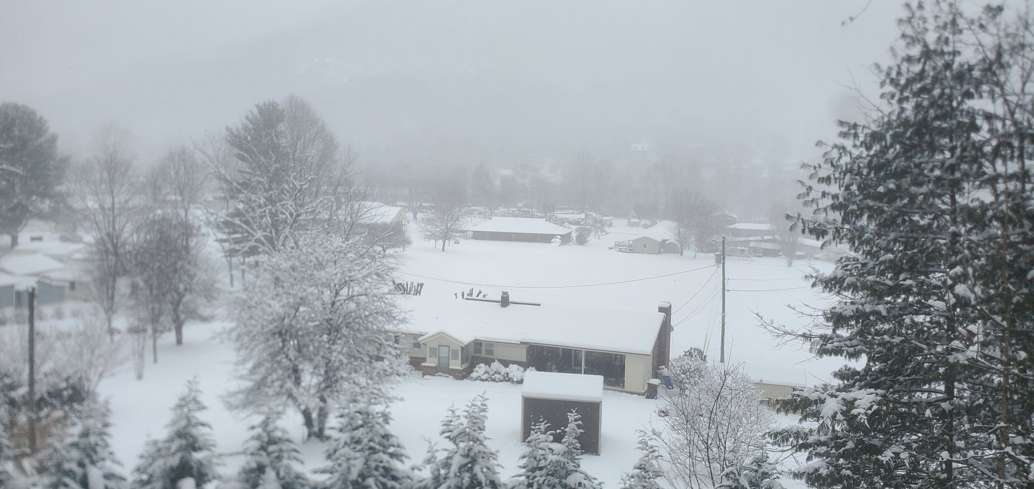
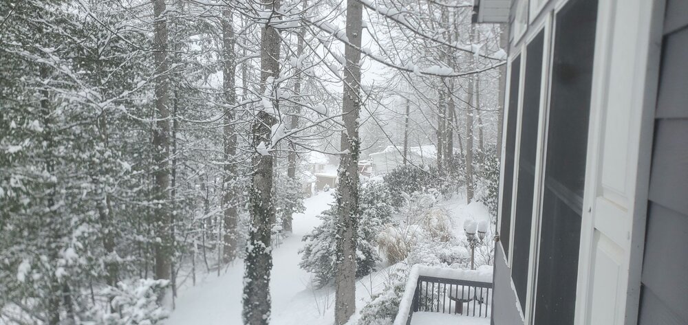
Near 10 inches now. I'll take another measurement to report to GSP around 12:30. A couple of shots from the front porch.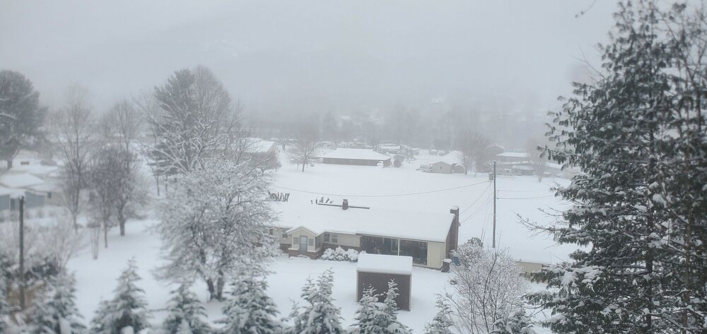
-

The Jan 31 Potential: Stormtracker Failure or 'Tracker Trouncing
Bob Chill replied to stormtracker's topic in Mid Atlantic
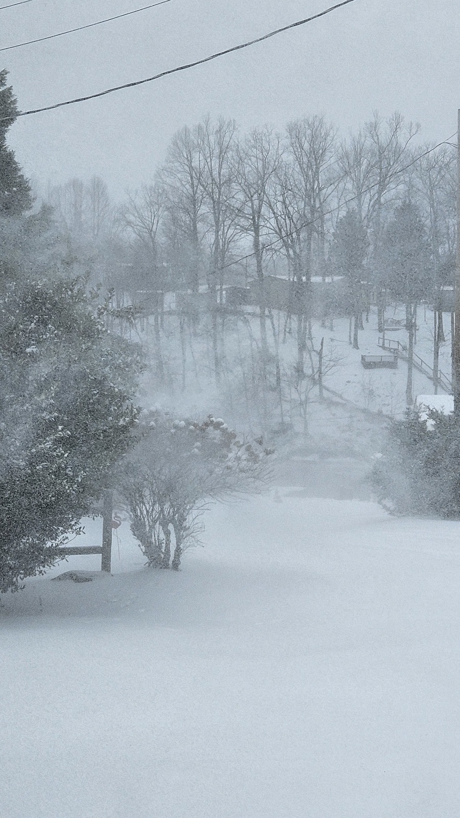
Up to 2 inches so far. Looks like most models are going to bust low on the NW periphery. Not sure if I can squeak another inch out but the mesos aren't going to do well with this one in my yard. 15 degrees and the wind is picking up. Roads dont look like roads lol. Snowmobiling isnt a thing down here but I sure wish I had one today lol. Deep winter.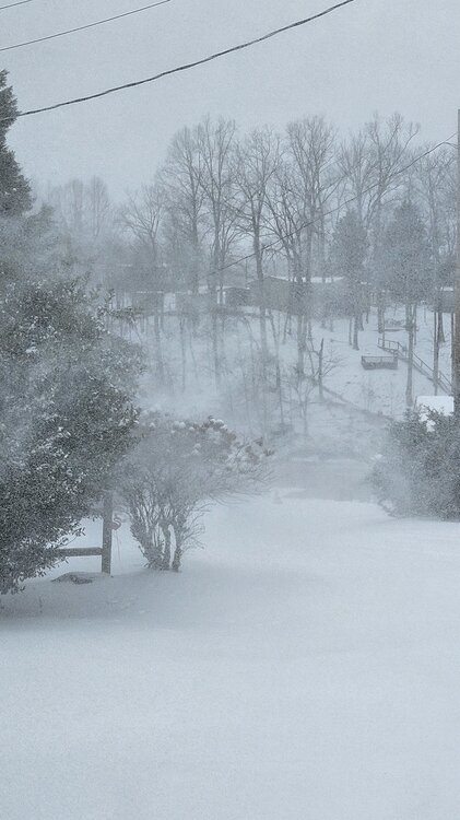
-

February 2026 Medium/ Long Range Discussion: Buckle Up!
frd replied to Weather Will's topic in Mid Atlantic
Interesting happenings as you are aware way up top with the strat warming causing more pressure on the AO going forward. I read this will also manifest in Greenland blocking, almost re-cycles through the runs into late Feb. We just need for things to go right for us. I am almost tempted to think that mid to late Feb could feature another severe arctic outbreak and powerful cyclone in the East. -
Zing! Congrats YYT on their 4 blizzard of the season(second time stealing my storm)
-

January 30th- Feb 1st ULL and coastal storm obs
WinstonSalemArlington replied to JoshM's topic in Southeastern States
-
That's an inch????
-

January 30th- Feb 1st ULL and coastal storm obs
KrummWx replied to JoshM's topic in Southeastern States
Off and on flurries for the past ~2 hours in midtown Raleigh. Fucking love dry slots!!! -

The “I bring the mojo” Jan 30-Feb 1 potential winter storm
Silver Meteor replied to lilj4425's topic in Southeastern States
For Eastern NC that looks great. Problem is ... I DON'T BELIEVE IT. -
.
-
GFS finally full on folded to dry slot. It’s over folks
-
Most airports don’t do snow depth anymore. Consequence of getting rid of full time weather observers and going to ASOS in the 1990s. Airports that still have an observer on site will have snow depth. Guess BDL has one again. For a long time they didn’t.
-
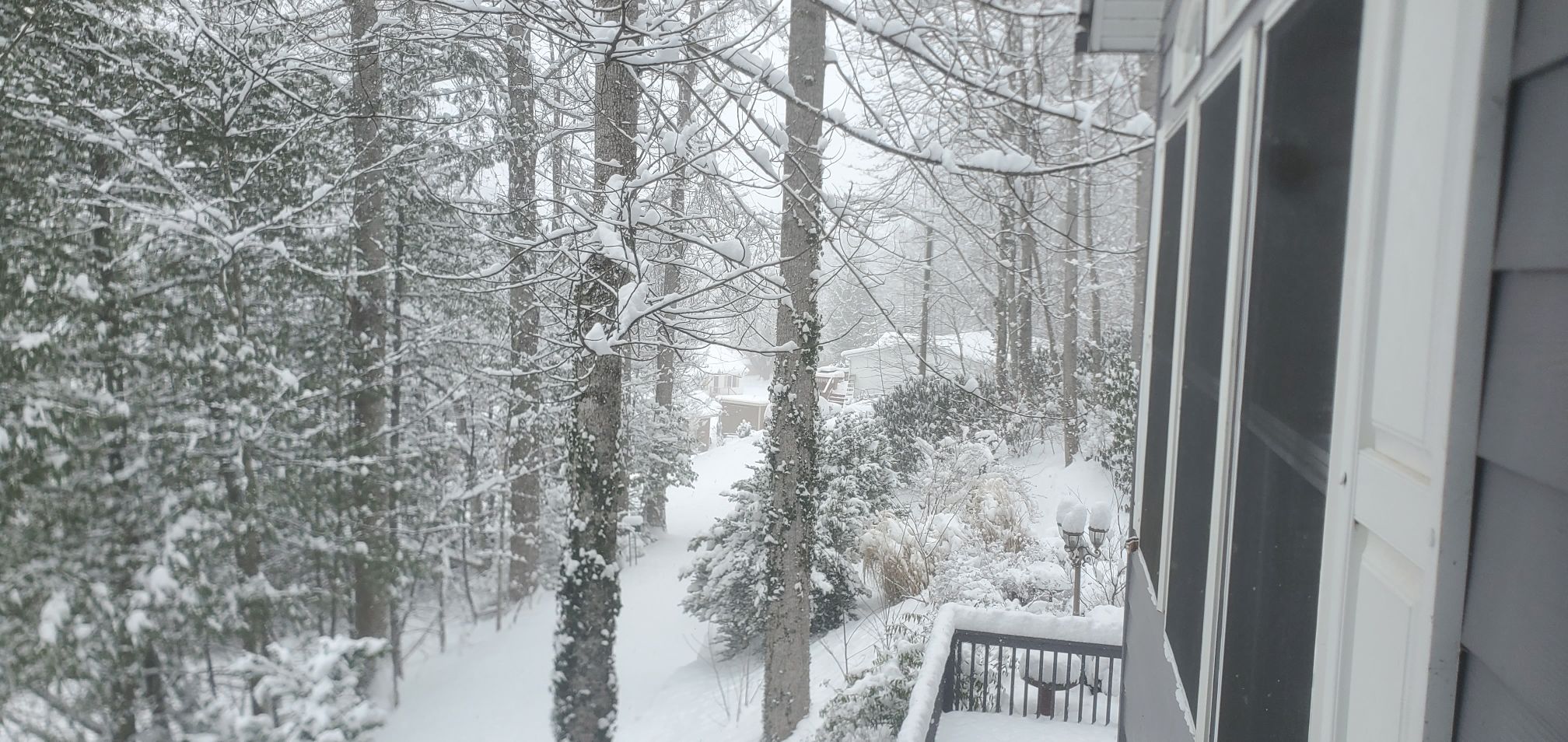
Thanks for the updates. I've been curious how the mountains in TN are doing. I'm in Greeneville, TN, so not too far from Gatlinburg. I measured about 9 inches about an hour ago at my house and still coming down. I thought you would be in a good spot for this. Hopefully we can keep the high ratio snow going for awhile. Keep us posted.
-

January 30th- Feb 1st ULL and coastal storm obs
CentralNC replied to JoshM's topic in Southeastern States
0Z GFS has an unbelievable blizzard here at that time. 6Z backed off. Fantasy land but you can see this pattern can produce extremes. Our threats are not over by a long shot. -
I think FOX got to -10 They also went from -5 to 14 in 1 hour like usual lol
-

The “I bring the mojo” Jan 30-Feb 1 potential winter storm
Grayman replied to lilj4425's topic in Southeastern States
-
Posting this in the Cliff Diving thread is just mean
-

Richmond Metro/Hampton Roads Area Discussion
benjammin replied to RIC Airport's topic in Mid Atlantic
Light flurries in Lynchburg. Sent from my MNP1095 using Tapatalk -
Icon has nothing really but it does have a clipper come down if it would’ve went out past 180
-
 The only thing that really upsets me about this storm is now all of a sudden in the triangle this has turned into a night time storm and a quick one at that. All week I was excited about seeing snow during the day. As usual...life in Southern wake co. Sigh
 -

The “I bring the mojo” Jan 30-Feb 1 potential winter storm
USCG RS replied to lilj4425's topic in Southeastern States
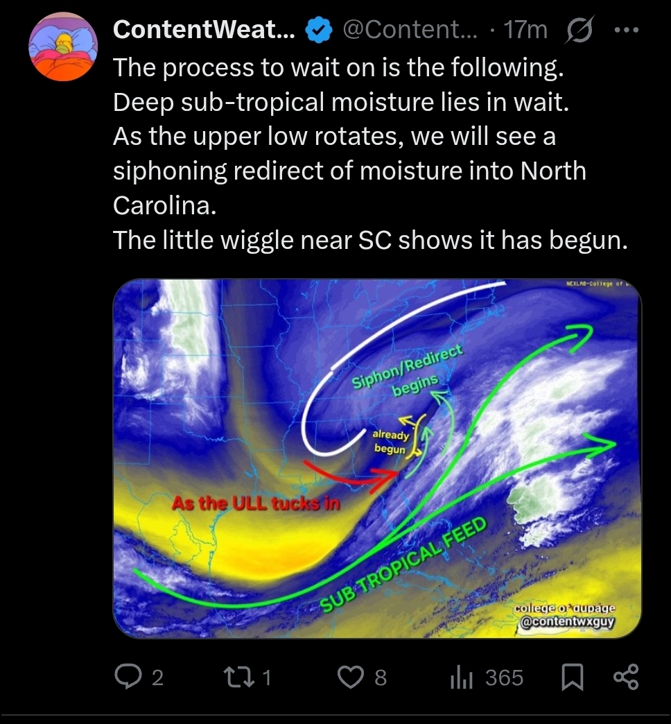
https://x.com/ContentWxGuy/status/2017622514646602106?s=20
-
That’s a nice shot with the plane at final approach on runway 270.
-

The “I bring the mojo” Jan 30-Feb 1 potential winter storm
StantonParkHoya replied to lilj4425's topic in Southeastern States
Idk. Snowing pretty decently in north Raleigh right now. . -

Richmond Metro/Hampton Roads Area Discussion
wasnow215 replied to RIC Airport's topic in Mid Atlantic
Does anyone know if that snow is reaching the ground in Lynchburg and Chatham and Halifax? -
Where do you get the snow depth data? ORH seems to just have a series of M’s BOS doesn’t seem to show it