All Activity
- Past hour
-
Pattern just has the feel that is something is going to pop, and without much particular warning.
-
There’s a decent signal on the 12z EPS for a chance of another Advisory type of event in the Friday/Saturday period.
-
Cold and dry seem about right.
-
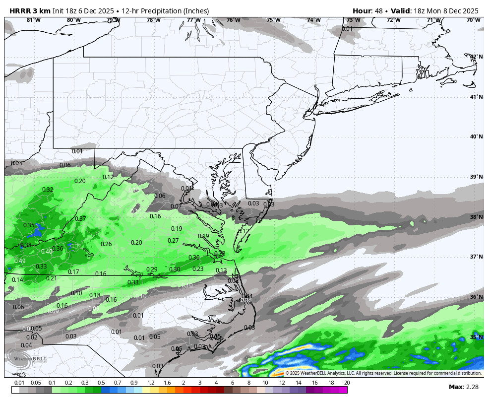
Long range HRRR is intriguing too. If I was you I’d be thinking about a 0.5” refresher course down there. See if we can get any more juice or a northern push in the next 36 hours. Ease off the confluence a little bit more…
-

Central PA Fall Discussions and Obs
Blizzard of 93 replied to ChescoWx's topic in Upstate New York/Pennsylvania
There’s a decent signal on the 12z EPS for a chance of another Advisory type of event in the Friday/Saturday period.
-

December 2025 Short/Medium Range Forecast Thread
Carvers Gap replied to John1122's topic in Tennessee Valley
The other thing I am noticing is an uptick of the mean snow total over TRI. That might be "IMBY" a bit too much, but that is usually a good thing for everyone when it goes up. The 12z AIFS-Ensemble has 2-5" of snow from TYS to SW VA. The 12z GEFS has 1-6" of snow from TYS to TRI. -
12/5: 1.5”
-
December 2025 Short/Medium Range Forecast Thread
Carvers Gap replied to John1122's topic in Tennessee Valley
I just think climatology really doesn't support super cold air until mid-December. There are lots of "whys," but I also think the MJO wasn't in the phase where the cold centers in southeastern NA. But it is MUCH colder than models had it when the SER was once modeled here w/ highs in the 70s. IMHO, modeling has tended to have a shallower trough and that has verified. The bitterly cold air I have seen modeled has been w/ the cold air masses of Dec 8th and 14th. And to the number that matters, TRI is -6.8F for the month so far. That is pretty big departure. Every day has been BN w/ a trace of snow on two of the six days. I can say this...I have been freezing my tail off while running in the mornings. I pretty much ice skated one morning on freezing fog. Pretty good start in my book. -

Mid to long range discussion- 2025
WinstonSalemArlington replied to wncsnow's topic in Southeastern States
Stout Alaskan Ridge upcoming -
12Z OP EURO is cranking out some bitter cold for late next week / weekend from the upper Mid-West / Great Lakes then into the Northeast. Big cold high drops to Iowa/Missouri by next Saturday and pushes east. OP at face value is storm squashing cold. We'll see but one thing for sure solidly below normal through mid month at least.
-
Digital Snow Thread Winter 2024-2025
WinstonSalemArlington replied to SnowenOutThere's topic in Mid Atlantic
-
Mid to long range discussion- 2025
WinstonSalemArlington replied to wncsnow's topic in Southeastern States
-
Just in time for xmas. Lock it up. Sent from my SM-S921U using Tapatalk
-
Very early in the season. Hopefully the region will score this season.
-
Mid to long range discussion- 2025
WinstonSalemArlington replied to wncsnow's topic in Southeastern States
December 15 -
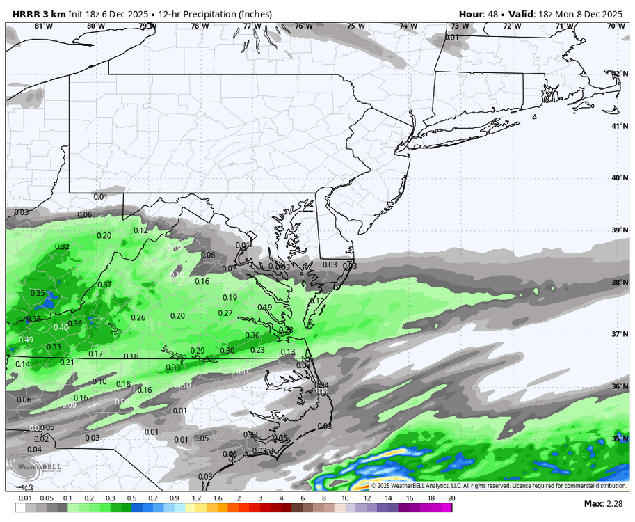
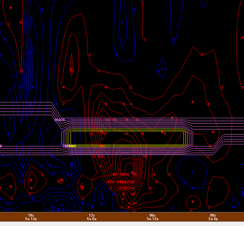
Dec 6-7th (It's not a clipper) Clipper
Paulie21 replied to Chicago Storm's topic in Lakes/Ohio Valley
Pretty much all models hinting at a nice corridor of higher UVVs for northern IL tonight between 850mb - 750mb. Not perfectly co-located with the small area of DGZ but not bad at all for a couple hours of 1"+/hr rates perhaps. Not perfectly textbook case but looks like theta-e lines in the cross section are more spaced out and climbing. Perhaps some slantwise convection possible? Not a perfect setup but it does coincide with best LRs (saturated) in the sounding, strong speed shear above veering wind profile, AND weak absolute vorticity. Could really thump right before dawn.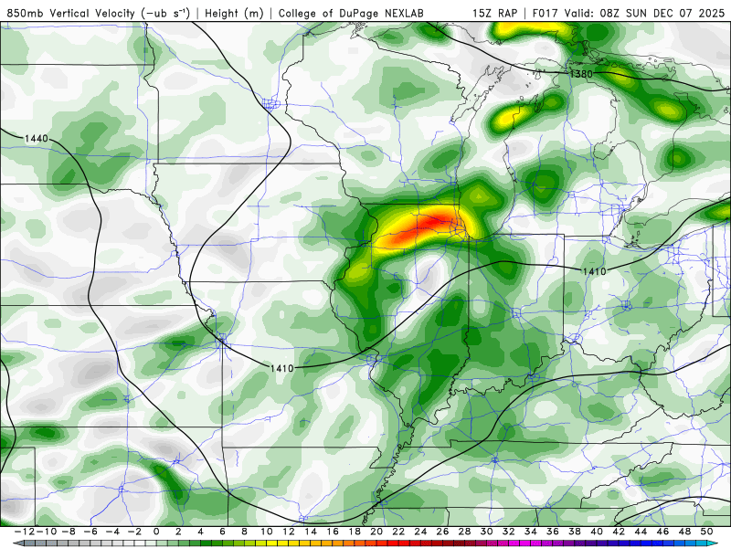
-

December 2025 regional war/obs/disco thread
AstronomyEnjoyer replied to Torch Tiger's topic in New England
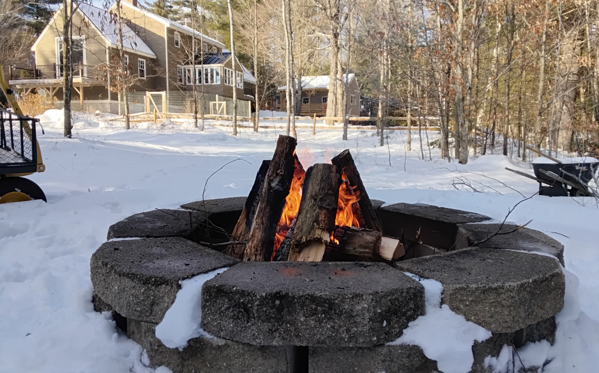
Sun came out and temp rocketed up to 37.9°. Taking advantage of the nice weather to get rid of some of the softwood that was a little too sporty for the inside fireplace.
-
Unfortunately you can’t. I was just looking on pivotal. You can see more of a wider view for the EPS on tropical tidbits, but that roles out after 3.
-

December 2025 regional war/obs/disco thread
Go Kart Mozart replied to Torch Tiger's topic in New England
Where can I see a continental view of these? The Pivotal free site has only the US view. -
And it's gone. Nothing but a memory. Hopefully we get a lot more. It was an enjoyable little event. It was nice having a deep winter day in early December.
-
Sun is out in Eastern CT, temp 42F, feels nice out!
-

December 2025 Short/Medium Range Forecast Thread
Daniel Boone replied to John1122's topic in Tennessee Valley
So far the truly cold air hasn't been making it into the Great Valley this Month. You can see how it fell down west and East of the Great Valley in the Month T Plot. It's in the 40's Today. That falls within Average for here. This Mornings Low was above Average due to being socked in with Fog and low St Deck. Yesterday was near Normal as far as daily goes. The point being, although much of the East( MW, Oh Valley, NE and MA have been very cold, our Area and Southeastward hasn't in comparison. Qustion to debate is, the Reason why?. I'd like to see what everyone can come up with and get a common denominator . Mine is no strong Hp press down western slopes of Apps. Then there has been the residual heat Sourh of us left over from the Cuban HP that weakened and moved on SEward that pulls up toward the Jet and mixes. If Modeling is correct showing the strong HP coming down from Canada into the Plains we will be in the Icebox as well as we all know. -

December 2025 regional war/obs/disco thread
Kitz Craver replied to Torch Tiger's topic in New England
Little OT, but it’s pretty funny how psyched we were for T-.5” this am. Damn, it’s been desperate times, lol -

Central PA Fall Discussions and Obs
Itstrainingtime replied to ChescoWx's topic in Upstate New York/Pennsylvania
Just seems hard to imagine we get through the next few weeks without all of us getting some snow. But we've been snakebit in recent years which leaves me feeling a bit jaded. Still, I'll roll with this pattern. -