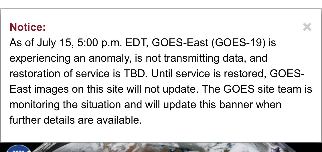
All Activity
- Past hour
-
sky is a milky grayish orange, and the smell of smoke is notable.
-

2026-2027 Super El Nino
csnavywx replied to Stormchaserchuck1's topic in Weather Forecasting and Discussion
Leaning towards it getting even stronger than the 1877-78 event, much less the 97/98 one, but that depends on whether or not we get any sort of pause in the WWB train/standing wave. That event was exotically warm across most of North America through the vast majority of the winter. In fact, farmers were planting their crops in Minnesota in February (yes, really). Article covering that from Mark Seeley out of the University of Minnesota: 1878 El Niño saw crops planted in February Texas itself was mild (relative to normal at the time) and very wet into the fall and especially winter. The current event you're suffering through is a side effect of a persistent rossby wave train that has set up in (at least in part) due to the response to the forcing induced by the developing Nino, but ENSO relationships in the summer are weaker and it's also partly just bad luck. -
 We have a lot of fixing to do.
 -
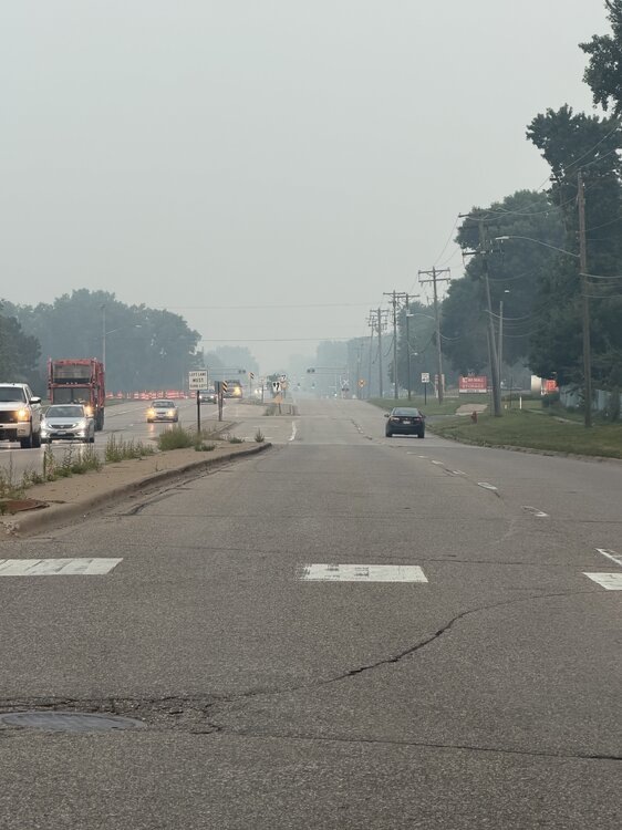
Driving into work this morning you couldn't even see Manhattan from the turnpike the smoke was so thick.
-
MI into PA looks p locked in with the sludge air today, rough
-
hey guys hope all is well and everyone's enjoying their summer. I was just wondering when do you think this smoke problem will go away?
-
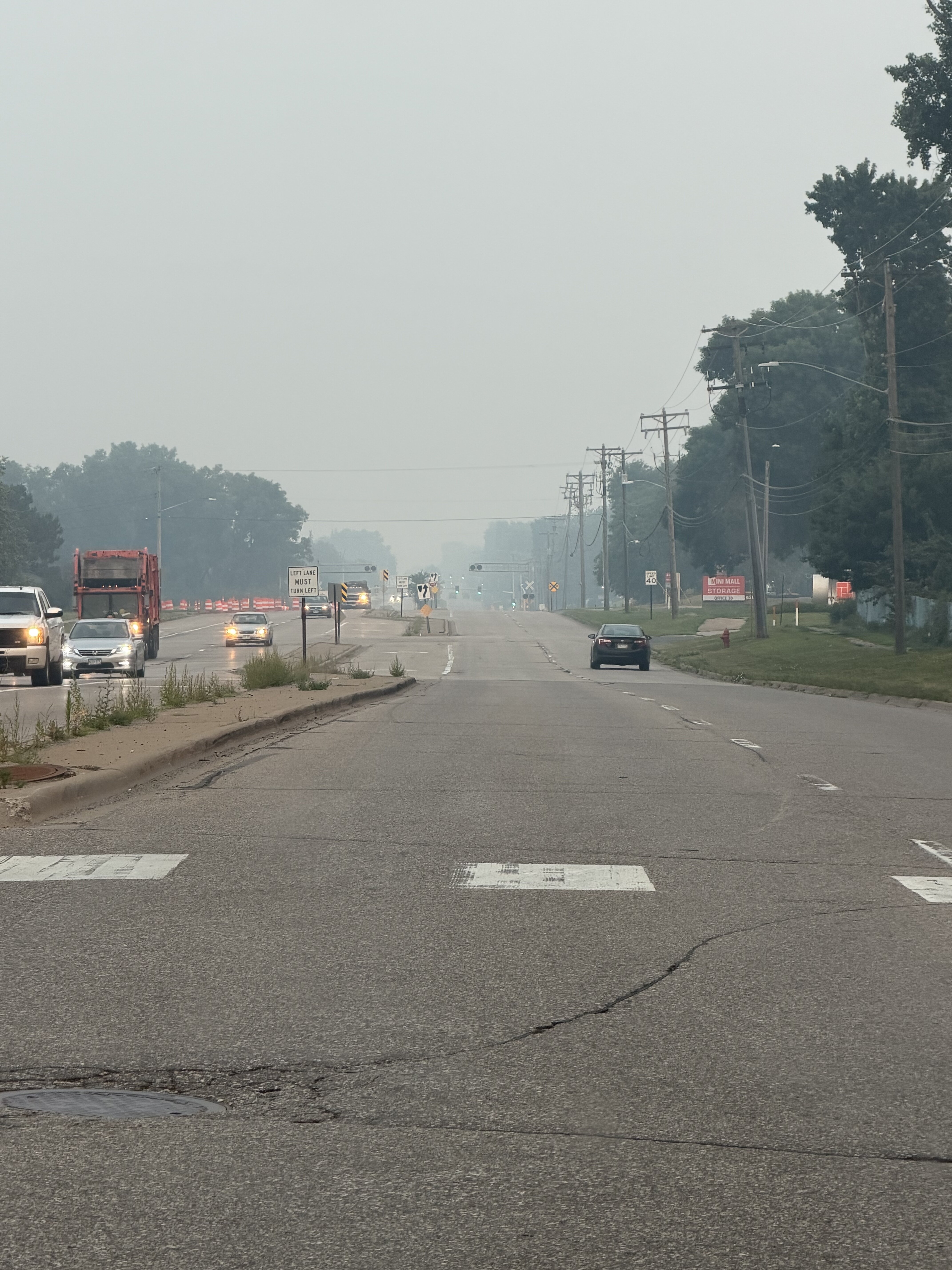
Pretty nasty out there this morning
-

2026-2027 Super El Nino
40/70 Benchmark replied to Stormchaserchuck1's topic in Weather Forecasting and Discussion
Maybe it eventually becomes more east-based given how far east the warm pool is relative to other events, but right now at the surface this is clearly basin-wide and not as east-based as 1997. I have posted the weekly figures. It's similar to 2015. Do I think that this really matters? No, there is so much warm water throughout the ENSO basin. This all screams "variable pattern that is warm in the seasonal mean" to me. -
Vis 10 miles here with deep blue skies. Best climo.
-
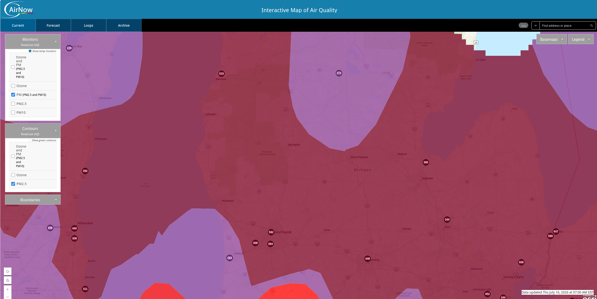
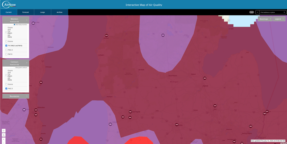
530 was the peak AQI in Minneapolis overnight. Eyes and throat burn working outside in this crap. Good times
-
2026-2027 Super El Nino
40/70 Benchmark replied to Stormchaserchuck1's topic in Weather Forecasting and Discussion
Clearly my early hunch was wrong, as is often the case. -
2026-2027 Super El Nino
40/70 Benchmark replied to Stormchaserchuck1's topic in Weather Forecasting and Discussion
They are touting the pattern in the composite of Super El Nino events as being comparable to the precursor pattern in SSW events, which when combined with W QBO favors a warming in January or February. While I agree that any warming will be during the second half, I can't help but question why we haven't actually seen any SSW during super El Nino events, despite the similarity to the precursor pattern....then don't address that. They are also focusing on the low arctic sea ice as a big factor to predisposing the PV to disruption. -
IF we get enough smoke it may stop us from getting to 100F LOL.
-
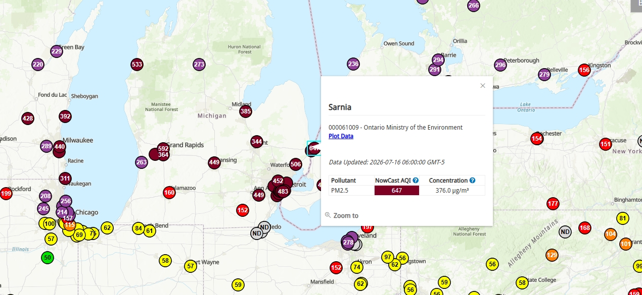
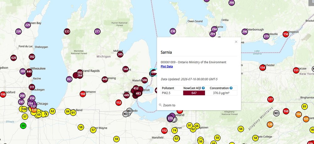
Crazy high concentrations...
-
 Wow really, how pathetic
 -
700! lol
-
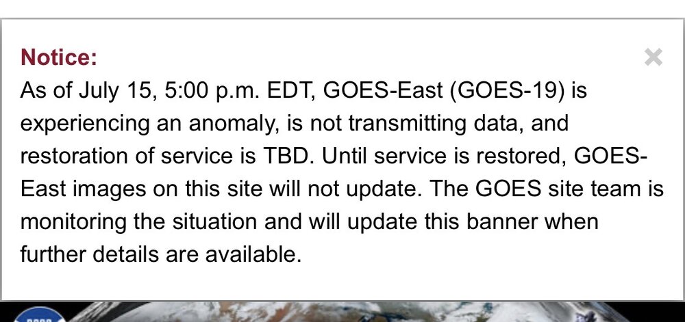
Here's the reason
-
2026-2027 Super El Nino
EastonSN+ replied to Stormchaserchuck1's topic in Weather Forecasting and Discussion
I have been thinking the same thing. 1983 and 2016 shows the potential that super ninos bring. 97/98 is the feared example, however, the west PAC water temps are different this year which can help offset the E PAC warmth in terms of MJO. I am actually looking forward to the potential. -
 It's been yellow-orange here since first daylight. No visible sun.
 -
 that will get fixed too, eventually
 -
I'll be out of town on Saturday (still in the slight, but still) - so I expect a massive severe line to wipe out the DC area.
- 1,012 replies
-
- 1
-

-
- severe
- thunderstorms
- (and 7 more)
-
I swear you could smell the smoke this morning. And my eyes were stinging coming into work. Going to be such a fun day
-
Seeing aqi of 700 around Detroit. Insane to see whats going on back home in the lakes region.
-
Thats where im from before coming out this way. It is really bad up there. Got family and friends messaging me on how breathing is making their throats scratchy even after 5 mins outside. Really insane and worse than 2023.
- Today
-

2026-2027 Super El Nino
TriPol replied to Stormchaserchuck1's topic in Weather Forecasting and Discussion
Don't weenie tag me but, boy if we can get a phase between the the polar jet stream and what's sure to be an extremely active subtropical jet stream this winter, it could really get a historic snowstorm.