All Activity
- Past hour
-
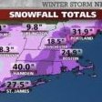
Yeah 30” for me during that one on LI
-
They will I work in the coms department that did this video
-
 Second part is/has been a dud here
 -
.thumb.png.4150b06c63a21f61052e47a612bf1818.png) I was skeptical, but nice to tack on a bonus inch this afternoon maybe even a little bit more when it’s done.
I was skeptical, but nice to tack on a bonus inch this afternoon maybe even a little bit more when it’s done. -
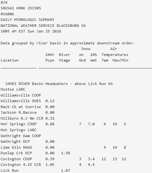
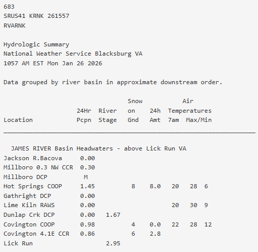
I JUST got off the phone with NWS Blacksbug. They were trying to confirm what happened in this area this weekend. I gave them my totals, what was on the ground now and what types of precip I had. And WHY would they call you ask? Well, Covington CO-OP (who is notorious for reporting either low of not at all) reported 3.4 inches yesterday 0.0 today and 4 OTG this morning. So they INCREASED OTG but reported no new snow. Then Hot Springs CO-OP (which usually does a great job) reported 7.0 yesterday with 7.0 OTG, then 8.0 this morning with 8.0 OTG (I'm guessing they oopsied and put OTG for new snow too).
-
Looks like MCPS can’t even get to the busses at Shady Grove. They’ll be digging them out for a while. Hoping mcps closes all week, I think they will.
-
 Yup. More pillows IMG_7867.mov
 -

Pittsburgh/Western PA WINTER ‘25/‘26
Burghblizz replied to Burghblizz's topic in Upstate New York/Pennsylvania
Models are flip flopping, but even the western solutions don’t really get much to western Maryland. So wouldn’t see anything meaningful yet on timing or of it’s even a factor. -
14.5” Hamden.
-
Temp maxed at 30 which helped some melting. Headed back down now. 27 and it’s gotten hella windy
-
I think the biggest uncertainty we're going to have with this system is the energy coming from northern Canada. That has a lot to interact with over the next few days as it does a 360 degree loop over James Bay.
-
1/25: 8.5”
-
I noticed the GFS and Euro are considerably colder than the NAM3k. Are the mesoscale models going to be better at estimating this?
-

January 2026 Medium/Long Range Discussion
StormyClearweather replied to snowfan's topic in Mid Atlantic
12Z WeatherNext looked similar to, though a bit east of, 6Z. No idea on QPF, but shows light snow for most of us from roughly 0Z Saturday > 0Z Sunday. -

Pittsburgh/Western PA WINTER ‘25/‘26
Gordo74 replied to Burghblizz's topic in Upstate New York/Pennsylvania
Anyone got any maps for next weekend? I’m debating on a western MD trip and wondering if return travel Sunday would be safe. -
Interesting expanding area of light snow happening. It's been getting progressively heavier for the last 20 minutes and is starting to coat things now. Pretty cool.
-
We need the same adjustment. If the longwave features adjust west the same way they did last week that energy diving into the Midwest that becomes the storm will trend west also. Right now it’s coming in too far east for what we need. Shift that west and watch. Do I know it will no. A trend can reverse anytime. But this isn’t significantly more complicated. There is going to be a major wave amplification off the east coast. The pattern argues for it. It’s been identified as a period to watch for a long time. The question is where exactly. We don’t need some crazy adjustment in the phasing being shown. We juts need to shift the whole thing west. Some are applying the typical miller b thing here but the reason miller bs always fail for us is rarely does the NS dig south enough. That isn’t the issue on guidance right now.
-
Headed back down after a high of 30 in Charlottesville currently 27/1 under full sun
-

January 25-26th, 2026 Final Storm Totals
DavisStraight replied to The 4 Seasons's topic in New England
20 last measurment, still snowing.⁹ -

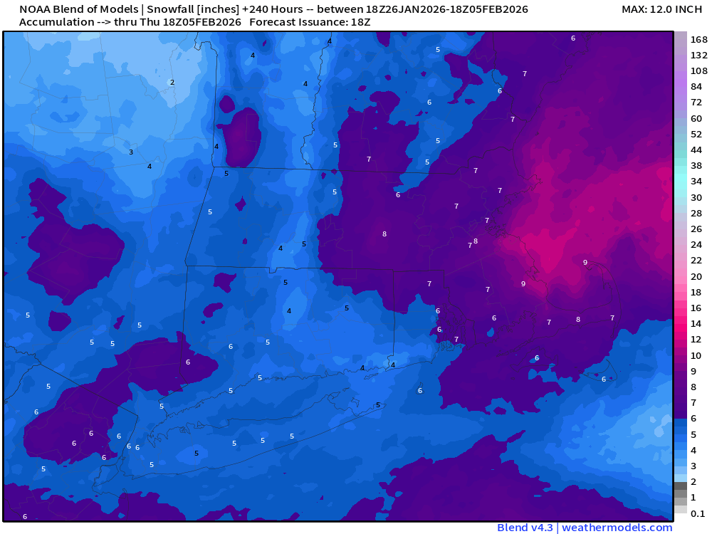
Possible coastal storm centered on Feb 1 2026.
Ginx snewx replied to Typhoon Tip's topic in New England
-
 Another 1.5" so far today. 18.5" storm total.
 -
Big one for me in CT was Nemo in 2013. 40” .
-
Baltimore City schools closed tomorrow. Man you know it's bad when the city closes for more than a day
-

E PA/NJ/DE Winter 2025-26 Obs/Discussion
Mikeymac5306 replied to LVblizzard's topic in Philadelphia Region
Lately, it's been me, or Wiggum starting the storm threads. My preference is to confirm the major models are all on board and the NAM is in range before a storm thread is started by me. Can't truly speak for Ralph but I know he is waaaaay better than I am at reading the models and knowing when a threat is legit. Look. we're all tired right now, but Winter is not over! Got more tracking to do! -
17.0 Moosup


.thumb.jpeg.f5c6ba9d911ec96b3b124f8606aee58e.jpeg)