All Activity
- Past hour
-
 guam peak wind 83 kt pressure 970.5mb PGUA 052355Z AUTO 24043G64KT M1/8SM R06R/0100V0200FT FG VV009 26/25 A2872 RMK AO2 PK WND 26083/39 LTG DSNT N CIG 006V009 SLP715 T02600253 10260 20253 55036 PWINO $
 -

Central PA Summer 2026 Discussion/Obs Thread
canderson replied to Voyager's topic in Upstate New York/Pennsylvania
If you get into a bind DM me but I bet you have power tmrw night PPL is very good at restoration- prob the best I’ve come across in all the places I’ve lived -
 82/48 today, with a breeze. Perfect summer weather. AC not needed on these days.
 -
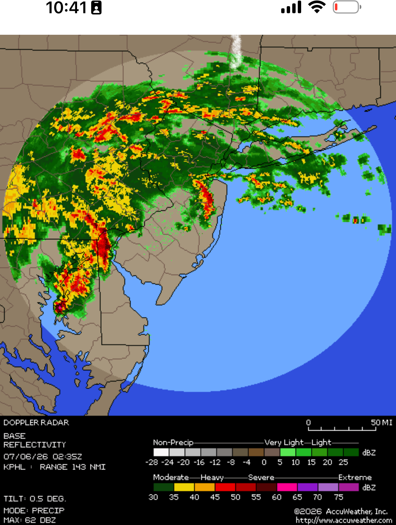
radar/satellite today
-
Hoisting the Sultan Signal: Heavy Rain Event July 5-7
powderfreak replied to WxWatcher007's topic in New England
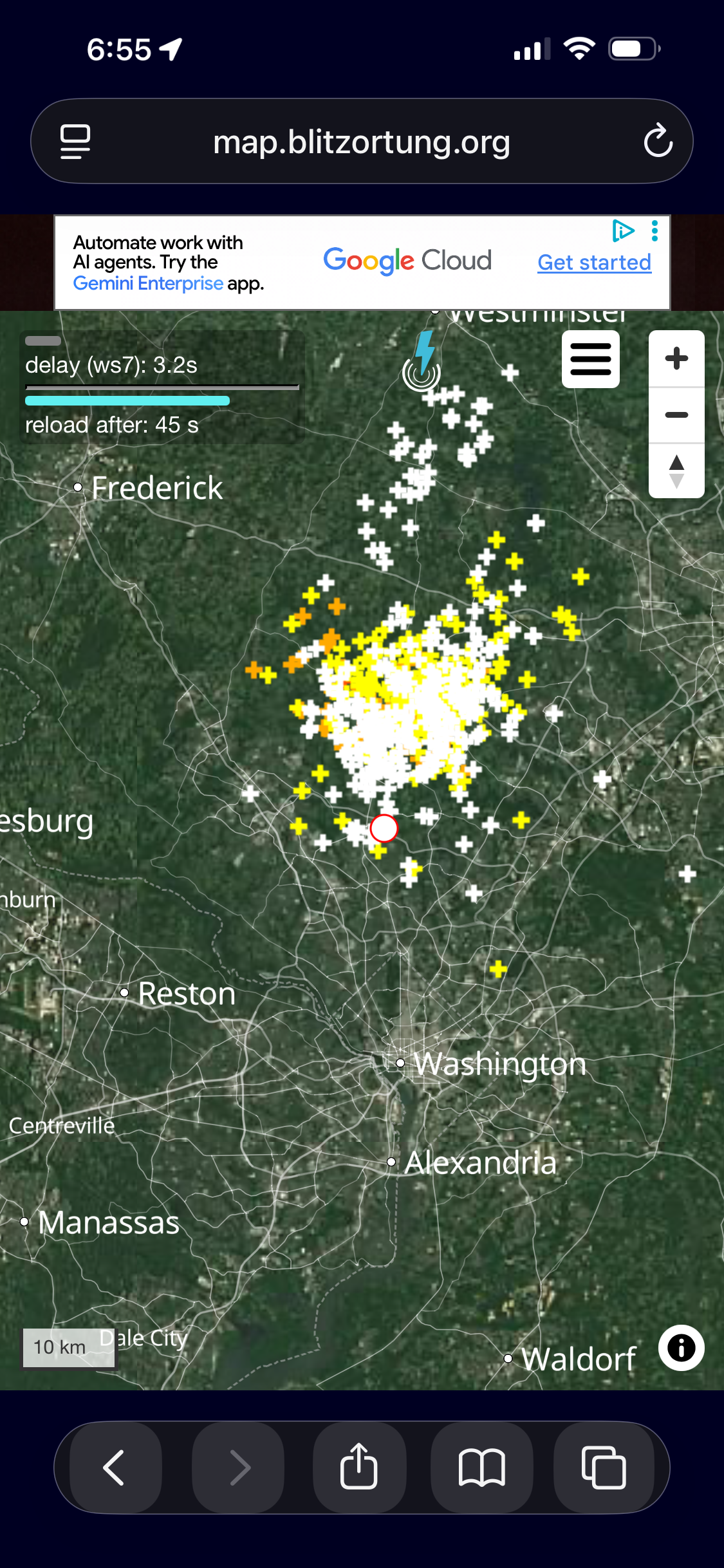
It’s like one big thunderstorm. Lightning across three states.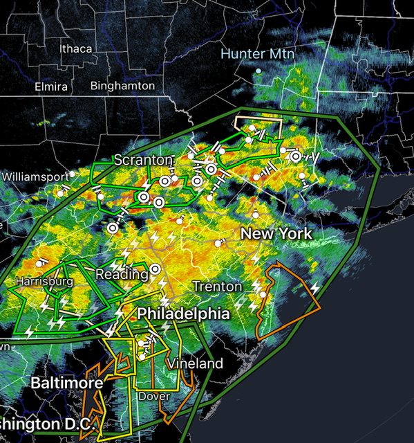
-
Should be fun in the morning heading home. There is a creek down my street and there’s no other way around it.
-
Hoisting the Sultan Signal: Heavy Rain Event July 5-7
powderfreak replied to WxWatcher007's topic in New England
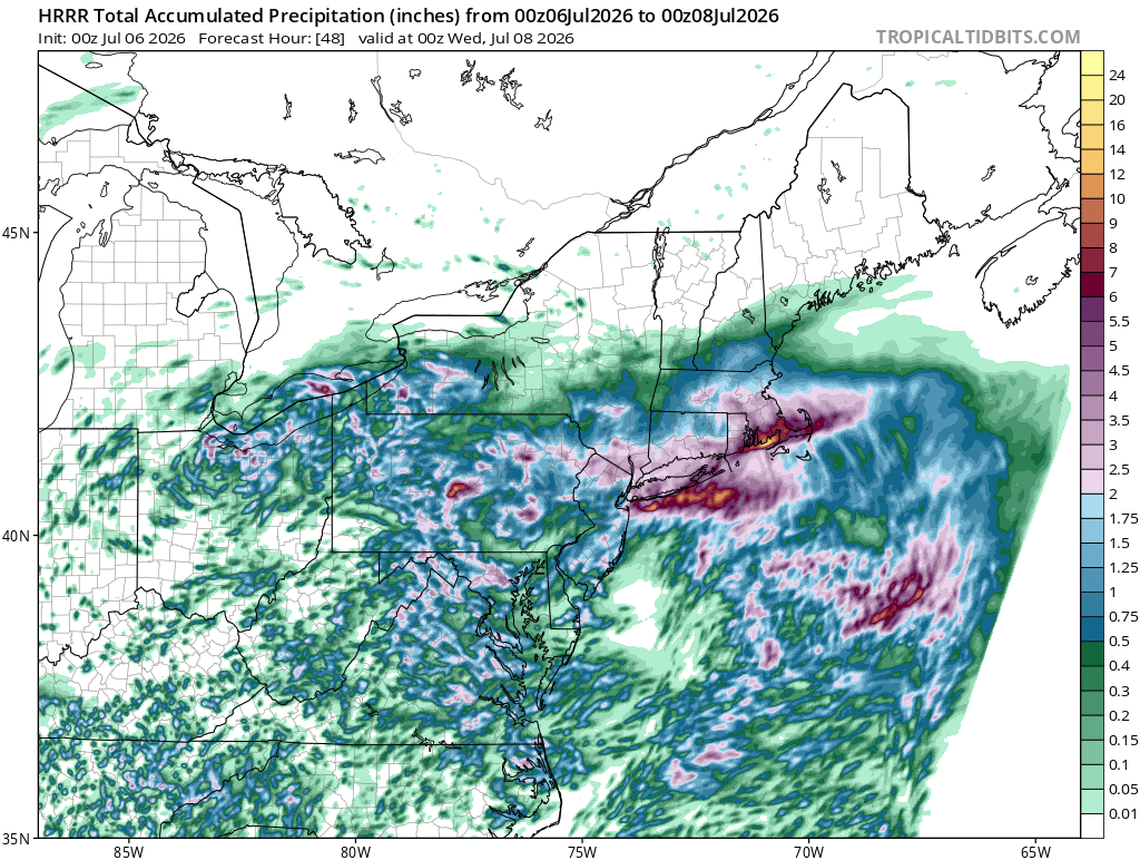
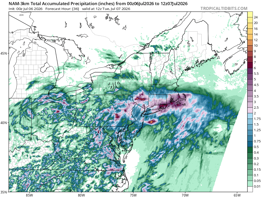
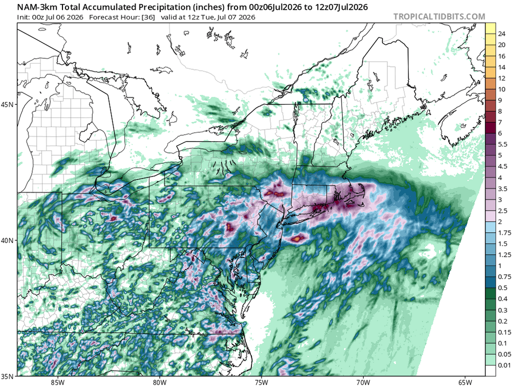
South coast smoked on NAM and HRRR.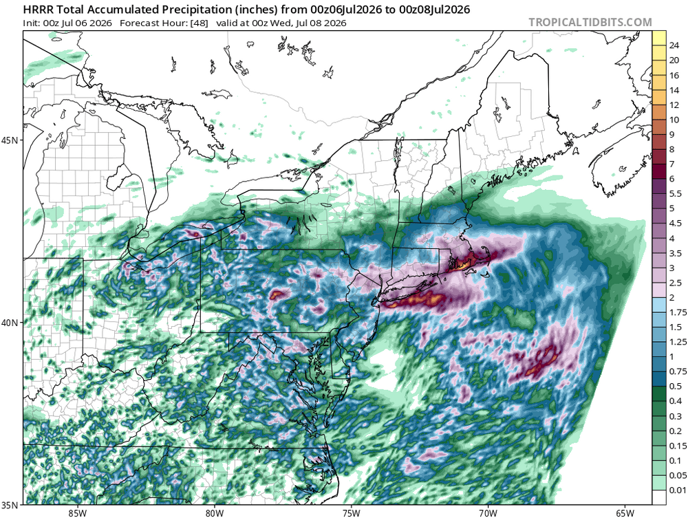
-
It won’t let me attach but the radar is absolutely insane. Lots of radar watching the next 24 hours.
-

Hoisting the Sultan Signal: Heavy Rain Event July 5-7
WxWatcher007 replied to WxWatcher007's topic in New England
NAM still pretty aggressive across CT. Several flood reports in PA tonight. -
Just had one of the loudest claps of thunder I’ve ever heard in my life.
-
1.57 in 24 hrs!!!!!
-
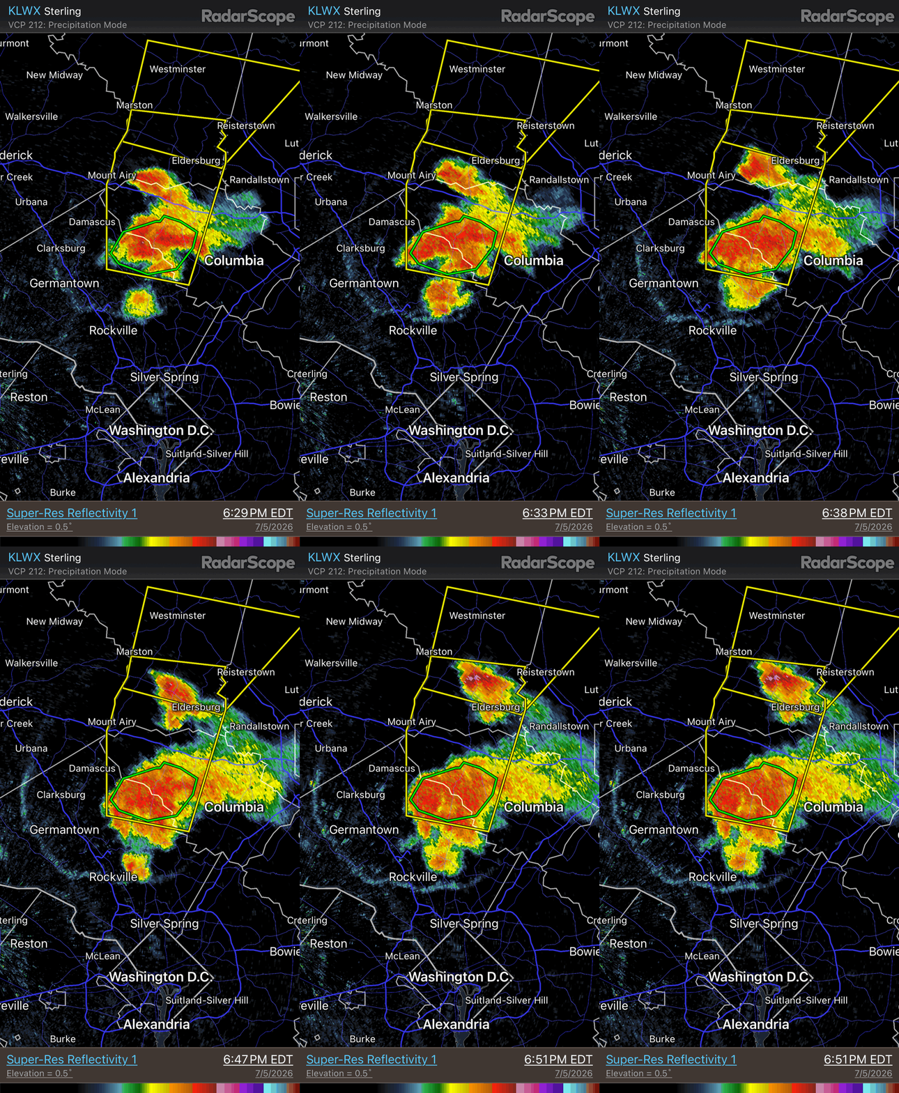
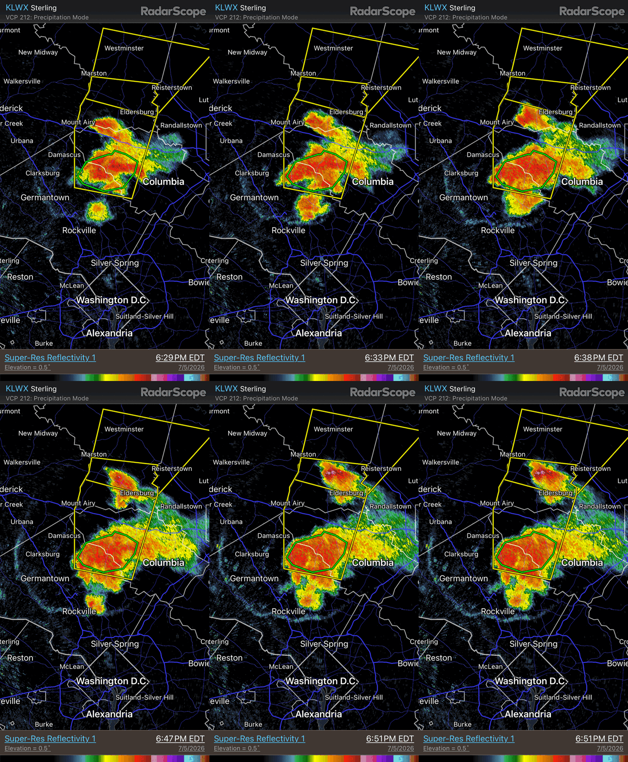
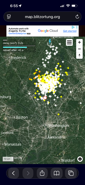
When you have light/weak winds 500 mb and below, chaotic storm motion is common. Mesoscale factors such as storm rotation, outflow boundaries, and cell back-building (discrete propagation) can take front and center, so you get all sorts of odd storm motion. This is basically what you see almost every day in the summer in the Southeast and Gulf Coast states! We saw the same thing today, esp. w/ that svr storm W of Columbia. Hardly moved at first and then started to drift/build S. I attached a short loop of the W of Columbia svr storm. Also, the CG LTG was intense w/ this storm (plot attached). I think this storm was briefly a supercell before it gusted out. It split as well, indicating rotation. See the storm to its N moving NE fairly quickly? That's a left (anticyclonic) supercell split! You can tell b/c of it flared look NW to SE yet moving NE. When a supercell splits, the mesocycylonic split slows down and turns more to the right, while the anticyclonic split accelerates and moves more to the left (in the Northern Hemisphere).
-

Big Heat (and storms?) Week into July 4th Weekend
EastCoast NPZ replied to yoda's topic in Mid Atlantic
The line split just as it got to me. Got .12" on strong winds. As usual, the real storm slid to my north. You probably did well again. -

Central PA Summer 2026 Discussion/Obs Thread
Jns2183 replied to Voyager's topic in Upstate New York/Pennsylvania
I still think I may get a hotel for tomorrow night. I can only get no or crappy sleep for so long Sent from my SM-S731U using Tapatalk -
Hopefully it works here!
-

Central PA Summer 2026 Discussion/Obs Thread
mahantango#1 replied to Voyager's topic in Upstate New York/Pennsylvania
.22 rain today so far, we're missing almost most of this. -
Central PA Summer 2026 Discussion/Obs Thread
canderson replied to Voyager's topic in Upstate New York/Pennsylvania
I had you closer to market, my bad -
Central PA Summer 2026 Discussion/Obs Thread
Jns2183 replied to Voyager's topic in Upstate New York/Pennsylvania
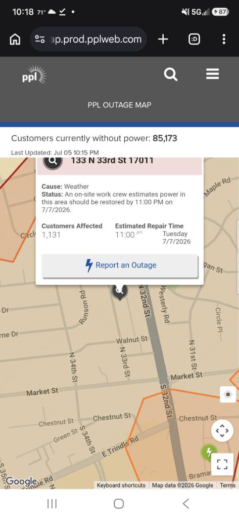
Where do you see that. Map still says Tuesday Sent from my SM-S731U using Tapatalk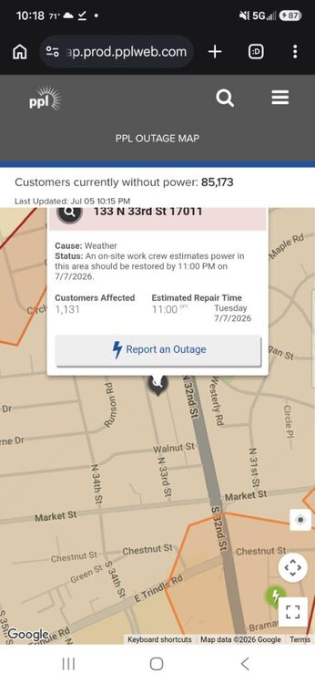
-
Yeah this doesn’t look good….
-

Central PA Summer 2026 Discussion/Obs Thread
Blizzard of 93 replied to Voyager's topic in Upstate New York/Pennsylvania
Lightning in Marysville as well. -
Guess watering my deck plants about 20 min ago was the trick.
-
Central PA Summer 2026 Discussion/Obs Thread
canderson replied to Voyager's topic in Upstate New York/Pennsylvania
Heavy rain and thunder have returned -
Central PA Summer 2026 Discussion/Obs Thread
canderson replied to Voyager's topic in Upstate New York/Pennsylvania
Pretty sure they moved your power restoration draw back two days, to Thursday -

Big Heat (and storms?) Week into July 4th Weekend
Interstate replied to yoda's topic in Mid Atlantic
0.09 so far. Some really good strikes earlier.