All Activity
- Past hour
-
About 1/2 in west AVL
-
Only 27 at the house with wind all night. Almost guarantee tonight will be colder
-
Plus there'll probably be potential for 3'+ storms with the warming climate.
-
The 2010-11 winter was the first and last time I ever heard JB predict an early end to winter. Just before mid-January he posted that all the high latitude blocking was going to completely break down by early February and that winter was going to come to an abrupt end in the east and not come back again. For the most part, he ended up being right
-
Sure looks like a great opportunity to see the northern lights tomorrow https://x.com/NWSSWPC/status/1988294702827802778?t=oyTOXhCmE28A0p76D7te4w&s=09
-
 Bruh do you have any idea how much of a fit of rage I went into seeing this last night Sent from my SM-S166V using Tapatalk
 -
 One of the more impressive snow squall days
 -

November 2025 general discussions and probable topic derailings ...
CoastalWx replied to Typhoon Tip's topic in New England
Nice band for Dryslot -
My aurora chat is popping off and they (not experts... hobbyists) are leaning tomorrow night. They are very excited... G4/G5. Gonna make a plan to get out in the boonies.
-

November 2025 general discussions and probable topic derailings ...
mreaves replied to Typhoon Tip's topic in New England
Light snow/flurries. About an inch overnight. 27.6°. Wintry appeal commences.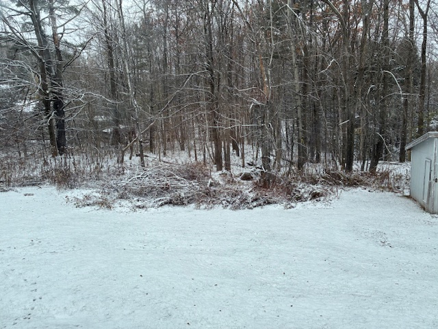
-
 31° with a stiff NW breeze and snow varying from random flakes to moderate squalls. There are nice coatings where the wind deposits enough flakes.
 -

November 2025 general discussions and probable topic derailings ...
SJonesWX replied to Typhoon Tip's topic in New England
nah, it's really warm outside. sitting at 34 off a high of 36 with a few flakes floating around. torch confirmed. -

November 2025 general discussions and probable topic derailings ...
rimetree replied to Typhoon Tip's topic in New England
First flakes here. Tomorrow looks to have better chances. 36/25 -
November 2025 general discussions and probable topic derailings ...
mreaves replied to Typhoon Tip's topic in New England
Tip? You can almost see the whole thing! -

Central PA Fall Discussions and Obs
2001kx replied to ChescoWx's topic in Upstate New York/Pennsylvania
A snowy morning here this morning..Roads were horrible It didnt help that i dont have my winter tires on yet..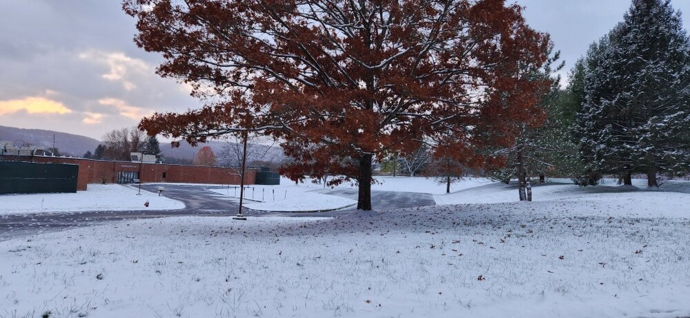
-
100%. While there was copious cold during the 70s, big storms were mostly absent until 79. Otoh, the 60s mostly rocked. The 80s were solid but things quieted down after the Vet day storm. The 90s struggled and if 95-96 didn't happen then it would have been a lost decade for the most part. 2000-16 was really good for bigger storms but not without a few epic bust storms and some real gut punch seasons. The period after the Jan 2011 storm thru Mar 2013 was God awful but it was just a few years even though it felt like a century lol. Then 13-16 happened... 2017 thru 2024 was been ho hum but is it that uncommon to have a period like that? Not really when you think about it. Last year was a real winter even if it was sub climo snow. You could say last winter was similar to the bulk of the 70s. Our winters are streaky good and bad. Been that way since I was born. A hot streak of bigger storms is coming and based on the last 8 years or so, prob sooner than later. Wx around the world has been more extreme in general and there is no doubt in my mind that a bigger storm than Feb 2010 or Jan 2016 is coming here at some point.
-
Going to STL this weekend and 75 is going to feel amazing.
-

November 2025 general discussions and probable topic derailings ...
dryslot replied to Typhoon Tip's topic in New England
Special Weather Statement National Weather Service Gray ME 1232 PM EST Tue Nov 11 2025 MEZ012-013-019>021-033-111815- Southern Oxford-Interior Cumberland Highlands-Androscoggin-Southern Franklin-Kennebec-Central Interior Cumberland- 1232 PM EST Tue Nov 11 2025 ...An area of heavy snow showers will affect southwestern Kennebec... southern Oxford...Androscoggin and northwestern Cumberland Counties... At 1230 PM EST...An area of heavy snow showers was along a line extending from near Waterford to near Turner...and moving east to east-southeast at 15 MPH. Locations impacted include... Waterford, New Gloucester, Wales, Fayette, Livermore Falls, Stow, Fryeburg, Lovell, Mount Vernon, Lewiston, Winthrop, Livermore, Leeds, Auburn, Monmouth, Wayne, Harrison, Casco, Buckfield, and Otisfield. This includes Interstate 95 between mile markers 69 and 90. This also includes... Pleasant Mountain, Long Lake, Crocker Hill, Streaked Mountain, and Singepole Ridge. * Visibilities will drop quickly to less than a half mile in this area of heavy snow showers. Travel is not advised during these heavy snow showers. Rapid visibility reduction and potentially slick roads may lead to accidents. Consider delaying travel until the snow showers pass your location. If traveling pull off to a safe location. LAT...LON 4399 7014 4395 7027 4396 7049 4398 7075 4400 7099 4424 7099 4426 7061 4445 7033 4446 7023 4449 7012 4449 6998 4443 6991 4430 6989 4418 6996 TIME...MOT...LOC 1730Z 276DEG 14KT 4413 7077 4429 7029 $$ JC -

Central PA Fall Discussions and Obs
Itstrainingtime replied to ChescoWx's topic in Upstate New York/Pennsylvania
Please tell her how proud I am of her. -
November 2025 general discussions and probable topic derailings ...
dryslot replied to Typhoon Tip's topic in New England
Was just getting ready to post that from radar scope, It looks to rip here as that is blossoming on radar, I should've been in the woods today but i elected to get the snow blower on the tractor instead............ -
 Street level elevation there is about 210 feet, so the sensor is 150 feet too high.
 -

November 2025 general discussions and probable topic derailings ...
dendrite replied to Typhoon Tip's topic in New England
Looks like some high ratio fluff in your direction.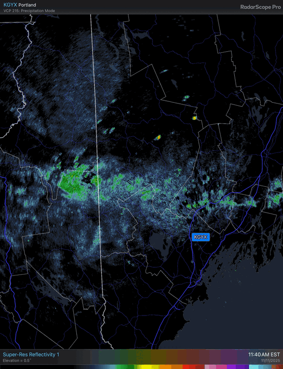
-
November 2025 general discussions and probable topic derailings ...
dryslot replied to Typhoon Tip's topic in New England
Temps have dropped below freezing at the surface now, Down to 31°F -
November 2025 general discussions and probable topic derailings ...
dendrite replied to Typhoon Tip's topic in New England
Plenty cold. That’s just big dendritic growth. -

November 2025 general discussions and probable topic derailings ...
Brewbeer replied to Typhoon Tip's topic in New England
Snowflakes flying in the brisk NW wind here in Westport, 39/25


