All Activity
- Past hour
-

2026-2027 Record-breaking El Nino
LakePaste25 replied to Stormchaserchuck1's topic in Weather Forecasting and Discussion
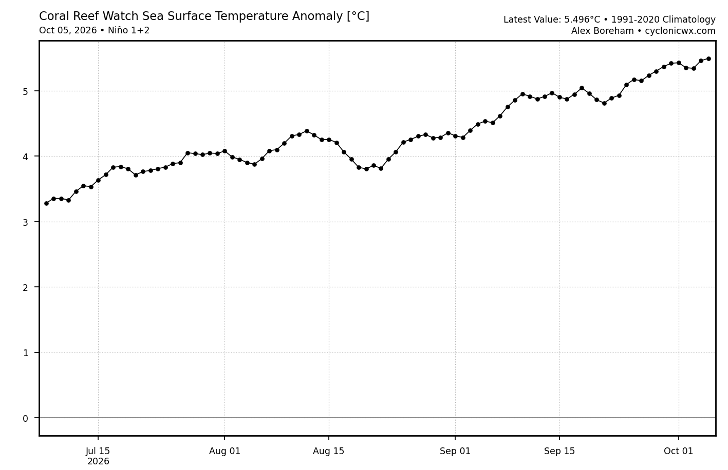
Still waiting on that big Nino 1+2 drop modeled by the CFSv2. Any day now.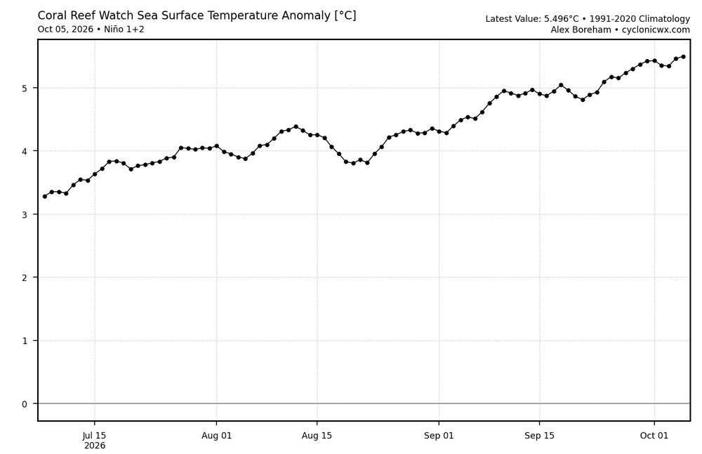
-
33.3° low, with a light breeze still going this am. Climbed right back through the 40s already, gorgeous out there in every way
-

2026-2027 Record-breaking El Nino
GaWx replied to Stormchaserchuck1's topic in Weather Forecasting and Discussion
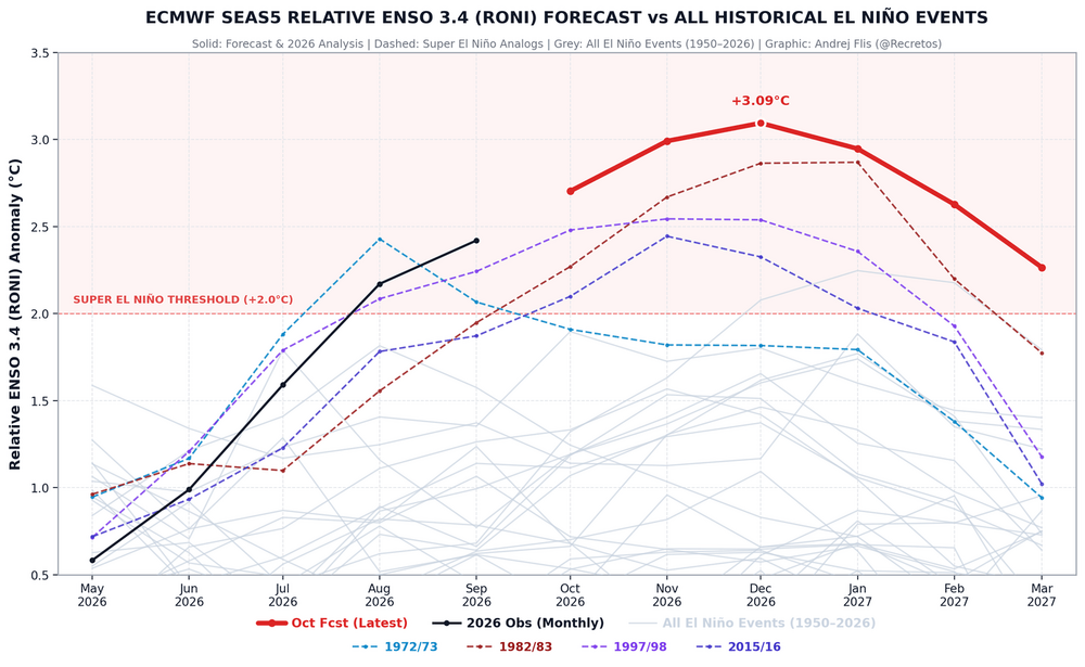
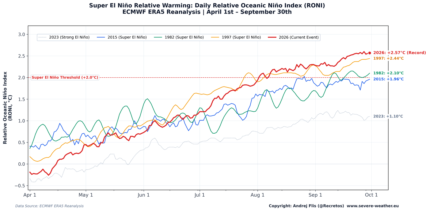
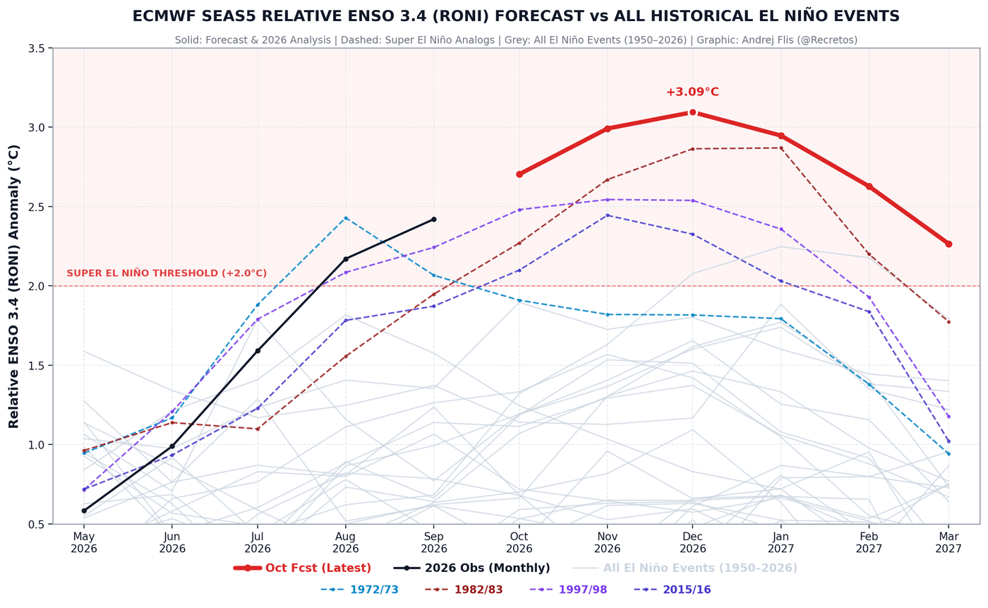
This is the official RONI version of yours, which takes into account the amount of GW between Ninos (specifically as regards the warming of the global tropical SSTs) and thus gives a better comparison of Nino strength from Nino to Nino: 26 has been record warmest since early Aug and currently is 0.13 warmer than 97, 0.47 warmer than 82, .61 warmer than 15, and 1.47 warmer than 23: Here’s the new Euro RONI prog: 26-7 remains strongest, even warmer than the rapidly warming late peaking 82-3 although only barely warmer than 83 in Jan: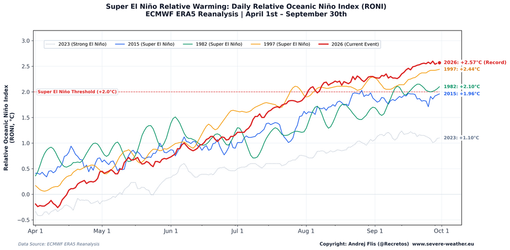
-
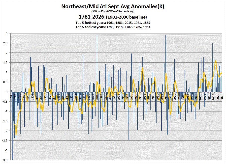
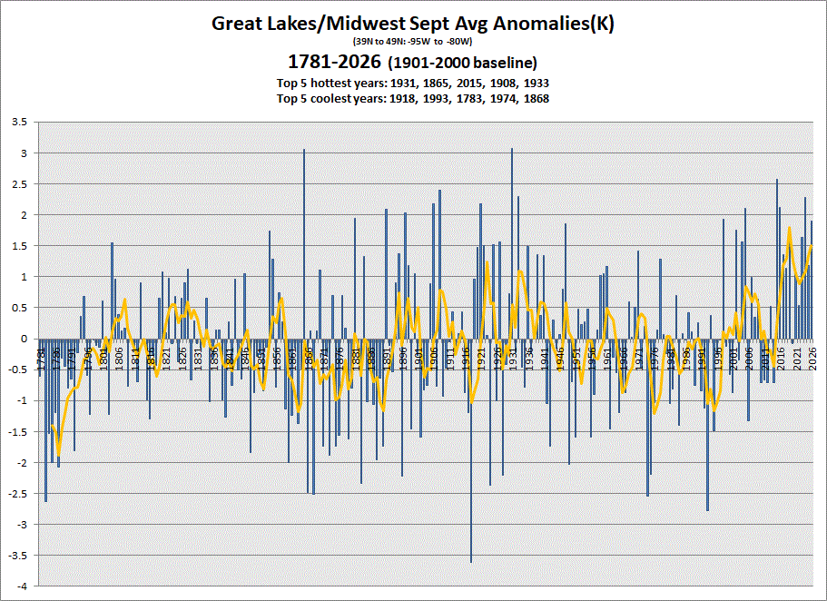
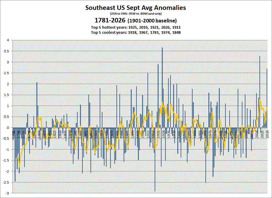
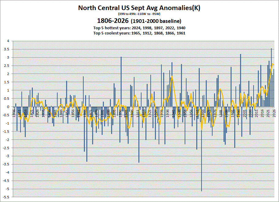
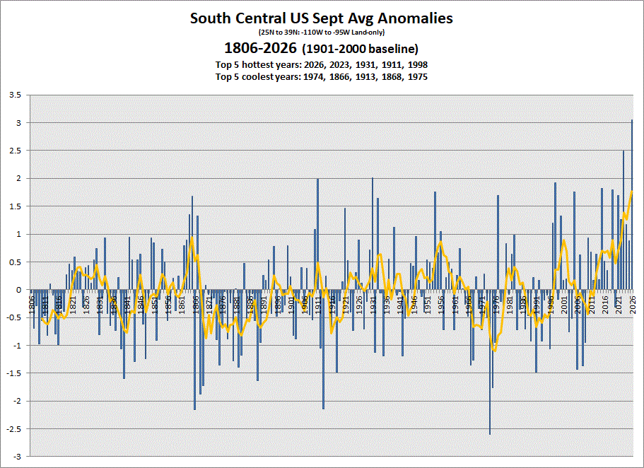
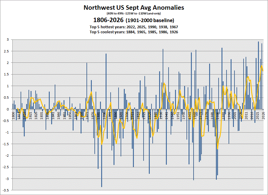
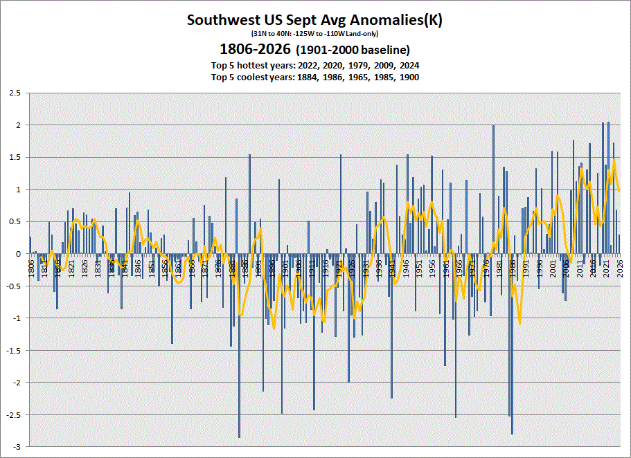
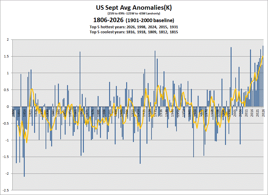
Sept anomaly charts for the various sections of the US & the US as a whole.
-

2026-2027 Record-breaking El Nino
mitchnick replied to Stormchaserchuck1's topic in Weather Forecasting and Discussion
In light of the Euro seasonal snowfall map with the change from last month, higher the better -
Ah...didn't know about antecedent conditions...
-

Central PA Autumn 2026
TheDreamTraveler replied to canderson's topic in Upstate New York/Pennsylvania
Yeah Isaias honestly has me a bit concerned for the gulf states. I could see this potentially becoming a cat 3 before landfall but weakening should start occurring right before landfall though it's hard to know for certain. Still funny it looked like we were going to go all season without a hurricane and then this thing pops up and finds the perfect environment to form like this. But that's how it goes sometimes even in very quiet hostile seasons. Another thing too is the intensity forecast is still the weakest part of the NHC's expertise. It's funny how many storms I've seen just blast through the intensity they'd originally forecast. Or sometimes they just fall apart when they weren't forecast to. That's why I hate making intensity forecasts lol -
Yeah. CoCoRaHS has numerous 8-14" rain amounts over and east of Pensacola for the last seven days.
-
Down to 34 in Nazareth PA (75 miles west of NYC). Light frost everywhere, hope my peppers have a little more life left.
-
 generic prescription drugs in india: IndoCureGlobal - buy meds online
 -
 Cold pool near -3 and seems to be on the move recently.
.thumb.gif.d41aa178e16b5896ce675d353abc6444.gif)
-

E PA/NJ/DE Autumn 2026 Obs/Discussion
FPizz replied to PhiEaglesfan712's topic in Philadelphia Region
35 this morning. chilly -
35 here too, but did turn on the heat. Most likely will turn it back off tomorrow morning.
-
Fakersville FTW!!
-

Mid-Long Range Discussion 2026
WinstonSalemArlington replied to BooneWX's topic in Southeastern States
Mid-Month -
Based on timing and the game being at night the worst should be over by then I would think. But depending on how bad it is they may have to think about moving the game
-
My neighbors tree fell and took out a pole. PSEG had no poles. An out of state crew replaced it 8 days later. the tree that fell was hollow and had the largest carpenter ant nest I’ve ever seen. Because of that tree falling during the storm my property was inundated with carpenter ants. Had no choice to get an exterminator they were on the house from that stupid storm
-
My guess is that they might be running out of 'I' names. They didn't retire Idalia either (after 2023). I think you need a Cat 4+ to retire an 'I' name now. Then again, nothing will ever beat the f-up of not retiring Emily.
-
Yeah always is the case. I think it could come in as far east as maybe Destin but don’t think it’s going much east of that
-
Uber niños have a better chance of being torch in the upper midwest I feel. But MN is so cold that a torch looks like highs in the 20s and 30s and lows in the 10s rather than the usual sub zero lows and highs in the teens. Still cold.
-
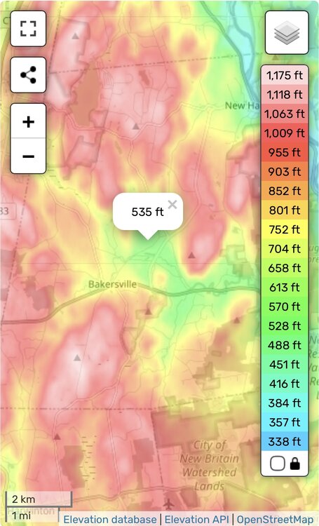
He does have a sheltered valley there and I’m sure it’s a local min on rad nights. But his temp is still too cold from no proper shielding. If everyone was near 32° there I could probably buy 28ish, but 24° would be a New England min excluding HIE. lol
-
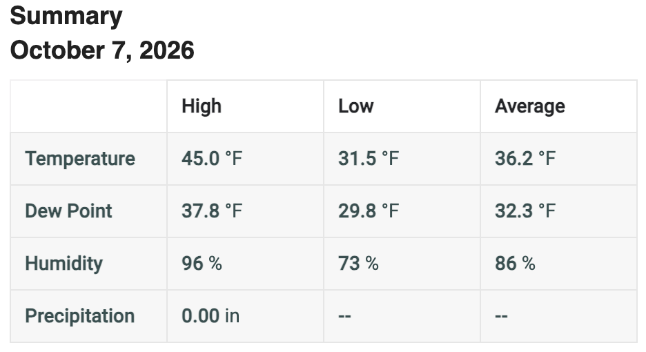
Looks like we dipped below freezing, but just the tip.
-
37.6 low back home , in California this week where it’s mid 90s .
-
Hate seeing that convection showing up on the coast, that typically screws us in these tropical setups. Ive seen this dozens of times with a tropical system going west of the apps retrograding into a large non-tropical low where days of heavy rain modeled ends up as a singular line of strong storms while the coast gets inches of rain and the convection sits there. This is not a great setup for prolonged rain in the piedmont of NC. Eastern slopes of mountains will get pummeled though
-
The mean improved by 2 inches from September one.







.gif.19e72c553e851ec9519cbe5744adbfa2.gif)