All Activity
- Past hour
-

Chester County PA - Analytical Battle of Actual vs. Altered Climate Data
chubbs replied to ChescoWx's topic in Climate Change
But your Phoenixville chart shows increasing heat waves in the same 1978 to 2025 period. There are other explanations for the discrepancy. Station changes at Octoraro Lake being the most likely. You've been making the same cherry-picked comparisons with PHL for a decade now. Invariably the story changes when additional stations are included. Its about time for a KPTW update -
Yep. Did a bit better than you last week with the drizzle here, but my veggie garden is already thirsty as heck after two sunny days
-

Central PA Spring 2026 Discussion/Obs Thread
pawatch replied to Voyager's topic in Upstate New York/Pennsylvania
37 degrees this morning. Can’t remember seeing such temperature swings. No surprise though with the clear blue skies last night. -
So glad you experienced some snow yesterday! That was a cute little system.
-
Chester County PA - Analytical Battle of Actual vs. Altered Climate Data
chubbs replied to ChescoWx's topic in Climate Change
The chart shows more heat waves at Phoenixville, when you consider the spurious warmth at Phoenixville in the 1930 to 1940 period that is well documented in this thread. -
43f at 3pm yesterday in death valley with changeable skies....40s most of the day, pretty wild for met summer 33-34f this morning for lows, not earth shattering but nice to see it can still happen Congrats to those northern mass folks who saw anything from cat paws to brief burts of moderate to heavy wet non accumulating snow or a slushy coating...so cool in met summer
-
Chester County PA - Analytical Battle of Actual vs. Altered Climate Data
chubbs replied to ChescoWx's topic in Climate Change
The Coatesville move from urban to rural occurred in 1948, well before the 1970-2025 period in the chart. Yes the Coatesville stations have different elevations, but there is little impact on annual average temperatures, hence the good agreement between the Coatesville series and NCEI over the 1970 to 2025 period. - Today
-
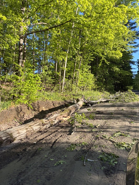
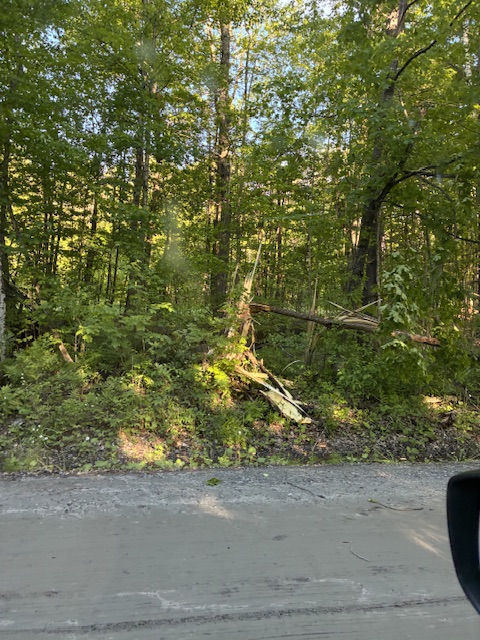
Down to 34F here; good end to May: golfed in Tropical storm forced winds with a wind chill in the 30’s, heard the loud bang, only 0.09” of rain and low temps in the 30’s
-
36 and frosty this morning..
-
It was far better than this last POS. no one should ever consider making a thread for that last one - mods dropped ball badly
-
lol hurricane bob and eventually 1991 halloween forever changed the landscape
-
It wasn’t high end regionally, but it was good enough for some excitement. That’s going to be hard to come by this season. I have extremely low expectations in the basin this season.
-
Thirty-eight point seven First 30s in ten whole days Outdoor shower time
-
Spring will finish up with 8.95" rain here which will make it my 4th driest in 45 years. Ytd of 14.90" is 5" below normal.
-
Bob was a yawner for most.
-
1.03" total rainfall.
-
He spent equal time in that discussing how the block was causing it to be cold It was even. He may be all those things you say he is but he was fair in that particular whatever it is.
-
We even had a little up here. This was up by my golf course.
-
Au contraire. I got in 9 holes at 4:30.
-

Central PA Spring 2026 Discussion/Obs Thread
mahantango#1 replied to Voyager's topic in Upstate New York/Pennsylvania
70 was the high today. -

Summer Outlooks
WinstonSalemArlington replied to WinstonSalemArlington's topic in Southeastern States
-
Maybe the severe drought was the friends we made along the way?
-
Nothing panned out today. It looked like it was going to rain all day, but it never really started. Only 0.05" here. Total for this 10 day wet pattern was 4.94". We need a few more of those to get back to normal. Still in D2 conditions here, but D3 is only a few miles away.
-

2026-2027 Strong/Super El Nino
GaWx replied to Stormchaserchuck1's topic in Weather Forecasting and Discussion
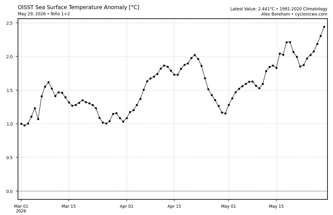
Latest OISST 1+2 anomaly is +2.5C (non-relative). That tells me that relative 1+2 is at a pretty hefty ~+2.0: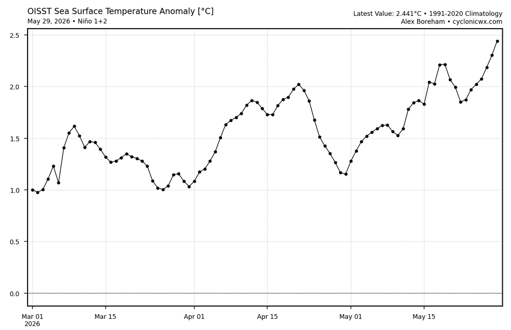
-
https://x.com/nwsspc/status/2060807137387774179?s=46&t=nTdsbQZkQMPkUI3zGjAXJg slight risk in Great Plains and marginal risk surrounding that goes into the south east and Midwest .






.thumb.gif.f92b16c631a1d15d405ed77b33f0710d.gif)