All Activity
- Past hour
-
I’m hyped.
-
That seems to be the pattern most of this decade with the exception of the first half of 2024, at least here in S WI. Long periods of nothing interspersed with about 6 weeks of precip and storms, followed by another 2-3 month stretch of nothing. Hopefully we can get enough precip in the Spring this year.
-

February 2026 OBS & Discussion
Freezing Drizzle replied to Stormlover74's topic in New York City Metro
Great data list, @SACRUS Were the measurements done somewhere in Newark-proper before the airport was established? Does the airport location goes back to 1931? -

Central PA Winter 25/26 Discussion and Obs
Mount Joy Snowman replied to MAG5035's topic in Upstate New York/Pennsylvania
I had just been born three months prior. -
If we get a big dog at some point between now and April I would say A, but I can't go more than a flat B. Personally I am not one who enjoys prolonged cold so that doesn't help the grade before someone says Detroit has had a good winter. We have had a consistent winter with periodic snows but our biggest storm is only like 5.9". It has been endless penny fluff.
-
Interesting my father always talked about the storm and the amounts but it didn’t seem that impressive on these maps
-
I feel like we’ve said this like 2-3x in the last 15 years. “This will never be topped” and then it is, and not to far in the future. Not to get into wolfie favorite debate, but I think we’re seeing the extremes of CC play out kind of in real time. We’ve had some absolutely barren seasons recently, and then an all time blizzard. Youre getting the lowest of the lows and highest of highs basically.
-
I was thinking the rad pits could have one last hurrah below 0F early next week. Cold high cresting over deep snow pack....that'll plummet regardless of when in the season it is occurring.
-

Feb 22nd/23rd "There's no way..." Obs Thread
Hoosweather replied to Maestrobjwa's topic in Mid Atlantic
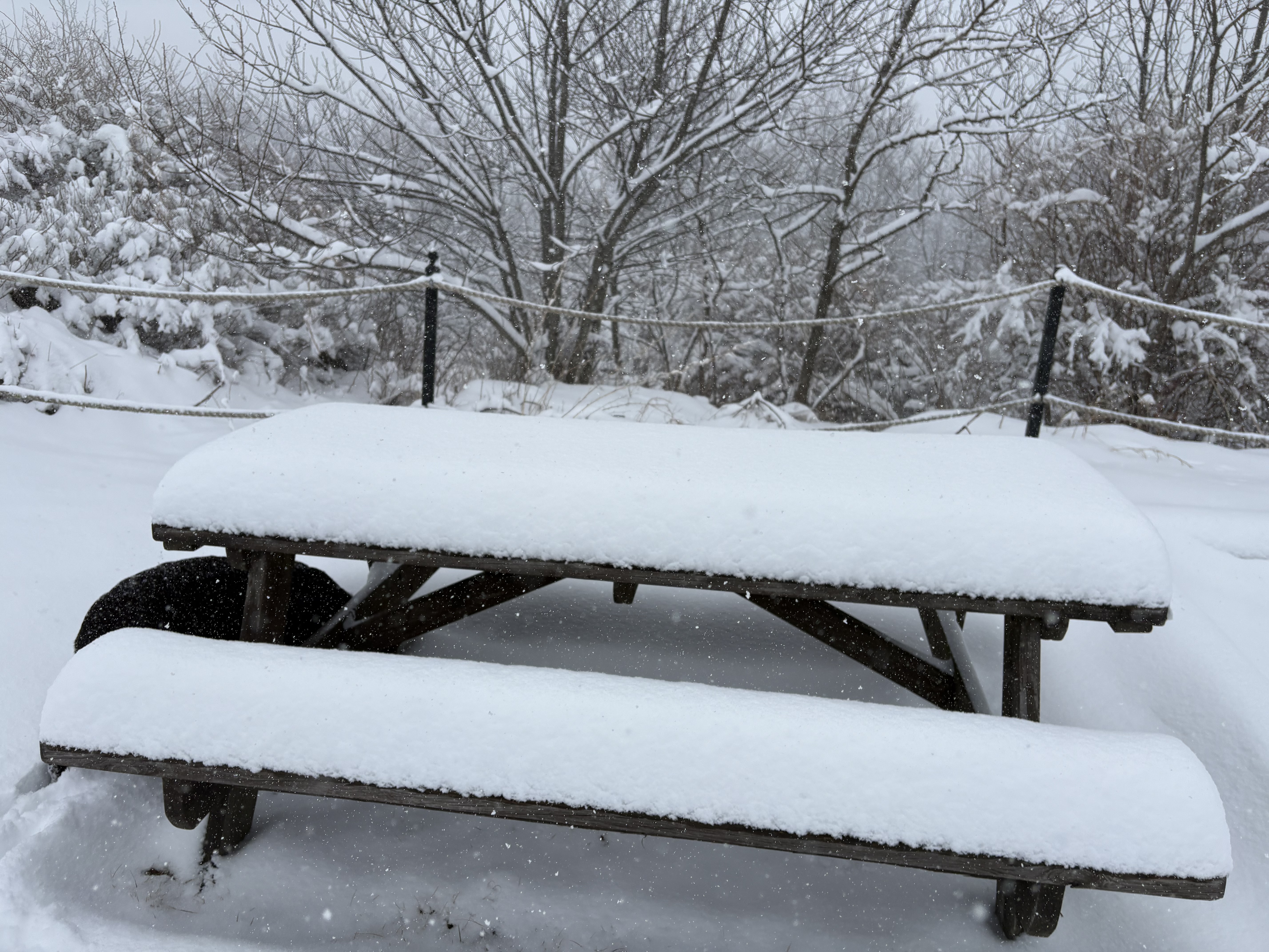
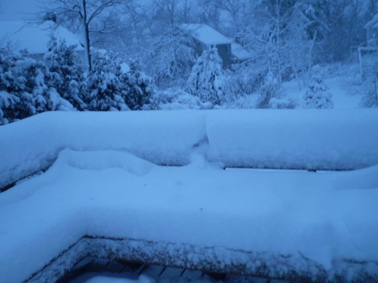
Not letting me add multiple photos but this is a pic from beside our place at around 2pm. This is before the heaviest snow which fell from then till about 6. Now it also was windy but that’s roughly 8-10 on the seats already. Long and short- as crazy as it sounds (and in the valley 3000 feet below they got a dusting!)- this actually happened at Wintergreen. I don’t know if it was a perfect spot for upslope or what- but it was easily over a foot. Incredible to witness!
-
Winter cancelled/uncancelled banter 25/26
Freezing Drizzle replied to Rjay's topic in New York City Metro
You know the forecast is uninteresting when the Banter thread has the most recent post. -
NYC was in the cross hairs for at least 36-48 hours out....it was iffier beyond that....the system did not have long lead time though....the huge retrograding bomb started showing up inside 4 days IIRC....it was kind o chaotic because we were focusing on the first threat which was like this marginal temp firehose into SNE....I had nearly foot of pure blue snow on winter hill in that first event. I took this pic early on the morning of 2/24/10.
-
I hope we lock in on a wet spring, those always tend to be fun for severe as well.
-
That looks really cold Monday afternoon through Wednesday. Monday's eve is steeped in a sneaky Montreal Express; very efficient transport of low level syrup from western QUE/E Ontario. Thickness say 520 to 525 but the sounding may be more upright with the coldest, relative to normal, being the lowest 300 mb space of the sounding. It's all happening over a pan-dimensional snow pack, too. I bet we decouple and see (the season's last?) -0s lows in the interior around 4 am Tuesday morning. Might even call that the local pattern nadir, and it's rising in principle through the 10th after that.
-
Yeah it's obvious now that Monday is going to be suppressed to the south and shredded. Our hope to get a little accumulating snow is Tuesday, but of course the problem Tuesday is the cold air is moving out. So that looks like a mix storm with snow changing to rain. We need the Tuesday wave to come in early in the morning like last night's Euro showed. If that happens we can get a couple inches of snow before it changes to rain.
-
The weather today and tomorrow has premium potential.
-

Feb 22nd/23rd "There's no way..." Obs Thread
North Balti Zen replied to Maestrobjwa's topic in Mid Atlantic
Welcome! -
Man... talk about radiative cooling .. all the way down to 3 degrees at FIT
-
Meanwhile, early cherry blossoms in DC.
-
Yeah I can see a reload near mid-month...mentioned this yesterday. PV starts to get pressed down into Hudson Bay on ensembles....if that verifies, that's a LOT of cold not far away, so we'd prob have an additional threat or two if that's where it starts to settle.
-

Winter cancelled/uncancelled banter 25/26
WeatherGeek2025 replied to Rjay's topic in New York City Metro
good times, last week i was punching my numbers for my snowmap for 20+ -

Pittsburgh/Western PA WINTER ‘25/‘26
Rd9108 replied to Burghblizz's topic in Upstate New York/Pennsylvania
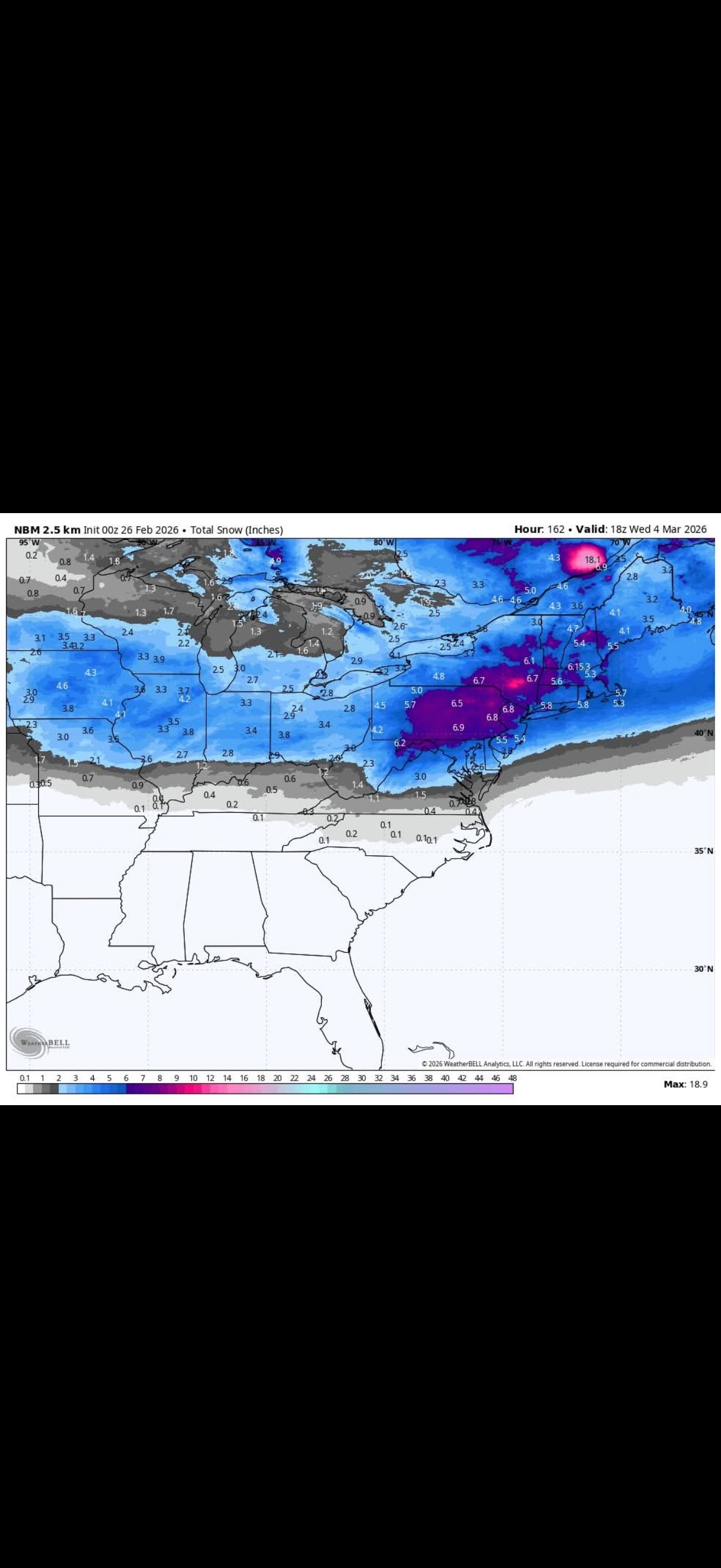
Not really seeing any signs of anything notable but heres the latest NBM.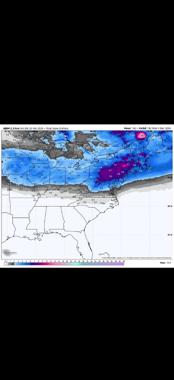
-
Not over IMO.
-
That is bit too early to be impacted by the reversal...lag time is like 15 days at this juncture.
-

E PA/NJ/DE Winter 2025-26 Obs/Discussion
MJO812 replied to LVblizzard's topic in Philadelphia Region
The wave on Sunday ruined this threat. It would have been a nice threat if it stayed in one piece. -
The GEFS takes longer to get to phase 8. Likely around the 20th.