All Activity
- Past hour
-

2026 Mid-Atlantic Severe Storm General Discussion
somecallmetim replied to Kmlwx's topic in Mid Atlantic
Pretty perfect Alexandria fail unfortunately. But we did get hit hard with rain last week at least. -
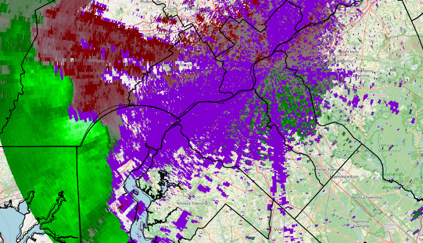
Deluge with scattered thunder and lightening. I'm up to 2", including an inch in the past 27 minutes. We're passing through 3-4 inches easily based on that radar. My street is a river. Meanwhile, if I'm reading it right, it looks a huge bow echo is heading into South Jersey. Wild evening.
-
 Just dropping by to add this
 -

2026 Mid-Atlantic Severe Storm General Discussion
GramaxRefugee replied to Kmlwx's topic in Mid Atlantic
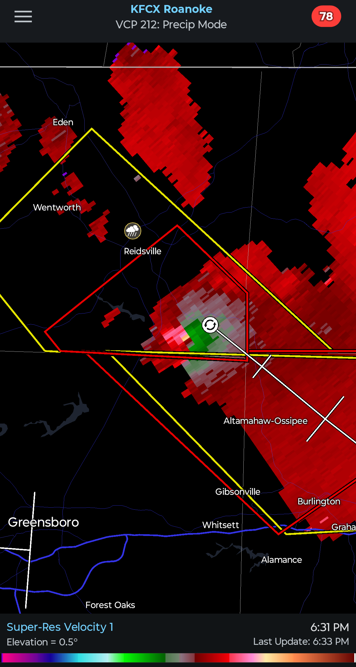
About 0.3" but picking up again. Not as strong here as you other guys saw around here, even though we were strongly tornado warned. Rather mild storm. -
things are going downhill in Asheville currently.
-
 From the other day but wow! https://x.com/accuweather/status/2082234180726047101?s=20
 -

2026 Mid-Atlantic Severe Storm General Discussion
Herb@MAWS replied to Kmlwx's topic in Mid Atlantic
Columbia: 0.61” imby, 6.89” for July. -
E PA/NJ/DE Summer 2026 Obs/Discussion
KamuSnow replied to PhiEaglesfan712's topic in Philadelphia Region
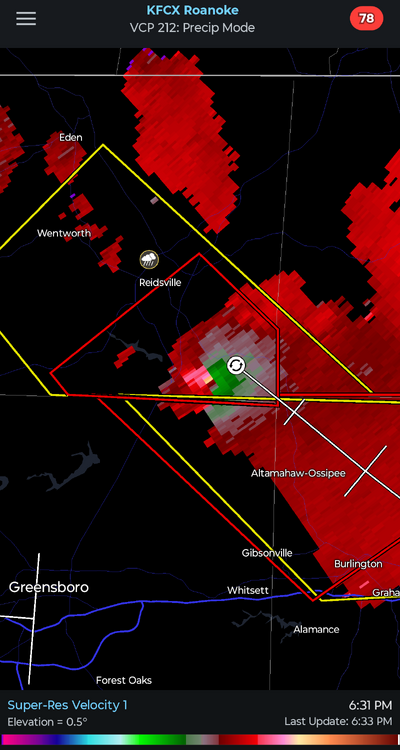
There's a tornado warning area that stops about 5 miles west of here. Also we're in a severe warning here. Storms seem to be moving slow, been hearing muffled thunder for a while now. Mostly I'm rooting for rain, got a total of 0.50" in the 2 rounds of storms last week, and nothing more than some light showers the laat 2 days. Interesting!.jpg.f17ee810375a75e0887da64d001bac25.jpg)
-
We got the ol Mt Mitchell split but still had some mammatus, a shelf cloud and decent gusts
-
How are the twin cities* faring? *Ellicott City/La Plata
-
Rain is almost done, sun trying to come out to the west, and still getting random close lightning strikes
-
 1.10 at a nearby PWS. Solid out the gate. Looks like BDL is close to 2".
 -
 Double IPAs will do that to you.
 -
Bit of a lull here in Rockland County but radar looks juiced.
-
 Webbed tadpoles?
 -
E PA/NJ/DE Summer 2026 Obs/Discussion
SouthernNJ replied to PhiEaglesfan712's topic in Philadelphia Region
The line of thunderstorms is bowing forward moving into the area. Some circulations are appearing as well, including near Avondale/Kennett Square. This activity is moving northeast and will enter Delaware and Montgomery counties before reaching Philadelphia. TPHL 6:33 PM: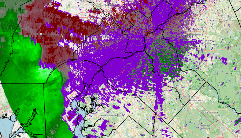
-
SREFs?
-
 Shooting .. but only Stein comes out
 -

2026 Mid-Atlantic Severe Storm General Discussion
Random Chaos replied to Kmlwx's topic in Mid Atlantic
My rain gauge is showing over 8in/hr rate right now. 0.62” so far.- 1,643 replies
-
- 2
-

-
- severe
- thunderstorms
- (and 7 more)
-
Shooting blanks
-
Yeah I just saw that on PulsePoint! Power outage counts from BGE are surprisingly tame given that wind. Looks like some wires down on Patuxent Rd down near Woodwardville as well.
- 1,643 replies
-
- 1
-
-
- severe
- thunderstorms
- (and 7 more)
-