All Activity
- Past hour
-
Definitely dropped amounts.
-
Are you thinking ice storm potential in Southwest/Central/Southside VA into RIC? Or mostly sleet?
-
Indeed I'm absolutely positive he's laughing his ass off at the mood swings as he reminisces about having winter storm warnings in one room and an advisory in another so no matter what any met said, it would always verify in his house and something about seeing the whites of its eyes before getting excited
-
.
-
No, no lets not reshuffle like that. Genuine question is where do you see the north shift coming from? Synoptically I have a hard time seeing how much further it can go north with a solution like the 18z Euro as it has a perfect phase.
-
Sure, but this isn’t impressive cold for late January. Most areas haven’t even dipped below 10 yet. I think my low is 13. Once we dip sub 5 that’s “impressive” for late January. to me a 0 degree reading is the same as 100 degrees in summer here. 5 degrees to 98. 10 degrees to 95. 15 is 90. so far we’ve had no nights below 10 and 2/3 below 15. So it’s been cold but not impressive by any means.
-
Actually about the same lol. Still good! I need another bourbon.
-

Central PA Winter 25/26 Discussion and Obs
Blizzard of 93 replied to MAG5035's topic in Upstate New York/Pennsylvania
It’s all good to see the positive trends. -

Possible Record Breaking Cold + Snow Sunday 1/25 - Tuesday 1/27
Brasiluvsnow replied to TriPol's topic in New York City Metro
welcome back lol -
I don’t want too much to change either. But if I had to guess, final track will be shifted about 100 miles north of what the entire model average is now. Maybe 150. Might put our forum in the jack, and maybe even flirt with mixing across the southern half. I’ve seen so many big ones shift north like this.
-

Southern MD / Lower Eastern Shore weather discussion
SnowtoRain replied to PrinceFrederickWx's topic in Mid Atlantic
With any of these bigger storms I always get flashbacks to the January 2016 storm, nice front end thump, going to bed with heavy snow falling and over 8" on the ground. Then waking up in a panic because of the sound of torrential rain. I had not shoveled anything yet and there is a drain near the back door that stops water from getting into the house that needed to be cleared. So I half awake stumble out the back door to be greeted to the most hellaciously heavy sleet I have ever seen. Ended up with 10" of snow, 2" of sleet on top of that and then 1" of snow to cap it off from the all day flurries we got while the western shore was beaten down with heavy snow. I learned from that storm never trust the deformation band will eventually make it to the Eastern Shore because by the time it does the storm is pulling away and that band is long gone. Also, as nice as it is to have a detached garage behind the house, it is hell to dig out. Probably one of my least favorite major snow events... -
I might be able to make Thursday but already have a commitment on Friday. Maybe I can get @Scraff to carpool with me.
-

Richmond Metro/Hampton Roads Area Discussion
RVASnowLover replied to RIC Airport's topic in Mid Atlantic
Agree on both comments. This setup is different. Euro has been trending more amped and weaker HP -
Time to check the latest Natty Blend.. holy fuck..just keeps getting better
-
Here's my 2 cents... Climatology speaking, there will be significant icing after Heavy Snow this weekend. The question is where does that ICE line set up and when? Even up here in southern VA, its difficult to get a pure snowstorm like this one without having some icing. Honestly, Its hard to not get upset with the models trending north but in the overall scheme, there is absolutely nothing we can change about that. They could trend back south tomorrow and Thursday. Its hard to say. But whether its snow or ice or both. The Carolinas and Virginia are getting this Winter Storm. Just a matter of how much we are getting is the ? Let's see what 0z and 6z show.
-

Central PA Winter 25/26 Discussion and Obs
paweather replied to MAG5035's topic in Upstate New York/Pennsylvania
Sorry about that. -
Fishel said it perfectly. I completely agree with his line of thinking. .
-

Texas 2026 Discussion/Observations
DFWWeather replied to Stx_Thunder's topic in Central/Western States
Not exactly...Just to clarify the terminology a bit...when meteorologists talk about a ‘dry slot,’ they’re referring to the dry conveyor belt wrapping into a mature cyclone. It’s a broad synoptic feature that shows up in global mass fields and satellite water‑vapor imagery. It’s not something the NAM typically resolves well at the end of its run, and the model actually has close to an inch of QPF down by midnight Fri/Sat, which suggests a fully intact precip shield rather than a dry slot intrusion. About the analogs I posted earlier: When I mentioned Feb 2003 and Dec 2013, I was referring to the H5 pattern and overall pattern structure, not the exact surface impacts. Those events share several large‑scale similarities with this setup: 1) A deep, well‑established Arctic air mass 2) A southern‑stream disturbance ejecting from the Southwest 3)Strong overrunning and isentropic lift 4) A marginal warm layer aloft that cools with time 5) A broad, long‑duration precipitation shield Dec 2013 did produce some icing, but the event was actually sleet‑dominant because the warm nose was shallow and weak. That’s why it’s a useful analog here — the thermodynamic structure favored sleet, and this system is showing a similar profile so far. So the comparison isn’t about matching the exact precipitation type outcome — it’s about the larger‑scale pattern and storm mechanics. From that perspective, the analogs line up pretty well. -
We don't talk bad about the NAM when it shows something we want
-

January 2026 regional war/obs/disco thread
HoarfrostHubb replied to Baroclinic Zone's topic in New England
Bullseye over Sleeping in Tolland -
Unless there was some unconventional cooling conditions that night, and assuming the -34 reading is correct, places like Sandyston and Walpack would had to have been -40 or better. I'm not sure there is any real dataset for out that way that far back. It would be interesting to pour through old newspaper articles or local journals if any still exist, to see if there is any reference to it. For tonight, I'm hovering between 7 and 8 above, and my high today was only 18. I'm thinking I'll make it to 0 or a shade below by morning. I'm changing out weather stations, and plan to use the 24-hour reprieve from the cold tomorrow or Thursday to get it done. Fingers crossed the new one works well.
-

January 2026 regional war/obs/disco thread
OrangeCTWX replied to Baroclinic Zone's topic in New England
Eric Webb is currently live on Fox Weather. I wonder if he will acknowledge the north shift -

1/23/26-1/25/26 Winter Storm Thread
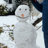
WishingForWarmWeather replied to AMZ8990's topic in Tennessee Valley
Ooo - how do I make this with my son? -
Ok peeps, time for 0z and forget about the Euro. NAM is running, onward and forward we go…
-
High of 27 15 at 9PM 10 will probably be the low. Burning some of that wood I split yesterday. Toasty in here. Heat pump on vacay.