All Activity
- Past hour
-
Stormy morning. Round one passed and a another cell is aiming this direction. Mammatus clouds present in the sky this morning around these storms. 0.3" in the gauges last I checked.
-

Augdewst 2026: Summer's Last Stand
Damage In Tolland replied to Prismshine Productions's topic in New England
Well don’t Mets look at data and models ? -

2026 Atlantic Hurricane Season
NorthHillsWx replied to Stormchaserchuck1's topic in Tropical Headquarters
I think the biggest difference is, during those recent dead August's, the primary limiting culprit was abnormally high SAL. That hasn't been an issue this year, yet the basin has remained so hostile in the upper levels that even strong waves with solid moisture envelopes have failed to develop. The cap got blown off in those previous seasons because SAL decreased heading into September. This year, there are no indications the shear will subside (but for windows as your forecast notes) and it won't be so much of a "back loaded" season more than a wave finding a small window during peak climo. Also, there is some science to back Nina seasons being more back-loaded than Nino seasons. With almost 0 activity to this point, just few storms might appear to make this look back loaded, but I seriously doubt we see the cap come off like in recent years with frequent high-end development through September or even beyond. With Nino strengthening, I actually could see an early end to the season as well. It only takes 1, and with water temp anomalies off the SE coast running about the highest in the basin, that is of concern, but it is going to take perfect timing and a thread the needle type event to get a system through to take advantage. The rest of the basin is likely cooked besides some low-end development, like 96L -
Two things that can work in our favor for severe weather later in the season are more robust mid-latitude systems producing better dynamics and of course tropical systems. I am pretty doubtful we'll get tropical impacts this year - but certainly the first factor could play into it. September 24, 2001 comes to mind as a clear cut example of fall severe events here. Get a robust shortwave or closed H5 low and weird things can happen. Even as late as November we can get a super dynamic system (the type where the storms come up form the SW to the NE instead of NW to SE and give us brief spin ups and damaging wind along a squall line. ETA: And don't forget those weird January/February events we've seemingly seen a few of over the past decade or so where we get a random slight or enhanced to cover some weird cold season dynamic event.
-

Augdewst 2026: Summer's Last Stand
weatherwiz replied to Prismshine Productions's topic in New England
The slight east has been expanded eastward. Will be a fun day into MA/CT -
Augdewst 2026: Summer's Last Stand
weatherwiz replied to Prismshine Productions's topic in New England
Same here. I've been wanting to dig into this more too but I'm really curious as to the LA Nina events of 2017-2018, 2020-2021, and 2021-2022...for some reason these seasons exhibit some larger spread in the trimonthly numbers versus the traditional ONI and ENS-ONI. Even 2025-2026 I think had this to some degree. -

Augdewst 2026: Summer's Last Stand
Chrisrotary12 replied to Prismshine Productions's topic in New England
Honestly, I used the weather app every day. Use it as a first glance. Then if I see anything of interest (such as today’s 45% of rain). I’ll actually look at a model. And then learn that the chance of rain or rather impactful rain is much lower. -
.31" here so far. Didn't cancel soccer practice at the HS
-
I'm not quite sure how 96L hasn't been classified as at least a depression. It looks better formed than several TS's from earlier this season on the morning visible and one would think after how close it was on ASCAT yesterday and given marked improvement since, it would definitely qualify as a tropical cyclone. As for intensity, it is probably a TS given information yesterday had some TS wind barbs and it has only improved since. Me thinks this gets named at 11...
-

Augdewst 2026: Summer's Last Stand
SouthCoastMA replied to Prismshine Productions's topic in New England
Will finish August with just over 1" at 1.05". -
Augdewst 2026: Summer's Last Stand
Chrisrotary12 replied to Prismshine Productions's topic in New England
As opposed to twitter? -
Augdewst 2026: Summer's Last Stand
Chrisrotary12 replied to Prismshine Productions's topic in New England
Ah! Didn’t know if that was for torch or blues and fall. Thanks for clarifying. -
Euro seasonal is nice
-

Augdewst 2026: Summer's Last Stand
Typhoon Tip replied to Prismshine Productions's topic in New England
I'm actually quite interested in the test for RONI In physics, physicists are always chomping at the bit for natural extremes, because it is at the boundaries of what is conceived as possible, that the boundaries finally get to be tested. RONI isn't exactly an offset factor to the prior generational ENSO, whereby a laboratory test can be very readily examined (... droll understatement). In fact, there is NO way to do that. It has to be tested by the vagarious doings of the wholesale atmospheric hemisphere(s) over time. This is one of those times. Agreed. The extremeness of +ENSO definitely puts a plan in place that gives RONI ( I suspect...) it's best test to date. If this were to say go over the unthinkable 3.5 ...then a 2.7 equivalent attack on the canonical climate pathways should be observable. I mean if this ENSO gets out of whack and STILL there were comparatively/relatively minor impacts, then the amount of RONI's current importance/significance gets a side eye look as not being enough - and vice versa. etc -

Augdewst 2026: Summer's Last Stand
40/70 Benchmark replied to Prismshine Productions's topic in New England
Heh... @Typhoon Tip -

2026 Mid-Atlantic Severe Storm General Discussion
dailylurker replied to Kmlwx's topic in Mid Atlantic
Models seem to want to hold off on storms until this evening around dark. The slight risk area includes most of the area. Time is ticking on thunderstorm season. I'd like to get a good lighting show. It's been super lame in the lighting department imby.- 2,217 replies
-
- 1
-

-
- severe
- thunderstorms
- (and 7 more)
-
2026-2027 Record-breaking El Nino
40/70 Benchmark replied to Stormchaserchuck1's topic in Weather Forecasting and Discussion
-
The O's are 3 under .500, now watch they win today and lose the next 4 or 5 after in a row.
-

Augdewst 2026: Summer's Last Stand
Brewbeer replied to Prismshine Productions's topic in New England
it's worth looking at multiple sources for forecasts and information comparing data makes it easier to figure out what's likely, what's possible, and what's BS -
Man, the latest CFS is how you watch 'ole man winter swallow a pistol.....brutal combination of east-based El Nino overlaid onto residual MC regime....look familiar? It should-
-

2026-2027 Record-breaking El Nino
bluewave replied to Stormchaserchuck1's topic in Weather Forecasting and Discussion
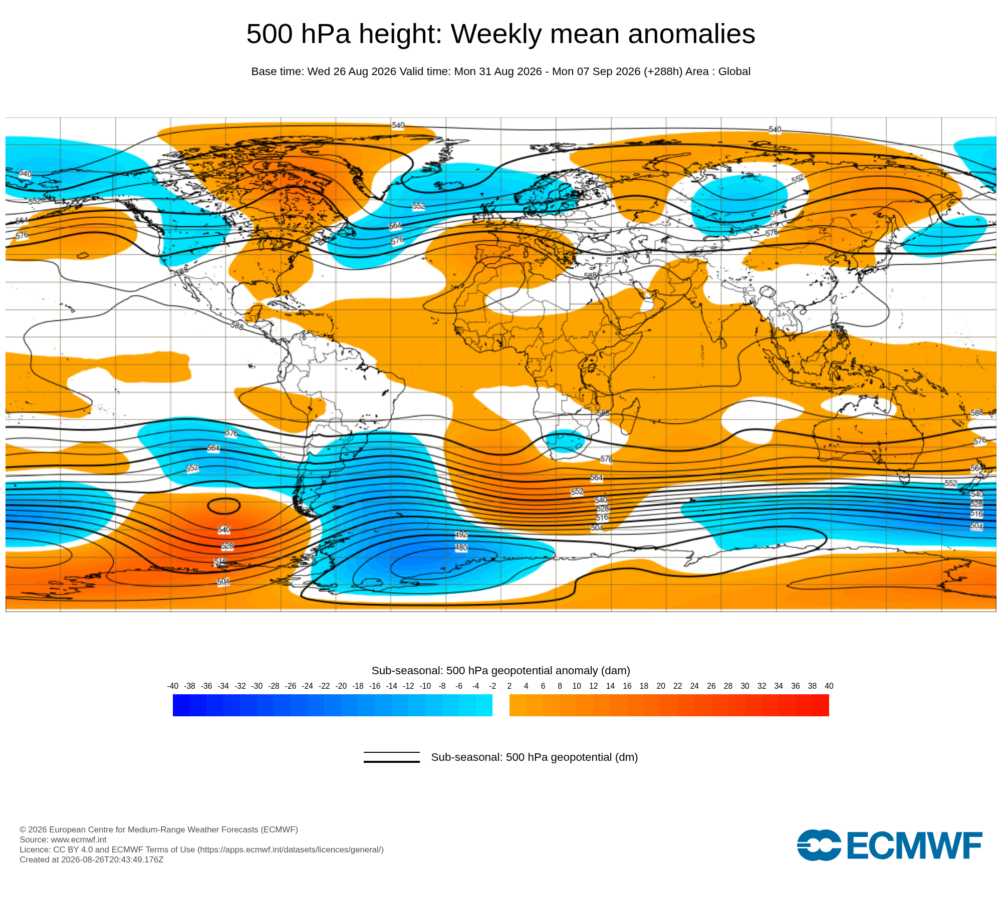
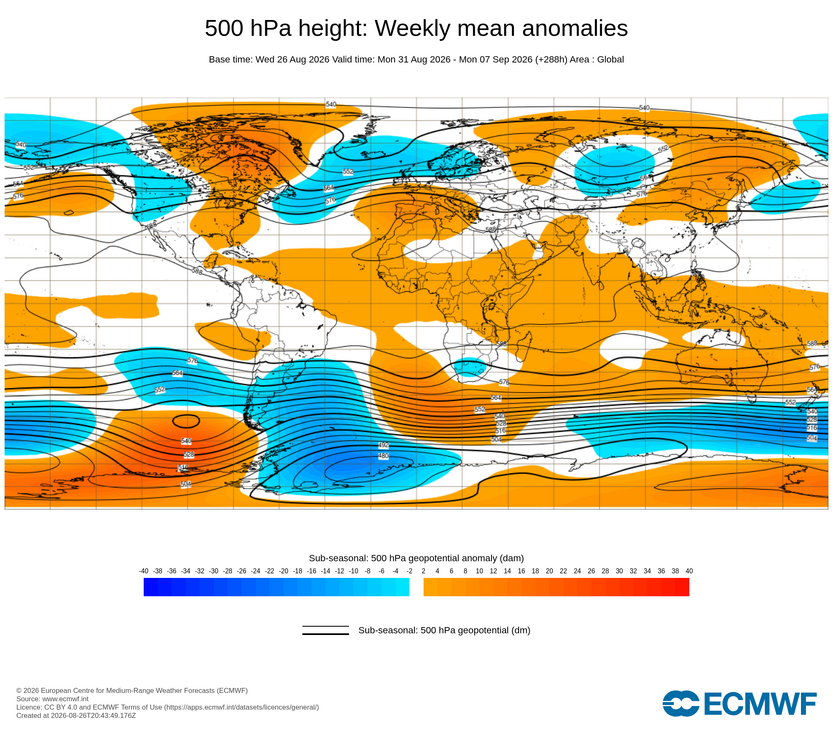
At least the start of September will show some similarity to 2023 and 2015. But the forecast is for a stronger Southeast ridge this time. Matches the summer theme of stronger mid-latitude 500 mb ridging than past developing super El Ninos.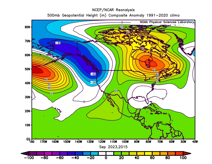
-
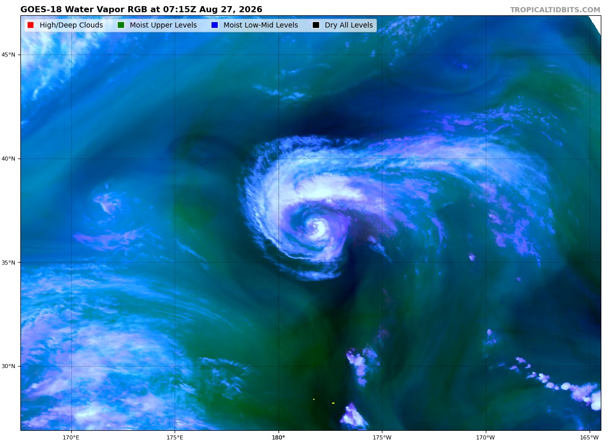
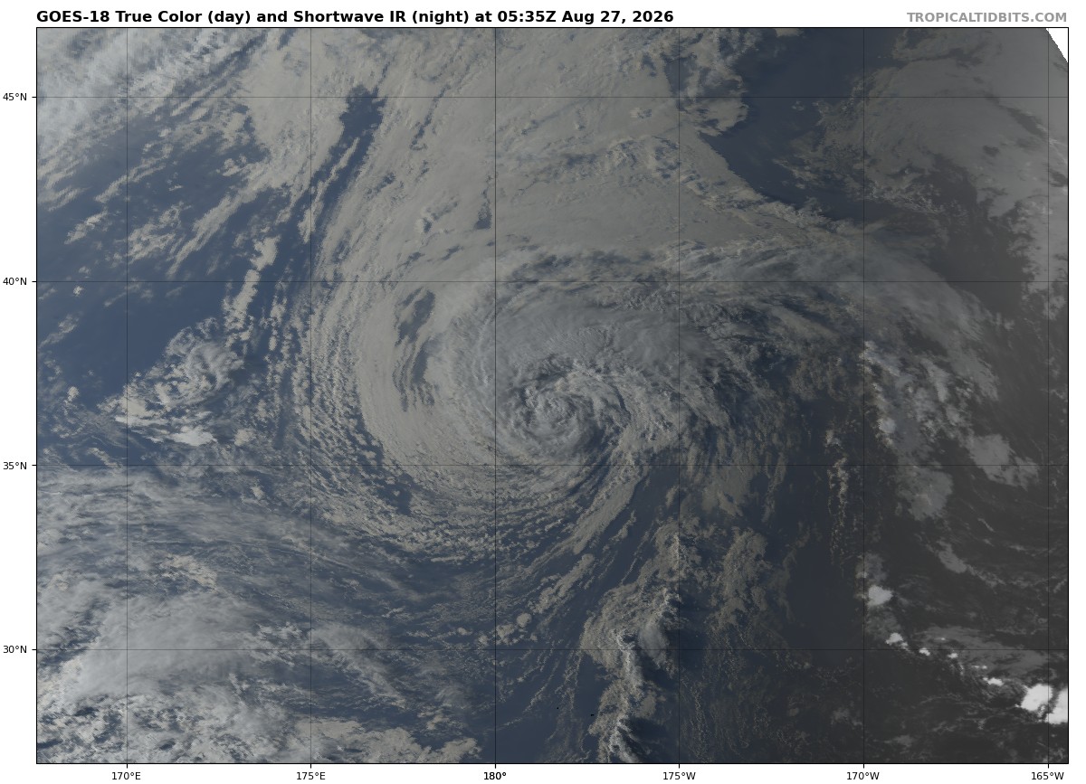
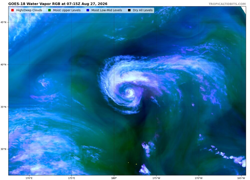
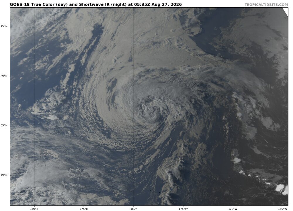
Lala is still rather stunning as she undergoes transition
-

Central PA Summer 2026 Discussion/Obs Thread
Mount Joy Snowman replied to Voyager's topic in Upstate New York/Pennsylvania
Low of 68 with .01" of rain. Curious to see how things set up today. -
Augdewst 2026: Summer's Last Stand
40/70 Benchmark replied to Prismshine Productions's topic in New England
If ever there were a season to be leery of disregarding ENSO in favor of CC-oriented conceptualizations, it's this one. -
Augdewst 2026: Summer's Last Stand
40/70 Benchmark replied to Prismshine Productions's topic in New England