All Activity
- Past hour
-
Euro AI is pretty amped. Definitely trending towards a little snow, although temps will be borderline for accumulation
-
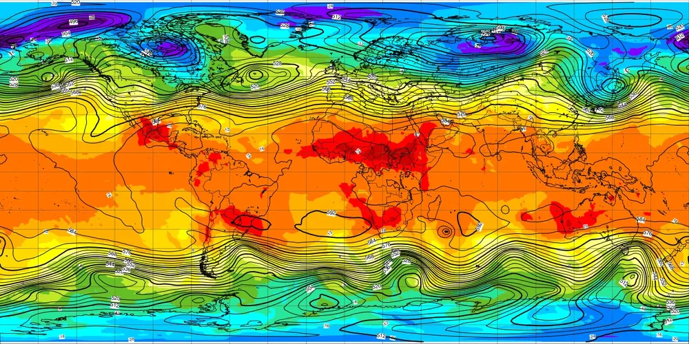
This overall dry pattern has been persistent as hell for quite awhile now (started back in the fall of 2024). We’ve basically seen relentless cold with very few breaks since the end of November but the dryness has continued. The only real exception was last weekend
-

E PA/NJ/DE Winter 2025-26 Obs/Discussion
Mikeymac5306 replied to LVblizzard's topic in Philadelphia Region
Lot of roads look like that now. -
.thumb.jpg.6a4895b2a43f87359e4e7d04a6fa0d14.jpg)
Central PA Winter 25/26 Discussion and Obs
Yardstickgozinya replied to MAG5035's topic in Upstate New York/Pennsylvania
I'm down here at City Island at the crack of dawn shooting some pictures with my dslr, although I forgot my d*** tripod.I'll post when I get home.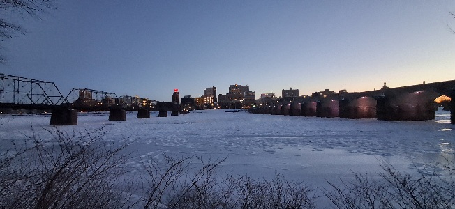
-
5.2/0.5
-

2025-2026 ENSO
donsutherland1 replied to 40/70 Benchmark's topic in Weather Forecasting and Discussion
The EPS is suggesting that the PNA+ regime that commenced is approaching its end. Moreover, a WPO+/EPO+/AO- (neutral)/PNA- pattern will develop near February 10th +/- a few days. The evolution of this pattern will very likely mark the end of the severely cold pattern that has gripped the eastern third of the CONUS and seen multiple waves of Arctic air masses sweep into the East. It will likely also dent the persistently warm pattern that has dominated in parts of the West, at least for a time. The West will probably see a resumption of the warmth during the closing 7-10 days of February. The outlook for the eastern third is a more uncertain. A WPO+/EPO+/AO- (neutral)/PNA- pattern is typically a milder pattern, but not exceptionally warm one. Were the AO to go positive, the probability of more significant warmth would open up. Finally, there is the complication of shortening wave lengths that will increasingly become a factor mid-month and beyond. As wave lengths shorten, teleconnections lose their predictive skill. Instead, synoptic factors that can only be forecast at shorter lead times play a more prominent role. -
Very impressive Arctic outbreak possible next weekend as a lobe of the polar vortex is forecast to dive into the Northeast. Places like NYC have a chance to drop lower than this weekend since the winds look to be stronger with more of NW flow and stronger high pressure to the west. Instead of the light winds like we had this weekend which didn’t transport the coldest air into the heat island. My guess is that we will finally get a thaw beginning a few days later as the entire polar vortex shifts back closer to the Arctic and Asia.

-

Central PA Winter 25/26 Discussion and Obs
Voyager replied to MAG5035's topic in Upstate New York/Pennsylvania
Thanks MAG. I know most on this forum love cold and snow, so in reality, I don't belong here, but some of the most knowledgeable mets and hobbiests reside here, and I need good information and analysis. That being said, I have about as bad of a job as one could have when it's crazy cold. That's why I need some warmer breaks periodically. The ice alone at the springs gets insufferable at times. The water mixes with the snow and creates an unavoidable 2-3 inch ice sheet that we have to try to walk and work on. It starts to get tiring and overwhelming over time. -
I opened the door to let the dog out and said "man it's warm." Amazing how quickly 21 degrees feels warm after days and days of Arctic air.
-
Yep. A waste unfortunately.
-

February 2026 Medium/ Long Range Discussion: Buckle Up!
snowfan replied to Weather Will's topic in Mid Atlantic
Book your tee times, plant those spring bulbs, get the grill ready...
-
Really with the lone exception of last weekend, we have been in a dry pattern since the end of November. A very persistent cold pattern for sure but also an overall dry one
-
Kudos to the cold and dry folks, nailed it.. We wasted 2/3rd of what could have been a very memorable period.. At least we got the one big dog. Next chance of bigger qpf looks to be around Valentines Day, as others have mentioned, hope there will be enough cold around by then.. After Valentines Day, I think most are ready for spring..
-
With deep snowcover, Salisbury, North Carolina is -1° this morning.
-
I just ran out in boxer shorts to grab a bag of wood pellets for a pellet stove. I kinda stood there for a second and thought, hey, it's not out here lol. 19
-
Friday night doesn’t seem like much. It gets going too late outside of an inv trough swinging down.
-
you know its been cold when 21 doesn't feel that bad. just a light parka is all that's needed...and jorts...always functional and fashionable
-
6z euro AI looked a little better. After that it gets dicey. We’re going to need to hope and pray that the -NAO is just enough to fight off the Conus torch coming. Especially in SNE. The Pacific is ugly.
-
19. Torch
-
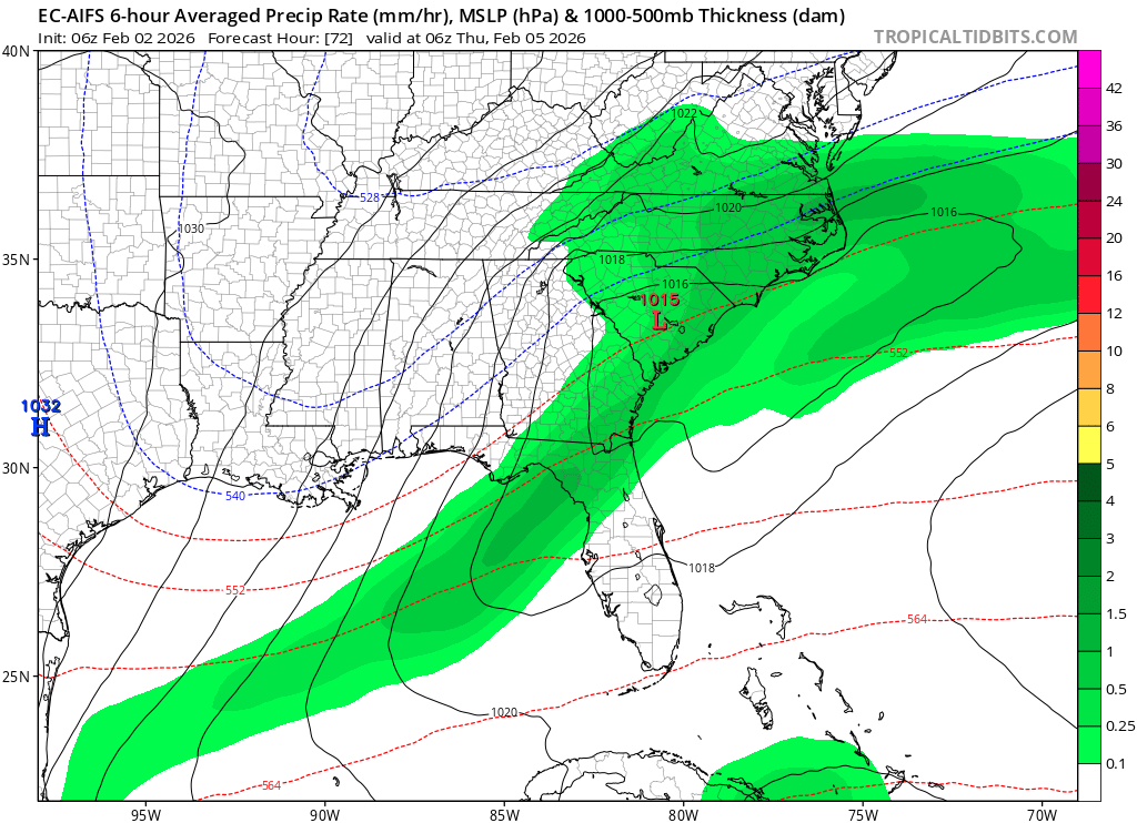
Euro AI not too interested in 5-6th except frontal squalls I think. Clipper on the 10th and then swfe string redeveloper 14-15th. Looks like high pressure holds to our north.
-

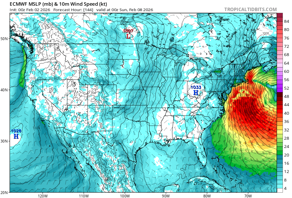
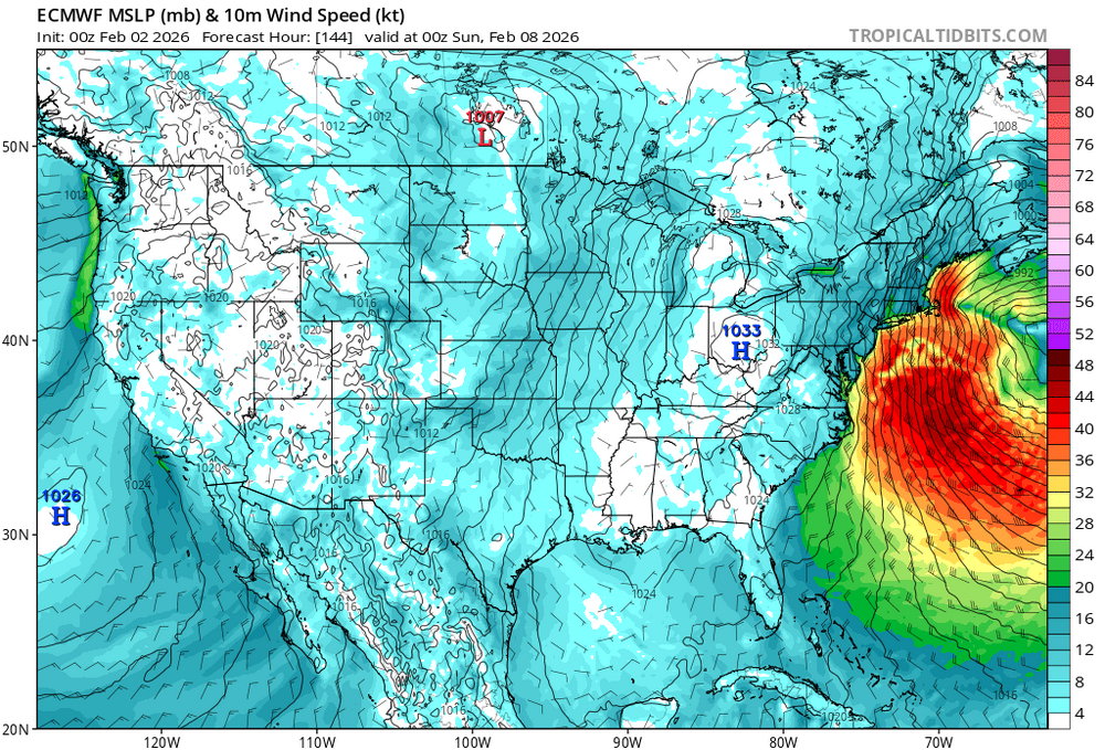
Possible coastal storm centered on Feb 1 2026.
The 4 Seasons replied to Typhoon Tip's topic in New England
If anyone has totals from the OES yesterday or anything from the islands/cape please let me know. ill be doing a map today for totals for SNE...mostly for archival purposes/posterity -
February 2026 OBS & Discussion
donsutherland1 replied to Stormlover74's topic in New York City Metro
Following this post, the temperature rose to 20° at 8:45 pm in Islip. -

E PA/NJ/DE Winter 2025-26 Obs/Discussion
Birds~69 replied to LVblizzard's topic in Philadelphia Region
Some may actually rise above 32f today. First time in a while… 15f -
Dude is a genius who has written so many familiar things.
- Today
-

February 2026 Medium/ Long Range Discussion: Buckle Up!
winter_warlock replied to Weather Will's topic in Mid Atlantic
Slow Drip ur faucets that should save ur pipes bro