All Activity
- Past hour
-
One red flag with this system is pretty academic but with high end events in this area they almost always have significant outbreaks west of here before arriving. This event underperformed massively the day before, with just 6 weak tornado reports. Not much science to that as the atmosphere is fluid and a system can certainly change overnight but usually major severe outbreaks in the south start out in midwest and move into our area
-
Won't be much but as cold as it is a little light snow could cause some road problems tomorrow morning. Sent from my SM-G998U using Tapatalk

-
I didn't notice anything here in Solon. BTW, you should be getting hammered now under that stationary snow band.
-
Another thing is don't look now but looks like the AO and NAO are looking to go negative towards the first of April. Also the PNA looks to ease up so don't get too excited for long term warmth.
-
Somewhere around 300". I'm usually pretty close to Herman's totals and they stand at 341" as of today but there were a few times this winter they were hit a bit harder than me. Measuring snow here is damn near a fulltime job and I just don't care as much as I use to. However, from Friday through last night I've received an estimated 55" while MQT officially stands at 48.1" during the same time, with a season total of 262.7". Today starts the cleanup. There's 4-5' drifts of wind-packed snow across the entire driveway this morning and while I do have a Kubota tractor, this is still going to take some time. Will try to post a few more pics today.
-
Too early. Hoping we get more snow.
-
Think it's a wooded undeveloped spot. Probably conservative land.
-

Spring 2026 Pattern Discussion Thread
Carvers Gap replied to Carvers Gap's topic in Tennessee Valley
If that had arrived at any other time of the day than peak sun angles….4-5” would have accumulated here. MBY prob picked up 0.5” of snow at two different times. -

Central PA Spring 2026 Discussion/Obs Thread
Jsauss replied to Voyager's topic in Upstate New York/Pennsylvania
@WmsptWxdid you take note, S&S is getting baked on social Media. People are trolling them like i have never seen. its great. -

Pittsburgh/Western PA WINTER ‘25/‘26
colonel717 replied to Burghblizz's topic in Upstate New York/Pennsylvania
Heavy snow here, Wow. Almost whiteout.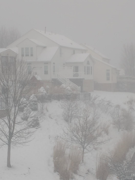
-
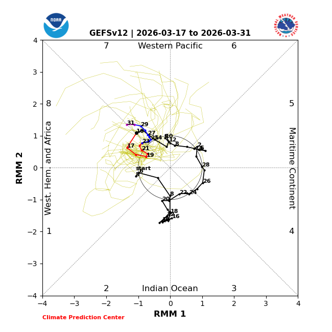
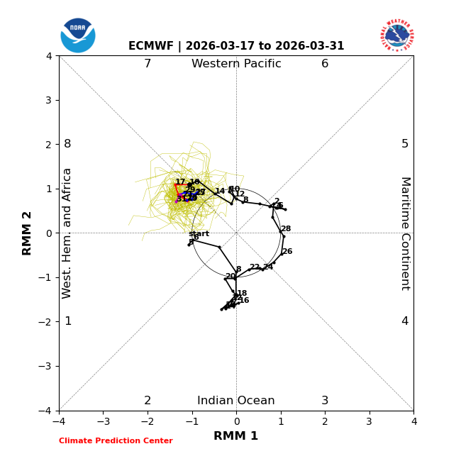
Today’s MJO forecasts are suggesting it may back up into phase 7 in a portion of the rest of this month but otherwise be in phase 8. Those two phases have averaged the two coldest March post winter La Niña phases in Baltimore, which tells me it will be rather difficult for warmth to win out overall the rest of this month despite some of the days being warm in between cold periods: GEFS: EPS:
-
https://youtu.be/q9S8WRkAw0g?si=MRqIr5eI-hA5adjI nice video explaining what happened
-
I agree…probably for BDL. But they were canning human observers as ASOS took over so they may not have had anyone directly at the airport to do the obs. So they may have found a contract or volunteer observer close by. Not sure…just guessing.
-
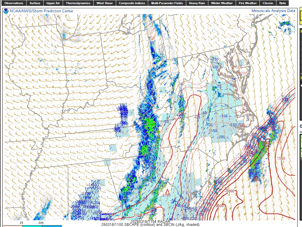
Yea someone posted it yesterday before the front but there was not a SINGLE wind report in the RAH area before the front got here. All of those in central NC were post frontal winds, which were impressive. Swaths of 50-60 mph gusts were certainly seen. We most definitely gusted over 40 out of the NW here a few times. On X this morning I saw a SPC met using this map as justification that the event was not a bust. I can post it if I can dig it back up. To me that’s very poor messaging. There’s been a reckoning on social media and I can say from being in the triangle people are PISSED about the perceived overreaction to what amounted to a cool/dreary day. There needs to be better and clear messaging from an accountability standpoint when these events are forecast incorrectly
-
Wind woke me up around 3am howling pretty good. A car cover took a beating but no branches down. We lost them ALL over the past few seasons. Only registered 30.9mph as the high gust but sensor placement, wind direction, yada, yada...
-
 PHI NWS sending survey teams to Kent Co, MD for possible tornado damage.
 -
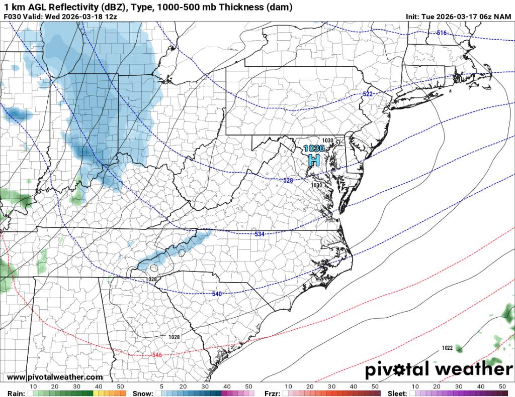
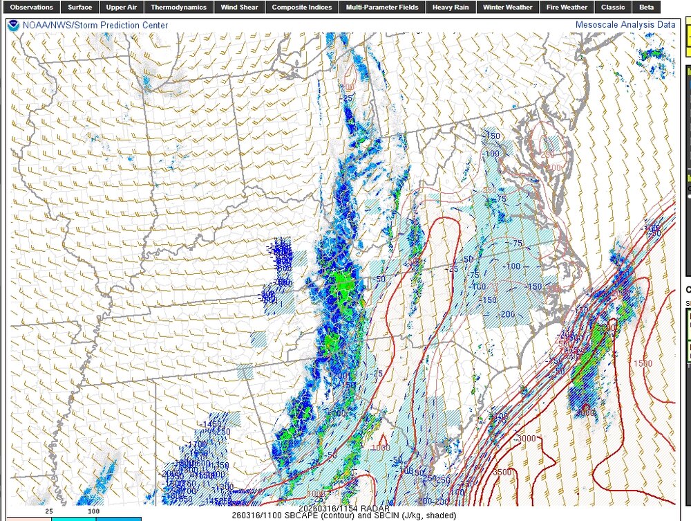
Good case study for sure. This what got my attention in am (below at 8:00 am) and RAP progression or lack of as the morning went on.
-

Central PA Spring 2026 Discussion/Obs Thread
Itstrainingtime replied to Voyager's topic in Upstate New York/Pennsylvania
Morning low of 27 in Maytown. Total precip yesterday was 0.63" which likely puts me solidly in last place in the QPF derby. I struggled to go with either a T or .01" for snowfall, ultimately I went with a T because I couldn't verify .01" when I went out last night. When in doubt, I slightly undercut. Was still nice to see wintry precip within 90 minutes of temps in the 60s. -
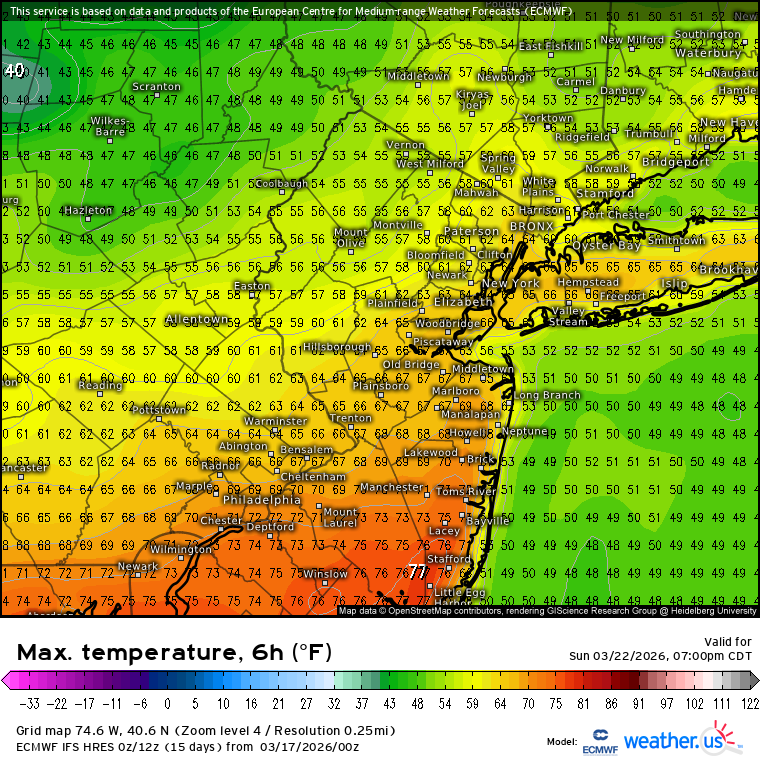
A small piece for Saturday into Sunday but the 80° warmth should stay to our south.
-
 Incredible. I helped install this station too! You can see it from US 50 by the fire department.
- 1,046 replies
-
- 1
-

-
- severe
- thunderstorms
- (and 1 more)
-
 South Mountain off 340 is white too. Now let's see if we can pull off one more snow event next week...
 -
I’m going to enjoy these last 2 days of winter like temps! 40s and full march sun is about the perfect day to me and we will be begging for this in about a month and a half I promise you
-
 Unlike the winds, rainfall was not impressive: only 0.24” total.
 -
Very impressive 30.2 this morning. Looks like the first of three straight sub freezing mornings. We finished with 0.49” yesterday when I thought for sure we had a shot at an inch but when the line broke apart before getting here we were left with just a few minutes of moderate rain followed by light rain/drizzle almost all afternoon. Still a good soaking for most of the state
-
i dunno Will seems to think that they are definitely for BDL, at least most of them he said. When i was reading old PNS they would sometimes state "within 2mi of major airports". So i guess the observers had to be within 2 miles of the airport itself as a requirement.