All Activity
- Past hour
-
0z euro is fun lol
-
0.30” from last night shower
-
Wet. Around 0.50”. Bangers in there.
-
about an inch here, 66/66 and foggy
-

September 2025 OBS-Discussion centered NYC subforum
bluewave replied to wdrag's topic in New York City Metro
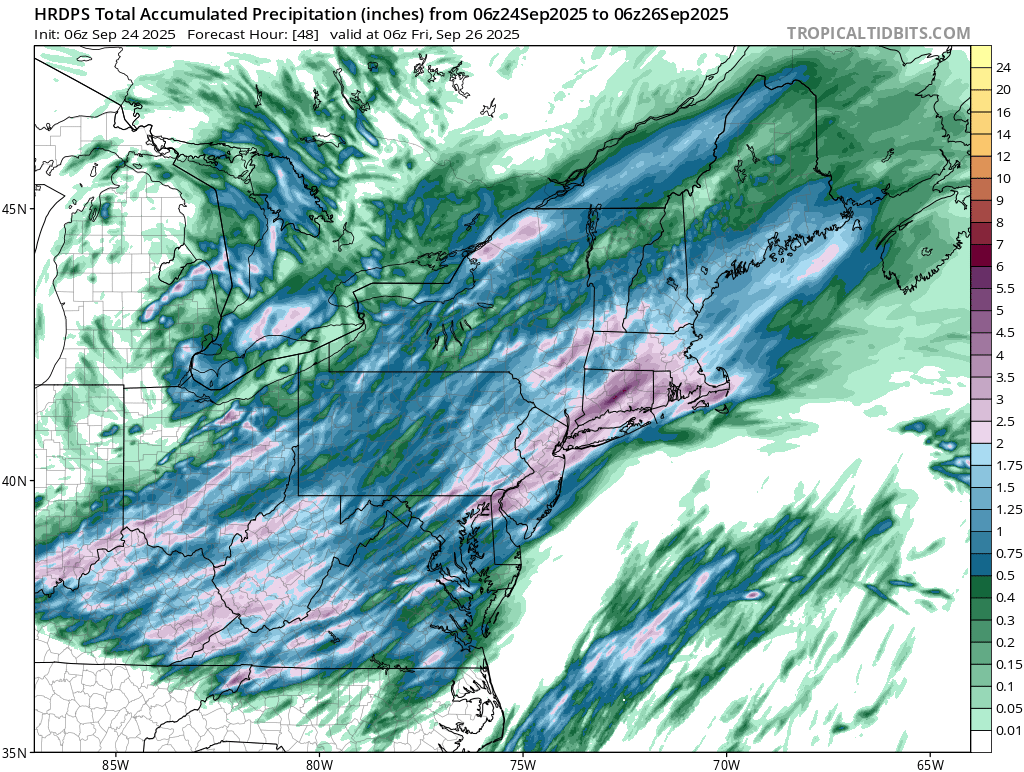
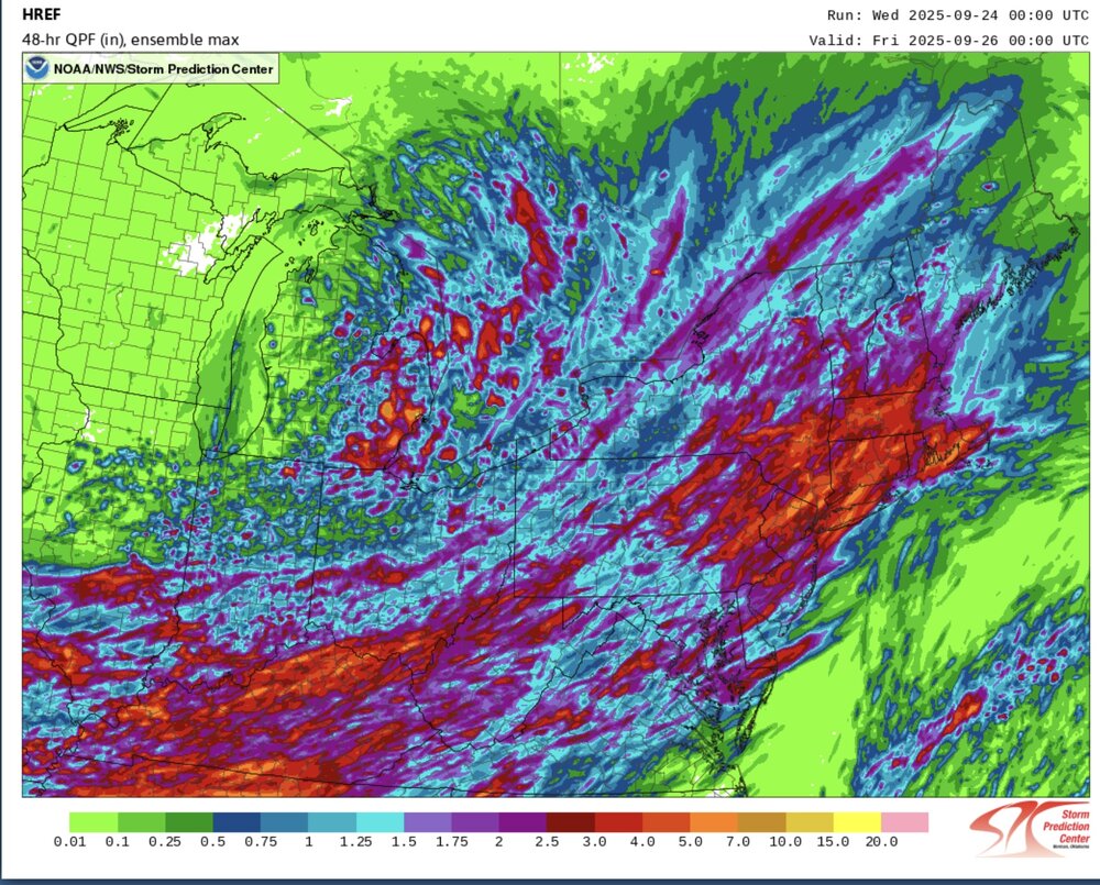
This looks like our best rainfall potential in a while. Good signal from the CAMs for a widespread 1.5”+ with pockets of 3”+ possible. Just had brief heavy downpour here.
-
How did things turn out?
-
@Gawx Starting to wonder if we are seeing a secondary peak in this solar cycle
-
0.16 overnight and 2.17 for the month. Looking like another inch before all is said and done. Not as dry as imagined.
-
.18" overnight 64/65
-

Central PA Summer 2025
Mount Joy Snowman replied to Voyager's topic in Upstate New York/Pennsylvania
Low of 63 with dense fog and a whopping 1.97” of rain. -
0.25” overnight. We wait
-

September 2025 OBS-Discussion centered NYC subforum
donsutherland1 replied to wdrag's topic in New York City Metro
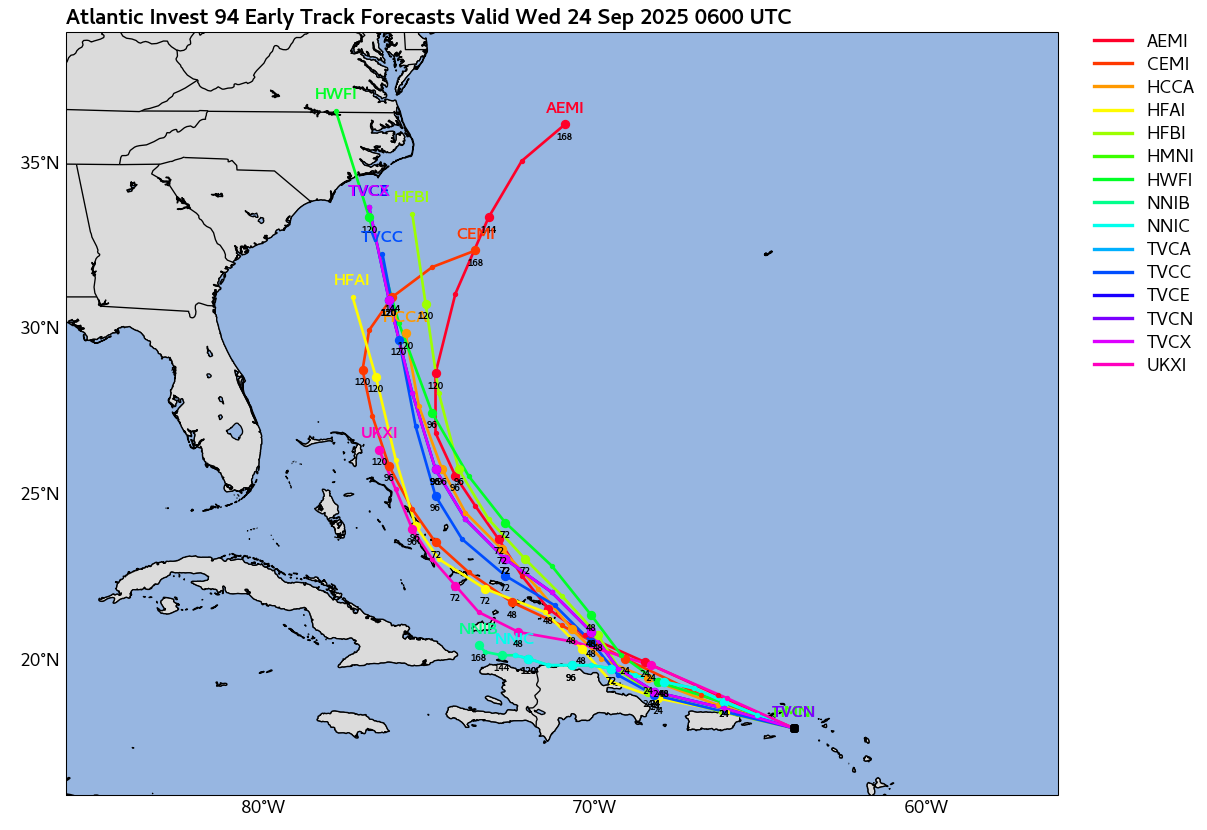
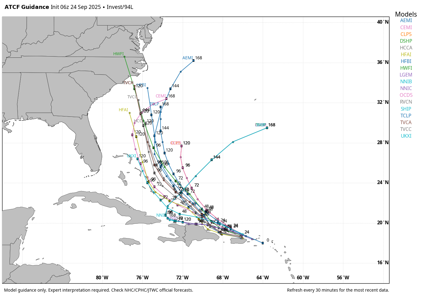
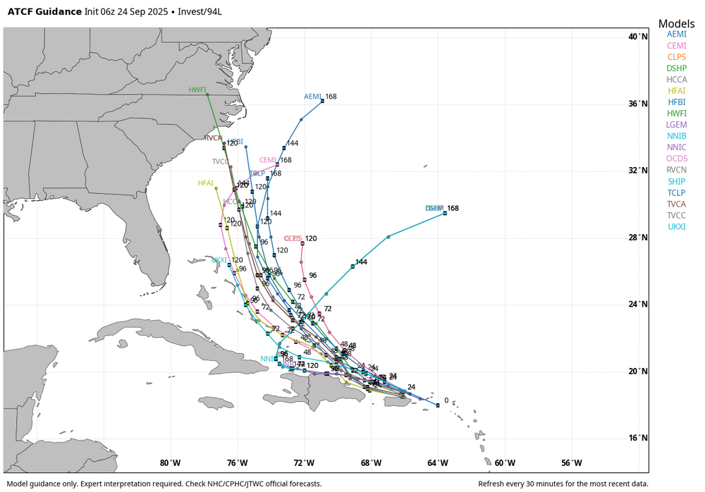
The early guidance on Invest 94 now shows a cluster of solutions indicating that the system could be approaching North Carolina in five days. Much can still change, as five day forecasts are subject to large errors. A near miss or out-to-sea solution remains viable.
-
Lightning and thunder for hours overnight .79
-
Very good call. It also looks dry as a bone which obviously is not good at all given the ongoing drought since the end of July
-
Central PA Summer 2025
Mount Joy Snowman replied to Voyager's topic in Upstate New York/Pennsylvania
From all the modeling I’ve looked at the past few days, Thursday was always supposed to be the most widespread day. -
Rain for the seed last night. Looks like a decent soaking coming up into tomorrow for many.
- Today
-
0.00"
-
About .4” yesterday.
-
 I take back what I said, I didn’t realize he would chase into China. Looks strongly like he got the eye of a likely still major storm. Good for him this was a wild chase I can’t wait to see his videos
 -
Favorite cocktail so far? Sent from my SM-G970U1 using Tapatalk
-
Azores now under a hurricane warning. I wish someone was chasing there this should be a solid impact especially for a location that doesn’t really deal with many hurricanes
-
Looks like some good totals in parts of CT from 0.50-1.50”. Did DIT “congrats NNE” himself to another inch of rain?
-
Nice little nocturnal event, only .37” of rain
-
WB 6Z ATCF tracks for 94L.
-
2025 Atlantic Hurricane Season
NorthHillsWx replied to BarryStantonGBP's topic in Tropical Headquarters
Latest HWRF takes a cat 3 into NC from 94L