All Activity
- Past hour
-
God I have fought this war for decades and been chastised by many for my thoughts. Thank you
-
I am beyond tired of seeing those maps... They are of little value to most folks; and grossly misunderstood... We have been in and out of moderate to severe drought levels for the past several years. And yet, here we are with solid water supplies and no water jug filling lines forming at the neighborhood fire hydrant.
-
It's been a torch winter for most of the globe. Other than some odd cold spikes in the south.
-
-
Going to be some wild weather between now and the end the month summer like warm temps and winter temps and snow chances
-
It will begin to turn milder tomorrow. The temperatue will return to the middle 40s tomorrow afternoon. Readings will then return mainly to the 50s for Friday through the weekend. The mercury could reach 60° on Saturday. The major weather story this week is the super March heatwave that is under way in much of the western U.S. March monthly records are being set in numerous cities. Today, Flagstaff, Palm Springs, and Phoenix are among the cities setting March monthly records. Additional records are likely in coming days. The ENSO Region 1+2 anomaly was +1.5°C and the Region 3.4 anomaly was 0.0°C for the week centered around March 11. For the past six weeks, the ENSO Region 1+2 anomaly has averaged +0.98°C and the ENSO Region 3.4 anomaly has averaged -0.15°C. Neutral ENSO conditions will continue through at least mid-spring. The SOI was +3.73 today. The preliminary Arctic Oscillation (AO) was +0.539 today. Based on sensitivity analysis applied to the latest guidance, there is an implied 74% probability that New York City will have a warmer than normal March (1991-2020 normal). March will likely finish with a mean temperature near 44.7° (1.9° above normal). Supplemental Information: The projected mean would be 2.2° above the 1981-2010 normal monthly value.
-
Weekend getting kinda interesting on some of the latest runs… .
-
Madison County has had more tornadoes in the last 50 years than McDowell. Not many would believe that!
-
F this. April 22nd I'm okay with it, not March 22. Basically 20-25 degrees above normal. To much too soon, like last weeks travesty.
-
Poor GFS. It's just not mentally stable. (analogy)
-
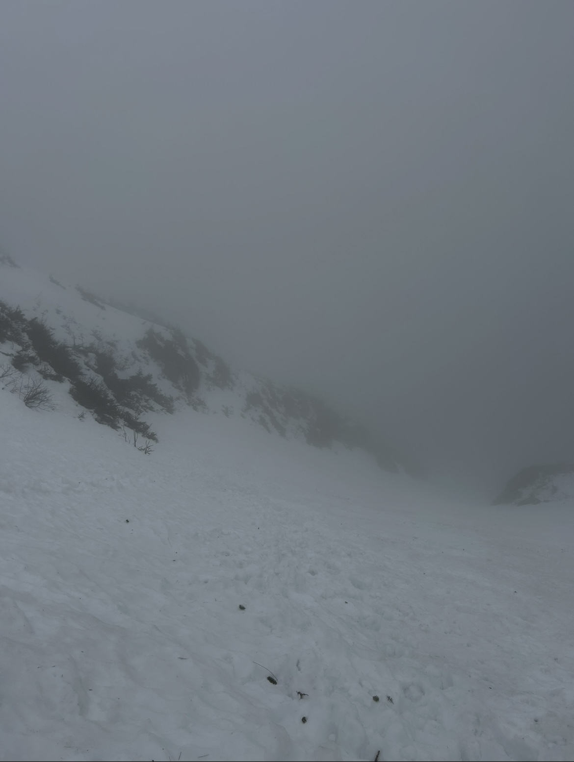
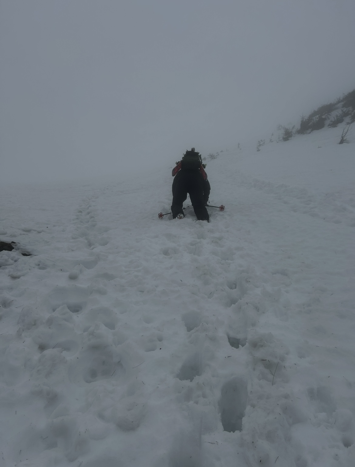
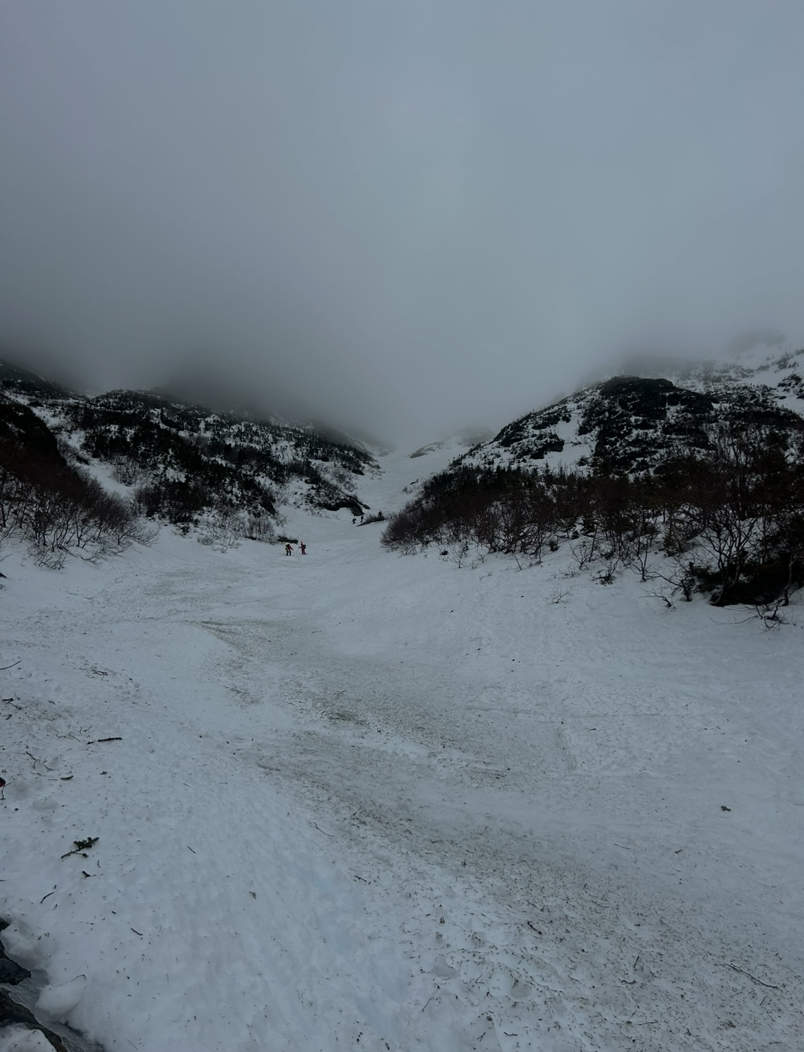
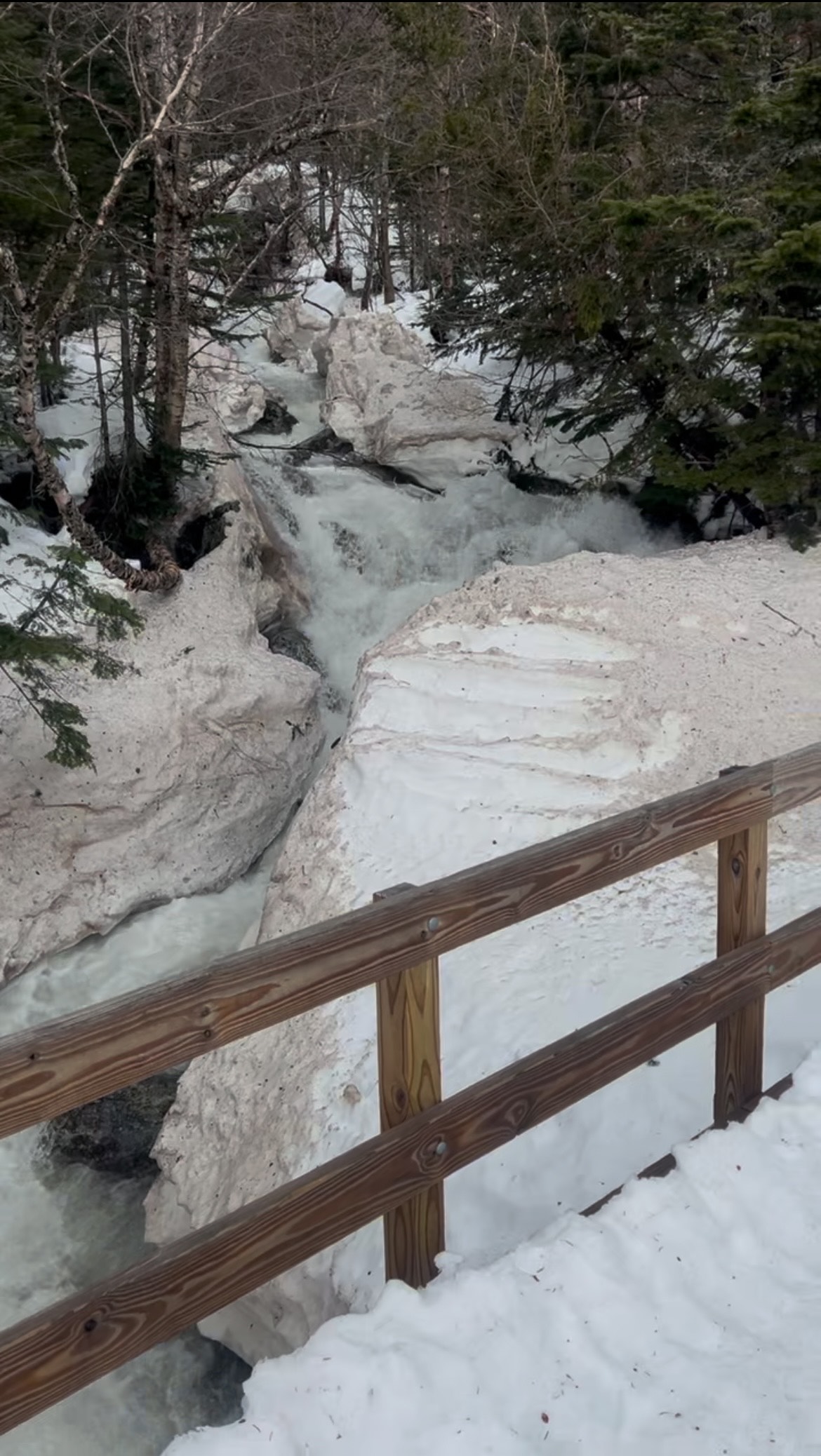
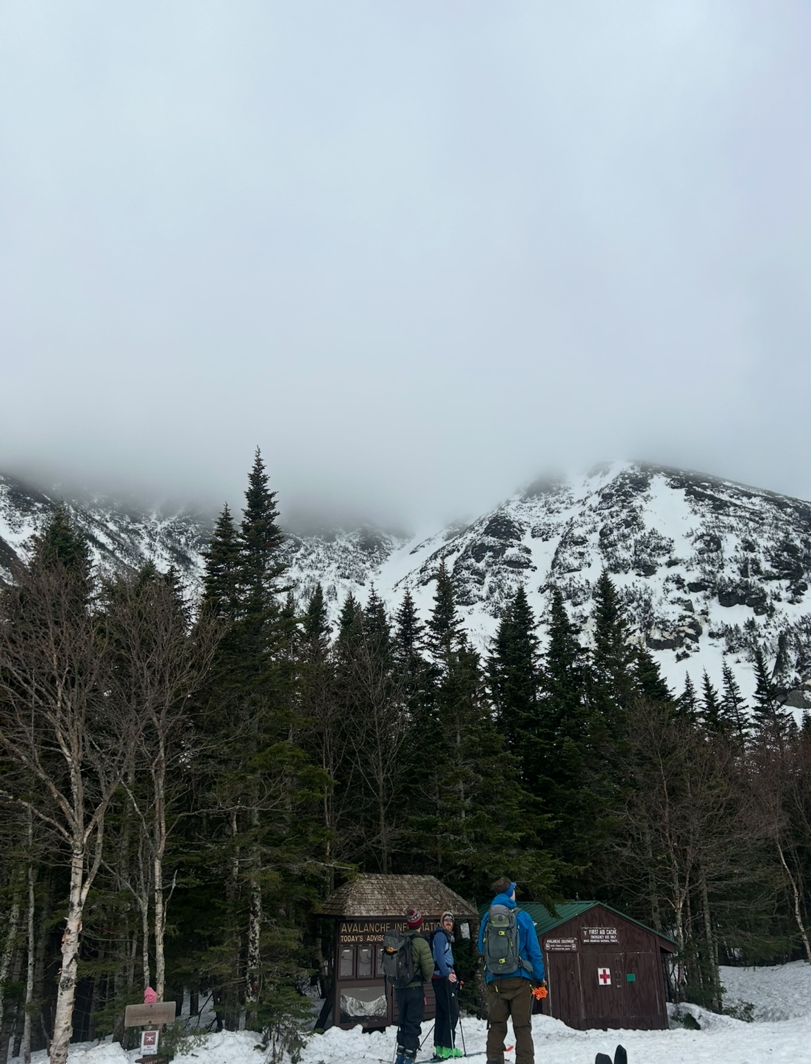
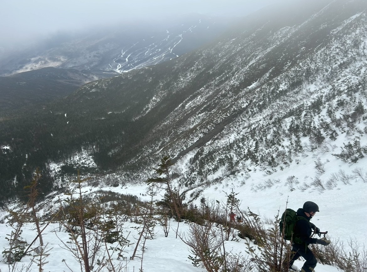
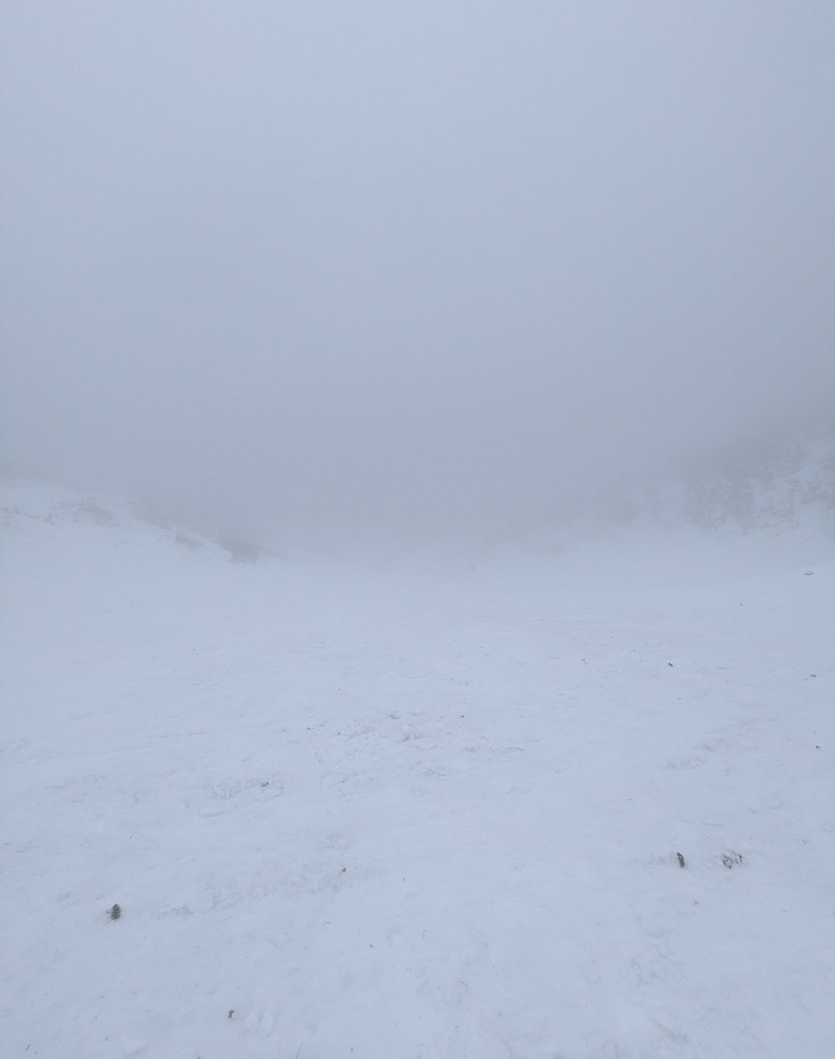
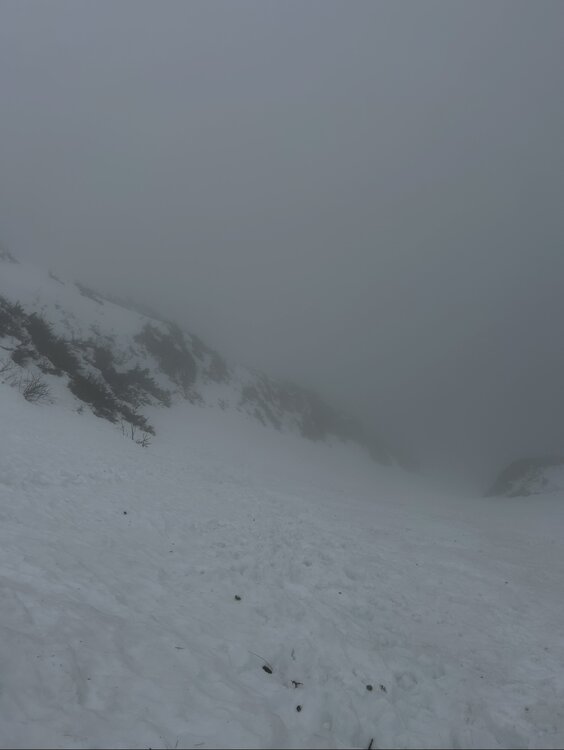
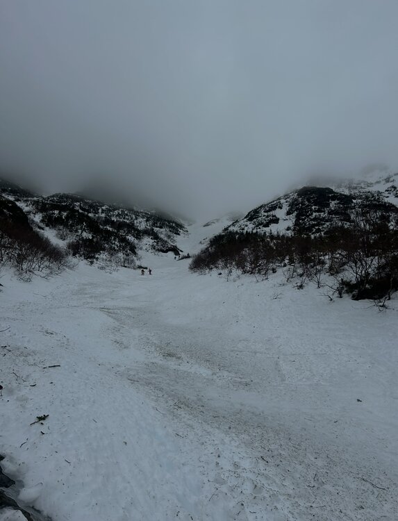
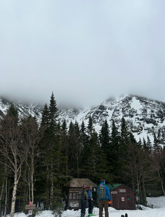
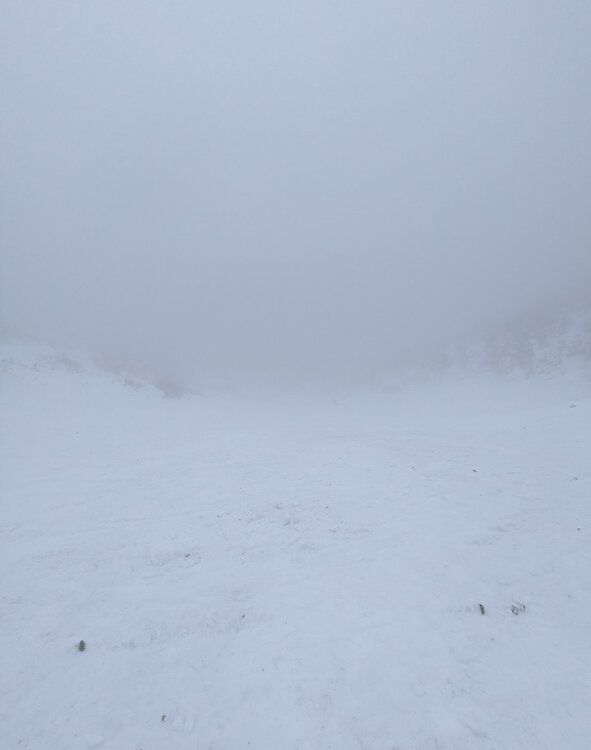
With the Mid-March thaw delivering a hefty blow to the low elevation snowpack across New England, the window for enjoying peak depths in the Presidential alpine was coming to an abrupt end. Ultimately the thaw provided some spectacular spring skiing up high from 3/9 to 3/11, with report after report filtering out of the Presidentials showing cobalt blue skis and little overnight firm ups folding into a superb corn surface across the Gulfs, Ravines and Snowfields. My schedule did not allow me to time up the best conditions, but with a marginal weather window available on Sunday 3/8, I decided to take it despite no guarantee of success. Having already been turned around in the alpine due to avalanche danger in January, I was wary that a second disappointment would be the result. The crux of the day was clear, trying to time the clearing of elevation fog before the snowpack up high froze solid. Saturday night's (3/7) cold front cleared New England of much of the low level moisture that enveloped the region in dense fog for much of Saturday. The lone holdout were the high peaks of the Presidentials, with just enough moisture and orographic forcing to shroud the summits in clouds. Forecasts indicated that gradual clearing of summit fog would occur through midday, perhaps opening up a window for sunshine to peek through. At the same time, colder air was beginning to filter across the higher elevations, threatening to lock the snowpack into ice by the afternoon. Pulling into the Pinkham Notch parking lot at 9:30, I checked the temperature profile across Mount Washington, the summit had quickly plummeted from the upper 30's to 34. Fortunately, temperatures at 4000 feet held firm in the mid 40s. The gradient was tightening but the window to try and steal a descent was still there. Racing up the TRT there was the constant roar of meltwater raging down the Cutler River. The evidence of the thaw was everywhere. Just a few days prior Andrew Drummond had tagged a rare descent of Empress in mid-winter conditions, while Dutchess and Dodge's were wide open for the taking for those looking for exposure. These snow packed lines had thinned out considerably only 24 hours into the thaw. Cruxes of these lines had receeded to cliffs, rocks and brush, their now hanging snowfields filled with rain runnels. By the time I reached Hojos much of the high alpine was still shrouded in fog, much to my dismay. The summit continued to inch closer to freezing, now down to below 33 degrees. It was going to be a one run type of day. Hillman's Highway appeared to be the best option as 2/3 of it's length remained in the clear and only the snowfields above the choke were obscured. Additionally, the Hillman's bootpack is one of the easier pitches in the zone and features plenty of platforms for transitioning. If the freeze came faster than anticipated there would be plenty of options to turn around and descend from. With the clearing trend forecasted, we hoped that perhaps the fog would burn off during the climb. While climbing, it was clear that wishful thinking regarding visibility would not pay off. The cloud deck actually began to lower, now fully obscuring the view once we reached Hillman's right choke. Despite the poor visibility, the snow in the couloir was a pleasant surprise. The lack of a pure refreeze overnight rendered the surface a bit heavy but wind affected enough that it wasn't pure slop. Outside of a few punchy spots the booter was drama free. Approaching the top of the line, some aspects were beginning to harden - we had just beaten the freezing line to the top of Boott Spur. The heavy snow on the descent was a substantial workout, though while shrouded in cloud cover the surface was very workable and pleasant. Once we punched through the overcast about 1/2 down, temperatures spiked quickly and the snow gained a noticible grab to it. Fortunately the sustained pitch of Hillman's helped negate the impact of the sticky snow until we reached the apron. The ski down to the car was slow going, the Sherb was melting fast and rocks were everywhere on "coreshot corner". Despite conditions not truly aligning, it was a fantastic day up high on the eastern slopes of the Presidentials! I still jealously watched footage of bluebird skies, huge linkups, and perfect corn snow all over the mountain emerge over subsequent days, but I was thrilled to not view from afar with sour regret. Sometimes you just have to go and make it happen.


-
Gfs much further north
-
18Z DGEX!
-
 Final detailed report- Public Information Statement National Weather Service Mount Holly NJ 256 PM EDT Wed Mar 18 2026 ...NWS Damage Survey for 03/16/26 Tornado and Wind Damage Event... .Overview... On the evening of March 16, 2026 a narrow but intense line of storms along a strong cold front progressed through Delmarva, southeastern Pennsylvania, and New Jersey. Wind damage consistent with straight line winds of 60 to 70 mph was observed in many locations across the region. There were pockets of more intense damage listed below. The National Weather Service would like to thank our county emergency management partners for their help in our surveys. .Ridgely Maryland Tornado... Rating: EF-1 Estimated Peak Wind: 90-100 mph Path Length /statute/: 0.9 miles Path Width /maximum/: 250 yards Fatalities: 0 Injuries: 0 Start Date: March 16, 2026 Start Time: 10:26 PM EDT Start Location: 2.7 Miles SSE Ridgely / Caroline County / MD Start Lat/Lon: 38.9086 / -75.8742 End Date: March 16, 2026 End Time: 10:29 PM EDT End Location: 2.2 Miles SE Ridgely / Caroline County / MD End Lat/Lon: 38.9195 / -75.8641 Survey Summary: A narrow path of damage began shortly beyond the intersection of Route 404 and Holly Road and continued east towards the intersection of Holly Road and Central Avenue. The damage path began at two residences. One residence had minor roof damage. At the other residence, the roof of a barn was blown off along with all walls collapsed. Debris from the barn was thrown over a quarter mile away into open fields. There was a horse trailer that was thrown across the yard and flipped multiple times. Multiple windows on the first floor of the house were blown out. Significant tree damage was then observed beyond both of these properties as multiple large softwood trees were uprooted with large branches also snapped. Damage continued to the east with multiple large tree branches snapped in a more wooded area. Near the intersection with Central Avenue, the damage ended with multiple trees snapped or uprooted in this area marking the end of the damage path. .Frederica Delaware Tornado... Rating: EF-1 Estimated Peak Wind: 90-100 mph Path Length /statute/: 0.7 miles Path Width /maximum/: 75 yards Fatalities: 0 Injuries: 0 Start Date: March 16, 2026 Start Time: 10:48 PM EDT Start Location: 2.1 miles SSW Frederica / Kent County / DE Start Lat/Lon: 38.9841 / -75.4940 End Date: March 16, 2026 End Time: 10:49 PM EDT End Location: 1.9 miles S Frederica / Kent County / DE End Lat/Lon: 38.9833 / -75.4810 Survey Summary: Tree damage started at the intersection of Carpenter Bridge Road and Fork Landing Road, where multiple trees were uprooted and snapped. Tree damage continued eastward along Fork Landing Road, including multiple trees snapped. One snapped tree fell into a shed, destroying the shed. Tree damage was observed along Fork Landing Road until just before Browns Branch. .Ridgely Maryland Thunderstorm Wind... Peak Wind /E/: 80-90 mph Path Length /statute/: 0.22 miles Path Width /maximum/: 75 yards Fatalities: 0 Injuries: 0 Start Date: March 16, 2026 Start Time: 10:24 PM EDT Start Location: 2.4 miles SSW Ridgely / Caroline County / MD Start Lat/Lon: 38.9147 / -75.9027 End Date: March 16, 2026 End Time: 10:24 PM EDT End Location: 2.3 miles S Ridgely / Caroline County / MD End Lat/Lon: 38.9154 / -75.8987 Survey Summary: A brief area of significant wind damage occurred along Saathoff Road. The start of the path of wind damage involved the complete roof removal of a farm outbuilding with one wall collapsed inward. Metal roofing material was then scattered downstream to the east into an open field. Beyond the open field, there was some tree damage including one softwood tree snapped at the trunk. Additional damage beyond this tree line along Saathoff Road quickly lessened showing the end of the path of significant wind damage. This damage was separate but approximately 1.3 miles west of the starting point of the Ridgely tornado. .Millington Road Thunderstorm Wind... Peak Wind /E/: 80-90 mph Path Length /statute/: 1.9 miles Path Width /maximum/: 1 mile Fatalities: 0 Injuries: 0 Start Date: March 16, 2026 Start Time: 10:24 PM EDT Start Location: 1.8 miles NW Sudlersville / Queen Anne's / MD Start Lat/Lon: 39.2084 / -75.8807 End Date: March 16, 2026 End Time: 10:29 PM EDT End Location: 2.2 miles N Sudlersville / Queen Anne's / MD End Lat/Lon: 39.2192 / -75.8474 Survey Summary: Along Coleman Road, the start of significant wind damage occurred as multiple trees were uprooted and large tree branches were snapped. A farm outbuilding also experienced removal of metal roofing that was scattered to the east into an open field. As the swath of wind damage continued, there was additional farm outbuilding damage near Mud Ford Lane as the roof of an outbuilding was removed with the debris being scattered to the east up to half a mile away. It was at this point that the damage path width was at its widest, with about one mile from the damage on Coleman Road to the damage on Mud Ford Lane. The damage continued towards Millington Road where multiple power poles were snapped, large tree branches were snapped, and additional metal roofing was peeled off a farm outbuilding. Significant wind damage was estimated to have ended near Higman Mill Road as the last point of damage was metal roofing removed from another farm outbuilding. .Camden Delaware Thunderstorm Wind... Peak Wind /E/: 90-100 mph Path Length /statute/: 0.7 miles Path Width /maximum/: 400 yards Fatalities: 0 Injuries: 1 Start Date: March 16, 2026 Start Time: 10:39 PM EDT Start Location: 5.0 miles W Camden / Kent / DE Start Lat/Lon: 39.1107 / -75.6362 End Date: March 16, 2026 End Time: 10:40 PM EDT End Location: 4.3 miles W Camden / Kent / DE End Lat/Lon: 39.1133 / -75.6228 Survey Summary: Tree damage was first observed on Honeysuckle Road just south of the intersection with Westville Road. The highest degree of damage was noted near the intersection of Probst Lane and Westville Road. Several trees were snapped, including multiple trees that fell onto mobile homes. One injury was reported in this location. Sporadic tree damage was observed further east near and along Quail Run. Based on the debris direction, this was determined to be straight line wind damage.
 -
The finishing touches of a wall-to-wall cold and snowy winter. For those who love cold and snow, 1957-58 is one of the very few universal A+ seasons.
-
Too cold. Colder than I expected actually. Just got a bike ride in and needed a couple layers and gloves. I’m ready for summer.
-
Meanwhile it’s July, lawn drying up, pond so low it’s unveiling dugout canoes from the Wampanoags and I’m in the normal zone because of a surplus of rain in early April.
- Today
-
Once in awhile is ok. The reality is outside of the deals it isnt even inexpensive despite the crappiness. That Big Arch burger is 10 bucks typical price. I can go to a local place and get a quality double smash burger with hand cut fries for 16. The best thing they have hands down imo(only thing I ever want) is the sausage McMuffin with egg and cheese.
-
I think that was the year of the May 18 freeze. Summer got a really late start that year.
-
Crazy how we had more severe weather here in WNC than down east.
-

2025-2026 Fall/Winter Mountain Thread
Buckethead replied to Buckethead's topic in Southeastern States
GSP confirmed that we did have a tornado Monday morning in Madison County. Sent from my Pixel 10 Pro using Tapatalk -
.thumb.jpg.6a4895b2a43f87359e4e7d04a6fa0d14.jpg)
Central PA Spring 2026 Discussion/Obs Thread
Yardstickgozinya replied to Voyager's topic in Upstate New York/Pennsylvania
I'm pretty sure it brings me back to my days that a kid and the early years with my son catching frogs, turtles and tatpoles in the local wetlands. -
Central PA Spring 2026 Discussion/Obs Thread
Yardstickgozinya replied to Voyager's topic in Upstate New York/Pennsylvania
Call me crazy. While i've been cleaning up debris, at my clients ,I could smell one of my favorite spring smells. I just walk to the edge of the woods and I found it. YUMMY SKUNK.
-
This hurts. Rest in peace, weather friend.
-
18z NOGAPS