All Activity
- Past hour
-
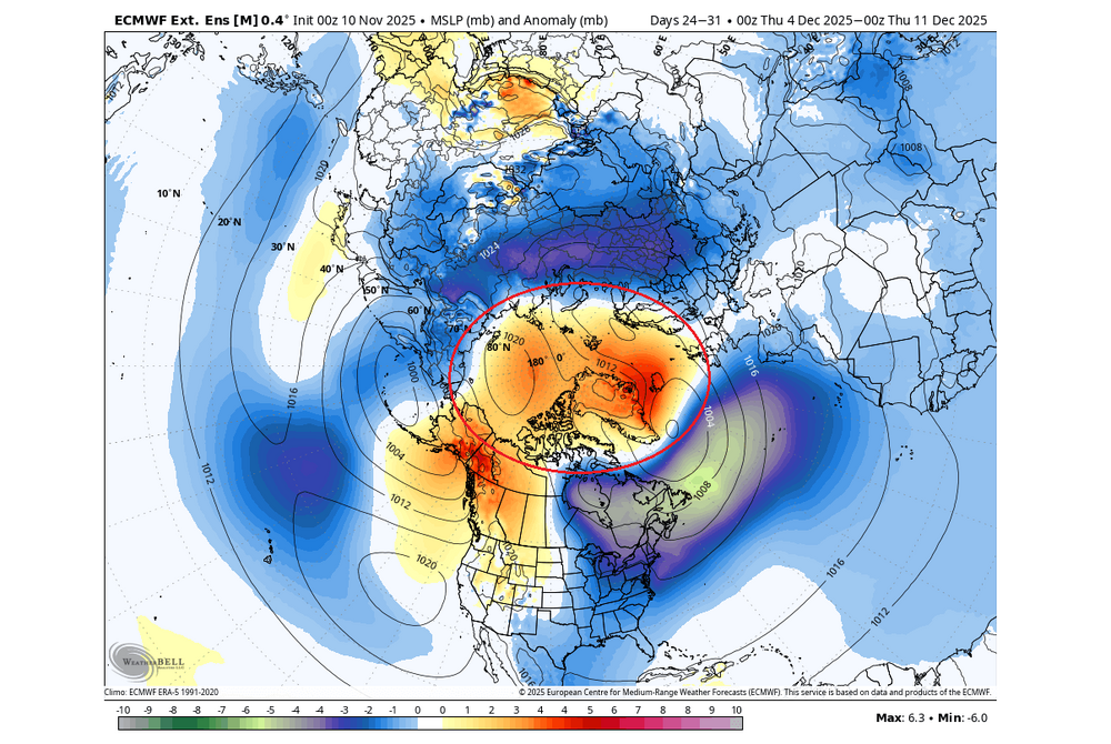
Ha! It was a poor attempt at humor. When we're in the middle of a 55-60 degree stretch in Jan with hopeless D10+ progs, SSW talk enters the chat like clockwork. And it never amounts to much lolol. Imho, some winters just want to work and others don't no matter what. Wasted blocking and random storms in the middle of futile indices are as common as typical/predictable stuff that produces. The early signs of the upcoming winter are promising. I think we can all agree on that. I've suspected we're on the front side of a longer duration blocking cycle for a couple of years now. Get things right in the AO/NAO region for the balance of winter and a ratter is prob off the table. Big winters outside of mod ninos are notoriously hard to predict. 13-14 was pessimistic leading in and we all fondly remember that one. I certainly didn't see it coming in Nov. The early Dec storm was a signal but then it got crazy warm before legit winter set in for 3 straight months. Any event during the first half of Dec is usually a reliable sign of an "acceptable" winter. So far it looks pretty good in general for that this year. Time will tell as always
-
Canaan Resort reporting 14”.
-

November 2025 general discussions and probable topic derailings ...
Ginx snewx replied to Typhoon Tip's topic in New England
Totally wrong -
November 2025 general discussions and probable topic derailings ...
Ginx snewx replied to Typhoon Tip's topic in New England
Giddy up.

-

2025-2026 ENSO
PhiEaglesfan712 replied to 40/70 Benchmark's topic in Weather Forecasting and Discussion
Yeah, people forget about that cool down in the last third of March 2011. Turned a solidly positive temperature departure to a near normal. I feel like the previous winter (2009-10) was more abrupt. Baltimore had 80 inches of snow by February 10, and the snow just stopped. The change was so dramatic, to the point there was record 90-degree heat during the first week of April. It's amazing, though, how so much snow was able to fall in such a short time during those 2 winters. And in 2 very different ENSO states (2009-10 being a strong el nino, and 2010-11 being a strong la nina). -
I had a Snapchat from one of my friends going deer hunting in Hamilton NC and it looked like an inch. Side roads were covered too. They must’ve gotten under some rates
-
 Very light dusting in the pre-dawn hours, gave a comical look to all the oak leaves in the yard as they were the only things holding snow. Flurries now, 31.3F wind ramping up.
 -

11-9/11-10 Early Season Snow Obs.
Holston_River_Rambler replied to John1122's topic in Tennessee Valley
Before the high clouds move in, here is a a tru color GOES pic of the area: High Knob snow shadow in effect: -

November 2025 general discussions and probable topic derailings ...
SJonesWX replied to Typhoon Tip's topic in New England
Nah, warmth confirmed by the pope -
.thumb.png.4150b06c63a21f61052e47a612bf1818.png)
November 2025 general discussions and probable topic derailings ...
HIPPYVALLEY replied to Typhoon Tip's topic in New England
-
Over my way it began when it stopped for you all. Snowiest February on record and the Oklahoma state record coldest temperature.
-
-
11-9/11-10 Early Season Snow Obs.
Holston_River_Rambler replied to John1122's topic in Tennessee Valley
Some pics form yesterday: Convective cloud tops: Snow on blossoms: Snow on kudzu: Probably about half an inch total IMBY: -
Here in NJ, after Jan, I got 5.25" total. Dec and Jan I got 55", so 60.25" total. We were on our way to breaking the 95/96 winter then it pretty much did stop.
-

Central PA Fall Discussions and Obs
Mount Joy Snowman replied to ChescoWx's topic in Upstate New York/Pennsylvania
Low of 30. It is cold out there with the wind. Love hearing all these first flake tales. #WinterIsComing -

November 2025 general discussions and probable topic derailings ...
jsw replied to Typhoon Tip's topic in New England
Flakes were in the air a couple of hours ago here, first snow of the year! If the spine of the Green Mountains doesn't block all of what is showing now on radar, we're in for some more proper snow showers. -
One thing that does bother are references to 2010/2011 being "over" in after January. There was a moderate overruning event later that season. Even without a SSWE we can get snow late season in a la Nina.
-
Yeah, blocked early then becomes unblocked later today.
-
For you Iguana

-

E PA/NJ/DE Autumn 2025 Obs/Discussion
Newman replied to PhiEaglesfan712's topic in Philadelphia Region
Although the chances of a KU are inherently lower in a Niña with a less active subtropical jet, we've seen some big ones in Niña winters such as 1996 and, a few years ago, Feb 2021. My biggest concern for this winter is a relentless Pac Jet which is helping to push along this brief cold snap this week. We had a perfectly timed rossby wave break that dislodged a piece of the Polar Vortex southward into the Eastern US, amplified by a peaking +PNA ridge. But too much energy crashing into the west coast is keeping the flow too fast, so this deep trough is unable to deepen and turn negative as the ridge out west breaks down quickly. I feel like that will be a theme this winter... The Western ridge breaking down too soon. I hope I'm wrong though! I'm favoring a near-normal snowfall year for Philly which will feel well above average compared to recent years. -
 Thank you everyone, nerve wracking for sure.
 -
 took in the plants for no reason
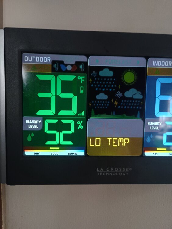
-
Whenever we grade this winter in March 2026, we must not forget snowfall on the Outer Banks in early November.
-
 I'm happy to learn that she's ok.
 -

November 2025 general discussions and probable topic derailings ...
WinterWolf replied to Typhoon Tip's topic in New England
Possibly…was just pointing out that there’s been some events since Isaias…although we are due, and I think we see some action starting in a few weeks.