All Activity
- Past hour
-

2026-2027 Super El Nino
mitchnick replied to Stormchaserchuck1's topic in Weather Forecasting and Discussion
Yet, and this may have already been mentioned, most modeling shows the upcoming MJO having an affinity for the Maritime Continent. https://www.stormsurf.com/page2/links/mjo_phase.html -
Well ours is from a FiberOptics company digging trenches in our yard in January to lay cable. And then just dumping the clay they dig up putting seed and straw down as if that would grow back. It was a neighborhood wide project and they chose for whatever reason not to use the easement.
-
.thumb.png.3513c28619bf91f0fa8e4004956c33df.png)
2026-2027 Super El Nino
annunciated replied to Stormchaserchuck1's topic in Weather Forecasting and Discussion
At that point further north, you're essentially trading cold(er) air for potential improvements in moisture, if perhaps a greater risk for ice. In my opinion, that could cancel out the warmth if not add to the snow total average if you can get a good background pattern instead of the polar jet constantly lagging back into Canada. -
Absolutely pouring here.
-
2026-2027 Super El Nino
annunciated replied to Stormchaserchuck1's topic in Weather Forecasting and Discussion
Good thing NA is on the verge of its cooling-off phase here in the troposphere; it'll be good to see the STJ start to go in a month or two as that temp. gradient becomes apparent -

2026-2027 Super El Nino
EasternLI replied to Stormchaserchuck1's topic in Weather Forecasting and Discussion
That's quite impressive looking too! I'm not quite sure what to expect with this thing other than a powerhouse STJ. It's unprecedented in many ways. I'm having fun just monitoring it. Tons of interesting aspects. Really fascinating event. -

2026-2027 Super El Nino
MarcmmKU replied to Stormchaserchuck1's topic in Weather Forecasting and Discussion
Worth nothing that if you get far enough north and or high enough in elevation in new england the correlation between cold and snow becomes almost nil. The climo there is cold enough that a 5-6 F + winter does not meaningfully affect snow odds. If you plot snowfall versus temp for a place like Stowe VT it will essentially be a random scatterplot with no correlation. -
Seems like some rotation on that one moving north out of Columbia
-
 Cheap Viagra 100mg [url=https://medmennews.xyz/#]Med Men News[/url] Buy generic 100mg Viagra online
 -
Just be clear... Are you saying Wiz is in correct in his analysis of what the parameters will look like overhead from late tonight through tomorrow? Or are you saying you can see what he's looking at but they won't produce the outcome he is expecting?
-
TS Lee vibes
-
pouring rains. almost 1" in the last 30-40 min
-

Augdewst 2026: Summer's Last Stand
powderfreak replied to Prismshine Productions's topic in New England
Our standards seem to be getting high if 1.5” of rain is the barometer of worthy rain. A half inch will soak in nicely. -
2026-2027 Super El Nino
mitchnick replied to Stormchaserchuck1's topic in Weather Forecasting and Discussion
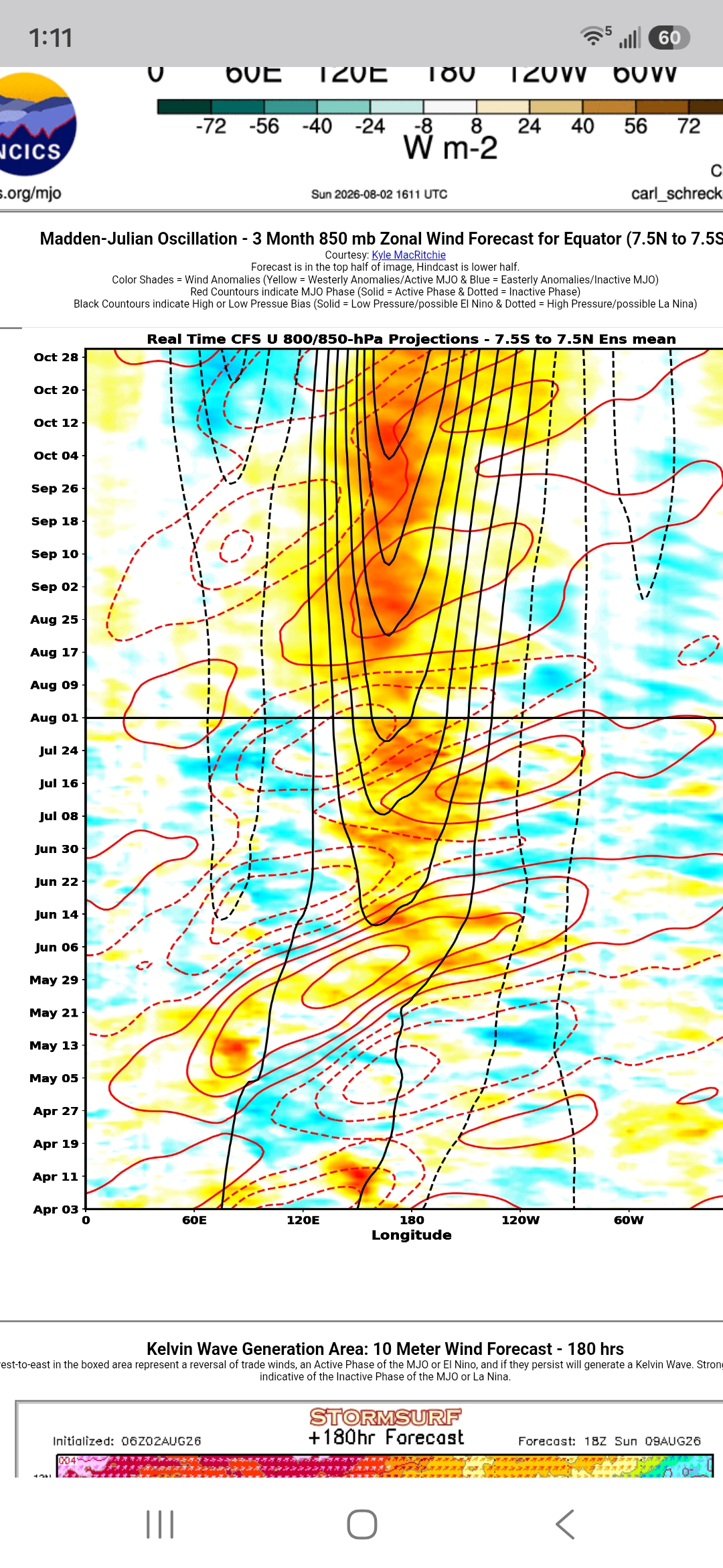
Cfs2 has been hitting hard in October for a while. Considering how far away we are from October, it might be the biggest yet if correct. But is that signaling the big finale? Idk. Just wondering based on an apparent November forecast peak.
-

Augdewst 2026: Summer's Last Stand
dendrite replied to Prismshine Productions's topic in New England
81.6/71 Dewtylicious -
(002).thumb.png.6e3d9d46bca5fe41aab7a74871dd8af8.png)
Central PA Summer 2026 Discussion/Obs Thread
ChescoWx replied to Voyager's topic in Upstate New York/Pennsylvania
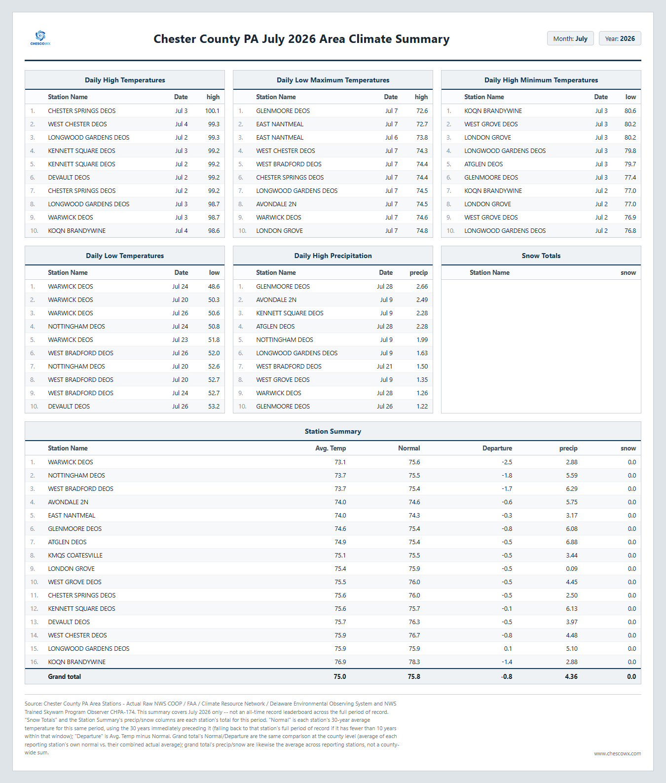
Below is the Chester County PA Climate Summary for July 2026. We finished the month with an average temperature of 75.0 this is 0.8 degrees below normal our average rainfall across the county was 4.36". This was our "chilliest" July since the 74.9 in 2021. Overall we finished as the 61st warmest and 66th driest July over the last 134 years. Our warmest July was the 78.7 in 1999 our coolest July was back in 2009 with an average temperature of only 70.9 degrees. Our wettest on average was the 11.64" average across the county way back in 1919. The dryest on average July was the scant 0.68" average back in 1944. Overall through the first 7 months of 2026 we have an average temperature to date of 51.9 degrees this is 0.5 degrees below the average over the last 30 years and the 61st warmest first 7 months since records began in 1893.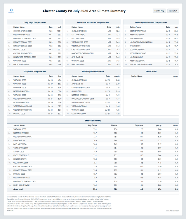
-
E PA/NJ/DE Summer 2026 Obs/Discussion
ChescoWx replied to PhiEaglesfan712's topic in Philadelphia Region
Below is the Chester County PA Climate Summary for July 2026. We finished the month with an average temperature of 75.0 this is 0.8 degrees below normal our average rainfall across the county was 4.36". This was our "chilliest" July since the 74.9 in 2021. Overall we finished as the 61st warmest and 66th driest July over the last 134 years. Our warmest July was the 78.7 in 1999 our coolest July was back in 2009 with an average temperature of only 70.9 degrees. Our wettest on average was the 11.64" average across the county way back in 1919. The dryest on average July was the scant 0.68" average back in 1944. Overall through the first 7 months of 2026 we have an average temperature to date of 51.9 degrees this is 0.5 degrees below the average over the last 30 years and the 61st warmest first 7 months since records began in 1893.
-

2026-2027 Super El Nino
Cobalt replied to Stormchaserchuck1's topic in Weather Forecasting and Discussion
You've done this for every winter. Nino, Nina, doesn't matter, you call for record warmth. Your multiple calls for a record warm winter in the East for 2024-25 and 2025-26 (easily accessible receipts) failed miserably. Neither you nor snowman19 should be patting yourselves on the back for being on the record warm train this winter when everything points towards it. It's like predicting that Shaq will miss a free throw and then being impressed with your clairvoyance when it happens. -
Picked up 1.76” of rain between 11:00-1:00 today. Now it’s just gross as the sun comes out. 78/76, Soupy
-

2026 Mid-Atlantic Severe Storm General Discussion
SnowenOutThere replied to Kmlwx's topic in Mid Atlantic
SPC mesoanalysis shows a tongue of moisture streaming directly off the Atlantic from South Carolina. Thanks to insane dew points our cape values are at 2500+. Vis sat shows some clearing behind the current line moving through which might act as a bit of an instigator too. Almost feels like a tropical system with the rotating bands of showers forming from the south. Interestingly, the low level shear also is somewhat reminiscent of a tropical cyclone.- 1,701 replies
-
- 1
-

-
- severe
- thunderstorms
- (and 7 more)
-

2026-2027 Super El Nino
GaWx replied to Stormchaserchuck1's topic in Weather Forecasting and Discussion
Today’s SOI rose to ~-8, the highest in a month, from ~-22 yesterday due to a sharp increase in pressure at Tahiti. However, Tahiti has most likely about peaked and it will be falling back noticeably within the next few days. Meanwhile, Darwin’s pressure looks to be higher tomorrow than today. Thus, I’m expecting another -SOI tomorrow, which would make it 85 straight -SOI days vs the record back to 1991 of 100 (set in 1998). Darwin should peak tomorrow followed by a drop for 2-3 days. But with Tahiti’s concurrent fall during that period, I’m thinking the -SOI streak will likely continue for at least the next few days and likely make it to at least 90 days. -
Tomatoes. eggplants, peppers and squash all doing great so far. I keep pruning the tomatoe suckers and its working out wonderfully. The lawn soil moisture % is very good, but the heat is preventing it from looking better. Last August trended drier as the month went on, I had a 34 % soil moisture near August 1 st and then it steadily declined to about 19 % by Sept 1 st. Maybe this August will be different.
-
2026-2027 Super El Nino
EasternLI replied to Stormchaserchuck1's topic in Weather Forecasting and Discussion
Yes, and it's looking like a big one too as the MJO swings back through again. -
85/76 now feeling like a sauna. Radar looks good and the precip disco is interesting with the discussion of big rainers
-

2026 Mid-Atlantic Severe Storm General Discussion
high risk replied to Kmlwx's topic in Mid Atlantic
As some of you have noted, there is absolutely low level shear today, and the low LCLs also suggest that a brief tornado or two is possible. The overall strength of the wind fields probably doesn't support a more significant threat, but I would not be surprised to see a few tornado warnings.- 1,701 replies
-
- 2
-
-
- severe
- thunderstorms
- (and 7 more)