All Activity
- Past hour
-
Assuming that's it for the week, I have received 30% of my year-to-date rainfall this past week. It's been a dry year.
-
The rains keep arriving.
-
0.54" today, giving event total of 4.96". 6.67" for the week!
-
Today/last night’s 0.84” has brought my 3-day storm total to 3.97” and the MTD to 12.99”
-
RDU didn’t open until 1943, so those were not taken at the airport. The wettest July in RDU history was in 2024 with 9.11” and I think it surpassed that mark today
-

2026-2027 Super El Nino
snowman19 replied to Stormchaserchuck1's topic in Weather Forecasting and Discussion
Completely agree. I actually think the PDO flips positive by the end of fall. Probably not by a lot, likely weakly positive but positive nonetheless. And @EasternLI Good catch with the +QBO and the STJ. The STJ is going to be roided up and raging this fall and winter. Super El Niño/++PMM/+QBO….it’s the perfect storm. Likely record-breaking strong -
 would be fun to have a VEI 6/7 leading into a super nino winter
 - Today
-
 a couple?
 -
RDU’s wettest July was in 1931, with 12.36.” The second wettest was July 1936, with 11.65.”
-
It’s gonna be a torch December. Like 80F on Xmas sorta torch.
-
 Go Yellowstone go!
 -
Dueling models
-
 The smoke was fun, but it’d be nice if we could get some volcanic ash from a massive eruption.
 -
 Take the AGW talk to the CC forum.
 -
There’s only a couple of deniers here and he isn’t one of them.
-
Through July 24th, it’s the wettest on record since way back in 1941!
-
78 here with a nice breeze
-
WxBrad: Yesterday's high of just 74° was the coolest high in July since 2014 in #Charlotte
-
The biggest heat dome on the planet! Anything from long range models on a major pattern change coming up in the US that breaks this heat dome apart?
-
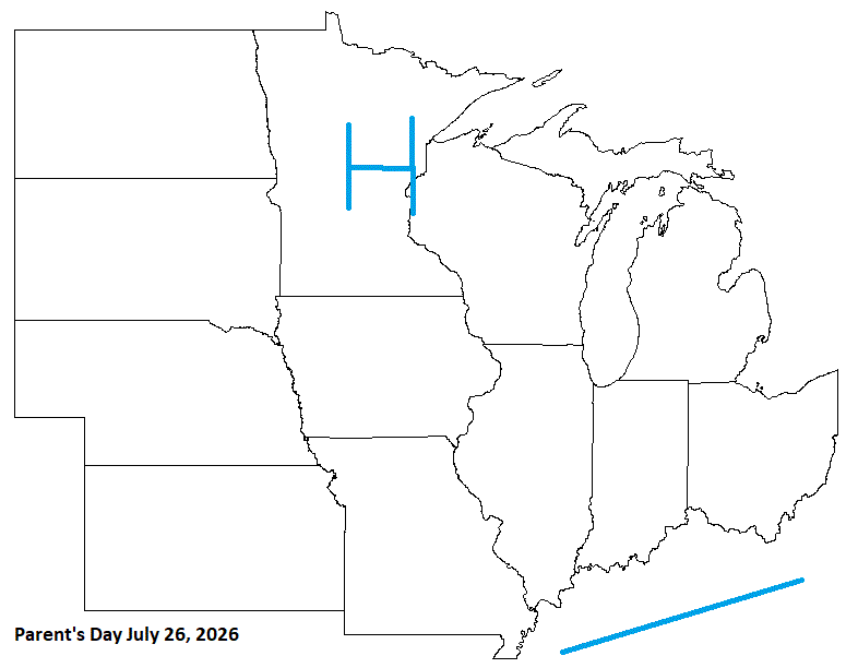
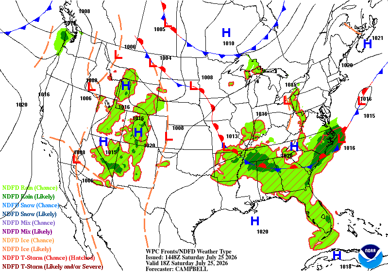
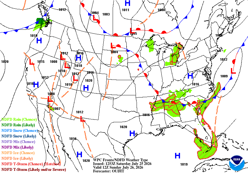
Too aggressive bringing in HP. Would have been a good cast for earlier this past week, tho, when HP moved in, and cooled things off pretty good.
-
Temps in the mid/upper 70's again yesterday. Stms petered out as they moved E. They did get decent rain to the N & W tho. As the heat builds this weekend. Looks like the Lake will help keep things a little cooler. Point has upper 80's for me, but that cast hasn't been reliable. Inland areas may get there.
-

2026-2027 Super El Nino
bluewave replied to Stormchaserchuck1's topic in Weather Forecasting and Discussion
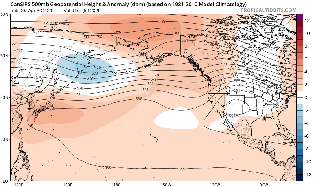
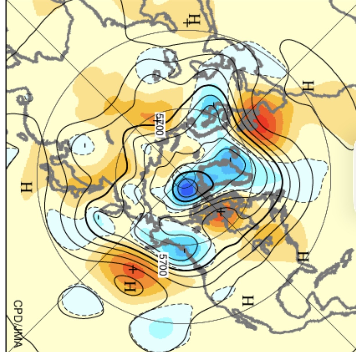
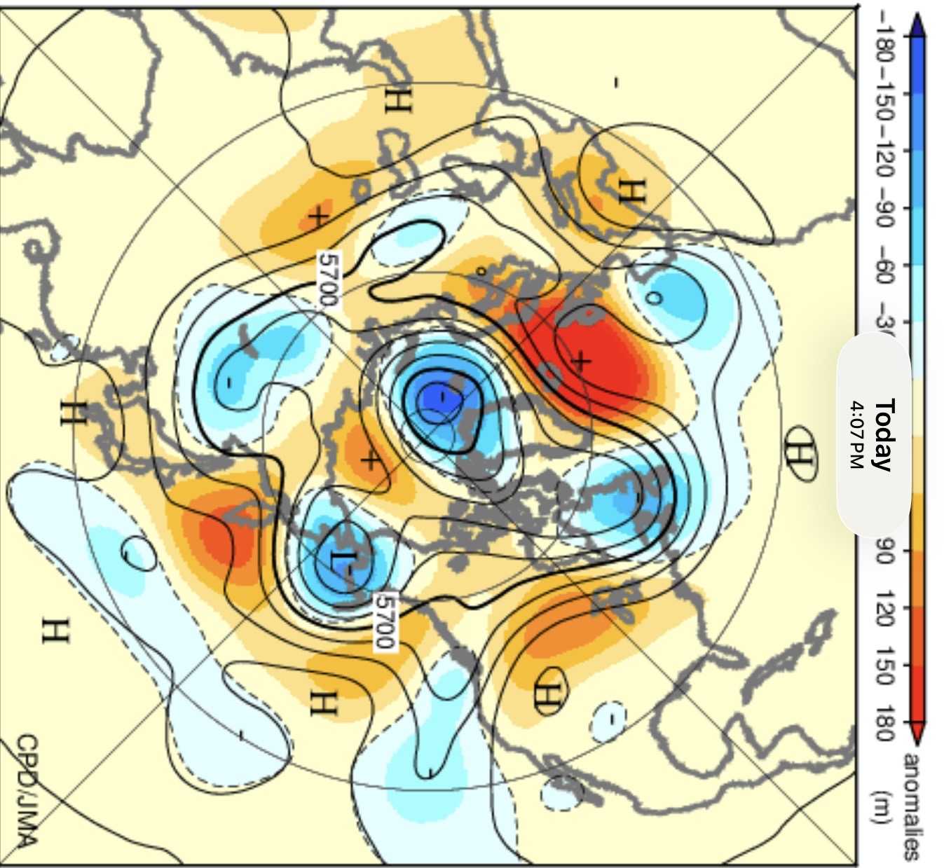
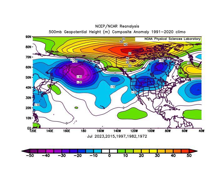
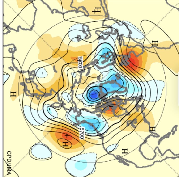
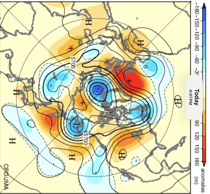
The -PDO 500 mb index has been more impressive than the SST index. Notice the near record high pressure north of Hawaii. This has displaced the Aleutian low into Alaska with the local cool there and warmth everywhere else in North America. This is a first during the month of July for such a strong El Niño. The Aleutian low is usually closer to East Asia with a developing super El Niño. The seasonal models as recently as around May 1st were going with this super El Niño composite especially on the Pacific side. So another case of seasonal models just defaulting to past El Niño climatology rather than seeing the actual pattern. The run around July 1st once the period was starting to do a little better. But still missed the magnitude of the pattern. July composite strongest El Ninos Verification July 1-20th with the 500 mb -PDO index one of the strongest on record for the period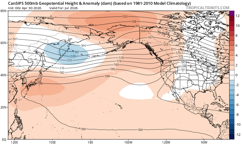
-
July 25 2000: An F4 tornado hits the town of Granite Falls. One person is killed and there is 20 million dollars in damage. 1915: Frost hits northeastern Minnesota. For Saturday, July 25, 2026 1891 - The mercury hit 109 degrees at Los Angeles, CA, marking the peak of a torrid heat wave. (David Ludlum) 1956 - The Andrea Doria sank in dense fog near Nantucket Lightship, MA. The ship was rammed by the Swedish-American liner, Stockholm, forty-five miles off the coast of Massachusetts. Fifty-two persons drowned, or were killed by the impact. (David Ludlum) (The Weather Channel) 1986 - Tremendous hailstones pounded parts of South Dakota damaging crops, buildings and vehicles. Hail piled two feet deep at Black Hawk and northern Rapid City. Hail an inch and a quarter in diameter fell for 85 minutes near Miller and Huron, piling up to depths of two feet. (The Weather Channel) 1987 - Sixteen cities in the eastern U.S. reported record high temperatures for the date. Beckley, WV, equalled their all-time record high of 91 degrees, established just the previous day. It marked their fourth day in a row of 90 degree heat, after hitting 90 degrees just twice in the previous 25 years of records. The water temperature of Lake Erie at Buffalo, NY, reached 79 degrees, the warmest reading in 52 years of records. (The National Weather Summary) 1988 - Thunderstorms produced severe weather from central Kansas to western Kentucky and southern Illinois during the day. Thunderstorms produced tennis ball size hail at Union, MO, and winds gusts to 65 mph at Sedalia, MO. Five cities in Washington and Oregon reported record high temperatures for the date. Medford, OR, hit 107 degrees. (The National Weather Summary) (Storm Data) 1989 - Early afternoon thunderstorms over west central Missouri drenched the town of Ferguson with four inches of rain. Early evening thunderstorms in Pennsylvania produced more than two inches of rain north of Avella in one hour. (The National Weather Summary) Observances: 25 Sat National Hire A Veteran Day 25 Sat Christmas In July 25 Sat Carousel Day 25 Sat Culinarians Day 25 Sat Health and Happiness with Hypnosis Day 25 Sat International Red Shoe Day 25 Sat National Drowning Prevention Day 25 Sat National Merry Go Round Day 25 Sat National Thread the Needle Day 25 Sat National Wine and Cheese Day 25 Sat St James TG 25 Sat World Drowning Prevention Day 25 Sat Houston Day 25 Sat National Hot Fudge Sundae Day
-

2026-2027 Super El Nino
GaWx replied to Stormchaserchuck1's topic in Weather Forecasting and Discussion
To compare to the prior Nino, July was similarly strongly -PDO and it hit most neg ~Oct 1st. Then it rose to a more moderate -PDO: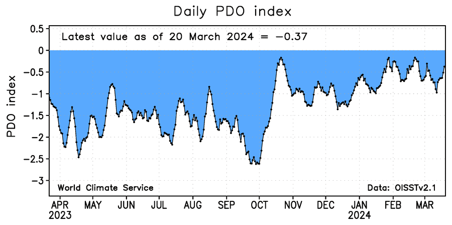
-

Central PA Summer 2026 Discussion/Obs Thread
mahantango#1 replied to Voyager's topic in Upstate New York/Pennsylvania
Beautiful weather we're having. I don't want to rain on anyone's parade, but my area needs beneficial rain soon.