All Activity
- Past hour
-
They spent no meaningful money over the off season. There we're ace's out there to be had but we end up with Charlie Morton and Kyle Gibson. How the F does that happen? Lol. No extensions for any of the young core. Just an awful off season. He's not totally to blame but he controls the purse strings and he does get some of the blame. He shouldn't get off the hook completely. Honeymoon is over lol.
-
Wagons north today. Congrats PF.
-
Man what incredible weather from STL to ORD yesterday. Truly wish we were there.
-
Canadian keeps Thursday nor Easter south . Hopefully that trend continues
-
Pretty amazing how consistently all the storms the last two days are either North or South. Just enough stabilizing marine layer to kill our storm chances.
-
Misty, foggy and a hint of dewiness in the air..it must be mid May in New England!
-
Oh man. Sorry. No clue what it’s like in my part of town. Did lose power at some point as BGE sent my husband a text about estimated time for power to return. Hopefully we don’t come home Sunday to a mess.
-
.thumb.jpg.6a4895b2a43f87359e4e7d04a6fa0d14.jpg)
Central PA Spring 2025
Yardstickgozinya replied to canderson's topic in Upstate New York/Pennsylvania
The purple time stroke dots show the cell getting its act together and pretty well illustrate its hard right turn up by Penn State and again above Harrisburg. It appears to lose some energy over @Blizzard of 93 before another pulse over The Harrisburg area , then most likely collapsing and resulting in the minor wind reports and heavy rains over the area by the looks of the lightning map.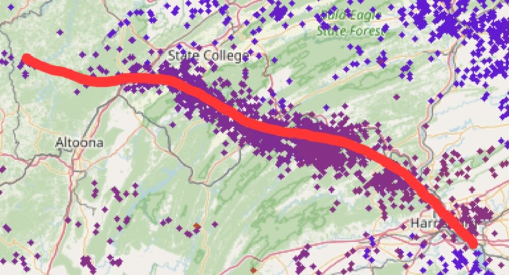
-
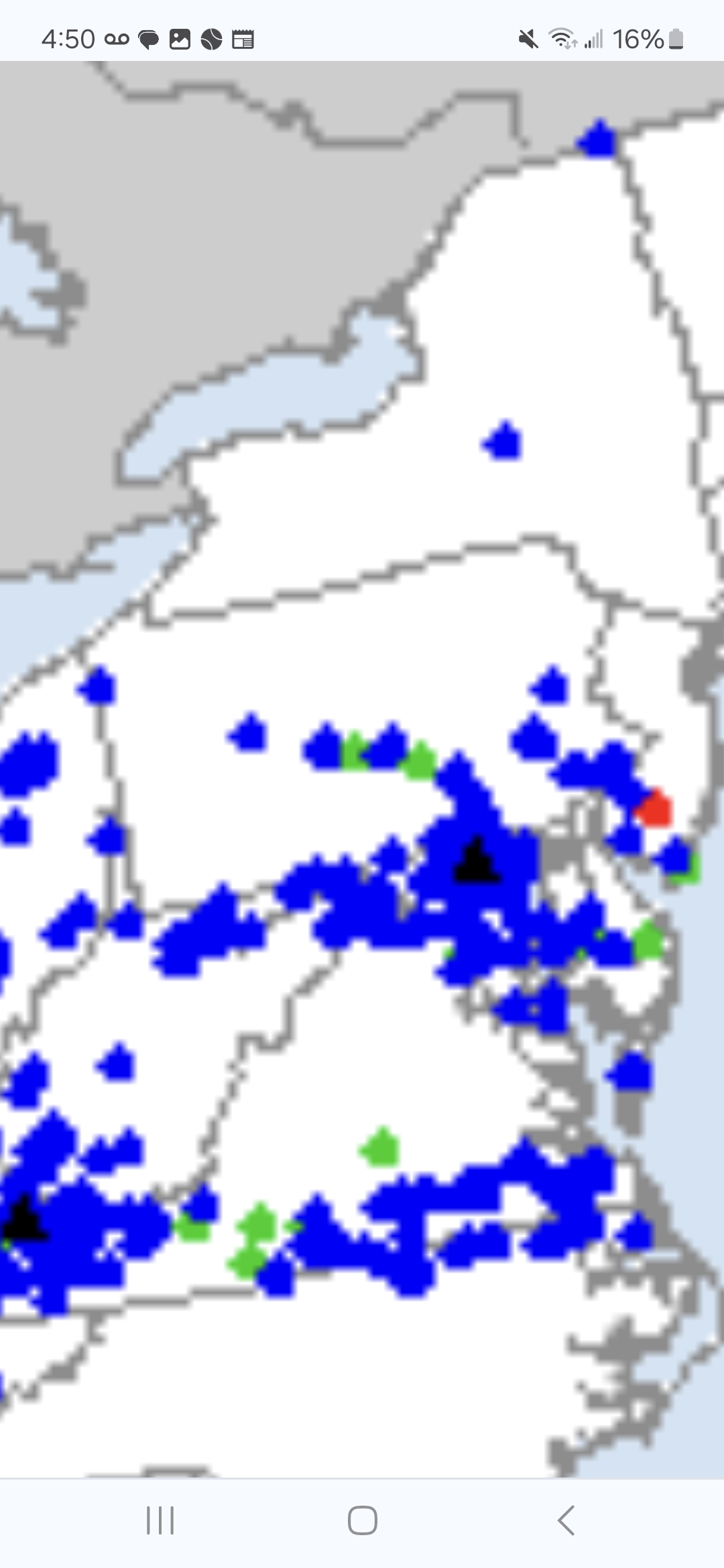
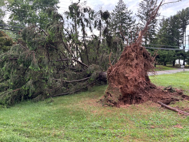
Pretty bad damage all around here in 21057. This is just one of the many trees down. Finally got power back around 330 AM.
- Today
-
My Wednesday to Friday forecast doesn't get me above 60 for any of the three days along with the rain...
-
Mostly missed here last evening 0.25” and some 30mph gusts
-
Dry overnight. 54F. Fog Sent from my SM-S921U using Tapatalk
-
Useless warmth.
-
It looks like morning storms are a bust. Its way down in VA. No biggie since my area has had over 3" this week.
-
Central PA Spring 2025
Yardstickgozinya replied to canderson's topic in Upstate New York/Pennsylvania
https://www.spc.noaa.gov/climo/reports/today.html I didn't find anything very substantial in terms of damage, but that was another awesome classic right turner that @Jns2183 spotted yesterday. I can't say I'v ever seen a cell do anything like that in terms of just snowplowing its way south through other cells heading east north east . Not to mention, when I first noticed it, I never thought it could affect our area considering the other storm motions I was seeing on radar. I didn't even have any idea it was on our doorstep when I responded to @Jns2183 post about it. That was absolutely amazing and it turns out that there is several local wind reports from Harrisburg and surrounding areas, including New Cumberland and another less than a mile down the road from my house on Steigerwalt hollow Rd. , although it does get a little foggy South of Harrisburg In terms of what's cell is responsible for what report. Figures I'd be watching it from the PaulB parking lot in Mechanicsburg. https://www.spc.noaa.gov/climo/reports/today.html
-
64/63 summer morning.
-
Came back on in Monkton finally at 3:30 am
-

2025 Spring/Summer Mountain Thread
Met1985 replied to Maggie Valley Steve's topic in Southeastern States
Big time storms rolling in hard. -
2025 Spring/Summer Mountain Thread
Met1985 replied to Maggie Valley Steve's topic in Southeastern States
Severe Thunderstorm Warning for... McDowell County in western North Carolina... Southeastern Mitchell County in western North Carolina... Southwestern Avery County in western North Carolina... Buncombe County in western North Carolina... Central Haywood County in western North Carolina... Southeastern Yancey County in western North Carolina... Northwestern Burke County in western North Carolina... * Until 430 AM EDT. * At 341 AM EDT, severe thunderstorms were located along a line extending from 5 miles northeast of Burnsville to 13 miles northeast of Downtown Asheville to 8 miles north of Waynesville, moving southeast at 45 mph. HAZARD...60 mph wind gusts and nickel size hail. SOURCE...Radar indicated. IMPACT...Expect damage to trees and power lines. * Locations impacted include... Ingalls, East Asheville, Ashford, Linville Falls, West Asheville, Swannanoa, North Cove, Celo, Little Switzerland, and Warren Wilson College. -
 Somerset had 3 tornado warnings in about 90min. Two after the initial tornado went through and at least the first and second one were a PDS warnings. Can’t imagine the trauma people there went through.
 -
Multiple fatalities reported in London, KY area.
-
Tornado warning for Southern Valley, headed towards @TellicoWx potentially. Very wrapped up cell, rotating on radar that broke out from the line.
-
 Fatalities confirmed in London KY from the long-tracked destructive tornado that went through Somerset (Pulaski Co.) and London (Laurel Co.) earlier.
 -
Heavy rain and stout wind here but no tornado thankfully.
-
So tell me: How exactly is this Rubenstein's fault? He didn't make the decision to make the bad signings and trade deadline moves. He and the ownership group just got full control less than a year ago...I think folks are blaming him just because, lol Now what WILL be his responsibility is what happens with Elias.