All Activity
- Past hour
-

Central PA Spring 2026 Discussion/Obs Thread
Blizzard of 93 replied to Voyager's topic in Upstate New York/Pennsylvania
.31 so far today in Marysville. -

2026-2027 El Nino
michsnowfreak replied to Stormchaserchuck1's topic in Weather Forecasting and Discussion
Not sold on a super el nino and especially not on a torch. I do think it will be milder here than the last 2 cold winters, however. -
Central PA Spring 2026 Discussion/Obs Thread
Blizzard of 93 replied to Voyager's topic in Upstate New York/Pennsylvania
Heavy rain in Marysville. -
Getting a great soaking rain today.
-
Partial sun and 57 here. Not a bad day.
-

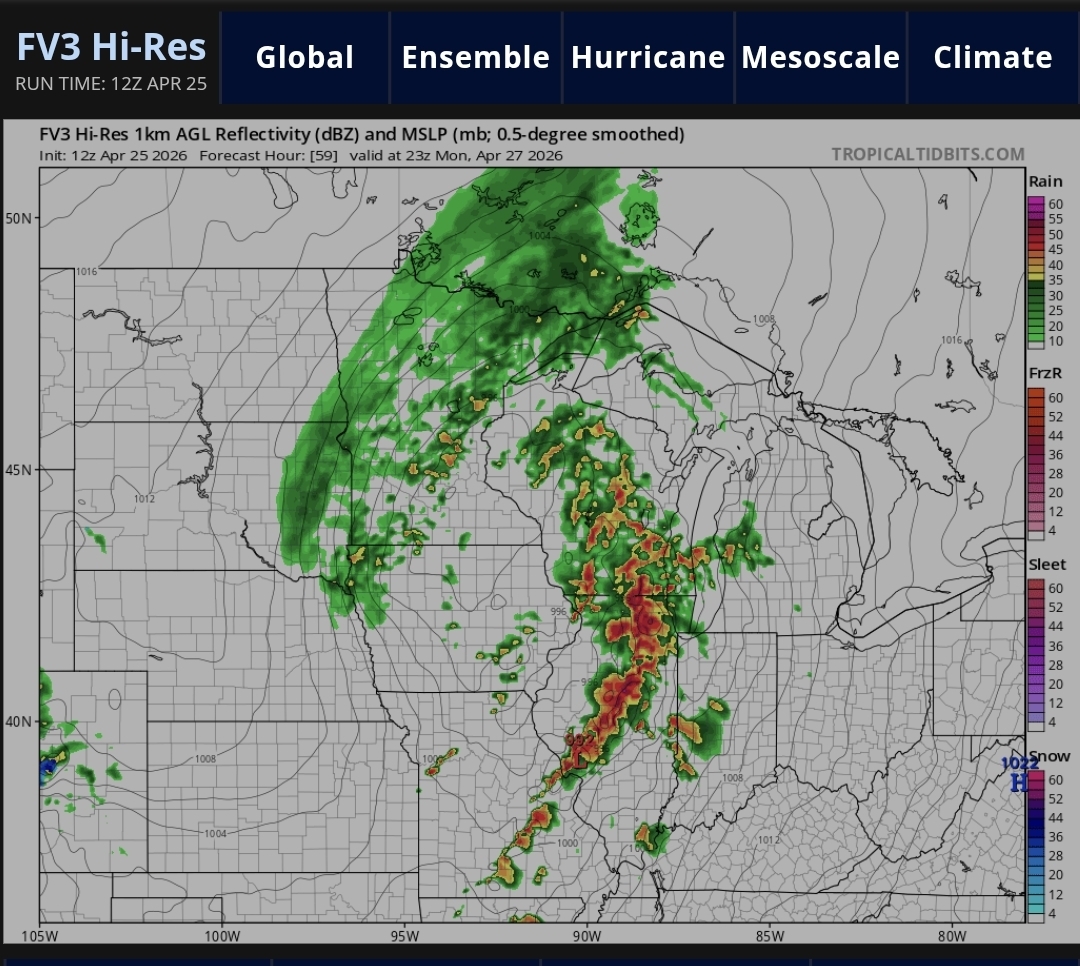
Potential Sever Weather Outbreak 4/27/2026
TheNiño replied to pen_artist's topic in Lakes/Ohio Valley
Am I being a weenie thinking this has high risk potential around the STL to Springfield area? I know it’s still too early to tell but the models certainly aren’t backing down. -
42 and showers
-
It's a balmy 43° here. All things considered, I'll take the rain.
-
Lovely Spring weather. 38.9F with steady rain.
-
NAMs had 1” + lol
-
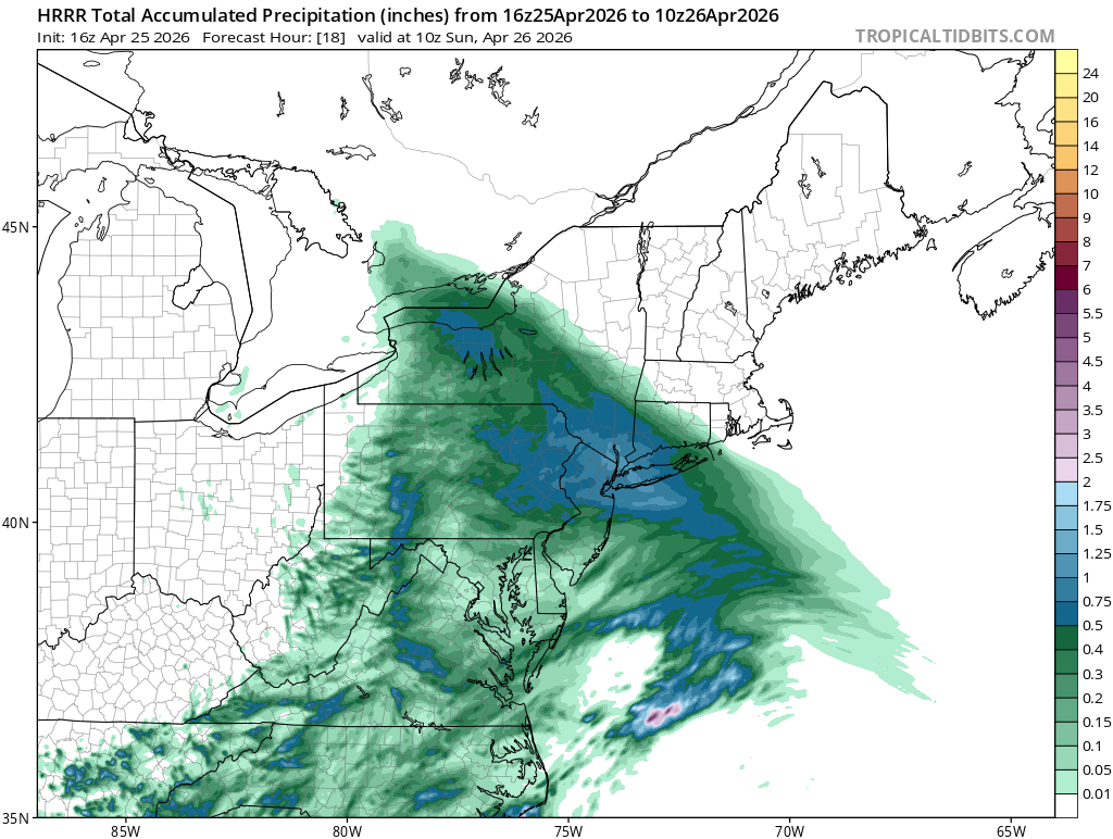
Latest HRRR

-
From FFC for 3 systems including today’s: 7 DAY RAINFALL AMOUNTS ARE FORECAST TO BE BETWEEN 1.5-2.25" NORTH OF I-85, WITH PROGRESSIVELY DIMINISHING AMOUNTS TO THE SOUTH AND EAST, DOWN TO ABOUT 0.5" IN EAST-CENTRAL GEORGIA. LOCALLY HIGHER TOTALS WILL BE POSSIBLE WHERE STRONGER STORMS OCCUR. INCREASING SURFACE PRESSURE AND DRIER AIR WILL SET UP OVER THE SOUTHEAST ON THURSDAY INTO FRIDAY
-
Yes, things have trended cooler. The onset of late-season blocking has played an important role.
- 864 replies
-
- 1
-

-
- april showers bring may..
- rain
- (and 2 more)
-
Last time we were entering a niño we were having snow level futility in regards to rain well into June.
-
It doesn’t “look” like it’s going to rain tonight. My yard is looking like hay and the ground is cracked. I’m not watering it anymore!
- Today
-
Not a drop yet here
-
Thing is, no one can say that after the winter we had. There was plenty of cold and snow to go around this past December, January, and February.
- 864 replies
-
- 1
-

-
- april showers bring may..
- rain
- (and 2 more)
-
Giga-Nino cometh
-
When is it going to be our turn?
-
Persistent light rain, some moderate at times since about 10 A.M. Temperature stuck at 38. Currently 36 up at High Point and 38 in Vernon per NJWXNET. When April opened based on late March and early April LR guidance I was expecting a +3 to +3.5 degree temperature departure for the month. Bust on my part. Cooler periods were very effective at beating back the warm periods. Unusual around here in recent years. Per @donsutherland1 April looks to average just about 1.5 above and that might slip a bit more before the end of the month.
- 864 replies
-
- 1
-
-
- april showers bring may..
- rain
- (and 2 more)
-

Central PA Spring 2026 Discussion/Obs Thread
WmsptWx replied to Voyager's topic in Upstate New York/Pennsylvania
Gullywasher here in the south middle of the state. Drought being busted. -
Not sure how anyone has the patience to watch the news.
-

Potential Sever Weather Outbreak 4/27/2026
A-L-E-K replied to pen_artist's topic in Lakes/Ohio Valley
Nice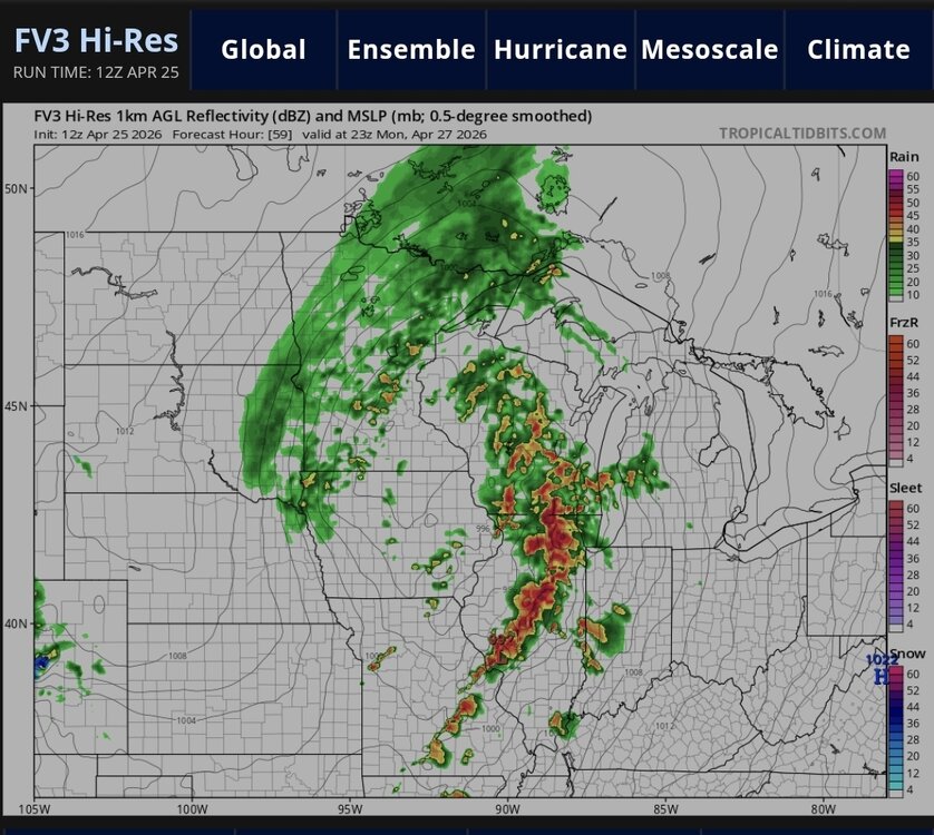
-
Dumping. Praise the lord! .
-
Drought breeds more drought. Monday continues to look like a Midwest shift. Sure they'll be some wind in the Mid-South and probably Mid-State, but I'd put the tornadoes in eastern Missouri, southeast Iowa and of course Illinois. Tuesday now looks more interesting in the Mid-South. Jet stream truly shifts south. LLJ looks a bit veered, but with the upper jet from nearly straight west that's plenty of turning with height. Tuesday much more moisture will be in place vs kind of JIT on Monday. Finally Tuesday outflow will be all around after Monday. If temperature forecasts are correct, those cooking boundaries will be ready to go Tuesday afternoon with their inherent locally higher storm relative parameters.