All Activity
- Past hour
-
Bit of frost this morning with a low of 34F. Now 63/38...nice day. I'm guessing we toss the GFS now but would be nice to get that clipper-like system next week to come in a little further south and crank up something interesting.
-
they'll be freshly ripened tomatoes and peppers from that hill in December
-
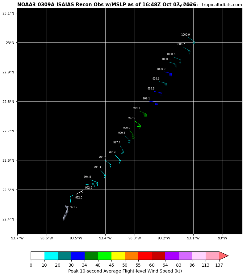
This morning's recon was having some data issues, wonder if they just missed it or the data was bad. If not Isaias we're about to see some big wind increases as winds catch up to that pressure drop.
-

2026-2027 Record-breaking El Nino
Cobalt replied to Stormchaserchuck1's topic in Weather Forecasting and Discussion
why do you still talk like this, you're 40?
-
Late to the game been bust outside. The Canuk's won the smack down fairly substantially for QPF the last week of Sept. IBY. They have been by far the most accurate QPF models for MBY all the way back into Aug so I'm gonna ride them through this winter lmao.
-
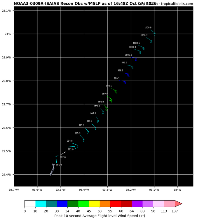
Wow latest recon finding about 10mb lower pressure than the previous one.
-
Whoa
-
So expect a big winter. Got it.
-

Tropical Storm Isaias
Prismshine Productions replied to WxWatcher007's topic in Tropical Headquarters
Another result of that: Further east delays the shear weakening Sent from my SM-S176V using Tapatalk -
 indian pharmacy prednisone: IndoCure Global - generic medicine online shopping
 -

E PA/NJ/DE Autumn 2026 Obs/Discussion
JTA66 replied to PhiEaglesfan712's topic in Philadelphia Region
Yeah, Irene, Isaac, Ida, Isaias…the “I” storms rarely disappoint. -
meanwhile the girlfriend..
-
I love how it tracks to my west yet the heaviest precip goes to the east.
-
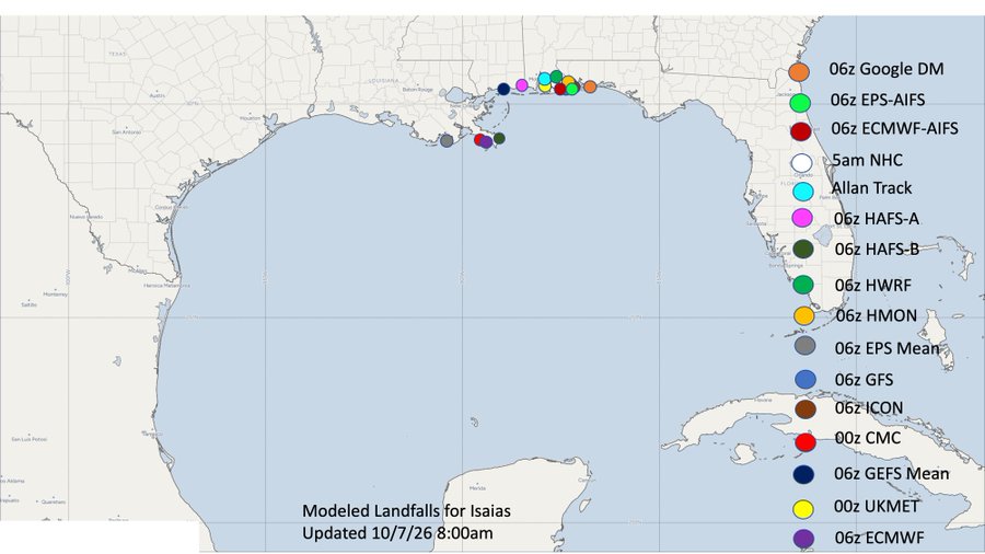
I like 50-75 miles east of there similar to Google. The 12Z GFS and ICON moved east.
-
Landfall right along the FL/AL line seems like the best bet right now
-
@Carvers Gap I'm very sorry for your loss. Yeah both my parents have graduated to be with the Lord. However I still miss them every day. Gonna be a long road for you and family. Thinking of you and praying for your peace at this time. Yeah I remember my first weather radio was a clunky box. I believe I lost my second radio on top of a payphone during a storm chase about 30 years ago. Probably a few maps too. At least I've never lost an expensive camera that way! ECMWF monthly clusters break down between cold, and quite mild. I lean toward the latter, but we can hope for the former.
-
Ike in 2008. Wasn't used in 2014
-

E PA/NJ/DE Autumn 2026 Obs/Discussion
Mikeymac5306 replied to PhiEaglesfan712's topic in Philadelphia Region
Someone brought this up either in the Tropical Forum, or MA Forum. It could be either it was 2020 and there was all the crap going on and it got overlooked, or they don't have enough "I" names to retire one. -
Forgot this whole subform existed till now! Though the recon this morning showed a weaker storm than expected based on IR presentation, it also appears to be on it's way to vertical alignment of its low levels with the convection flares now surrounding the center. Will be very interesting to see if the next recon flight shows strengthening as it flies through the storm; if it does, then we might be setting up for a bout of rapid intensification overnight as I believe that is the best window in terms of wind shear (and diurnal max).
-
I think the worst is Sat. after the game but I expect there to be upslope showers by kickoff at App. I think the escarpment gets 4-6 easily from this maybe more. We should be able to handle that with the antecedent conditions being fairly dry. Anything more than 8 and its trouble.
-
Bad news. Judah Cohen says that the slow rate of Siberian snowcover advance in the (*checks notes*) FIRST SIX DAYS OF OCTOBER implies a mild winter.
-
Low of 39
-
Okay I didn’t know this. I feel like I had never heard that name before but maybe it replaced a retired name?
- Today
-
lol why is the NHC in love with the name Isaias?
-

2026-2027 Record-breaking El Nino
forkyfork replied to Stormchaserchuck1's topic in Weather Forecasting and Discussion
maybe you should get it printed on a teddy bear and cuddle it to sleep every night <3