All Activity
- Past hour
-
High of 88 yesterday.
-
Every global model suite is showing close to 2 inches of qpf through next Friday.
-
-
If you’d actually look you’d see
-
Skubal dominated, which was expected with the Os inconsistent offense.
- Today
-
Flood Watch National Weather Service Baltimore MD/Washington DC Issued by National Weather Service State College PA 345 AM EDT Fri Jun 13 2025 DCZ001-MDZ013-016-017-504-VAZ037>039-050-051-053>057-502-527-131545- /O.NEW.KLWX.FA.A.0011.250613T2200Z-250614T0600Z/ /00000.0.ER.000000T0000Z.000000T0000Z.000000T0000Z.OO/ District of Columbia-Prince Georges-Charles-St. Marys-Central and Southeast Montgomery-Albemarle-Greene-Madison-Orange-Culpeper- Fairfax-Arlington/Falls Church/Alexandria-Stafford-Spotsylvania- King George-Southern Fauquier-Central and Southeast Prince William/Manassas/Manassas Park- 345 AM EDT Fri Jun 13 2025 ...FLOOD WATCH IN EFFECT FROM THIS EVENING THROUGH LATE TONIGHT... * WHAT...Flash flooding caused by excessive rainfall is possible. * WHERE...Including the following , District of Columbia, including the following areas in Maryland, Central and Southeast Montgomery, Charles, Prince Georges and St. Marys, and including the following areas in Virginia, Albemarle, Arlington/Falls Church/Alexandria, Central and Southeast Prince William/Manassas/Manassas Park, Culpeper, Fairfax, Greene, King George, Madison, Orange, Southern Fauquier, Spotsylvania and Stafford. * WHEN...From this evening through late tonight. * IMPACTS...Excessive runoff may result in flooding of rivers, creeks, streams, and other low-lying and flood-prone locations. * ADDITIONAL DETAILS... - Showers and thunderstorms will increase in coverage late this afternoon through this evening. Some thunderstorms will contain heavy rainfall, with rainfall amounts around 1 to 3 inches possible within an hour or two. Storms may also train over the same areas, causing the possibility for locally higher amounts around 4 to 5 inches of rain within a few hours. Heavy rainfall in a short period of time combining with already saturated soils means that creeks and streams may rapidly rise out of their banks along with the potential for flash flooding in urban areas. - Please visit www.weather.gov/safety/flood for flood safety and preparedness information
-
Let’s bring those 60s down on the cape+south coast up a few ticks. Come on, just a little nudge!
-
 Falian6029 joined the community
 -
Gonna call this the year of the east wind
-
Nurse dewy is…
-
You stomp on it?
-
Before it clouded up, you could see some pillars on the Katahdin cam.
-
Currently 72/66 at SBN but it feels much swampier than that. Maybe the recent dry dew points make it seem muggier.
-
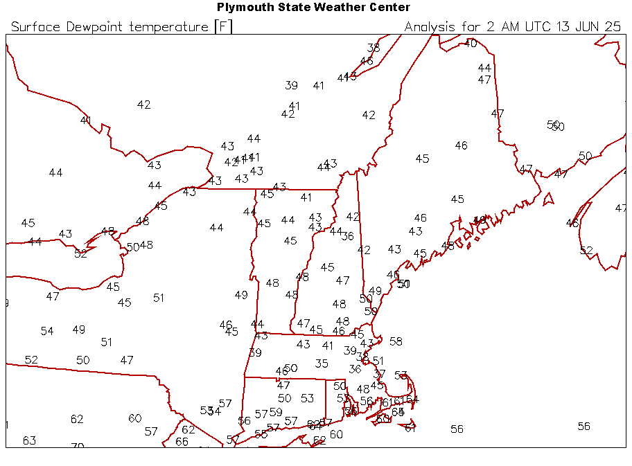
ORH at a 35 DP. Little pocket of very dry air over highly populated areas… EMATT.
-
This 7 day forecast blows chunks!! I must somehow convince myself that these are just the early stages of our first named winter storm of the year. We're laying the groundwork. Calling those ducks to the pond. And I pray it rains enough to kill all my grass. Because I'm going on 3 weeks with no mow and I cant even cut it anymore. Just got back from Chicago. Weather sucked there too. What do we feel about bowling weather? Time to join a league??
-
Picked up another .20" today from brief by heavy shower.
-
Odd DP for June
-
MBY hit 93 on Monday and has been close a few times since
-
Got lucky and had two rogue showers blow up overhead. 0.27” was enough to make the yard happy. 92.1 here today, yesterday was 92.6. Very hot summer pattern but we have been blessed with enough afternoon showers/storms to keep everything from drying out and this was an incredible post storm evening
-
Would be awesome to be out in town
-
BOS at 75/37 for 25% RH after 10pm is awesome. That’s a warm, dry, well-mixed breezy vibe. Mediterranean.
-
Thinking we have a shot at a MRGL on Saturday for a few localized wind events. Lapse rates are lousy, but there will be decent instability and modest deep layer shear.
- 1,003 replies
-
- 1
-

-
- severe
- thunderstorms
- (and 2 more)
-
Lots of things obviously need to align, but that's certainly what we want to see if we're hunting derechos. We would be well within the hot, humid air mass, but also just barely within the faster flow aloft, giving organized convective systems the opportunity to race to the east-southeast.
- 1,003 replies
-
- 2
-
-
- severe
- thunderstorms
- (and 2 more)
-

E PA/NJ/DE Summer 2025 Obs/Discussion
Ralph Wiggum replied to Hurricane Agnes's topic in Philadelphia Region
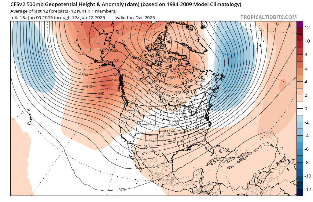
I don't hate this as we begin our winter season:
-
High 80°. Already 61° with a stiff breeze and dews well into the 40s.
-
?? Lots of oaks on the property.