All Activity
- Past hour
-
 All snow currently in Halls, light to moderate with dimes. No mixing that I can tell yet. Temp was up to 32 earlier, down to 29 currently.
 -

Jan 24-26 Weekend Snow and Sleetfest Model Thread Part Tres
TSSN+ replied to H2O's topic in Mid Atlantic
Yes that’s what that usually means. -
Tick snowier
-

Extreme Cold, Snow & Sleet: SECS 1/25 - 1/26
allgame830 replied to TriPol's topic in New York City Metro
Pretty much the same as previous run -

Southern Crippler - Get well soon Jimbo Storm Obs
WinstonSalemArlington replied to BooneWX's topic in Southeastern States
It funny how it’s colder in the Triad than most of the NC mountain locations. Heck, Durham is much colder than Asheville -
As someone in the industry, it’s not for no reason. Thank energy policy this past decade which pre maturely rushed the closure of coal fired power plants. You can’t replace that capacity overnight, it takes significant investment, much more than any company can possibly shell out without passing on. Luckily, electricity is still the best bang for your buck. It fuels almost every aspect of your life daily, for roughly the cost of a value meal.
-
Still the heaviest snow I’ve ever seen. 5” an hour, flakes the size of actual pancakes
-
 This storm looks nothing like the models we have been watching or am I not seeing something
 -

1/24-1/25 Major Winter Storm - S. IL, IN, and OH
MidwestChaser replied to A-L-E-K's topic in Lakes/Ohio Valley
Or maybe don’t take things so personally. At the end of the day, it’s just snow. It’s not gonna make anyone’s life better. -

1/24-1/25 Major Winter Storm - S. IL, IN, and OH
Powerball replied to A-L-E-K's topic in Lakes/Ohio Valley
This is one of the most widespread winter storms for the nation period. The guy on Fox Weather (Ari something) said yesterday that he's never covered a system this expansive (in terms of frozen/freezing precipitation) in his 20 year career. -

Jan 24-26 Weekend Snow and Sleetfest Model Thread Part Tres
JenkinsJinkies replied to H2O's topic in Mid Atlantic
Maybe 10” is the boom scenario and 4-8 is the most likely outcome? -

Central PA Winter 25/26 Discussion and Obs
MAG5035 replied to MAG5035's topic in Upstate New York/Pennsylvania
1st and probably only call I’m gonna do with this. I could’ve just put a text box that said 10-18” on it and called it a day and would’ve had the model support to defend it. But I am hedging some on the NAM thermals being at least partly right and a bit more sleet intrusion. Not full NAM, but somewhere in between that and the general consensus. These are purely snow numbers, obviously the reduced zones in the southern tier are for sleet mixing, but if that were to occur than sleet accumulations would be fairly notable as well (perhaps an inch or so). The only reason I’m giving the NAM a bit more weight in what is mainly a snowier consensus is strictly its handling of mid-level features and the warm nose. If the snowier consensus wins out, then the whole subforum simply sees 12-18”. Impact wise, that really isn’t that much of a difference.. this is going to be disruptive. I also think top end will be tempered a bit, mainly for speed of the system. Mostly I think there will be a lot of 14s and 15s with some 16-18” reports sprinkled in. It doesn’t look like any kind of a comma head lingers in C-PA to drive widespread amounts toward the 20” mark. What could overcome that is a fast start to the heavier snows when the best snow ratios will be before the mid-levels of the column start to warm later in the event. Both of these points were mentioned in CTP’s disco from yesterday.. which was a good informative discussion.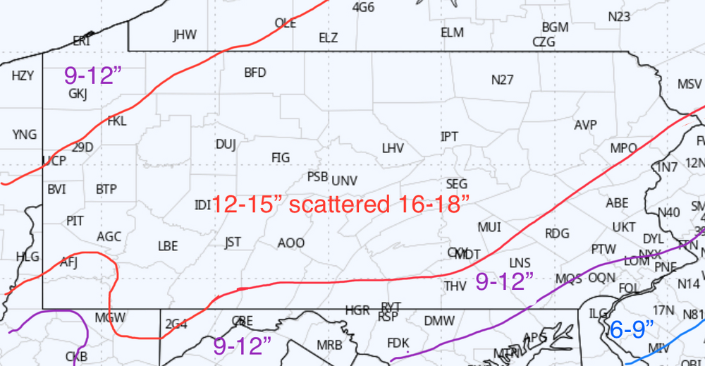
-

January 24-26: Miracle or Mirage JV/Banter Thread!
mattie g replied to SnowenOutThere's topic in Mid Atlantic
Wondering if this storm is going to ultimately have the lowest tracking/posting to snowfall ratio ever. -

“Cory’s in LA! Let’s MECS!” Jan. 24-26 Disco
Ginx snewx replied to TheSnowman's topic in New England
-

Southern MD / Lower Eastern Shore weather discussion
AlexD1990 replied to PrinceFrederickWx's topic in Mid Atlantic
I did....lol -

Extreme Cold, Snow & Sleet: SECS 1/25 - 1/26
WeatherGeek2025 replied to TriPol's topic in New York City Metro
how did the euro run? I was at the shopping center. I'm driving right now. -
Sleet is picking up over here in SW Lewisville.
-
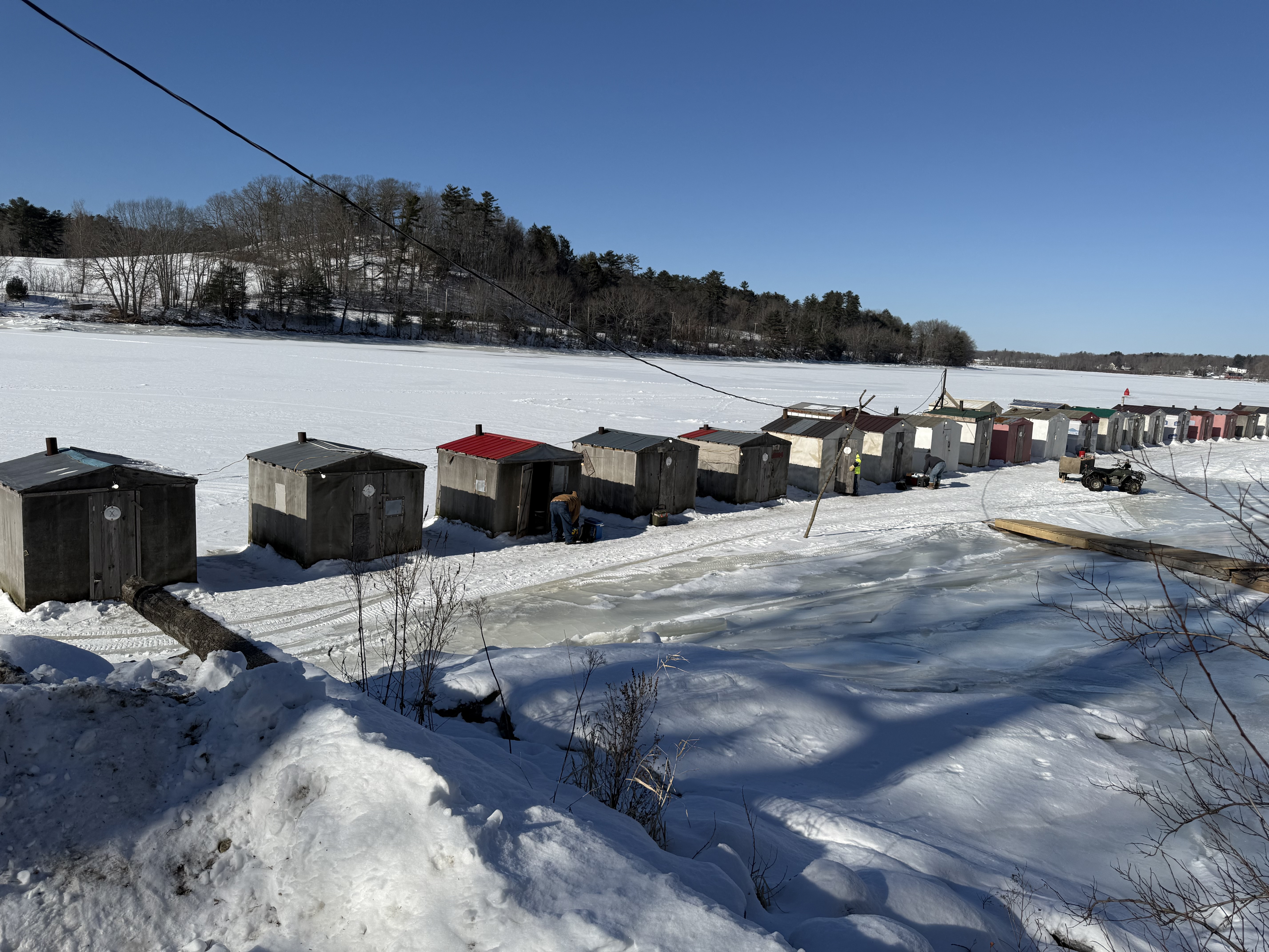
No it’s all good out fishing and it’s pretty nice out actually with the wood stove ripping in the shack lol

-
West based Greenland blocking might be in play due to the strat background state taking place during this time period. Would love to get a Manitoba Mauler to pop off NC and explode and do a loop de loop off the Mid Atlantic Coast. Been waiting decades.
-

“Cory’s in LA! Let’s MECS!” Jan. 24-26 Disco
weatherwiz replied to TheSnowman's topic in New England
The Winter lecture my professor just posted for winter weather forecast actually has a slide on Kuchera method. One of the bullet points Does not account for vertical velocity, depth of DGZ, saturation of DGZ, dry layers near surface, time of year, or stability Often overpredicts snowfall in in very cold airmasses and in marginal/mixing situations -

Central PA Winter 25/26 Discussion and Obs
pasnownut replied to MAG5035's topic in Upstate New York/Pennsylvania
Let’s hope that theme continues well east. -

Jan 24-26 Weekend Snow and Sleetfest Model Thread Part Tres
bncho replied to H2O's topic in Mid Atlantic
When you say Max 10" or whatever does that mean some isolated areas will receive up to 10"? -

Southern Crippler - Get well soon Jimbo Storm Obs
wncsnow replied to BooneWX's topic in Southeastern States
Still 35 here -
my thermometer has never been below zero until today. I got it in April
-

Jan 24-26 Weekend Snow and Sleetfest Model Thread Part Tres
WEATHER53 replied to H2O's topic in Mid Atlantic
I want to ask about the “mileage” of “near 95”. Along 95 and 5 miles away, or 10 or20 or 30? Thanks