All Activity
- Past hour
-
Feb 10-11 Mid Week Minor Event - Ride the hot hand?
wxsniss replied to HoarfrostHubb's topic in New England
Sidewalks covered in 10 min, roads starting to whiten 2 hours of this should get us to 2"+ -
light snow, 32° N Smithtown Mainly graupel. Got a dusting
-
Feb 10-11 Mid Week Minor Event - Ride the hot hand?
wxsniss replied to HoarfrostHubb's topic in New England
Borderline heavy here near Fenway -
The Weeklies are cold from week 3 onward - I wouldn't even say 50-60s seasonal stuff. Looks to me like highs in the 40s for many. I would assume most understand we aren't getting January temps in late February or March - LOL. But the Weeklies this afternoon are a slog. Maps are referenced above. Same, exact signal as the past two cold shots. I would put a target date from just after Feb 21 to the end of March(or earlier). I do think winter hangs on longer than most are gonna want it to...especially after this warm-up gets everyone ready for spring. I highly doubt NE TN and your area are done for the season. I would never guarantee anything...but the pattern itself would yield cold. I would suggest it may well be significantly colder than seasonal, but still a ways to go before getting too specific on my part. They were cold enough this afternoon that I was digging up the Pisgah snow analogs for May of 92. I think a lot of folks who are new to the region haven't seen what March can do in Tennessee as we have flipped warm during so many recent springs. I am not saying we go to that place this March...but I have certainly seen March be a winter month. This has been a winter where we have thought it ended multiple times. Does it have one last gasp? Maybe. I am gonna make one early call...I think fall comes early.
-
A good amount of the region is under severe drought or moderate drought per the US Drought Monitor. USGS river gaging stations are also showing below normal discharge.
-
.thumb.png.4150b06c63a21f61052e47a612bf1818.png)
Feb 10-11 Mid Week Minor Event - Ride the hot hand?
HIPPYVALLEY replied to HoarfrostHubb's topic in New England
Going to probably end with about an inch here but it’s pretty dense. -

Feb 10-11 Mid Week Minor Event - Ride the hot hand?
ORH_wxman replied to HoarfrostHubb's topic in New England
Vis maybe 1/8 mile now -

Feb 10-11 Mid Week Minor Event - Ride the hot hand?
DavisStraight replied to HoarfrostHubb's topic in New England
Looks like coastal NHs cleaning up. -

2025-2026 ENSO
michsnowfreak replied to 40/70 Benchmark's topic in Weather Forecasting and Discussion
The position of the Great Lakes - a direct path for cold shots - makes me think its very likely to see similar sustained deep cold periods like the one just passed, though not as frequent as shorter, more intense bouts as have been seen in recent years. Its really crazy to see two years in a row with deep south snow. Its been an absolutely fantastic winter for deep cold and snow/ice cover. This is two winters in a row the ratio of days with snow on the ground/snow depth to the total accumulated snowfall is greater than usual. Last winter snowfall finished below avg with snowcover around avg. This winter, while snowfall is still above avg to date, it is not as much above avg as is the snowcover. Should future winters continue to warm on avg, the opposite would likely occur (somewhat of a decrease in snowcover, while snowfall itself stats fairly steady). -

Feb 10-11 Mid Week Minor Event - Ride the hot hand?
DavisStraight replied to HoarfrostHubb's topic in New England
About 3 inches, light snow currently. -

Feb 10-11 Mid Week Minor Event - Ride the hot hand?
ORH_wxman replied to HoarfrostHubb's topic in New England
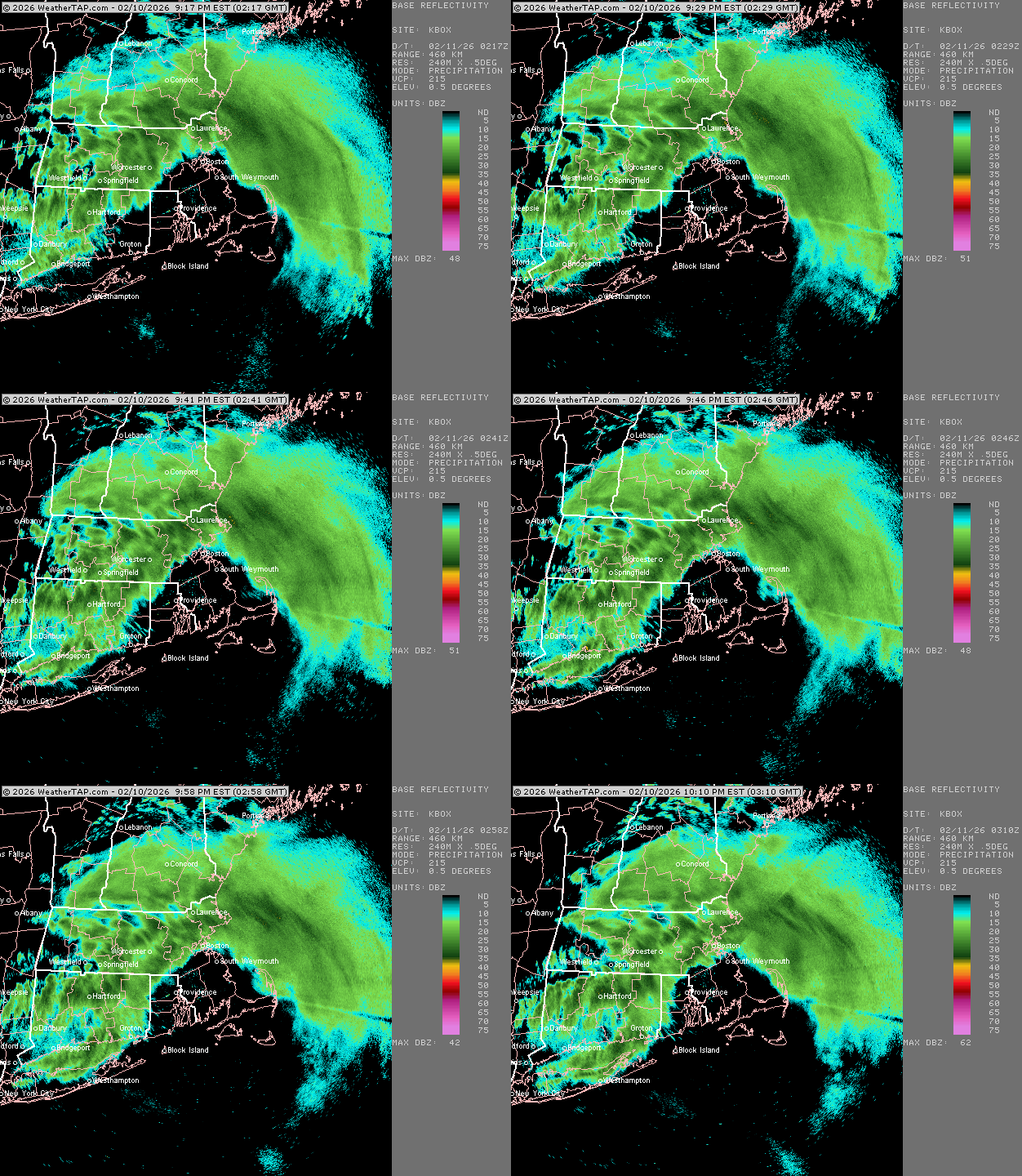
Ok actually white fog here now. Wow. If it can do this for an hour that would go a long ways. But the echoes need to co heal together a bit more. -

Feb 10-11 Mid Week Minor Event - Ride the hot hand?
Sey-Mour Snow replied to HoarfrostHubb's topic in New England
Looks like Kevin will get a solid 2-3 hours of good rates , training good cells in the northern 3rd of ct while he rest of the state gets flurries -

Feb 10-11 Mid Week Minor Event - Ride the hot hand?
ORH_wxman replied to HoarfrostHubb's topic in New England
Snowing good here again. But yeah, not an over achiever. We’ll prob be lucky to get 2”. -

Feb 10-11 Mid Week Minor Event - Ride the hot hand?
40/70 Benchmark replied to HoarfrostHubb's topic in New England
I think 3ish. -
Winter 2025-26 Medium/Long Range Discussion
DocATL replied to michsnowfreak's topic in Lakes/Ohio Valley
Agree…for the Mountain West. -

Feb 10-11 Mid Week Minor Event - Ride the hot hand?
40/70 Benchmark replied to HoarfrostHubb's topic in New England
Pouring snow now after a break...like a fog outside. -

2025-2026 ENSO
michsnowfreak replied to 40/70 Benchmark's topic in Weather Forecasting and Discussion
LOL cherry picking cities. No, its using the city/metro that i live in and comparing it to the climate period of record. I dont have time to cherry pick a random stat for a random city just because. When the already coldest time of year in your already cold weather city ranks 3rd coldest of 152 years on record...it absolutely is impressive and noteworthy. -

Feb 10-11 Mid Week Minor Event - Ride the hot hand?
radarman replied to HoarfrostHubb's topic in New England
Some kind of sleety snow crap but looks like a bust -
Feb 10-11 Mid Week Minor Event - Ride the hot hand?
ma blizzard replied to HoarfrostHubb's topic in New England
went from flurries to moderate within a couple mins -

Feb 10-11 Mid Week Minor Event - Ride the hot hand?
The 4 Seasons replied to HoarfrostHubb's topic in New England
? i dont know what you were expecting, you still look fine for 1-2 -
Central PA Winter 25/26 Discussion and Obs
Blizzard of 93 replied to MAG5035's topic in Upstate New York/Pennsylvania
Detailed & entertaining Forecast Discussion from CTP on the Sunday snow chance. KEY MESSAGE 2: Continuing to monitor the potential for winter weather on Sunday. Over the next few days, a closed low currently off the NorCal Coast will drop southward as it opens a bit, and take a turn to the east after reaching the Baja Peninsula. The trough swings east over the srn US, and eventually develops a sfc low as Gulf moisture is incorporated. Timing and occurrence are fairly well- agreed- upon at that point. Mud gets thrown onto the crystal ball as divergence in track of the low and depth/residence of the cold air over the ern US are seen in the latest deterministic forecasts. If precip gets into PA, the hints are still there that the air will be cold enough in PA to have some snow at first, but not a slam dunk certainty. As alluded to, the GFS and ECMWF, and ECMWF-AI latest runs are keeping the low track flatter. That would make much, if not all, of the precip miss PA to the south. But, ensemble means from both sides of the pond and nord de la frontiere make precip well into PA with the CMCE mean pushing the most QPF into PA - and much farther north. The latest NBM guidance has trended lower with PoPs, which matches recent trends in guidance. The best chance for precipitation is currently across southern PA. Additional shifts/modifications are likely and we will continue to keep an eye for a more consistent/longer trend to make tweaks to this weekend`s forecast. -

Feb 10-11 Mid Week Minor Event - Ride the hot hand?
CoastalWx replied to HoarfrostHubb's topic in New England
You’ll probably get 1 to 2


