All Activity
- Past hour
-

November 2025 general discussions and probable topic derailings ...
CoastalWx replied to Typhoon Tip's topic in New England
Yeah, first since yesterday. -
Temp down to 33 with light snow currently here in Haywood county! First snow of the damn season fellas!
-

E PA/NJ/DE Autumn 2025 Obs/Discussion
Birds~69 replied to PhiEaglesfan712's topic in Philadelphia Region
This is the same type of event as the other night. Overnight rains ending around daybreak....maybe .25". 58F/light-mod rain -

November 2025 general discussions and probable topic derailings ...
jbenedet replied to Typhoon Tip's topic in New England
Another +3 high in the books. -
Tropical thunderstorms 0.53"
-
Jealous that you made it out! Get some pics
-

November 2025 general discussions and probable topic derailings ...
kdxken replied to Typhoon Tip's topic in New England
Some big totals in the usual spots. -

11/8-11/10 First Snow and Lake Effect Event
Chinook replied to Geoboy645's topic in Lakes/Ohio Valley
looks like a miniature cyclone -
That area is so interesting with all the large old trees! Edit- just looked at Snowshoe cams, already starting to flurry up there and about 34 degrees.
-

2025-2026 Fall/Winter Mountain Thread
Maggie Valley Steve replied to Buckethead's topic in Southeastern States
Flurries are flying at Cataloochee now. 30F currently. -

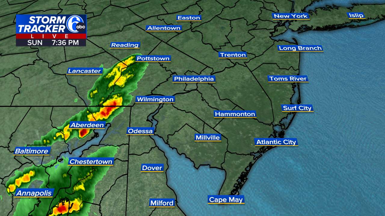
E PA/NJ/DE Autumn 2025 Obs/Discussion
Albedoman replied to PhiEaglesfan712's topic in Philadelphia Region
too late missed me - Today
-
How did NYC get record breaking snowfall in Nov. 1882 Nov. 1898 and Nov. 1938 ? We are way overdue !
-
E PA/NJ/DE Autumn 2025 Obs/Discussion
Birds~69 replied to PhiEaglesfan712's topic in Philadelphia Region
More reds developing. Maybe I'll get on the horn and wake drought guy...still warm out, 60 F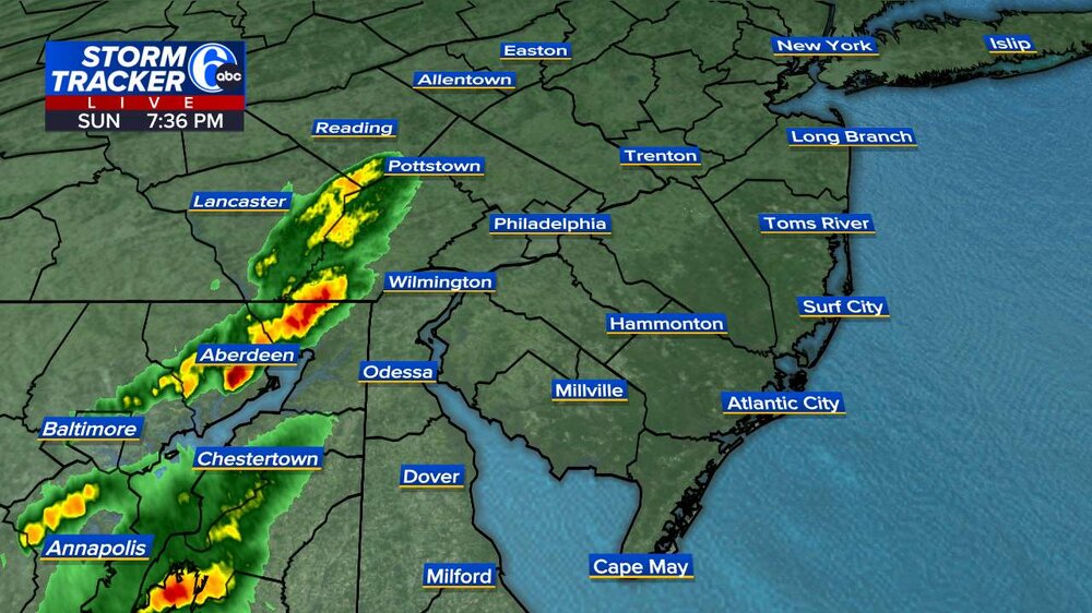
-
Can’t wait to go hiking out in WV tomorrow! Will probably get to Gaurdineer Knob right around 9am and hike for a while
-

11/8-11/10 First Snow and Lake Effect Event
ChiTownSnow replied to Geoboy645's topic in Lakes/Ohio Valley
I'm okay without those. They were confusing to the normal person. -

11/8-11/10 First Snow and Lake Effect Event
Powerball replied to Geoboy645's topic in Lakes/Ohio Valley
I miss the Snow Advisory and Heavy Snow Warning headlines too... -

11/8-11/10 First Snow and Lake Effect Event
sbnwx85 replied to Geoboy645's topic in Lakes/Ohio Valley
Vort max is coming ashore now. Band should shift towards Illinois. Strong meso low and a Lake Huron connection creating decent snows across Western Michigan. That should come south and keep the snow falling off and on until about midnight locally.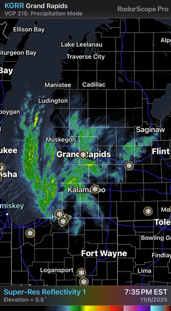
-

November 2025 general discussions and probable topic derailings ...
Cyclone-68 replied to Typhoon Tip's topic in New England
I’m so sorry..I’ll keep you in my thoughts and hopefully your situation will improve -
2025-2026 Fall/Winter Mountain Thread
Maggie Valley Steve replied to Buckethead's topic in Southeastern States
32 at Cataloochee. Good to see reports coming in from our neighbors in Eastern Tennessee! It won't be long now. -
Slowly bleeding in over the mountains
-
11/8-11/10 First Snow and Lake Effect Event
sbnwx85 replied to Geoboy645's topic in Lakes/Ohio Valley
7.5” from today. 3.5” in the last hour. Storm total is 9” including yesterday’s system. -
Now snowing here at 1750. 35.6
-
Temp down to 35 degrees now.
-

-
11/8-11/10 First Snow and Lake Effect Event
snowman33 replied to Geoboy645's topic in Lakes/Ohio Valley
The recent HRRR runs have the main band stationary over Lake County, IL. Gets O'Hare into the heavier totals.