All Activity
- Past hour
-
Nice -NAO pattern Nov 7-23.. through hr384 on the 00z GFS ensemble mean. That's what you want to see as a wintery pattern, constant sustained High pressure west of Greenland and over the Davis Strait through the entire model run. That's a good sign for Winter, and does correlate at about 55% to -AO the rest of the Winter. We aren't super cold in the east because of a N. Pacific High pressure in that time... but since the 23-24 Strong Nino, since June 2023, the PNA has been positive 21/29 months (CPC)! It's been hard for -PNA's to sustain..
- Today
-
Going to miss out on the snow events this winter as I've moved to Texas now
-
32.2, maybe going sub 30.
-
 Will be interesting to see where the period 2021-2025 falls on the 5-year cumulative snow futility list. Currently, this is the second least snowy 5-year period on record, behind the 5-year period ending 12/31/2024 (2020-2024). BOS would need 16.1" of snow by the end of December to move out 2nd place for 5-year futility. On the plus, maybe we've turned the corner since 2021-2025 is guaranteed to be snowier than 2020-2024 even if no additional snow falls before the EOY.
 -

Major Hurricane Melissa - 892mb - 185mph Jamaica landfall
Windspeed replied to GaWx's topic in Tropical Headquarters
Unfortunately, that's what you would expect to see from a higher-end Category 5. The footage is still insane, however. Thanks for sharing. RE: Deaths, I would be shocked if the toll remains below 100. There is just too far wide an area of immense devestation, especially through the interior of the island, and it takes time to search with cadaver dogs through all scattered piles of debris. -
LOL, forecast low from NWS for my location is 32, currently 30.8/21.9 at midnight.
-
 Already down to 28 here.
 -
-

Digital Snow/Ice Thread 2025-2026
WinstonSalemArlington replied to WinstonSalemArlington's topic in Southeastern States
-
 I blocked his arse early last year. He's a trouble maker.. he likes antagonize just to get a rise out of people.
 -

New England 2025 Warm Season Banter
TauntonBlizzard2013 replied to bristolri_wx's topic in New England
Just a shameless plug, may need it, if anyones hiring or knows somewhere that is, I’d take the lead. BS Criminal Justice. Trying to prepare myself, reading the tea leaves -
lol, I mean, I feel like I’m not saying anything particularly controversial. From an averages standpoint the last 7-8 years here have been objectively terrible. Sure, you sprinkle in a few good events, but even those were washed away shortly after. I feel like the argument has kind of shifted to “ well Jan 22 was awesome! And December 19 had some snow!”, like sure, we’ve had a good event every couple of years. If I wanted climo like that I’d just move to Norfolk VA
-
Did I say it hasn’t snowed? Lol
-
Might be my favorite event of the last 10 years
-
17 was close, but last year, I don’t remember anything last year? point still stands, close or not, last white Christmas here 2010.
-

MO/KS/AR/OK 2025-2026 Winter Discussion
stormdragonwx replied to stormdragonwx's topic in Central/Western States
First widespread hard killing freeze looks to be hitting the area this weekend. Some could even see their first teens for lows come Monday morning. -
Bold prediction for DC-Balt corridor. Points west, a little more reason to be bullish but the pattern has to establish itself on time and not end altogether after a good 3 or 4 week run. Relax, and reload. Hopefully we all get in on some fun this year.
-
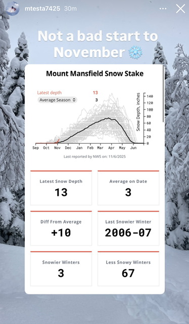
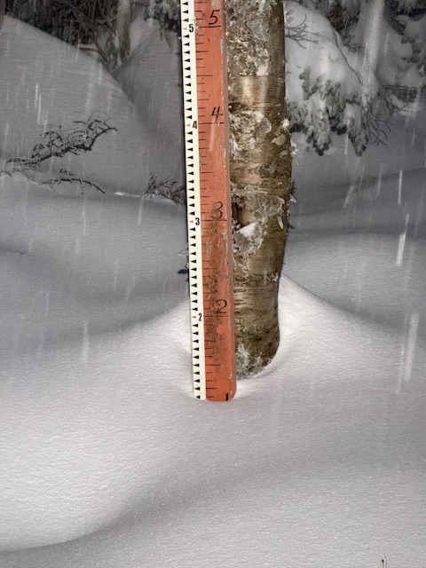
It’s important to note that the snow depth at the long term stake is higher on this date than 67 of 70 years. Only three November 6’s have had more snow on the ground at that location in the past 70 years.
-
 If you move up to 850mb the CanSIPS and CFS aren't that different considering what you would expect from a long range forecast. Canada looks cold from December through March, and 500mb heights in Western NA are above normal, which is about the best you can hope for these days.
 -
down to 36 at 10 pm, feels like I-95 gets first freeze tonight
-
1962-63 is one of the legendary winters ever here and many other places. It featured a QBO falling deeply negative from fall into winter. Was a weakish La Nina. It had an SSW event. The PDO was negative. The PDO is currently negative. October 1962 was warm, but finally got cold around October 19th. This year was warm, and it finally got cold here and frosted on October 20th. A strong cold front passed in early November and brought light snow to the region, there was even a dusting in lower elevations. After that cold front and snow event, the temp warmed and the warmest temperatures of the month were mid month and late month, as temperatures yo-yo'd a bit. The first few days of December were very warm, then the bottom fell out and December ended -7. The 60s were extreme, but since 2013/14 we've gotten closer to it's weather patterns. Just in a somewhat warmer world. We went years without extreme cold after 1996 and into the early 2010s (nothing sub zero). Since then we've seen sub zero cold invade multiple times and it's back to happening at least 2 to 3 of every 5 or so years. Weather is never exactly the same but large scale patterns will always come back. Like we will eventually get another blizzard or very anomalous snowfall event. A widespread 14-20+ inch type event. The gulf, Texas and deep south have had such events in this enhanced winter pattern we've been in since 2013/14 brought back the subzero weather that had disappeared.
-

November 2025 general discussions and probable topic derailings ...
WinterWolf replied to Typhoon Tip's topic in New England
Ya, It sucks. It always shows warm…no matter what. Throw it in the trash. -
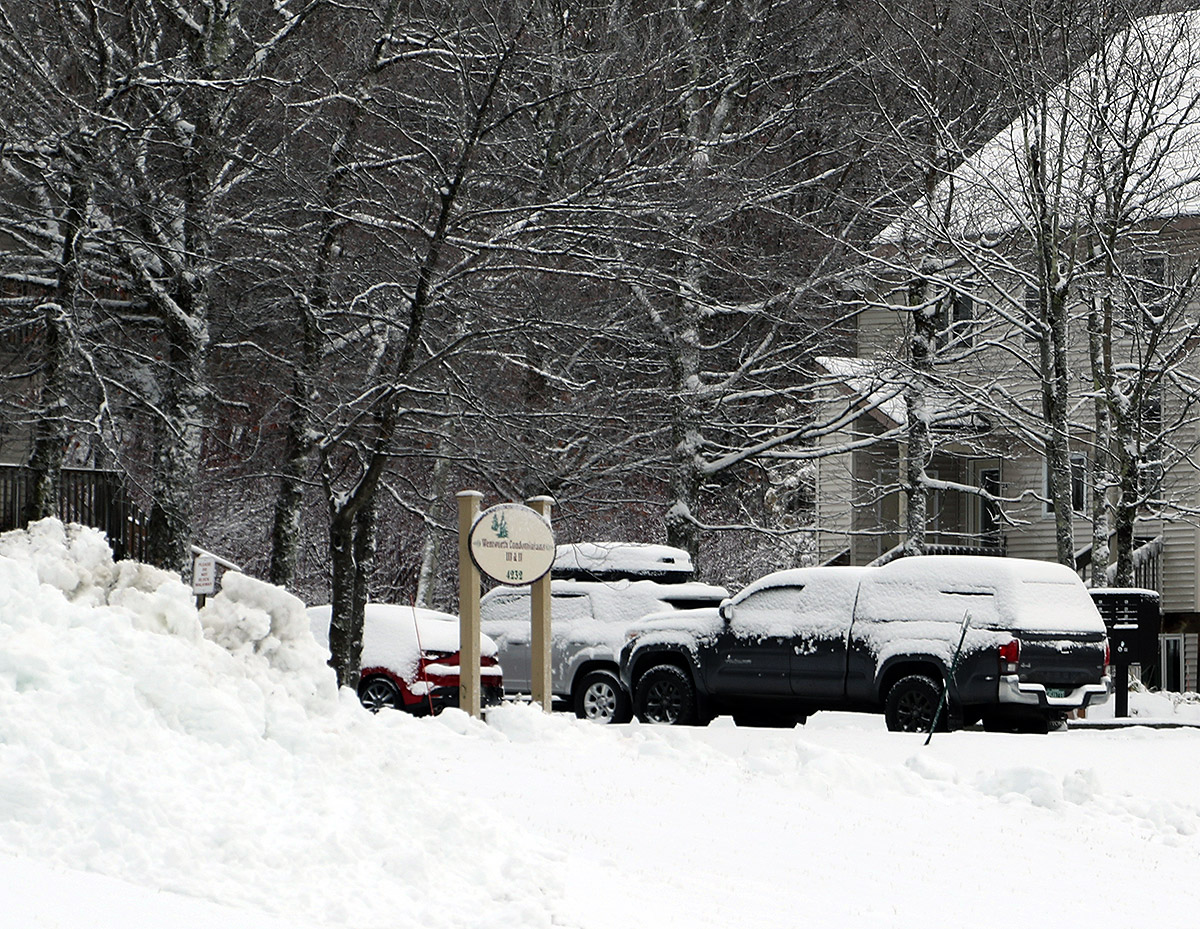
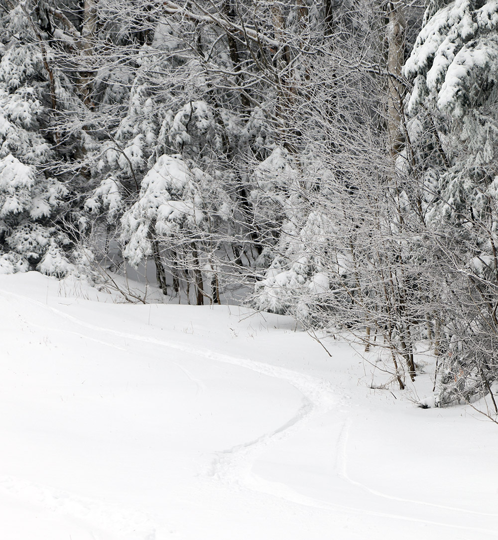
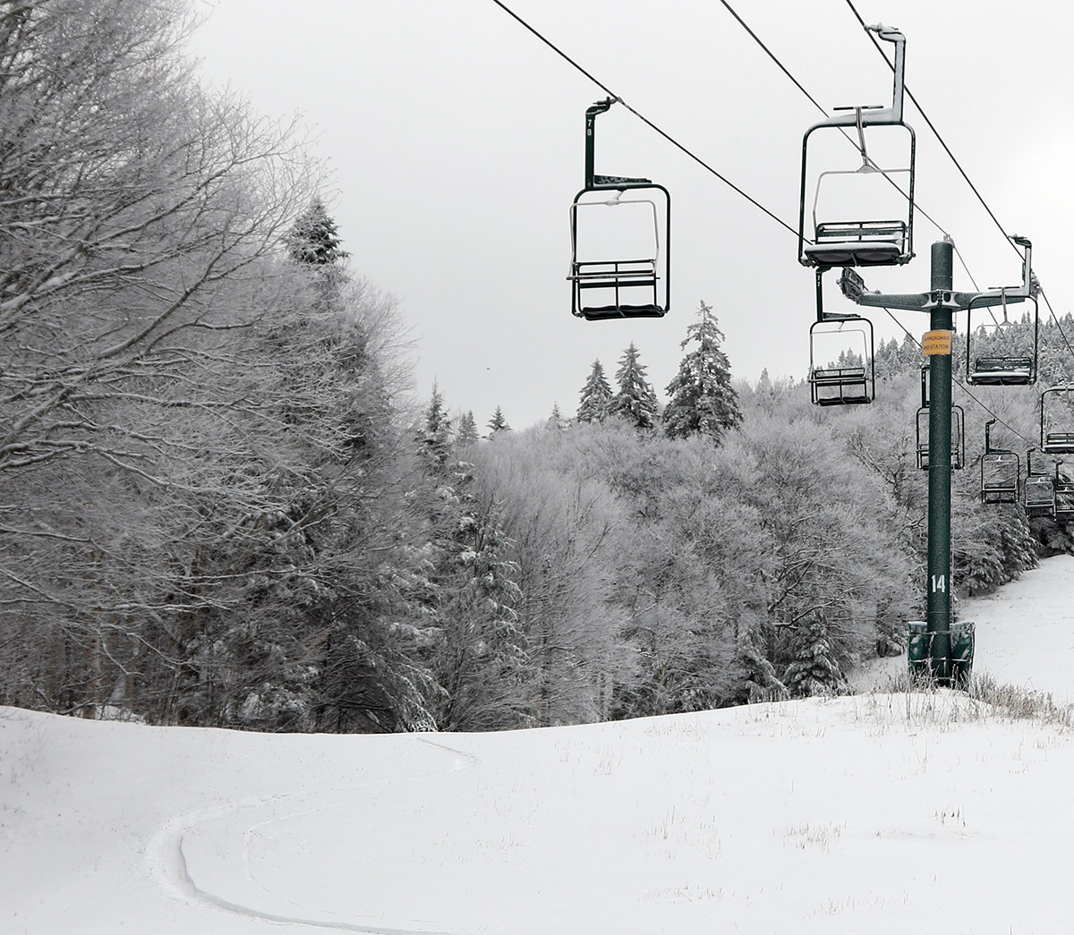
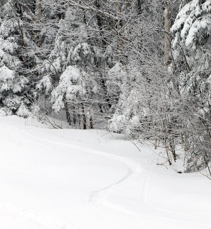
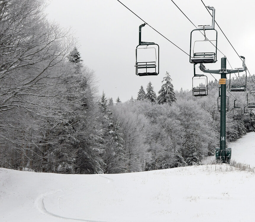
The clipper system affecting the area yesterday into today dropped another round of snow in the mountains and we even saw snow transiently accumulating in some of the lower valleys. This system was similar to the last one that affected the area on Friday into Saturday, but temperatures seemed to be a bit colder on the back side this time around. This morning when I checked the view on Bolton Valley’s Base Lodge Webcam, the accumulations appeared to be a bit more robust than last time around. Seeing hat, I knew there would be plenty of snow for using skins right from he base, so I geared up for a ski tour and headed up to the mountain. While the snow line was still fairly high with this system, the local ~2,000’ peaks around us in the Winooski Valley were coated with white for their top ~300’ of vertical, so that suggested that the snow level had dipped just a bit lower than what we’d seen over the weekend. Heading up the Bolton Valley Access Road, I saw the first traces of snow around 1,200’ just like Saturday, but Timberline showed a decent covering down to its 1,500’ base, and up in the Village at 2,000’ I found 3-6” of snow, which was more than what had accumulated Saturday morning. Temperatures were cooler today than they were on Saturday, and even at 2,000’ the temperatures were easily below freezing. The cooler temperatures meant that the powder was of much higher quality than what’s we’d seen over the weekend, and with some base snow already in place, the quality of the powder skiing took a big leap forward from where it had been. Compared to what was available on Saturday, today was simply easy breezy midwinter-style powder skiing. All you had to do was lean in and carve. When checking snow depths today, I couldn’t really differentiate the new snow from the old snow that was already present from the last system, but the updated elevation-based snow profile is below. In the list, the first depth values are what I found on Saturday, and the second depth values are what I observed today. Nov 1 --> Nov 6 1,000’: 0” --> 0” 1,200: T” --> T 1,500’: T-1” --> 1” 2,000’: 1-4” --> 3-6” 2,500’: 4-6” --> 5-9” 2,800’: 7-11” --> 9-12” 3,150’: 7-11” --> 10-16” With every one of these storms that passes through and drops snow, the potential increases for this to be the start of the winter snowpack. With typical November temperatures, I wouldn’t expect the higher elevation snow to melt too quickly, so we’ll just have to see if there are any warm spells or big rainy systems in the future that might be able to put a dent in the snowpack.
-

November 2025 general discussions and probable topic derailings ...
Torch Tiger replied to Typhoon Tip's topic in New England
it's warmer for DJF than it showed late summer through October. Far and away. Doesn't mean much, but more than it did then.