All Activity
- Past hour
-
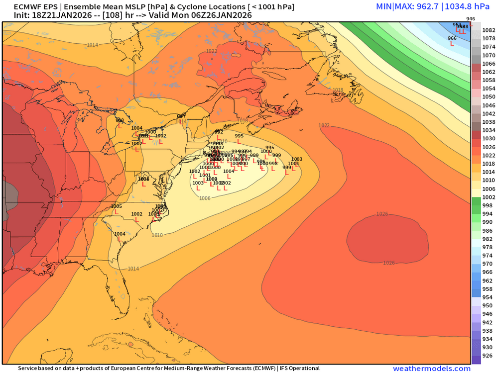
Tightening cluster just east of the cape on the 18z EPS
-

Possible Record Breaking Cold + Snow Sunday 1/25 - Tuesday 1/27
NorthShoreWx replied to TriPol's topic in New York City Metro
And this is a problem why? -

1/23/26-1/25/26 Winter Storm Thread
Holston_River_Rambler replied to AMZ8990's topic in Tennessee Valley
May not matter that much in the long run, buuuuttttttt: -

Possible Record Breaking Cold + Snow Sunday 1/25 - Tuesday 1/27
Noteaster101 replied to TriPol's topic in New York City Metro
I’m sitting here in Pearl River New York, seems like a solid 12 to 18 is on the table, no mixing issues here -
Well it was nice knowing everyone. My house by that means I will be buried under ice.
-
 I'm not making any judgments about trends until the 0z suite. The 18z runs almost always have wonky solutions.
 -

January 24-26: Miracle or Mirage JV/Banter Thread!
aldie 22 replied to SnowenOutThere's topic in Mid Atlantic
Now that i'm out by Winchester i wonder whatever happened to Fullmug -
https://x.com/i/status/2014108294885900466
-
 it was the GFS that had it going wide right! Nam and Euro had us at 30 inch forecast
 -

Winter 2025-26 Medium/Long Range Discussion
DocATL replied to michsnowfreak's topic in Lakes/Ohio Valley
GFS gives Chicago nearly 3 inches of snow through the first week of February. Wish we could get some rain instead. . -
Oh goodness that's right! He was fading the South and cold. Well I think natural gas already crushed him if he's short. Storm track might be another story, but it won't fix their trading account.
-
Ya hour 6 is probably their range
-

January 25/26 Jimbo Back Surgery Storm
Thrasher Fan replied to Jimbo!'s topic in Southeastern States
Always wondered what they mean by “Flat Ice” . -

2025-2026 Fall/Winter Mountain Thread
franklin NCwx replied to Buckethead's topic in Southeastern States
Light snow falling -

January 24-26: Miracle or Mirage JV/Banter Thread!
pazzo83 replied to SnowenOutThere's topic in Mid Atlantic
i bought a ton of "salt" (it's supposed to be natural) from the local Ace Hardware. -
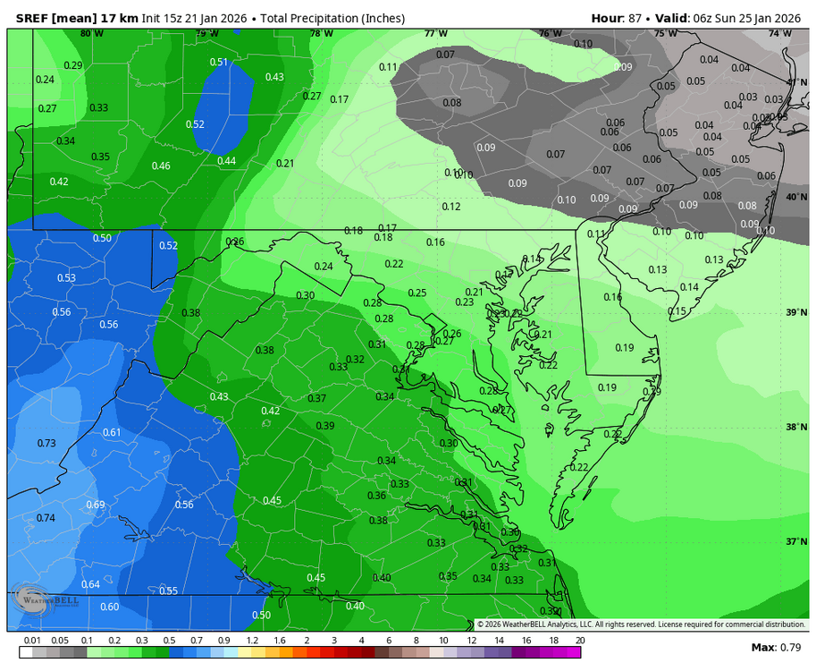
NBM Para 18z
-
January 24-26: Miracle or Mirage JV/Banter Thread!
aldie 22 replied to SnowenOutThere's topic in Mid Atlantic
I went out earlier to grab a few things and the store was super crowded...I picked up way too many sweets but heh...sugar -
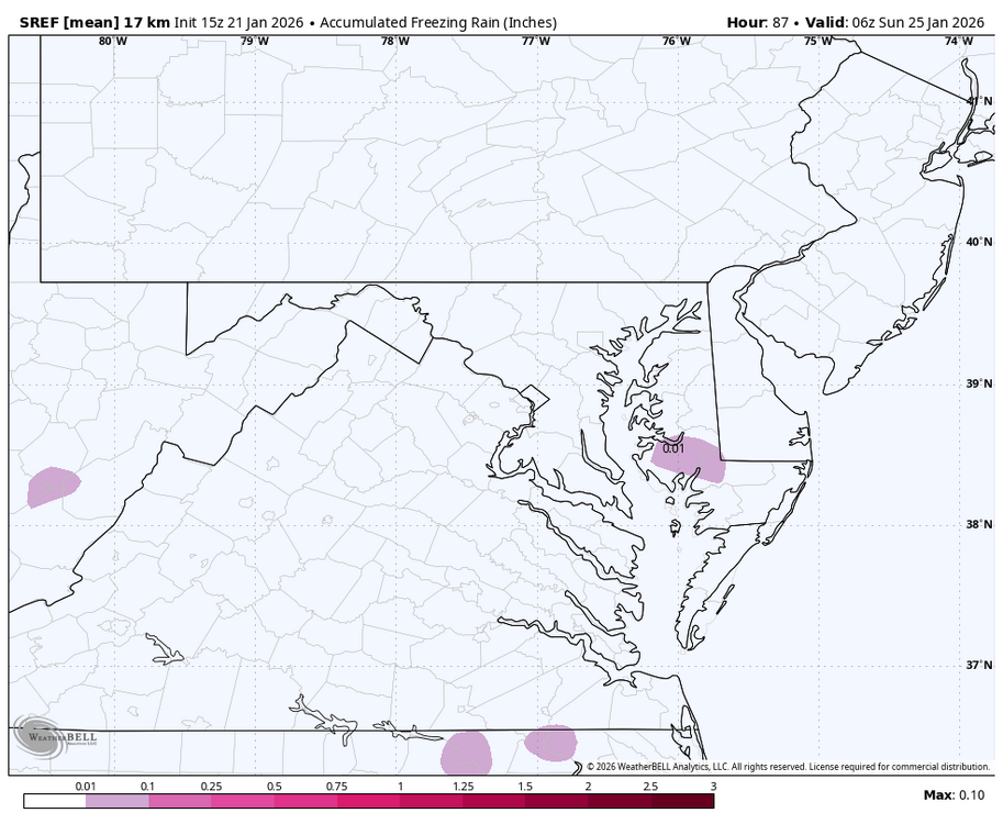
So, they are. The thing is that this is by far an overrunning event rather than a typical CCB coastal event. These types of over-running events don't happen too often, and 95% of the time lead to mix or rain. Now, that said, this storm is different in that we have an extremely cold airmass embedding itself over the area on Friday. So things to look forward for are: 1. How / where does the phasing happen over the southern plains. The faster the Sub-Tropical Cut-Off (relative to the pacific stream s/w) ejection the better. 2. The placement and strength of the 850 low over the OHV. The weaker the better, though this is related to #1 3. The strength and more particularly the depth of the cold air wedge that develops on Friday. The stronger the better obviously.
-
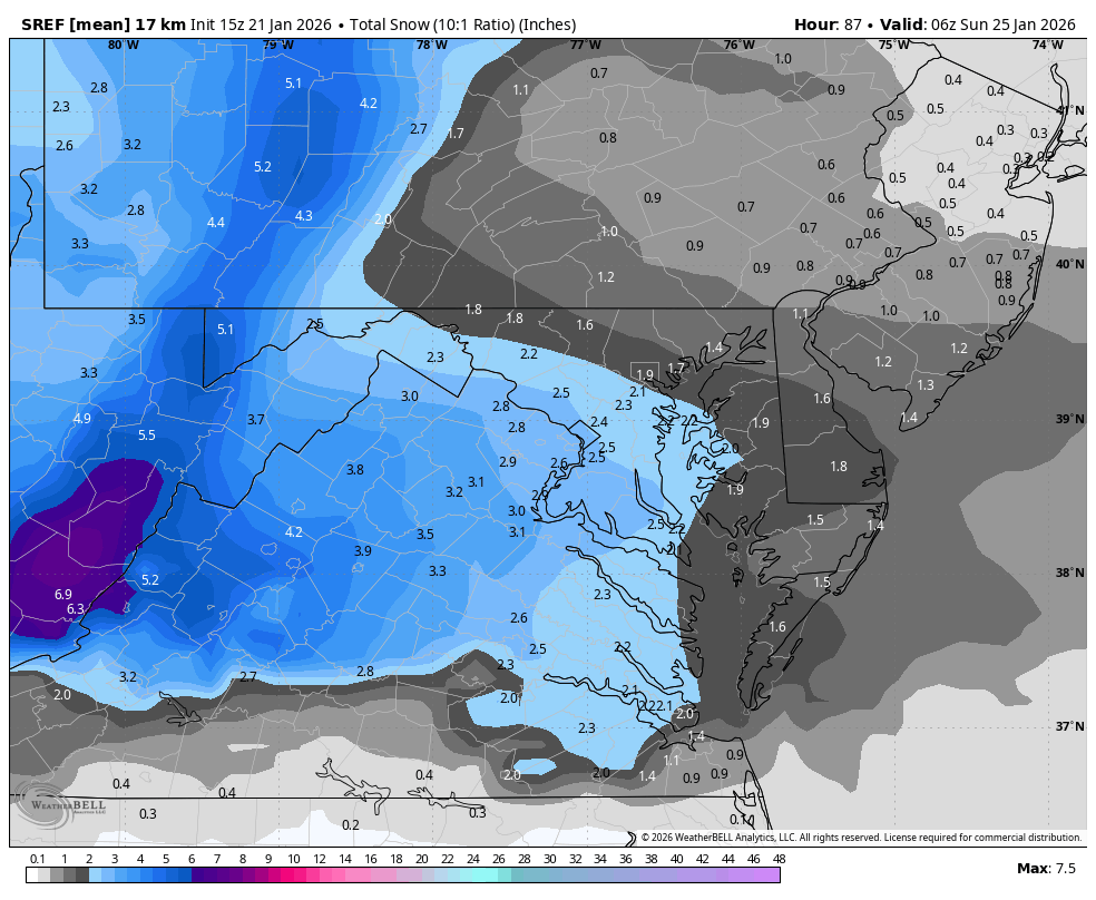
Waaaaay too far out for the SREFs
-
Possible Record Breaking Cold + Snow Sunday 1/25 - Tuesday 1/27
liwxfan replied to TriPol's topic in New York City Metro
You missed the storm of a lifetime. I drove home from setauket through port jeff to mt. Sinai. Almost didn't make it. Snowing harder then I've ever seen the rates were incredible. Was passing so many who were stuck on the roads. Barely made it in my jeep. There was thunder snow no joke for like an hour straight on the mt sinai harbor. I measured 33 inches where I was. It was un believable. Also the storm i compare all others to since. We were right on the rain /snow line for hours right before sunset. Once the sun set it was incredible. -
No Bam!! We need to see him wallow in defeat!! This storm has become personal lol .
-
Radar looks (decent ) . Hopefully continues thru about midnight and can extend out East
-
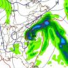
WB 21Z SREF thru 1am Sunday


-
Not sure why it was more north with that h5 look it’s not as phased. Interesting stuff
-

January 24-26: Miracle or Mirage JV/Banter Thread!
TowsonTownT replied to SnowenOutThere's topic in Mid Atlantic
I know everyone is stressed. I get it. We're 36 hours out and prime time for the rug pull. But don't worry folks. My snow shovel broke last year and my wife was adamant that I walk down to the hardware store this afternoon to get one. I said no dear, totally not needed. You're welcome.