All Activity
- Past hour
-
 About 16.5 here. Even if we get another one or 2 in before it's over tonight, that'll bring that's over 18 tonight. Whenever we get tomorrow is gravy. Very curious to see what happens tomorrow.
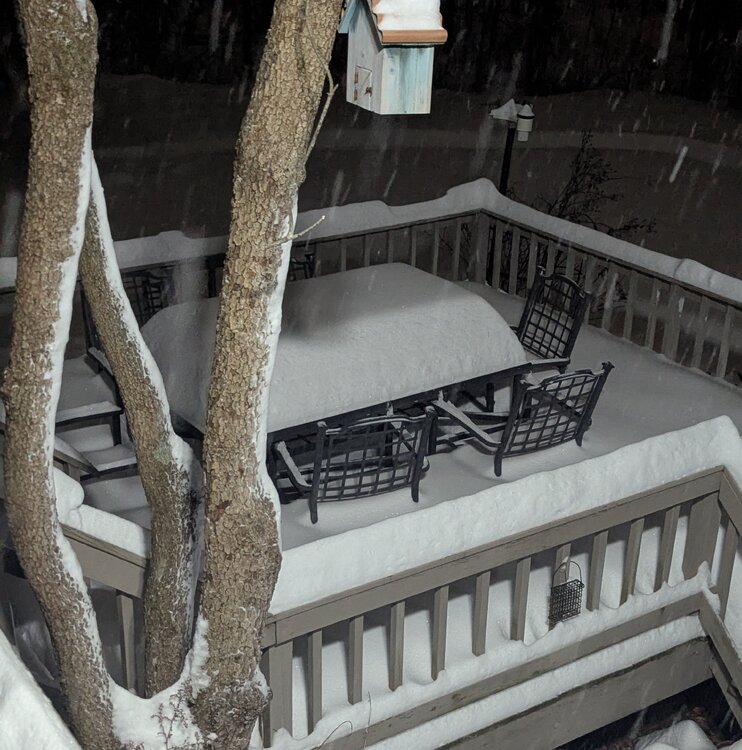
-

January 25-26 Winter Storm Potential
Chadzachadam replied to Ralph Wiggum's topic in Philadelphia Region
All done here. 7.5” snow plus almost 3” of sleet. No ZR at all and definitely no plain rain. High temp (so far) was 26 -
Comical how off the surface temps have been. Weather app has been estimating based on models and has been almost ten degrees too high all day compared to reality
-
 I would be wary of ending the snow across western & central CT too soon. While the rates will certainly decrease, there is ample low-level fronto & advection in the 925 and 850, even almost to the 700 level to promote more steady light / moderate snow across much of CT; while the back edge of it appears to be heading into western CT, I think it will expand and fill out; appearing to back-build. It will certainly not be anywhere near as heavy as earlier, but I think there will be ongoing light snow continuing well after midnight.
 -
I looked under the hood at the H5 vorticity maps and man this one will be hard to get right. Its a bunch of energy that retrogrades under the block in the NS that dives south while a piece of NS energy out of Canada dives south and picks up moisture. Personally, I think the odds of all of this happening is pretty low. I'll check out of this till Wednesday at least
-
 I could def see 2-4” for you tomorrow better NE
 -

Southern Crippler - Get well soon Jimbo Storm Obs
Tony Sisk replied to BooneWX's topic in Southeastern States
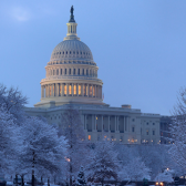
That looks like the northern lights!!! -

1/24-1/25 Major Winter Storm - S. IL, IN, and OH
HillsdaleMIWeather replied to A-L-E-K's topic in Lakes/Ohio Valley
Schools here have officially hit 6 school days off in a row, might for 7 or 8 of even more depending on the cold. -

Snow Contest January 25th-26th
WeatherGeek2025 replied to WeatherGeek2025's topic in New York City Metro
Jayson's is disqualified -
Why? Have you checked the temps for this upcoming week? Also, it snowed a foot in New Orleans last year - which averages 0.0” of snow annually. South Carolina snow is rare, but not impossible, especially on the heels of this airmass with a ton of snow / ice cover to the north / west. Not saying it’ll snow there, but I wouldn’t brush off the possibility entirely
-
This is my go-to, but it can often take up to a day to fully update after a storm. https://www.nohrsc.noaa.gov/interactive/html/map.html?var=snowfall_24_h&snap=1&bgvar=dem&shdvar=shading&o9=1&o13=1
-
 15" West Greenwich RI * had 14" at 6PM went and did drive way and had 3" more where I started once I got to other end. 400' Figured would see 17-18" but temps are up to 25 and some sleet mixing in measured 15" Lets see where we are Later tomorrow.
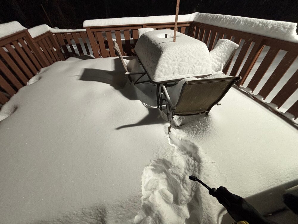
-
The Gfs lost? No way.
-
This hobby is comparable to a Crack addict
-

Mid-Long Range Discussion 2026
WinstonSalemArlington replied to BooneWX's topic in Southeastern States
-
Made it to 62 straight hours below 0. 20 is going to feel like a heat wave later this week
-
 All hi res does
 -
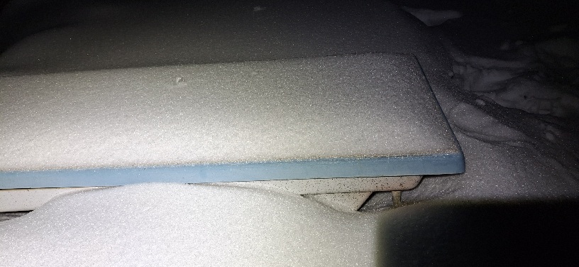
The cartop accumulations here all have this same odd pattern on the sides. As if worn down by the sleet.
-
.thumb.jpg.6a4895b2a43f87359e4e7d04a6fa0d14.jpg)
Central PA Winter 25/26 Discussion and Obs
Yardstickgozinya replied to MAG5035's topic in Upstate New York/Pennsylvania
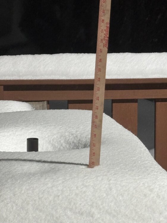
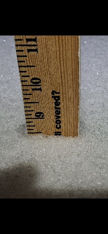
I was a little late getting out there for my second measurement at 8:00PM so there was surely some compaction, but I added 1.75 of sleet and snow after I brushed off initial measurement at 11:00AM of 6.375 for a total 8.125 of snow and sleet today. Now that said, I walked over to my neighbor's and took a one time measurement at 8:00PM off his open concrete slab, and measure'd. 8.5" that i'm sure has got squashed down from the sleet. The first 2 pictures are from my backyard. The second two picture or from my neighbors concrete slab. So maybe I did a little better than I initially thought. Below is my neighbor's concrete slab.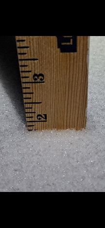
-
 I think tomorrow has some potential. Currently thinking 1-3 western CT/2-4 central and eastern. High ratio stuff may over perform. But we'll see.
 -
EPS support. GFS is suppressed south and east... I've read this book before.
-
Send my regards to my peeps in KJ.
-

Pittsburgh/Western PA WINTER ‘25/‘26
southpark replied to Burghblizz's topic in Upstate New York/Pennsylvania
A half inch could have blown off during some of those wind gusts we got! -
 NAM looked sweet for tomorrow