All Activity
- Past hour
-
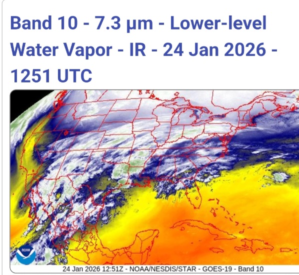
Snow returns on radar as far east as Boone NC and as far south as Russelville AL, Holly Springs MS....interesting
-
chattagirl started following Jan 24 - 26 2026 Ice, sleet, and for a lucky few..... snow storm
-

Jan 24-26 Weekend Snow and Sleetfest Model Thread Part Tres
GreyHat replied to H2O's topic in Mid Atlantic
-
06z GFS on bufkit 0.73" qpf for here, You can do more with less qpf because of ratios 260126/0700Z 49 03010KT 9.2F SNOW 17:1| 1.3|| 0.00|| 0.00|| 0.074 18:1| 7.5|| 0.00|| 0.00|| 0.43 100| 0| 0 260126/0800Z 50 02010KT 9.2F SNOW 25:1| 1.5|| 0.00|| 0.00|| 0.061 18:1| 9.0|| 0.00|| 0.00|| 0.49 100| 0| 0 260126/0900Z 51 02011KT 9.6F SNOW 29:1| 1.6|| 0.00|| 0.00|| 0.056 20:1| 10.7|| 0.00|| 0.00|| 0.54 100| 0| 0 260126/1000Z 52 02009KT 9.9F SNOW 28:1| 1.0|| 0.00|| 0.00|| 0.035 20:1| 11.7|| 0.00|| 0.00|| 0.58 100| 0| 0 260126/1100Z 53 02010KT 10.3F SNOW 28:1| 1.0|| 0.00|| 0.00|| 0.034 21:1| 12.6|| 0.00|| 0.00|| 0.61 100| 0| 0 260126/1200Z 54 02010KT 10.5F SNOW 30:1| 0.5|| 0.00|| 0.00|| 0.018 21:1| 13.2|| 0.00|| 0.00|| 0.63 100| 0| 0 ----------------------------------------------+----++-----+-------------++--------------++-------------++-----------+---+--- 260126/1300Z 55 02010KT 10.7F SNOW 30:1| 0.5|| 0.00|| 0.00|| 0.018 21:1| 13.7|| 0.00|| 0.00|| 0.65 100| 0| 0 260126/1400Z 56 02010KT 11.6F SNOW 28:1| 0.6|| 0.00|| 0.00|| 0.021 21:1| 14.3|| 0.00|| 0.00|| 0.67 100| 0| 0 260126/1500Z 57 02010KT 13.5F SNOW 20:1| 0.2|| 0.00|| 0.00|| 0.007 21:1| 14.4|| 0.00|| 0.00|| 0.68 100| 0| 0 260126/1600Z 58 02011KT 15.0F 0:1| 0.0|| 0.00|| 0.00|| 0.000 21:1| 14.4|| 0.00|| 0.00|| 0.68 0| 0| 0 260126/1700Z 59 02011KT 16.1F 0:1| 0.0|| 0.00|| 0.00|| 0.000 21:1| 14.4|| 0.00|| 0.00|| 0.68 0| 0| 0 260126/1800Z 60 02010KT 16.2F SNOW 23:1| 0.2|| 0.00|| 0.00|| 0.007 21:1| 14.6|| 0.00|| 0.00|| 0.69 100| 0| 0 ----------------------------------------------+----++-----+-------------++--------------++-------------++-----------+---+--- 260126/1900Z 61 01010KT 16.6F 0:1| 0.0|| 0.00|| 0.00|| 0.000 21:1| 14.6|| 0.00|| 0.00|| 0.69 0| 0| 0 260126/2000Z 62 01009KT 16.1F 0:1| 0.0|| 0.00|| 0.00|| 0.000 21:1| 14.6|| 0.00|| 0.00|| 0.69 0| 0| 0 260126/2100Z 63 02009KT 15.2F SNOW 20:1| 0.2|| 0.00|| 0.00|| 0.007 21:1| 14.7|| 0.00|| 0.00|| 0.69 100| 0| 0 260126/2200Z 64 02008KT 14.3F SNOW 17:1| 0.1|| 0.00|| 0.00|| 0.007 21:1| 14.9|| 0.00|| 0.00|| 0.70 100| 0| 0 260126/2300Z 65 01007KT 13.5F SNOW 13:1| 0.1|| 0.00|| 0.00|| 0.007 21:1| 15.0|| 0.00|| 0.00|| 0.71 100| 0| 0 260127/0000Z 66 36006KT 13.4F SNOW 14:1| 0.1|| 0.00|| 0.00|| 0.009 21:1| 15.1|| 0.00|| 0.00|| 0.72 100| 0| 0 ----------------------------------------------+----++-----+-------------++--------------++-------------++-----------+---+--- 260127/0100Z 67 36005KT 13.5F SNOW 8:1| 0.1|| 0.00|| 0.00|| 0.009 21:1| 15.2|| 0.00|| 0.00|| 0.73 100| 0| 0 260127/0200Z 68 01004KT 13.7F SNOW 9:1| 0.1|| 0.00|| 0.00|| 0.007 21:1| 15.2|| 0.00|| 0.00|| 0.73 100| 0| 0
-

Central PA Winter 25/26 Discussion and Obs
WmsptWx replied to MAG5035's topic in Upstate New York/Pennsylvania
I may go full tilt is it's seven degrees outside and fuckin raining :LOL: -
Extreme Cold, Snow & Sleet: SECS 1/25 - 1/26
snowman19 replied to TriPol's topic in New York City Metro
The initial front end thump is definitely going to be impressive. That’s locked in, I think the only remaining question is, when does the changeover to sleet with the warm nose then dry slot happen? As a sweeping generality, I’d say 6-10 in the NYC metro area (including the immediate north and west suburbs) before the changeover/dry slot -
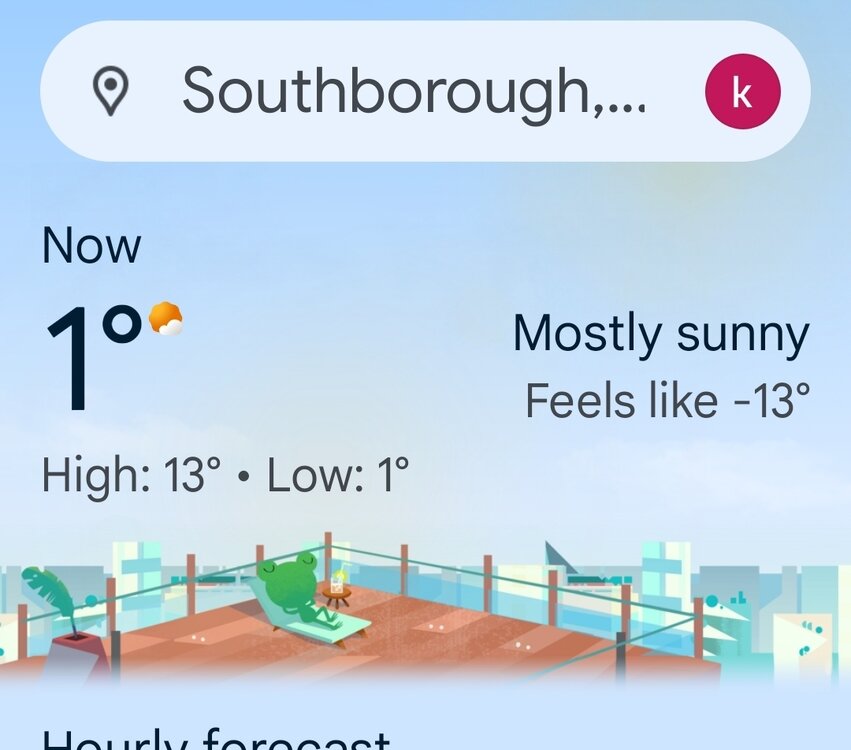
Its a wee bit chilly....Great for ice fishing. No trucks or ATVS breaking through the ice this year. My friend built himself a 5x8 Bob house. Put it out on the ice last weekend at Martin Meadow. Cut some holes in the ice and said the ice was at least 24 inches thick
-

Jan 24-26 Weekend Snow and Sleetfest Model Thread Part Tres
baltosquid replied to H2O's topic in Mid Atlantic
One of the big differences is a not insignificantly stronger 850mb low on the NAM… I feel like I’d trust the euro more on low placements and strength. Temp profile goes to NAM if those are pretty much the same but they aren’t in this case. Also I feel like I trust the euro QPF over the NAM. But I haven’t been looking at these models as long as many of the people here… -

Arctic Hounds Unleashed: Long Duration Late January Cold Snap
kdxken replied to WxWatcher007's topic in New England
-
Let’s talk winter!! Ohio and surrounding states!! 24'-25'
pondo1000 replied to buckeye's topic in Lakes/Ohio Valley
Since ‘08! Let’s go!!! That was in March too so it was gone in like 3 days. -
Arctic Hounds Unleashed: Long Duration Late January Cold Snap
#NoPoles replied to WxWatcher007's topic in New England
Great for ice fishing. No trucks or ATVS breaking through the ice this year. My friend built himself a 5x8 Bob house. Put it out on the ice last weekend. Cut some holes in the ice and said the ice was at least 24 inches thick -
1/24-1/25 Major Winter Storm - S. IL, IN, and OH
King James replied to A-L-E-K's topic in Lakes/Ohio Valley
I’m just a dude that follows my backyard and to me the models have kept us in the game since this thread was made. Models consistently show like 4-9 for our area. -

Pittsburgh/Western PA WINTER ‘25/‘26
TimB replied to Burghblizz's topic in Upstate New York/Pennsylvania
21.1 was the exact Snowmageddon number, wasn’t it? It’s a sign. -

January 25-26 Winter Storm Potential
Ralph Wiggum replied to Ralph Wiggum's topic in Philadelphia Region
6" is reasonable for our location. Seeing alot of posts here and FB on how we won't see less than 12" because this is a 16 hr storm. People are forgetting only about 4-5 hours of it is actually clean snow for our areas (7am-noon?). Past 12 hrs the trend now is a quicker flip as the warm tongue screams N and W. Just hoping this isnt it and 2 weeks of cold/dry -> spring. -

Jan 24-26 Weekend Snow and Sleetfest Model Thread Part Tres
Solution Man replied to H2O's topic in Mid Atlantic
Our post hit the same time, we both see it -
Snowing in Chattanooga… roofs and cars covered already Great to here. I am really rooting for you guys down there. I lived my whole childhood in Cleveland through my college years, and we were the one area of TN that would get shafted so many times. We're going to believe you guys are going to score big.
-

2025-2026 Fall/Winter Mountain Thread
Maggie Valley Steve replied to Buckethead's topic in Southeastern States
Snowing in Chattanooga. 30 here at the house. -
January 24-26: Miracle or Mirage JV/Banter Thread!
aldie 22 replied to SnowenOutThere's topic in Mid Atlantic
Perfect time for employees to clean the case -
Several runs were spitting out a finger of earlier front-running precip until yesterday over W NC- the earlier the onset, the more likely it is to be a period of SN without the warm nose present..... As y'all say, it is probably nowcasting time
-

1/24-1/25 Major Winter Storm - S. IL, IN, and OH
Baum replied to A-L-E-K's topic in Lakes/Ohio Valley
-

1/24-1/25 Major Winter Storm - S. IL, IN, and OH
Powerball replied to A-L-E-K's topic in Lakes/Ohio Valley
Believe it or not, there are reports of LES in parts of DFW right now. It has to be forming in the lowest 5,000ft (not impossible given how warm the local lakes are and how dense the low-level cold air is), because temps between 850mb and 700mb are still solidly above freezing. The synoptic precip is predominately sleet. Fortunately, we've mostly avoided the freezing rain thus far. -
Arctic Hounds Unleashed: Long Duration Late January Cold Snap
ariof replied to WxWatcher007's topic in New England
Record for days AOB 32˚ at BOS is 16 days … this will be close. Unlike the quick cold shots in 2016 and 2023 when BOS went to -9˚ and -10˚ it might not crack 0˚ but both of those went to 50˚ within a couple of days. -
tnwxwatcher started following Jan 24 - 26 2026 Ice, sleet, and for a lucky few..... snow storm
-
Pittsburgh/Western PA WINTER ‘25/‘26
Burghblizz replied to Burghblizz's topic in Upstate New York/Pennsylvania
I think the main thing at this point that will determine 10” versus 15” for Allegheny County is ratios. Everything else looks locked and loaded!


