All Activity
- Past hour
-
Yea I thought it was supposed to be further south. Actually just got under a torrential cell here with thunder.
-
Now the TOR watch comes out
-
Seems like the storms and rain are everywhere but where the actual risk region is?
-
Severe Watch just south of Immediate NYC metro from Middlesex - Somerset Counties and points south...
-
Hrrr has been insistent that the Loudoun-Frederick cluster is the entire show for areas north of DC
-
By Chestertown MD
-

Augdewst 2026: Summer's Last Stand
weatherwiz replied to Prismshine Productions's topic in New England
nice looking supercell with a TDS down in Maryland -

Augdewst 2026: Summer's Last Stand
NoCORH4L replied to Prismshine Productions's topic in New England
I think you'll have a better chance of staying dry on Saturday than SNE at least -
Yea this one is yours lol. Raining here, though.
-
Pouring here right now and under that Thunderstorm Warning.
-

2026-2027 Record-breaking El Nino
Maestrobjwa replied to Stormchaserchuck1's topic in Weather Forecasting and Discussion
Nooooo (good for some areas though) -

2026 Mid-Atlantic Severe Storm General Discussion
LeesburgWx replied to Kmlwx's topic in Mid Atlantic
Pouring precip for the past 20 minutes here -
I hope we get at least an inch. We've had almost nothing here since that severe t-storm with the hail 2 weeks ago. The ground is back to being very dry so we could use some heavy rain.
-

2026 Mid-Atlantic Severe Storm General Discussion
Eskimo Joe replied to Kmlwx's topic in Mid Atlantic
Looks pitiful on the TIAD and TBWI radars. -

2026 Mid-Atlantic Severe Storm General Discussion
midatlanticweather replied to Kmlwx's topic in Mid Atlantic
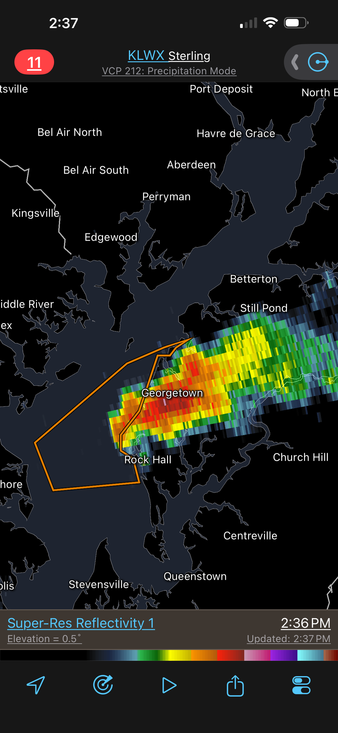
Did give the Tornado Possible in the warning. Good looking hook at times. -

2026 Mid-Atlantic Severe Storm General Discussion
AlexD1990 replied to Kmlwx's topic in Mid Atlantic
and now its warned -
That kind of SCP/SIGTOR bulls-eye is excellent for this time of year Mid-Atlantic or NEUS. And despite all the clouds and earlier showers, sfc-based CAPE is high w/ the bulls-eye just SE of the metro and a good gradient N suburbs. Current svr storm to the W ride that gradient (boundary)!
-
Heard thunder here, but looks like I’m gonna only get fringed and I’m ok with that.
-
Usual winners and losers.
-
2026 Mid-Atlantic Severe Storm General Discussion
AlexD1990 replied to Kmlwx's topic in Mid Atlantic
definitely a hook and rotation on velocity scans -
19 days since last measurable rain here. Hoping to end that today or tomorrow but outflow from the main line east of here has passed over, probably killing the chance
-
12z euro is similiar to the HRRR N NJ/NYC/LI/S CT under the gun
-
That sure looks like a supercell for Loudoun
-
Surprised no tor watch. 5% typically means one here. And w/ the CIG1 hatched area? Georgteown storm appears supercellular. EDIT: Now a TOR issued.
-
Blue