All Activity
- Past hour
-

Richmond Metro/Hampton Roads Area Discussion
mikeeng92 replied to RIC Airport's topic in Mid Atlantic
-
Wpc Sent from my SM-G998U using Tapatalk
-
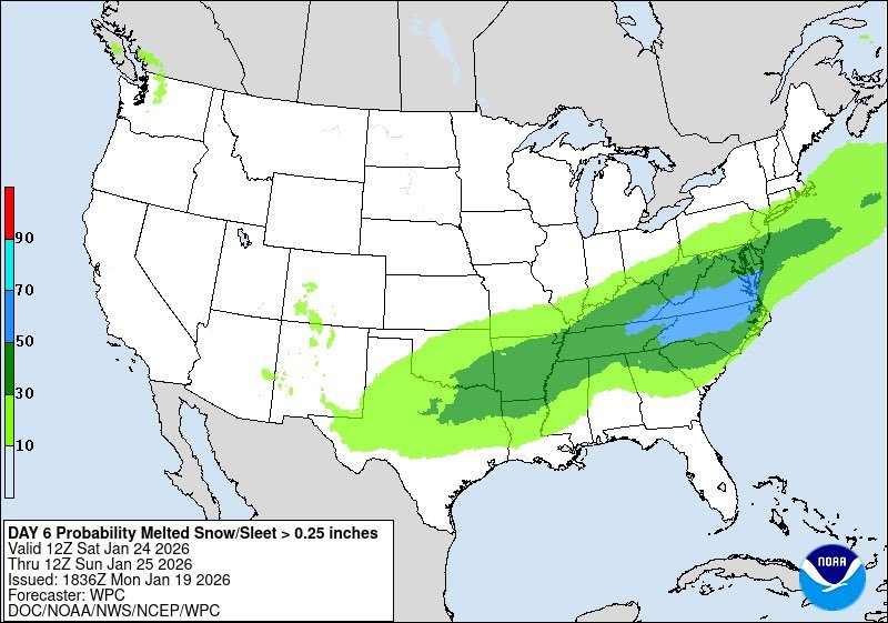
Odd that they wouldn't have the heavy snow outlook up to at least Philly/SNJ given the NBM map showing 6" up to 276/195.
-

Winter 2025-26 Short Range Discussion
Chicago Storm replied to SchaumburgStormer's topic in Lakes/Ohio Valley
you finally get your wish after the mid-week clippers. -
Winter 2025-26 Short Range Discussion
Chicago Storm replied to SchaumburgStormer's topic in Lakes/Ohio Valley
welcome back. -
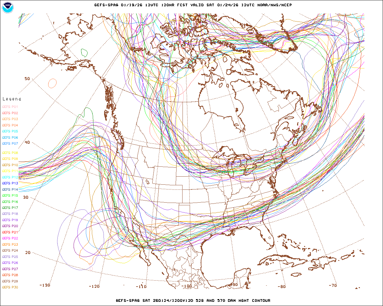
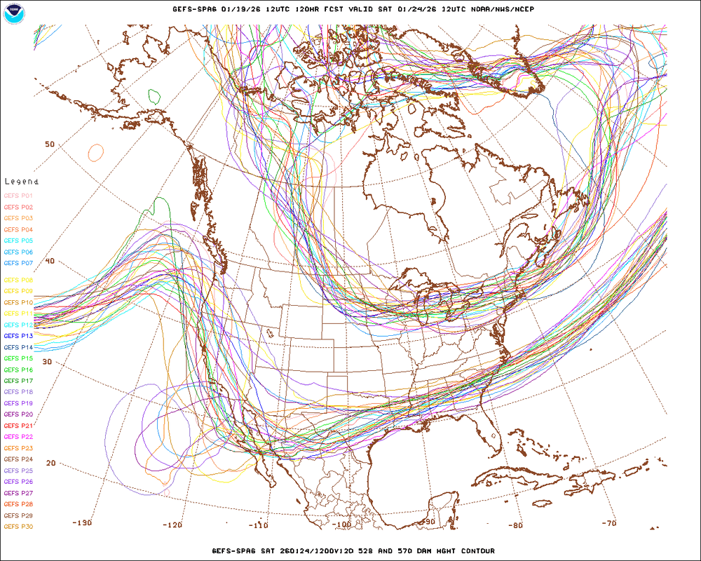
First, remember that the GEFS is now 31 members. I think there were dissemination limitations that prevent all members from being sent to various servers, but the 20 displayed in that image are only a subset. That said, there are certainly a bunch of GEFS members that are duds, but my guess is that those are the ones that keep the cutoff stuck in the far Southwest. Certainly limited support for that idea outside of the GFS/GEFS camp.
-
there *may* be a window early, right after sunset, before the more widespread clouds move in. possibly another window late, after 1am, if the cme effects are longer lasting.
-

E PA/NJ/DE Winter 2025-26 Obs/Discussion
Lady Di replied to LVblizzard's topic in Philadelphia Region
You're gonna need a bigger shovel. -

Rise of the Machines: January 18-19 Winter Storm Obs Thread
ORH_wxman replied to WxWatcher007's topic in New England
Growth really improved after about 830-9pm. Those 3 hours or so between 9-midnight we really stacked it up. Prob had at least 2/3rds of our accumulation during that stretch. I don’t think it ever snowed truly heavy for more than about 15 min at a time. But just very consistent efficient moderate snow with those heavier bursts mixed in which was stacking at 1-1.5” per hour. -
There’s almost a 10 degree difference in my temps than there’s. That’s scary. Lol .
-

Possible Record Breaking Cold + Snow 1/23 - 1/25
Franklin0529 replied to TriPol's topic in New York City Metro
Weather don't care about making a storm thread lol -

Let’s talk winter!! Ohio and surrounding states!! 24'-25'
buckeye replied to buckeye's topic in Lakes/Ohio Valley
the weekend has one of my eyebrows in raised position First 'potential' big one worth tracking for the OV in a long time. This type of scenario is what makes tracking fun. Being on the edge 5 days out and hoping for a shift. We've seen too many of these monsters bully north, sometimes to our benefit, (PD2003 and Feb2010), and often to our demise, (Feb 13, 2007). -

E PA/NJ/DE Winter 2025-26 Obs/Discussion
Ralph Wiggum replied to LVblizzard's topic in Philadelphia Region
Still an uneasy feeling for our sub forum with neither ens means budging whatsoever. Maybe an ass hair, but nothing that would make me think the AI/CMC/Ukie solutions hold water. The means are lock-step with each other right now. Very steady. Haven't seen that level of agreement in a long time. -

Winter 2025-26 Short Range Discussion
A-L-E-K replied to SchaumburgStormer's topic in Lakes/Ohio Valley
living the cad life -

January 25/26 Jimbo Back Surgery Storm
WarmNoseHater replied to Jimbo!'s topic in Southeastern States
thanks - that was the one i was trying to find unsuccessfully. -
Been out splitting wood for the upcoming vodka cold, so catching up on 12z. Both the GEFS and EPS look completely fine for this range. GEPS ofc looks awesome. Can't bother caring much about the AI models at this point.
-
Looks like early nighttime will be the best window for viewing in terms of cloud cover, then we could get blocked at the mid level between ~10 and midnight or so. The CME is impacting now so I’m hoping to be able to catch stuff after sundown if it isn’t oriented badly for big effects. Right now it appears we could get that coveted south Bz but not sure if that will stick in the end or there’s a big parcel of northiness to come that could dampen things.
-
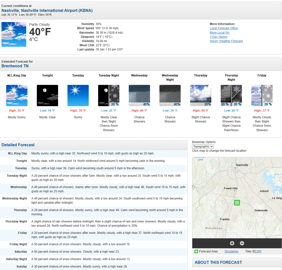
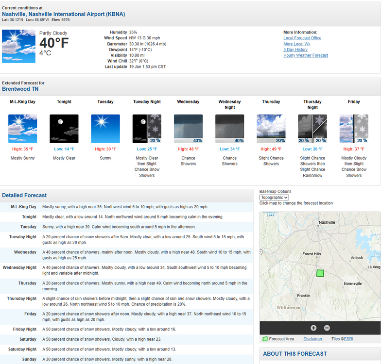
Reckon Nashville is gaining confidence
-
Winter 2025-26 Medium/Long Range Discussion
A-L-E-K replied to michsnowfreak's topic in Lakes/Ohio Valley
asplundh -
oops.
-
Well, that tells you what they are thinking. Of course subject to change if necessary but for now they are thinking max totals south of this forum. They door leave the door open for some northward adjustments. https://www.wpc.ncep.noaa.gov/discussions/pmdepd.html
-
Most are over the Tn Valley with some South with it. Maybe come up with a more likely solution between the GEFS , EPS and GEPS.
-
I tell myself every time models look solid this far out I won’t check again until at least three days out but I guarantee I’ll be looking again this evening lol
-
Its more for almanac and historical purposes
-
significantly pass. his time has come and gone.