All Activity
- Past hour
-
Of course Miller A is more prolific for the majority of the east coast, Miller B is dependent on N stream influx, so they are northeast centric....which is why we are more likely to get a favorable track and timing of evolution. Less time for it to go wrong....kind of like how storm chasers on the gulf coast would father a home-brew under pristine conditions than a CV long-tracker.
-
I don't give a rat's ass about the east coast as a whole, I care about MBY.
-
 https://dutashielddirect.shop/# where can i get generic avodart
 -
zithromax coupon: rapidzithrodirect - zithromax capsules price
-

2026-2027 Record-breaking El Nino
qg_omega replied to Stormchaserchuck1's topic in Weather Forecasting and Discussion
Never before have we seen such warmth so far east based, really historic -
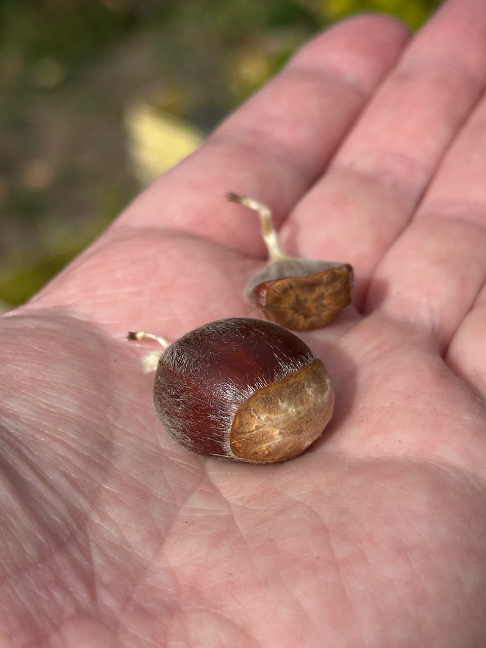
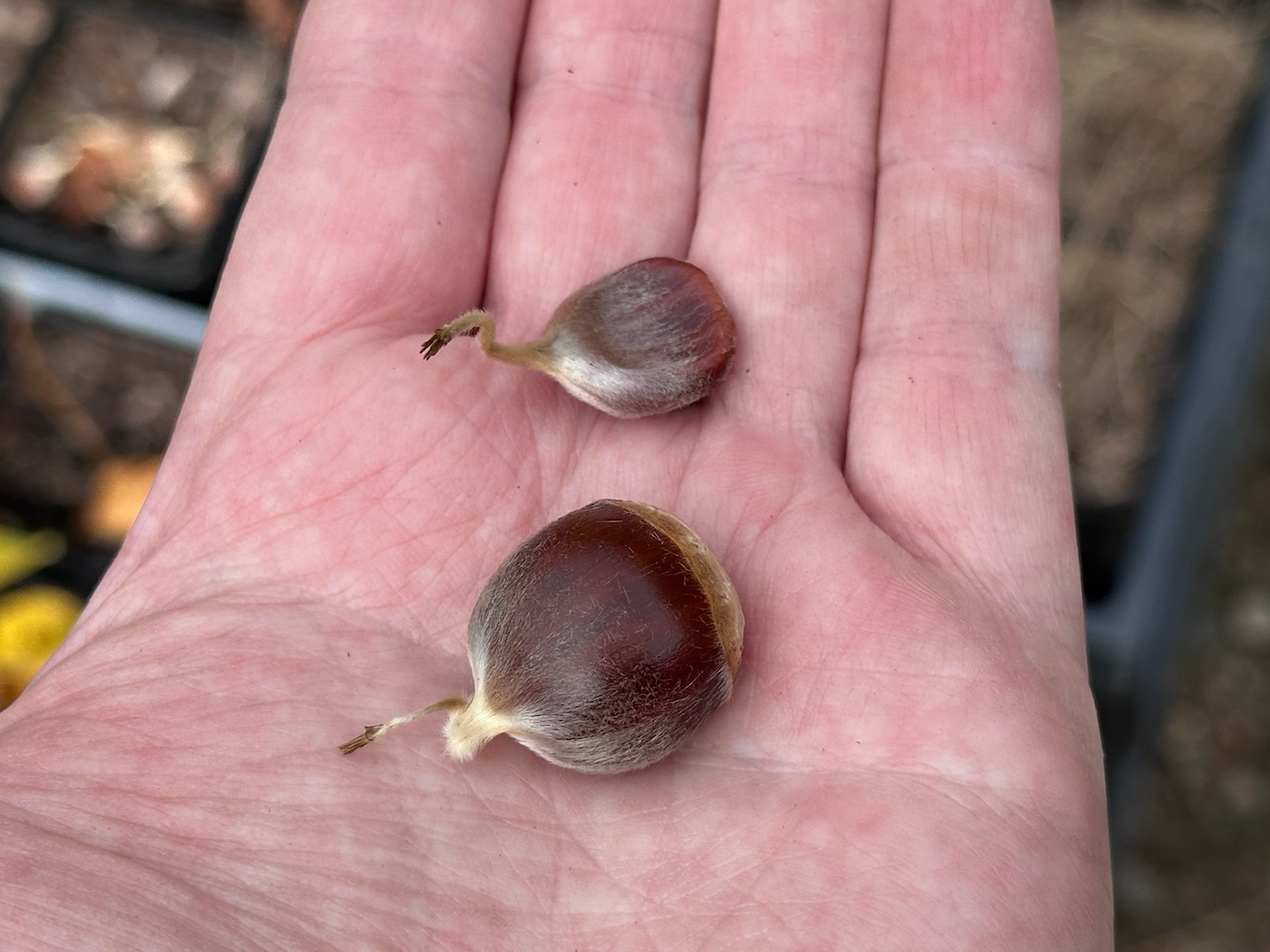
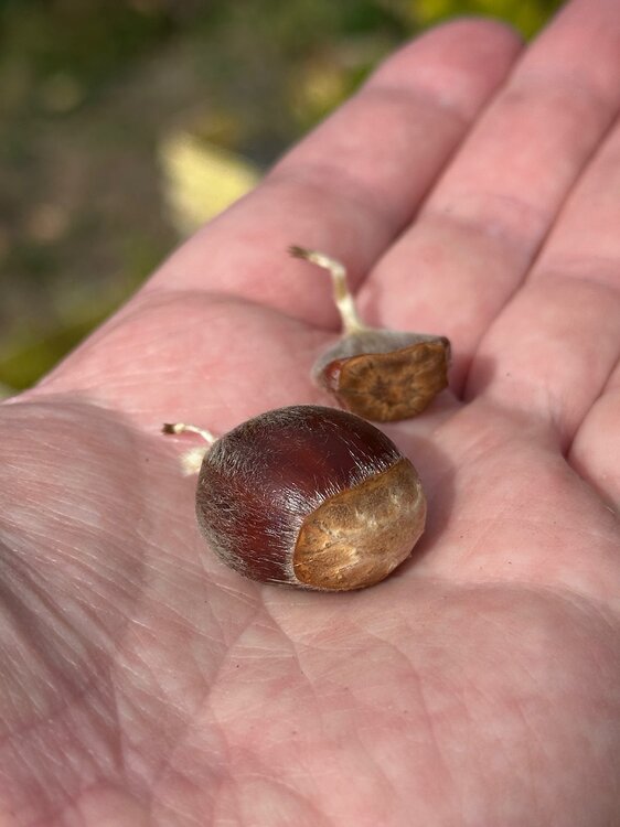
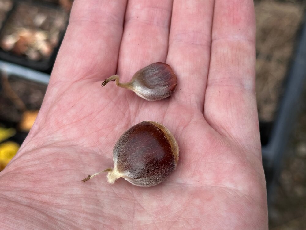
We got one. I climbed up the tree and cut the last burr off and found a fertilized chestnut. You can see the difference between the two. @wxeyeNH Any fertilized nuts up there yet?
-
Yes they do. I'm also slightly concerned about the face of my driver cracking.
-
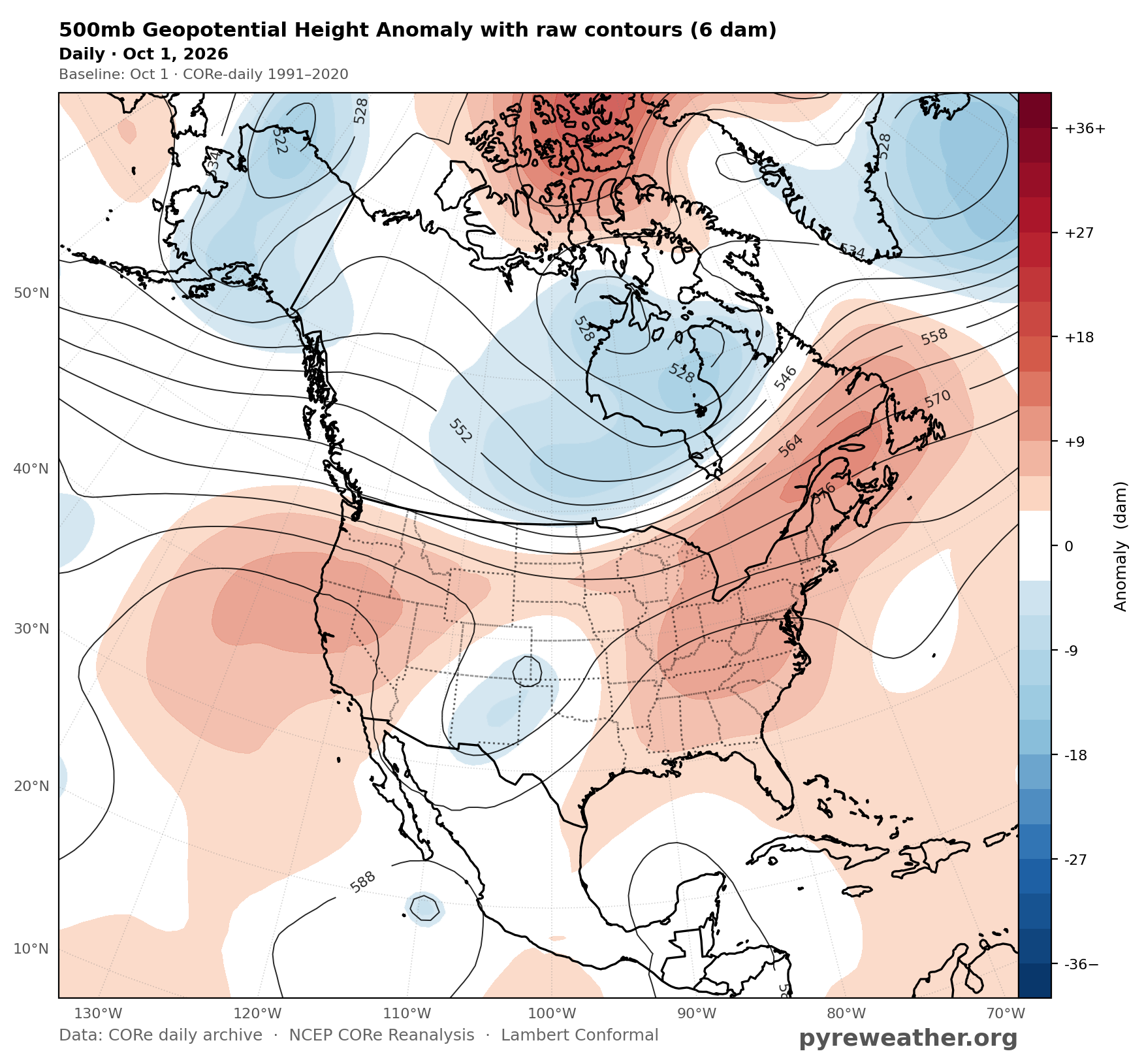
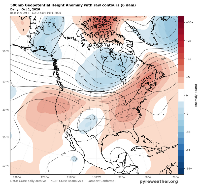
One of the few areas of North America that does really well with +EPO 500 mb pattern.
- Today
-
Dewpoint over 60. Blah.
-
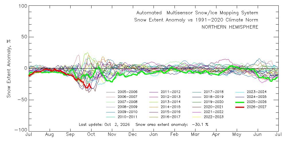
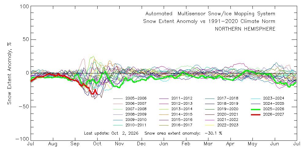
I don't see why having snow in October would be a bad thing. Would you rather it be 80 in October? People here run away with a small matching number of statistics. You see this especially with Super Nino analogs.
-
Anchorage also received 0.1" snow on October 1. That was its first measurable snowfall on record of October 1.
-
cry for me
-
haha
-
Farmers' Almanac a day ago · Old Weather Saying: “A warm October, a cold February.” For generations, folks have looked to October’s weather for hints about the winter ahead. Does a mild, beautiful October really mean February will come roaring in with bitter cold? Time will tell—but that’s part of the fun of old weather lore.
-
Right around an inch for the weekend. The upcoming week looks fantastic.
-
What I'm visualizing in my mind when I read posts like this from @forkyfork:



-
Light rain moving north into the area. Then dry for the foreseeable future
-
Rain wise Year Total precipitation 1960 46.39" 1961 39.32" 1962 37.15" 1963 34.28" 1964 32.99" 1965 26.09" 1966 39.90" 1967 49.12" 1968 43.57" 1969 48.54" top 15 driest years Rank Year Annual precipitation 1 1965 26.09" 2 1964 32.99" 3 1910 33.72" 4 1935 33.85" 5 1963 34.38" 6 1970 35.29" 7 1885 35.37" 7 1895 35.37" 8 1954 35.58" 9 1892 35.60" 10 2001 35.65"
-
So sorry for your loss, @RickinBaltimore.
-
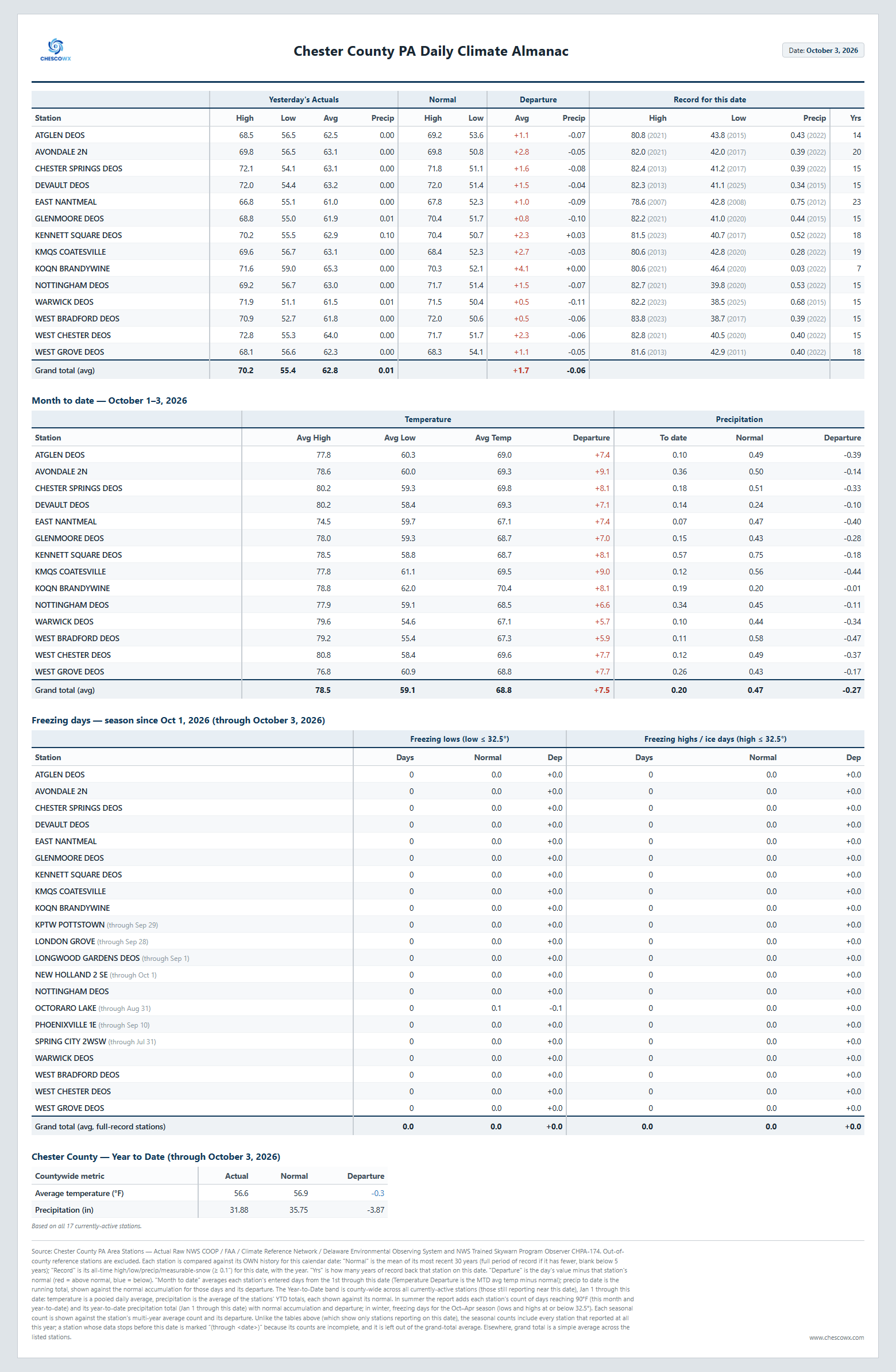
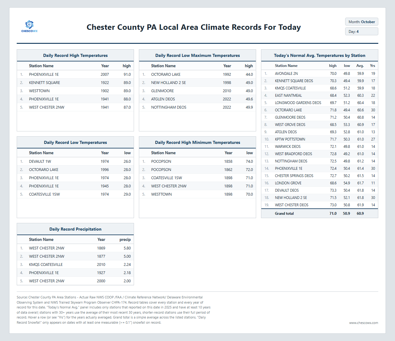
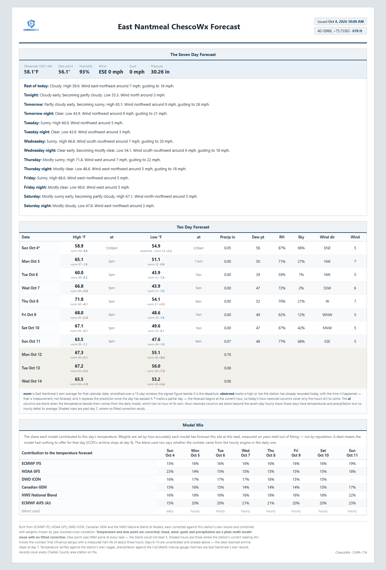
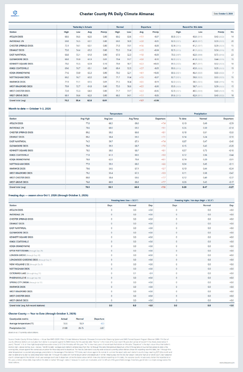
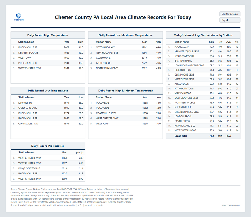
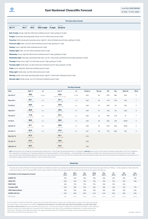
Some light rain and below normal temperatures today before we clear out for most of the rest of the week. We start the week with below normal temperatures with some lower valley locations likely to see some 30's for the first time this year by Tuesday or Wednesday morning. We start a slow warming trend through the week before we turn a bit cooler by next weekend.
-
(002).thumb.png.6e3d9d46bca5fe41aab7a74871dd8af8.png)
E PA/NJ/DE Autumn 2026 Obs/Discussion
ChescoWx replied to PhiEaglesfan712's topic in Philadelphia Region
Some light rain and below normal temperatures today before we clear out for most of the rest of the week. We start the week with below normal temperatures with some lower valley locations likely to see some 30's for the first time this year by Tuesday or Wednesday morning. We start a slow warming trend through the week before we turn a bit cooler by next weekend.
-
-
Bout the same over this way. With the .30" last night that brings my October total to .52". Already half of what I received all last month. Might be just enough to keep my local area from progressing into D1. Windy day on tap with clearing skies and temps in the mid 50's/mid 30's, fairly seasonal. Trees here have lost 40-60% of their leaves while the lakeshore hasn't even peaked.
-
46.7° at WXW1 / 48° at HFD 33.7° at WXW2 / 27° at SLK Coldest so far at WXW2. Should reach the 20s the next few nights with SLK having a chance of reaching the teens.
-

2026-2027 Fall/Winter Mountain Thread
Maggie Valley Steve replied to BlueRidgeFolklore's topic in Southeastern States
Fall colors are becoming noticeable now above 5K and even some early colors here in the Valley. Popular trees around the house have begun to turn yellow and drop. Our part of the Mountains have had a lot of rainfall since July. Fingers crossed the colors will be vibrant. We are booked solid for the next 25 days in our short term rental downstairs.