All Activity
- Past hour
-
We may not hit 70 today. Cloudy, drizzly 66 at the moment
-
Great. I can't wait to see daily pics of Powderfreaks friggin snowstick.
-
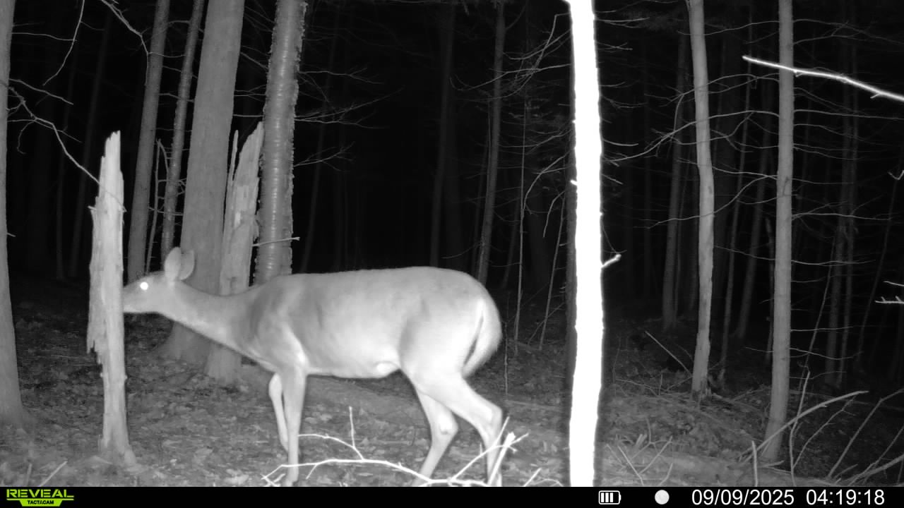
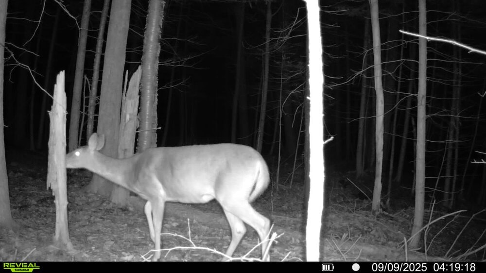
Was quite foggy this morning, Starting to take down the garden, Game Cams are out, Going to be in the woods in a couple weeks, From what i can see, Not as many acorns dropping this year like last year.
-
Yeah. The dewpoints usually aren’t real high and the longer nights allow it to start cooling down fairly early even if it does get really warm during the afternoon.
-
Standard deviation is just the average distance of each value in a dataset from the dataset’s mean. In a normal (or near normal) distribution (tied to the central limit theorem), then 1, 2, and 3 standard deviations from the mean cover ~68/95/99.7% of the data. So by nature >= 2-3 standard deviations away from the mean implies >=5% chance of occurrence. And IQR is just the middle 50% of the ordered data. Replacing a dataset’s tails with anomalies will skew the mean and increase the standard deviation, but not affect the IQR (or even median). There’s nuances to all of this, but that’s the gist of it.
-

September 2025 OBS-Discussion centered NYC subforum
Stormlover74 replied to wdrag's topic in New York City Metro
Tomorrow and Sunday my forecast is low 80s. Also looks warm in the 7 to 10 day range -
As long as it's not an all day rain event like this past Sunday. Garage sale rained out. Would like to try again this Sunday.
-
ensembles starting to show the tropics waking up a bit soon.. but looks like fish food
-

September 2025 OBS-Discussion centered NYC subforum
IrishRob17 replied to wdrag's topic in New York City Metro
Upton's forecasted high for KMGJ tomorrow is 81. -

September 2025 OBS-Discussion centered NYC subforum
qg_omega replied to wdrag's topic in New York City Metro
Where do you see low 80s -
36° with fog this morning, 34° without fog yesterday.
-
Inverse to the warming summer effect, the airport location move has had a cooling effect in the winter, especially on mins. I'll do a more detailed post at some point about this.
-
BUST!
-
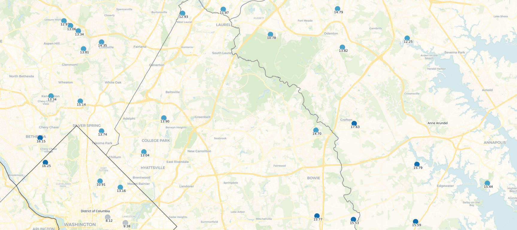
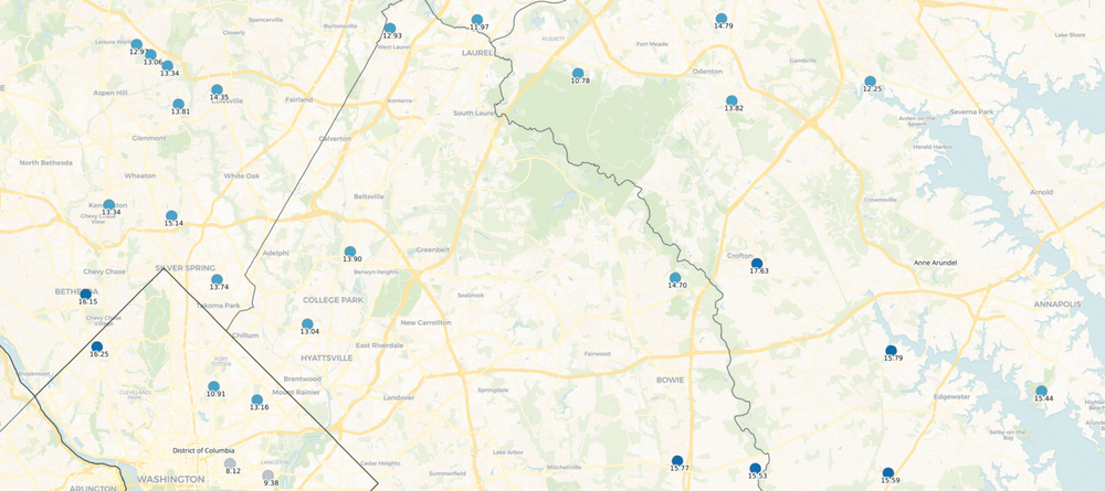
Yeah, you can see that a bit on this CoCoRaHS total map for our general area. My house is near the 13.74" in Silver Spring. Totals from June 1st - now. A big chunk - maybe 4" - all fell in a couple hours that one day in July when Sligo Creek flooded.
-
Im looking at the end of the month into the first of October for a big cold blast. The teleconnections look to be in the right spot for possibly something big. PNA will go very positive around and after the 15th. The NAO and AO will be negative..I know it early season but the PV will continue to be in a weakened state. Also yes we will warm up a bit but I don't see any record heat in sight.
- Today
-

September 2025 OBS-Discussion centered NYC subforum
psv88 replied to wdrag's topic in New York City Metro
0.01 -
-
So let me understand the logic here: the move of about 15 mi primarily east to an entirely new location for the airport records is not important and totally comparable to historical records, but the the new ASOS environment in the same general location as the old airport is not comparable? As someone who lives here, let me explain why you're wrong. In the summer, most late mornings/early afternoons see clouds/storms build up over the mountains and then drift east over the plains. Locations that are further west get the cloud cover sooner, and therefore tend to have a bit less sunshine warming in the afternoon. When the clouds produce cooling rains, that also reaches western areas sooner. This is the primary reason that moving the airport significantly east of its previous location has resulted in a bit higher afternoon temps at DIA, compared to the old Stapleton airport. It's also the main reason why, if you look at Boulder's long term records, the average summer highs are about 2 degrees cooler than Denver's. The Boulder airport is at almost the exact same elevation as Denver, but is located about 15 mi closer to the mountains. Mean temps are one thing, but there's no doubt that the location change has had a small, 1-2 degree (I'm happy to provide the data) warming effect on the airport's highs, which then results in more 90+ days. We have a ton of days here that top out in the 88-92 range, so you can see how the numbers would get bumped. No one said this makes the warming summers since the 1990s an "artifact" of the airport move. In fact, I did say we have warmed and see more 90+ days regardless.
-
yeah... this is what I'm seeing. Timing looks good with rather sudden height falls arriving nearing 18z associated with that rather intensely nucleated cold pool diving in. Sun matters..
-
SSWs are no sure-thing...agreed. They are a wild card, but I think at this point, most of us are willing to flip that coin.
-
yeah... it'll depend on the usual - timing with still some feeble heating potential during the day... But the kinematics look decent from this range. The GFS has been demoing terrible continuity with that synoptics of it so, more Euro and/or or Euro/GGEM blended.
-
If you want rain you need to head to Anne Arundel County. It's been a steady rain all morning. It's just PG and AA as usual. If there's rain in the forecast, it's happening here lol. Definitely not dry here since June.
-
September 2025 OBS-Discussion centered NYC subforum
Stormlover74 replied to wdrag's topic in New York City Metro
Yeah average highs in the upper 70s now and quickly dropping so even low 80s will be AN -
I would disagree with several points here
-
43°F this morning, 40°F yesterday, (was the low so far), Overnight temps are looking 40ish for the next few days.