All Activity
- Past hour
-
Illegitimate children https://x.com/boorish_sports/status/2047370077402505449?s=46&t=dhcbvkjmRcyBVQtDxJ3lRg
-
Yeah usually I am posting several shelf cloud shots by now or even a few wall clouds but not this year. Maybe a I need to chase dust devils.
-
Definitely something to watch. That hint of a possible secondary low on the GFS is something I never like to see. That backs the winds. Then we might have the leftover boundaries from storms, which is a bad thing by adding fuel to the fire. If anything, I see some strong winds and hail.
-
SPC is in backup mode today
-
78. Might hit the range for a bit. Work can wait an hour
-
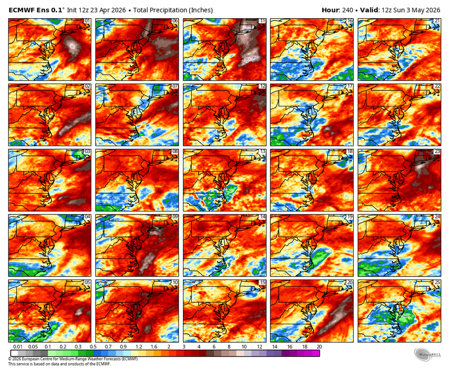
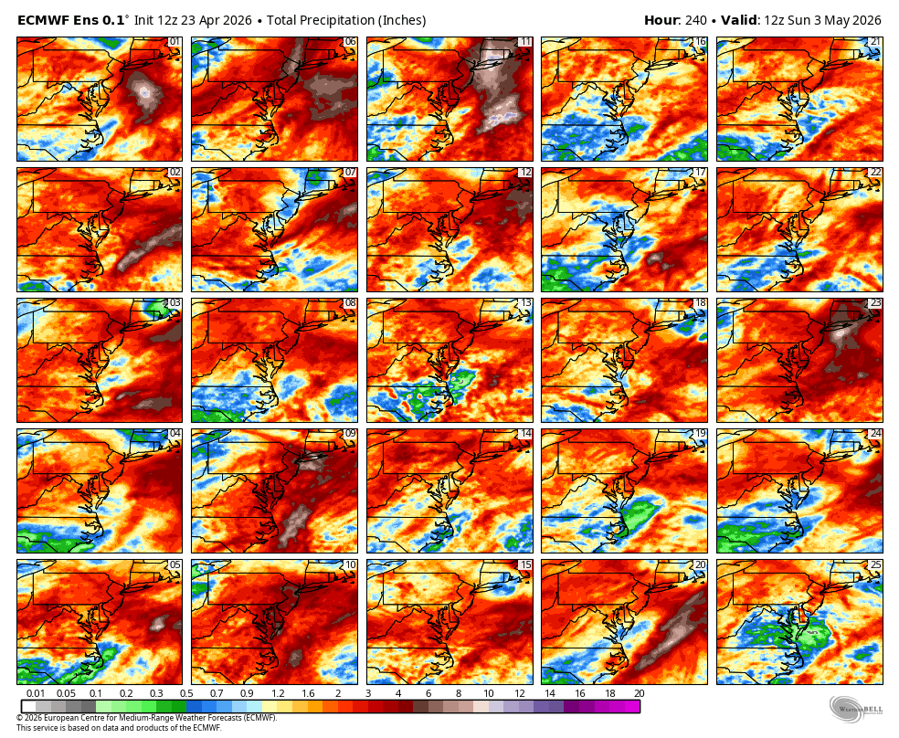
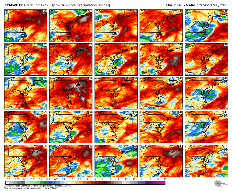
WB 12Z EPS. Just through Day 10, lots of good hits. If it were winter, this place would be hopping in here...

-
Beautiful day down at the marina. Laptop set up and cigar in hand. Perfect
-

-
Nice breezy spring day
-
What a difference 100 miles makes. We're nearly at 5 inches of rain for the month up here. 4.71" to be exact.
-
Lol
-
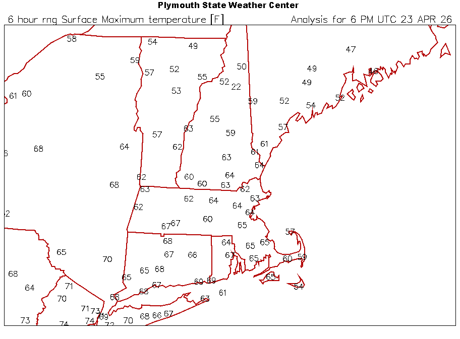
No. It’s typical spring. Gorgeous here today, 68 and full sun.
- Today
-

2026-2027 El Nino
PhiEaglesfan712 replied to Stormchaserchuck1's topic in Weather Forecasting and Discussion
Yes, it was pretty much a disjointed el nino, which just lingered around in the weak el nino/warm neutral phase until late 2019/early 2020, before eventually going into a solid la nina (which lasted until early 2023) and -PDO (which is still ongoing). As I pointed out earlier in the New England thread, 2026 is a polar opposite of 2020 (as we are exiting a weak la nina/cold neutral phase and heading towards a strong to super el nino, and maybe transitioning to a +PDO): -
I understand the feelings ..I wouldn't attempt to dismiss or belittle them. However, taken fwiw I don't recall many April 23rds since I've been alive, that had very dependably desired weather outlooks either in play, or having been experience up to this point in the month. I'm not put off by this like it's a new plague and CC thing. I mean okay ...maybe.. But this seems to be behaving typically to me. You wanna croon and crow, go back to 2005 May. Now that'll knock back some Zanax. I dread this time of year because of what it is, which is behaving as usual to date as far as my experience and climate awareness say it should.
-
even if it were 20 years, who cares
-
Yeah Monday is coming into focus in the Mississippi Valley. Worst severe may be just north of most of us up in Illinois. Then we'll see if STL can double down on Missouri as the Show Me State. For the storm anxious around here.. Exit ramp now looks more like warm mid-levels than MCS washout. Guess it doesn't matter either way if you don't like tornadoes. Either way if NWP holds, should be some wind west Monday night. Other hazards are TBD; much can change either direction until then. Fairly solid upper level winds remain over the Deep South the rest of next week. Could be another chance or two. However a dry dewpoint push after Monday could mitigate rapid moisture return. We'll see.
-
March ended up sucking-usually in this type of winter we would have gotten something especially first half....
-
Any updates for today spc has a 15 yellow high lighted risk for west and western portion of middle tn and along i65 with a 30 orange high lighted risk clipping far northwest tn and upper Mississippi River valley for Monday .
-
Another perfect day
-
looks like tuesday is falling apart though!
-
Yeah, the transition seasons are just way to long now, especially spring. Spring hangs on forever. The snow threats and real cold stopped in late February, and we'll basically be having the same shit weather from then until the solstice.
-
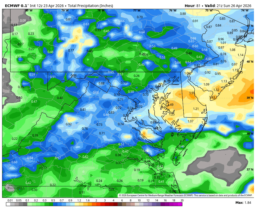
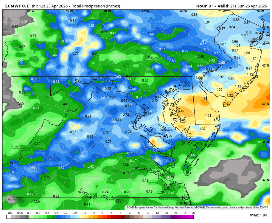
WB 12Z EURO. Most of this falls Saturday night/ early Sunday.
-
I mean eventually it will rain, but every time we get within a few days the rain disappears. So the drought and fires will continue to worse. This spring is a big pile of dogshit. Enough already.
-
80F at DCA again.
-

It's time to grade Winter 2025-26(now that it's actually over)
HighStakes replied to CAPE's topic in Mid Atlantic
C+/B- So close to an A- but fell short due to lack of one more moderate event and a couple more light events.


.thumb.gif.f92b16c631a1d15d405ed77b33f0710d.gif)