All Activity
- Past hour
-
As hurting as the convection is, at least it is nicely circularly-banded and looks more like a classic TC. Did not have that at all w/ Arthur, Bertha, Cristobal, or Dolly. Shear was the big issue for those. Edouard's issue is dry air, but you can do a bit better overall for max TC intensity when only dry air is an issue I have noticed empirically.
-
2026 in a nutshell? Yeah. I'm not flying down.
-
Yes, NW flow events are *notorious* in New England for its biggest tor events and outbreaks. Historically, it is a little less defined in the Mid-Atlantic b/c it does well in SW flow (College Park, Sep 2001) and TC events (remains of Ivan in Sep 2004), but you have June 23, 1944 (WV hit hard) and June 2, 1998 (Frostburg MD F4). https://www.weather.gov/lwx/events_19980602 https://www.tornadotalk.com/june-2-1998-tornado-outbreak/ And, of course, the derecho on June 29, 2012. I think an EML present is important for high-end derechos.
-
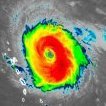
Satellite imagery looks horrible. Radar at least shows some banding on the northern side but overall the southern side looks devoid of much right now.
-
I’m not convinced. 2017-2018 were wet summers if I recall, but it’s been consistently humid for for at least a month and a half straight (I got back from Vegas in early July). Dews in the 70s on the regular.
-
MRX released a graphic about August severe events in the area. They were centered on SWVA it seemed like, but the number lined up almost exactly with the 2006 El Nino August. Both were in the 70s for severe reports, with 2006 I think at 79 and this year 75. That was well above average and the 75 was 3rd most August severe events in the last 20 years. The winter of 2006/07 was near normal in December, decently AN in Jan, and fairly BN in February. It was relatively low on snow amounts, but here on the northern Plateau we got a few snow events in February.
-
Friction helping that core organize a lot in last few scans. Think it comes in east of NHC forecast though.
-

2026-2027 Record-breaking El Nino
raindancewx replied to Stormchaserchuck1's topic in Weather Forecasting and Discussion
Canadian update shows PDO trending positive through Feb-Mar before reversing again. It shifted the center of the El Nino east. Still has a central event, which is why it is cold for the East. But it is shifting the warm plume/enhanced equator moisture east with each run now. -

2026-2027 Record-breaking El Nino
MJO812 replied to Stormchaserchuck1's topic in Weather Forecasting and Discussion
Yep both have been consistent -
I have only lived in the DC area for 8 years, and I am still trying to get an overall feel for local nuances when it comes to tstms, esp. when the "DC split" occurs. That seems more than just a random coincidence. And it is apparent the corridor from about 30 mi W of BWI to the city is a favorable area, so is just E of I95 to the Delmarva, and it seems really apparent CHO-RIC-ORF area in terms of a "hot spot!" Also, w-cntrl and swrn VA get some really nicely-structured supercells at times!
- 2,263 replies
-
- 1
-

-
- severe
- thunderstorms
- (and 7 more)
-
wind gust up to 39kt near Edouard's east side
-
Agreed, think we see 50-55 knots at LF. Would take some pretty good intensification for anything over 65 knots so I doubt it. but wouldn't completely discount it given how small it is.
-
Dry air definitely still looks to be an issue, and that was a clear limiting factor even when this was a lemon. I agree that there's no one size fits all for TCs, which is why the Twitter conversation sometimes gets frustrating because cold top convection does not automatically equal RI. You can see the dry air on the northern flank clearly, and it seems clear that it's having an impact, though I think the expanding outflow on the northern side of Edouard does limit it some. I've always been of the opinion that you need organization before substantial intensification so that's what I look for. Today we've seen substantial progress in that department. We went from a weak and elongated low this morning To a much tighter wind field, with a meaningful pressure drop this evening on the first recon pass of the evening. I still think an overnight/morning convective burst aided by diurnal maximum given the developing inner core should allow for modest intensification, with an added boost from frictional convergence. Like someone else said earlier, I think this is one of those short fuse homebrew cases where we do say if this had more time it could have intensified more substantially. Regardless, it will be interesting to watch given the radar coverage we will have from now through landfall. Tonight I'll be watching to see 1) if the reduction in central convection leads to a collapse in the nascent inner core and if not 2) how soon we see the overnight convective burst I'm expecting. 18z HAFS has that happening around 5am.
-
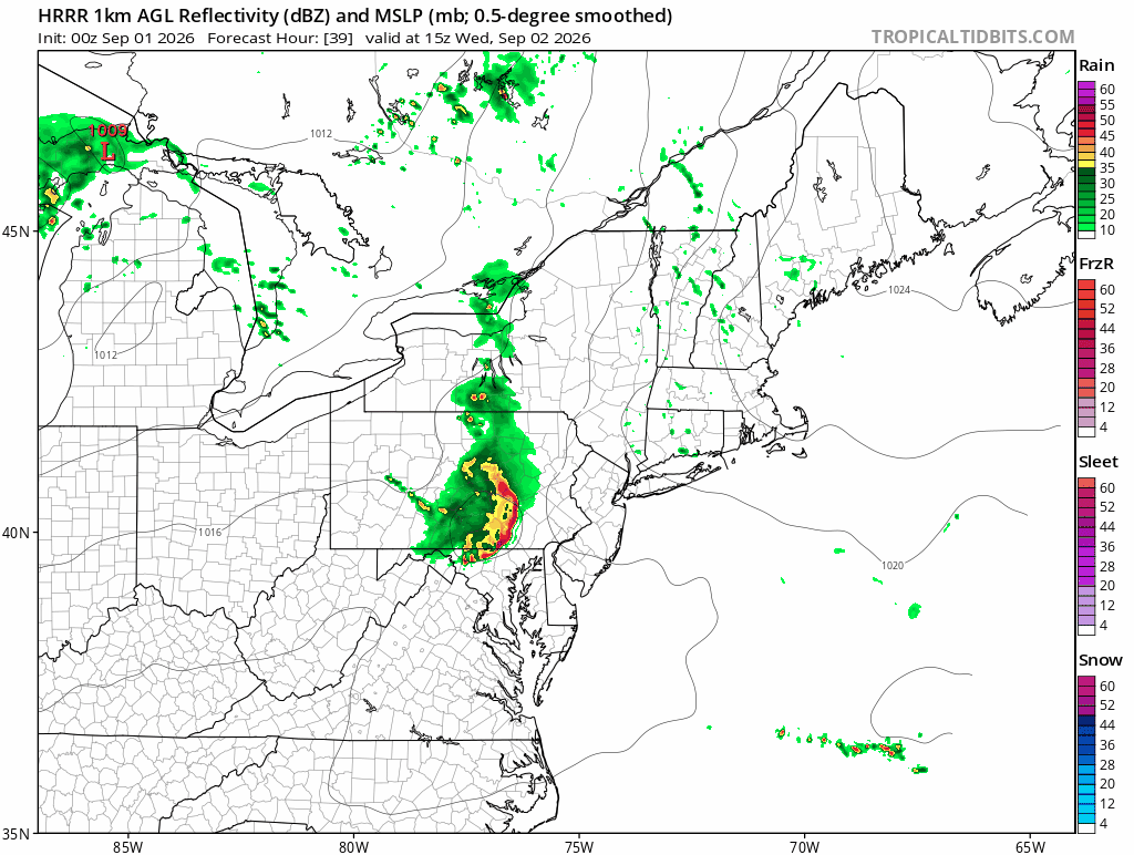
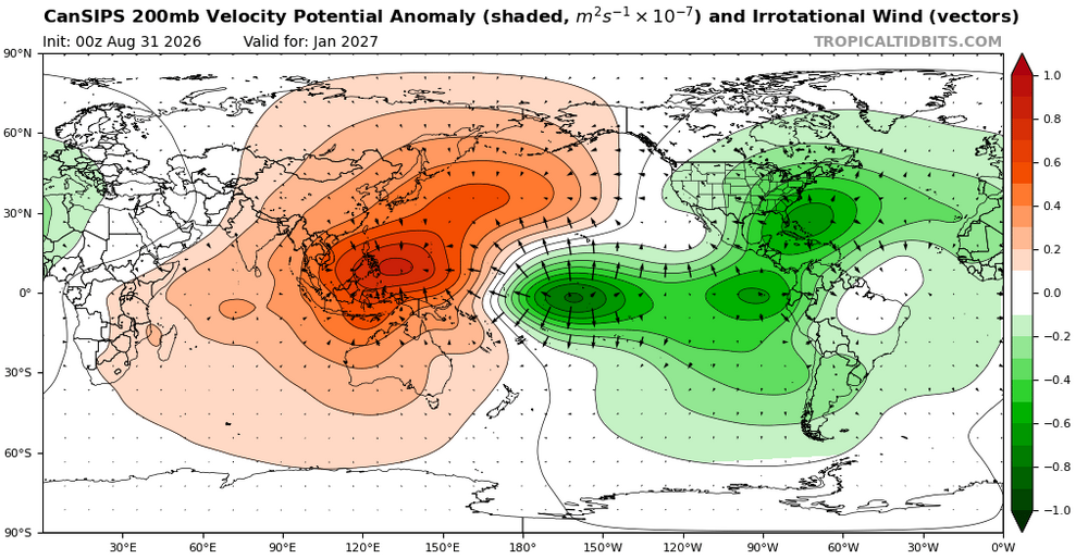
The Sept 1 seasonal CANSIPS barely budges on its cold winter idea for the SE. Big PNA ridge and trough east of Hawaii. Split flow and seasonal cold. I remain skeptical, but a normal "biased warm" model is cold for our DJF time frame. Precip is AN for most of the region, and much AN for far eastern areas. Temps are BN. There is a coastal storm signal for the entire winter. We'll see! But man.... And if correct, it implies the worst of winter might well drag into March w/ an anomalous PNA ridge which reaches almost to the NP. Normally, these types of winters feature a stable PV, but good luck if that setup occurs.
-
I’m not sure how long it’s going to rain, but I’m glad the Orioles scored that run in the top of the fifth.
-
 trustworthy online pharmacy or buy drugs online express scripts mail order pharmacy https://cse.google.com.tj/url?q=https://quickph.com trustworthy online pharmacyand https://www.liveviolet.net/user/vipcunnlch/videos online pharmacy without prescription [url=https://cse.google.jo/url?sa=t&url=https://quickph.com]top online pharmacy[/url] online pharmacy no prescriptionand [url=https://cyl-sp.com/home.php?mod=space&uid=171320]express scripts mail order pharmacy[/url] shop medicine online
 -

2026 Mid-Atlantic Severe Storm General Discussion
high risk replied to Kmlwx's topic in Mid Atlantic
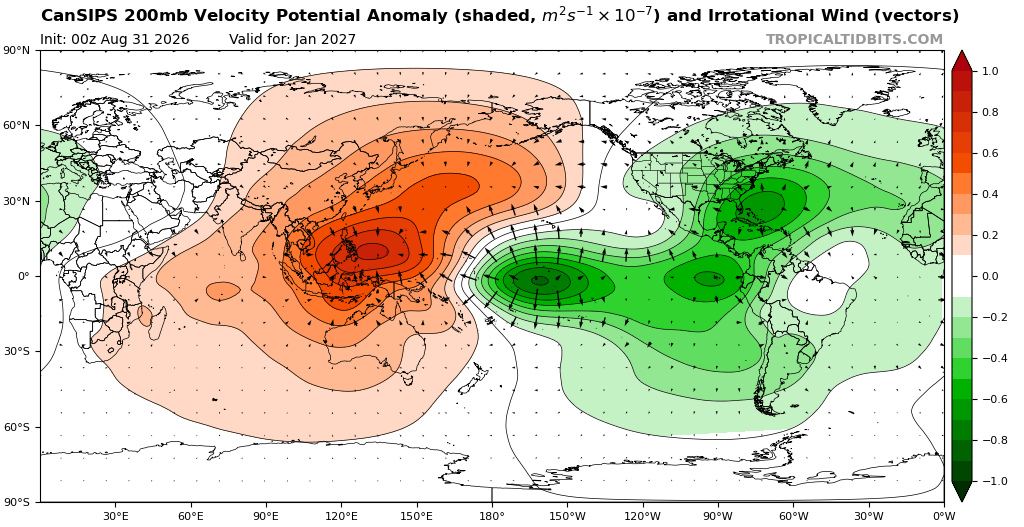
Not much to add to the ongoing discussion: trying to place and time particular events between now and the end of the week (best chances between Wednesday morning and Friday midday?) is likely to be futile, but higher end events in the Mid-Atlantic are certainly on the table. A taste of the potential.....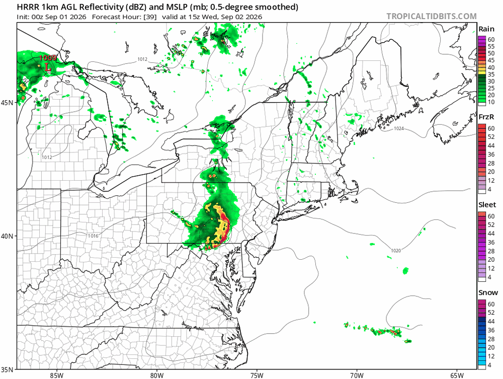
- 2,263 replies
-
- 1
-
-
- severe
- thunderstorms
- (and 7 more)
-
I somehow missed posting about Sunday’s rainfall rough estimate at my home. I was alerted to it by Cocorahs and local TV wx. I very roughly estimate my home got 1”. That gets my total MTD through yesterday of a solidly wetter than normal ~8.85” to help the drought.
-
Yeehah!
- Today
-
 @bkviking @dmillz25 @Rjay Friendly reminder for September forecast temps
 -
Welcome to Meteorological Fall! It will feel like it eventually. I promise.
-
Monday, September 7, 2026 8:25AM EDT The past week has been one of the most active weeks of stormy weather in the region for a very long time with multiple MCSs and derechos causing repeated instances of widespread tree damage and even some structural damage with the northwest flow around the ridge of high pressure that has been parked to our west-southwest. During the September 1st through September 6th period much of the region has received 8 to 14 inches of rain with most areas seeing peak wind gusts from severe thunderstorms during this period in the 70 to 85 mph range. Now we watch as a deepening trough drops into the region with causing the flow locally to back to southerly. With a surface low developing nearby over the region in response to this trough southeasterly surface flow will bring in mid 70sF dewpoints into the region. With Pwats also rising above 2.25 inches and CAPE in excess of 1,000 J/kg along with tall skinnier CAPE profiles. Storms that develop will be very efficient rain producers. With the strongest forcing for accent located over the region numerous storms will be able to develop and train over the same areas leading to a significant flash flooding threat given all of the recent rain. Numerous bands of showers and thunderstorms will train over the region from late morning through this evening before we see a more uniform area of heavy rain over the region through the night tonight as the surface low strengthens and moves to the east over the northern Chesapeake. There will be a risk for a few tornadoes through the afternoon with embedded supercells given decent low-level shear near the surface low (effective SRH of up to 300 m2/s2) and decent enough 0-3km CAPE (>100 J/kg). When all is set and done by tomorrow morning most areas would have received an additional 3 to 6 inches of rain with localized areas that get under training bands in excess of 10 inches leading to major flooding. Always remember to turn around don’t drown. It’s not worth it! ...
-
-PNA!
-
We just need to get Chuck on board
-
www.StoweCountryHomes.com for rentals. Black Diamond BBQ and Trapps Bier Hall for food. Northwood Gallery in the village for a small town shop featuring Vermont artists.