All Activity
- Past hour
-

2026 Severe Wx - General Thread
HillsdaleMIWeather replied to largetornado's topic in Lakes/Ohio Valley
Not one to crap on the spc but kinda baffled they didn't issue a watch. They've shown multiple times they're willing to issue one for lone supercells causing tornadoes but this time just didn't. -
30.9° with ZL
-
Big boomer rolling through. Loud cracks.
-
Here's mine a few minutes ago.

-
I feel bad for the people effected, but the video with the frozen lake in the foreground is classic.
-
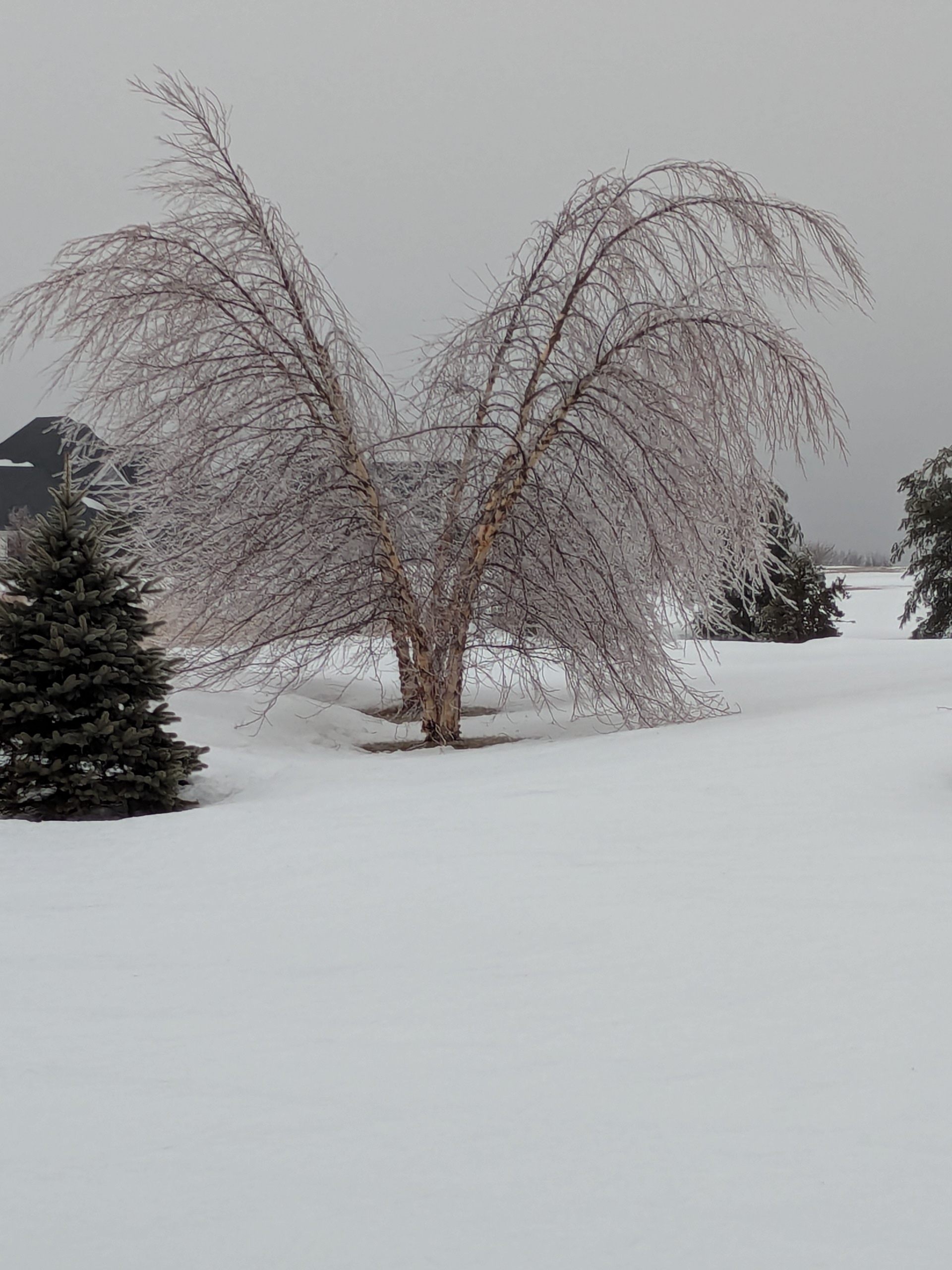
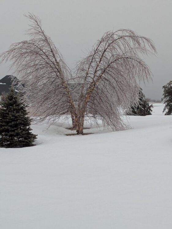
Still lots of ice on the hill in Burlington CT...
-
The lakes are shrouded in fog coming off the ice. At this rate the urban lakes will be ice free in a week or so. So far we’ve picked up under a 1/10” of rain. Far cry from the 0.50-1.00” totals advertised a few days ago.
-
The beginning of a series of rains has commenced. TWN has me at 19C/68F for Sat which would be seriously impressive with the snowpack and amt of ice on the lakes. I say 5% chance of verifying. WUN has 15C - I'll go with 16C prediction. If I somehow get to 20C (2%) that would be the 2nd earliest in modern records just 1 day behind Mar 8 2000 and 3 days ahead of Mar 4 2024. Storms are on tap during nox (overnight) with the temp rapidly rising to 13C. I'll be taking them seriously; my worst storms are now in early spring.
-
Yea. Both sups this evening and QLCS later after dark could produce.
-
I mean 11-12 days out….that’s a tough one imo..especially with cold lurking.
-
Looks like DT called out Jays Wintery Mix on Facebook for posting the HRDPS and referring to it as the NAM, you hate to see it @Ji
-
Overall this winter for the H5 pattern, I’ve seen it missing strongly at times in both directions. Now if we’re talking 2m temperatures, WxBell maps are cold biased.
-
Shorter wave lengths change the importance of various teleconnections. Some have difficulty accepting that there are no universal patterns that apply at all times. Some on X/Twitter were insisting on the importance of a PNA+ ahead of the recent blizzard. Undoubtedly, they must be confounded that it occurred with a strongly negative PNA. But not those who understand the synoptic patterns. During the second half of February, a PNA- is more conducive to big Northeast snowstorms.
-
guess you can write off next winter for the Midwest.
-
so, I've got to drive to Greenville SC on the 17th/18th and taking I81-77-85, any chance I run into any weather (as it looks now) along my journey? also be returning the 20/21st... thanks in advance for those who dive deep into the LR.
-
I haven't seen motion in a MI tornado like that before. The cloud of debris and dust at :37 looks like the condensation part. Fiercer than Dexter and Gaylord!
-
Got enough teeny "flakes" to almost cover the ground, but our daughter's flight PHL-PWM came right on schedule.
-
Wow, snow is just banding over your area now. Bet you end up with at least 8". Long live March!
-
EPS has been exhibiting a rather pronounced cold bias at times in the medium range. Have a feeling it’s getting too carried away with the troughing again
-
We had a 16" paste bomb which inverted the supporting bows of my Ranger's Tonneau cover. (We were out of state, came home 5 days later to find a 5'x6'x6" ice cube atop the cover.) Eustis at 1,300' reported 34.5" and we (Maine Public Lands) were finishing a multi-year harvest on the Redington Public Lot. That winter the work was all north of the AT with elev 2,400 to 2,900 - might've gotten 40" there. Last load passed thru the very narrow crossing of the AT (as permitted with stringent constraints) on 3/22 just as the snow got super heavy; no way normal plowing could've kept that 200' AT inner corridor clear, would've needed a BIG payloader.
-
two nice events, 15+ here and the cold and pack retention, I mean I still have about 10-15" depending on where in open areas, still piles of 4-5' in spots, probably almost gone this time next week but was a solid winter, didn't make climo yet snow wise yet, about a foot away still.
-
More cells firing to the west, might not be a bad idea for a small tor watch from around Gary to near lansing and surrounding areas
-
23-24, 15-16, 97-98, 91-92, 82-83, 72-73, 65-66
-
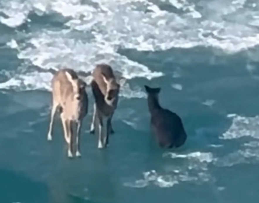
Thought this was wild from the other day. 3 deer floating on the ice between Detroit and Windsor.
-

Pittsburgh/Western PA WINTER ‘25/‘26
TheClimateChanger replied to Burghblizz's topic in Upstate New York/Pennsylvania
What's the severe weather risk look like us tomorrow? I wasn't given it to much thought until I saw this storm in Michigan which has to be EF3+.