All Activity
- Today
-

Fall 2025 Medium/Long Range Discussion
sbnwx85 replied to Chicago Storm's topic in Lakes/Ohio Valley
I know @Chambanais pulling hard for the 00z Euro. -
-

Fall 2025 Medium/Long Range Discussion
cyclone77 replied to Chicago Storm's topic in Lakes/Ohio Valley
Looks like it'll take another day or two to work out the fine details with this lead wave. Lots of moving parts. The large scale pattern really does support a high-end storm evolving out of this immediately following the lead wave. Hope we can sync things up properly to take advantage of it. -
Still hovering just above freezing here.
-
I haven't looked at the UKMET in a while. The 0z is also significantly divergent from the (hideous) GFS as early as day 5 and pretty cold at the end of its 7 day run. It actually tries to get some snow into our area on Sunday with the weak in-between shortwave. Other guidance has this feature very weak or further north. I'm happy with any model run that doesn't send repeated cutoffs to CA. I'd love to see the ECM and EC-AI move away from the southwest cutoff at 0z.
-

December 2025 Short/Medium Range Forecast Thread
jaxjagman replied to John1122's topic in Tennessee Valley
Still look like its getting into Africa before Christmas
.png.bc299553c890ff9901eb6530194a8570.png)
-
A measured 1.5 at 1850’ at 11pm from the clipper. Lull from 10pm on, but starting to pick up slightly as the upslope takes over. .
-
I usually do not post in this forum but I feel for you guys too. AS I said a few days ago in the Philly forum: Where the hell these long range so called weather gurus snow weenies seeing snow for our area on facebook and other media sources and who are just trying to make a few advertising bucks playing up the polar vortex bs but the current models are sure are NOT portraying anything like this right now for our area.. Every single snow chance has now dwindle to rain/mix event and also an insignificant rain event at best for our area as the cold dry air is winning the battle. The models have shown only one positive thing in the last two weeks for a major pattern change and a possible major snow event for us but when it will ever occur will just be plain luck. If you old timers recognize the current major pattern shift on the last weeks runs which we have not seen in nearly 6-10 years is identified as the four corner lows which are developing and pushing into the Gulf of America. Then these lows are quickly re-energized with a ton of moisture and are setting up for a good Miller A type of storm event- rain or snow along the east coast. The lows south of New Orleans into Tampa are impressive on the model runs. This is the best look in model runs in a long time as it appears the GOA is opening back up for business, however these low pressure systems are also quickly becoming southern sliders too. The cold dry air that does come through with a cold front is NOT retreating back up into Canada so quickly before the moisture reaches us. Would not be surprised if the Carolina's up to Washington DC sees more accumulating snow then us this year. This pattern is slowly setting up for a lot nuisance mix storm events snow/sleet to rain for our area if this keeps up. A pure snow event will be hard to come by in the next few weeks I basically want a 2-4 in long duration three day rain event asap to get the trees feet wet before the ground freezes and to get runoff back into the soon to be dry streams. Trout fishing and landscaping this spring will be severely hampered too if you do not get some significant rains in the next 2-3 weeks. When LCA declares a drought watch folks,its pretty serious. I have USGS gauging stations in my backyard for the Little Lehigh and if this stream dries up, the businesses will be greatly affected too throughout PA Quote
-
My area has so many snow holes in the historical record but now I know whenever I’m feeling down at WXW1 I can look at this…
-
At 12z the CMC and GFS were in decent agreement all the way out to day 7. Now at 0z they suddenly diverge pretty significantly as early as day 5. They've kind of switched places with the GFS suddenly much deeper and further southwest with a mature ULL meandering through CA and the CMC moving away from that look towards a more positively tilted and further east trof. The take home message is that this is a period of high model volatility. It probably doesn't matter much because either way we're too far from the cold air (through the mid-range) until the moisture is gone. I prefer the CMC look, however. It keeps us a little closer to the goods. I despise the deep ULLs burying themselves in CA , which are really hurting our chances.
-
Fall 2025 Medium/Long Range Discussion
sbnwx85 replied to Chicago Storm's topic in Lakes/Ohio Valley
The system Saturday is weaker and south. Then a cutter with rain which seems inevitable no matter what happens Saturday. -
Now we get to watch the models do their back and forth dance. GFS looks yuck with a stronger ridge, Canadian looks better.
-
Wow, amazing! Thanks for all the hard work!
-
Look guys, this post is not about the modeling BUT this IS the December Medium Long Range Discussion Thread. That's fine. I'm down with it. Let's do this. But, anyone take a look at the calendar lately? Its still November 23. Just sayin.
-
I very rarely bet against the Birds, but if the odds are screaming against them, I will. Let's just say, I too am enjoying my evening much better now.
-

December 2025 Short/Medium Range Forecast Thread
Daniel Boone replied to John1122's topic in Tennessee Valley
There about as lost as I've ever seen them. -
Yep, my current NWS forecast is 39/21 for Thanksgiving Day.
-
It's awful. Lots of bad posting going on right now. A few need a break already.
-

2025-2026 ENSO
40/70 Benchmark replied to 40/70 Benchmark's topic in Weather Forecasting and Discussion
I do some of that if I am no getting the look that I am striving for on the monthlies, but it's not based off of a model run. -

Fall 2025 Medium/Long Range Discussion
RCNYILWX replied to Chicago Storm's topic in Lakes/Ohio Valley
I put together a long range pattern thoughts document for LOT staff a few days ago regarding the the impressive agreement in a cold and potentially active pattern with some staying power. It'll be primarily -EPO driven at first but then with the stratospheric warming/SPV stretching event ongoing, that tends to translate with blocking also developing in the AO and NAO domains. If we can keep the PNA neutral to negative, could set up for a rare snowy December for a good chunk of the region. For Chicago since 2010, the only Decembers that had both above normal snowfall and below normal temps are 2010, 2013, and 2016. Below normal temps but below normal snow occurred in 2017 and 2022. I know that Detroit had a very good December in 2017 from a much more favorable clipper track there. Sent from my SM-S936U using Tapatalk -

November 2025 general discussions and probable topic derailings ...
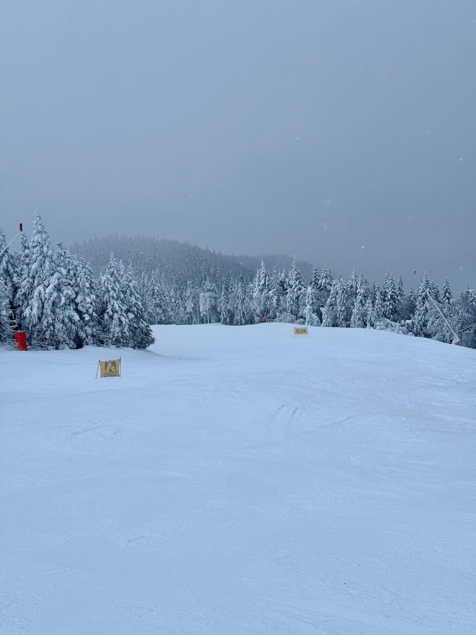
powderfreak replied to Typhoon Tip's topic in New England
Late afternoon, wintry vibe, getting dark fast. Crowds have left, being a Sunday in November. Folks have work and school on Monday. Key football games going on. Its been an odd mix of November feel, but midwinter vibes to start the season up north.
-
What looks like a cold pattern becomes nearly dominated by the SER as we move up closer in time. And any stronger storms will just pump up that ridge and we’ll have what we’ve mainly had for the past 7 years (warm cutters and then dry cold). Seems set in stone at this point.
-
2025-2026 ENSO
Daniel Boone replied to 40/70 Benchmark's topic in Weather Forecasting and Discussion
Almost as if Analogues were fed into it to get that outcome, lol -
Winter 2025-2026 Offers Return to Normalcy
40/70 Benchmark replied to 40/70 Benchmark's topic in New England
Thank you so much to the few who actually sit down and read this word-for-word....I know so few do given I don't have a significant following and I put so much time and work into it. Appreciate it. -
Vote.


.thumb.png.4150b06c63a21f61052e47a612bf1818.png)