All Activity
- Past hour
-

Rise of the Machines: January 18-19 Winter Storm Obs Thread
The 4 Seasons replied to WxWatcher007's topic in New England
looks like ~7.3 or so, don't short yourself lmao. -
Yea there seems to be a deamplifixstion trend in the 84 to 96 hr time-frame. If we can survive that this time, then we're golden.
-
Once we get to 84-96 hours, I’m sure we’ll see a reshuffling of models. No idea which way it’ll go.
-
After 12z run probably. Gotta get rid of the superstitious studs dawg. Embrace the thrill!
-
I drove from Annopoils area to Fenwick Island del this morning. Your area seems to have been the jack.
-
This weekend looks like we could see record breaking cold
-

Rise of the Machines: January 18-19 Winter Storm Obs Thread
Brian5671 replied to WxWatcher007's topic in New England
close to 6 inches here all 3 events combined -

Central PA Winter 25/26 Discussion and Obs
pasnownut replied to MAG5035's topic in Upstate New York/Pennsylvania
its gonna be a big dog for many. Just hope that includes us -

January 25/26 Jimbo Back Surgery Storm
WinstonSalemArlington replied to Jimbo!'s topic in Southeastern States
-
Central PA Winter 25/26 Discussion and Obs
pasnownut replied to MAG5035's topic in Upstate New York/Pennsylvania
suppression depression. dont wanna think of it, but ya have to. 1048 HP is stoud and likely the bully on the block. Hopin it has a little give and as we see things trend back north that we get back into the goods. -
6z GEFS was a beauty. Most of northern East TN in the 6+ mean. Some huge dogs showing 20"+ skewing it some though.
-
you should start the weekend storm thread ASAP not just because of the snow threat BUT also the incredible arctic airmass that will be in place starting later this week through the weekend.....and once we get past a certain number of pages break it up into part 2 - part 3 etc. etc. like we did for the 2010 Boxing day storm who's thread was started well in advance
-
Ben Noll being optimistic now lol
-

Rise of the Machines: January 18-19 Winter Storm Obs Thread
CoastalWx replied to WxWatcher007's topic in New England
Yeah it’s a wet snow but drier than I thought. If that makes sense. -

Winter 2025-26 Short Range Discussion
sbnwx85 replied to SchaumburgStormer's topic in Lakes/Ohio Valley
Taking my 2.5” from overnight with a smile. (That’s what she said?) -
Unfortunately, that's the whole list from 1950-present.
-

Rise of the Machines: January 18-19 Winter Storm Obs Thread
metagraphica replied to WxWatcher007's topic in New England
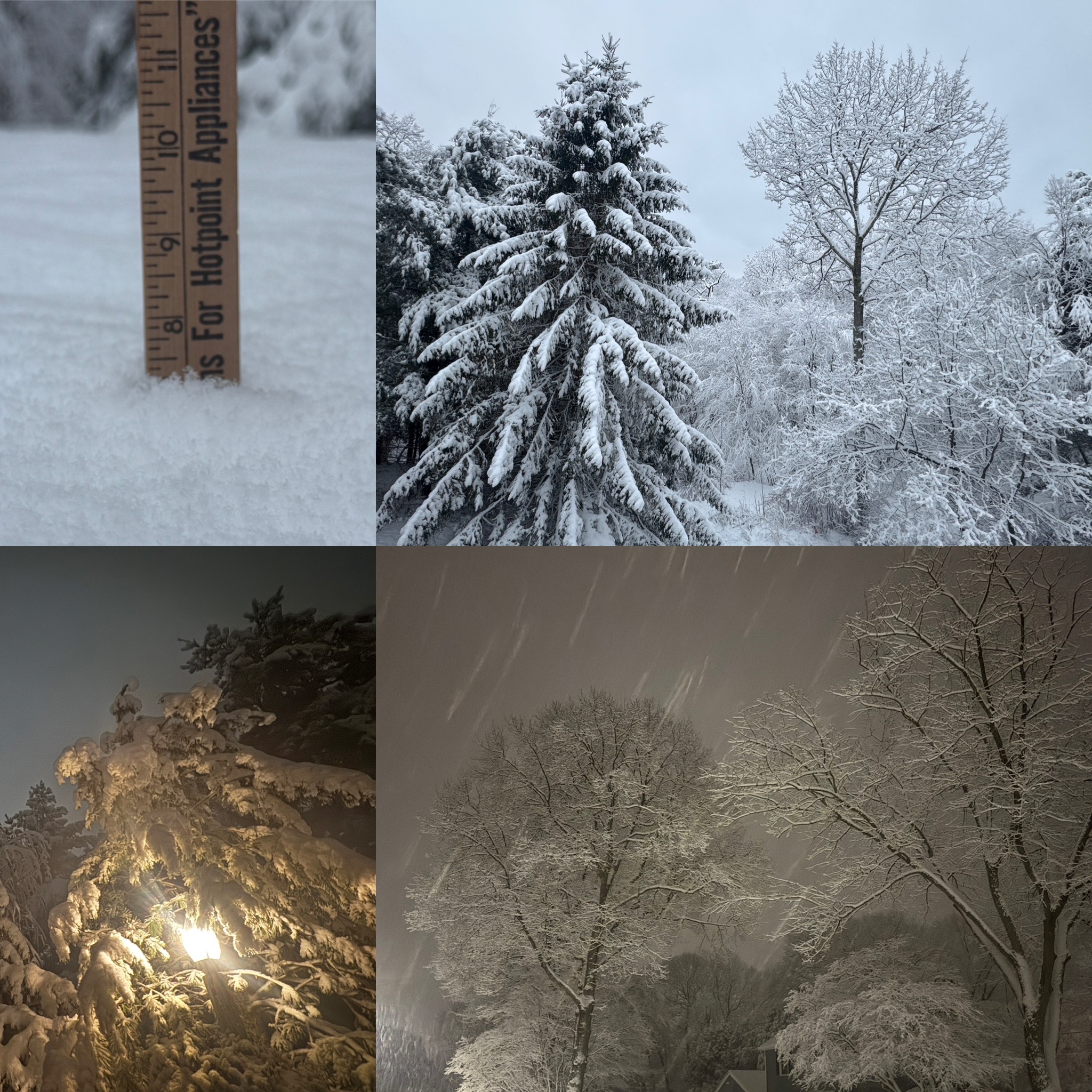
Last night around 1am And today now that we’re getting some blue sky . -
I read that way to fast just now I thought that said your son is 71 Lmfao need more coffee
-
My dad got a better view over in Wisconsin .
-
Rise of the Machines: January 18-19 Winter Storm Obs Thread
metagraphica replied to WxWatcher007's topic in New England
@The 4 Seasons 1.3" in the morning and 2.6" last night. 3.9" total. (just a trace on Saturday after sunset) -

Winter 2025-26 Short Range Discussion
WestMichigan replied to SchaumburgStormer's topic in Lakes/Ohio Valley
You got your snow last week. Time to let someone else in on the aciton -
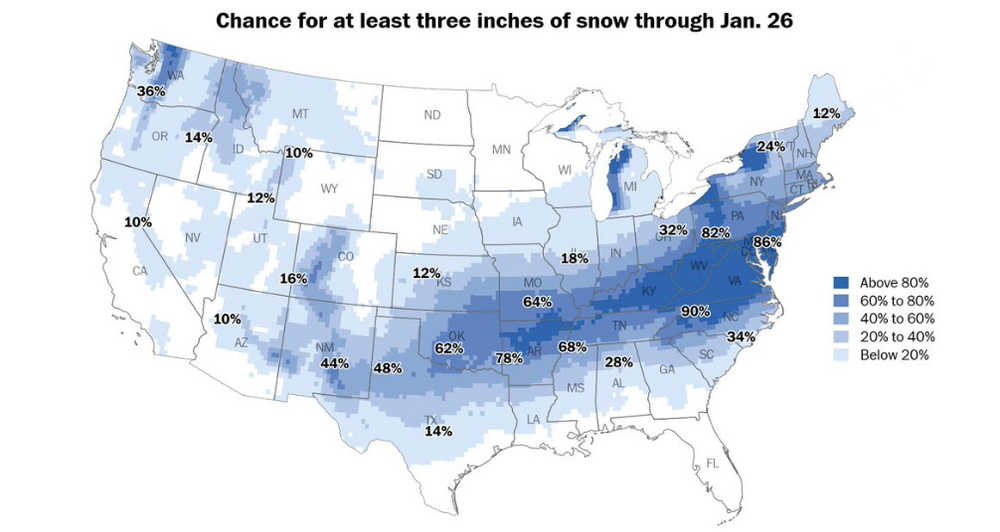
This would actually make sense. I've been watching winter storms forecast across the mid-south turn into Kentucky maulers (80% of the time) for over 50 years now.
-

Rise of the Machines: January 18-19 Winter Storm Obs Thread
TheSnowman replied to WxWatcher007's topic in New England
Holy Crap!! I Almost Jacked!! I ALMOST Jacked!! 7"!! MOST SNOW I’ve Seen since February of 2022! And of COURSE I was Home almost 2 1/2 Months just waiting for Snow, get Screwed like I’ve never been screwed time after time, and Now I LEAVE to LA Tomorrow! Can Only Enjoy 36 Hours of this. WTF. 15.25” Season.
-
@high risk would have a better explanation, but usually if the models are struggling with surface temps while everything else looks normal, it is something to do with how they are implementing approximations via a boundary layer scheme. Global and regional models simply can't calculate everything, so you effectively end up with little "models" inside of models. Models have always struggled with how to calculate the mixing and radiative transfer near the surface in stable conditions. The Euro is handling this poorly, which is how you get a minus teens forecast for parts of Virginia next week, which is not going to happen. I think it is even struggling with temps in the pre-storm period on Saturday, given the much colder surface temps than the GFS despite only 1° difference at 925mb. I'd just be cautious with any surface temp output from the Euro right now.
-

Central PA Winter 25/26 Discussion and Obs
Superstorm replied to MAG5035's topic in Upstate New York/Pennsylvania
That weekend storm is got me licking my chops! .