All Activity
- Past hour
-
0.31” today imby as of 4:30pm. 3.24” so far in July.
-
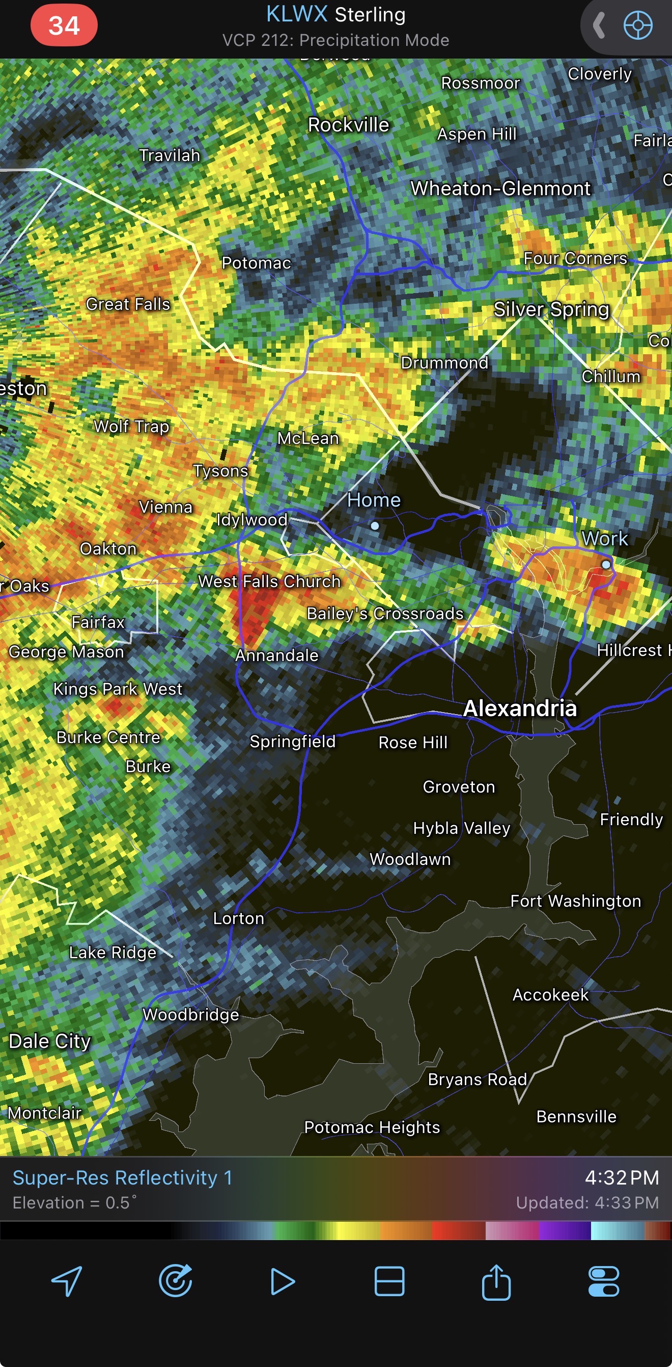
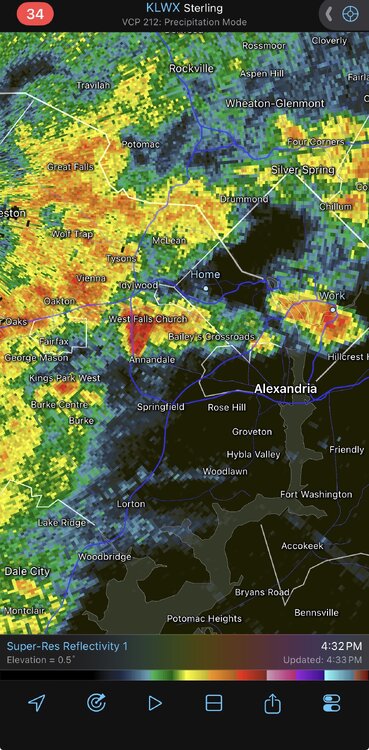
TVS on the stafford county cell. Likely TOR coming.
-
That Stafford storm is close to trying to do something….maybe
-
 Except that they did improve some of the area in NY and CT by one grade to reflect the rain. https://droughtmonitor.unl.edu/CurrentMap/StateDroughtMonitor.aspx?Northeast Change map shows this plus the improvement in Maine on in RI
 -
I'm in Carolina Beach this week, and the dewpoints the past couple days have been consistently above 75°F, even getting up to 81°F, if nearby weather stations are to be trusted. Heat index values have exceeded 110°F at times.
-
The rain is coming down hard. Storms are trying to fire back in my area after fading a little bit. I'm hearing a lot more loud thunder in the past few minutes. LFG!
-

Central PA Summer 2026 Discussion/Obs Thread
canderson replied to Voyager's topic in Upstate New York/Pennsylvania
It hasn’t rained that hard in a very long time -
They don't get a workout too often but nice to have one when you need one. No more flashlights or candles. No more freezing or roasting in the dark. You pretty much go on with normal life when the power is out. We did not have one for Sandy so that was the worst. If we had not had one now this would have run a close second with no a/c in a heatwave for 3 days.
-
Getting dark by me. Storms finally approaching.
-

E PA/NJ/DE Summer 2026 Obs/Discussion
BBasile replied to PhiEaglesfan712's topic in Philadelphia Region
One of the more ominous looking non-severe storms I've seen in a while. Absolutely dumping rain right now. Just put under a FFW. Storm added another 1 inch of rain in short order. Up to 1.39" on the day now..thumb.jpg.b97aa1d0c39704c9fa93613d639dcfab.jpg)
-
 Never underestimate the power of the atmosphere to rain between the data cutoff and when the map is released on Thursdays.
 -
The wait is painful….i am your meme
-
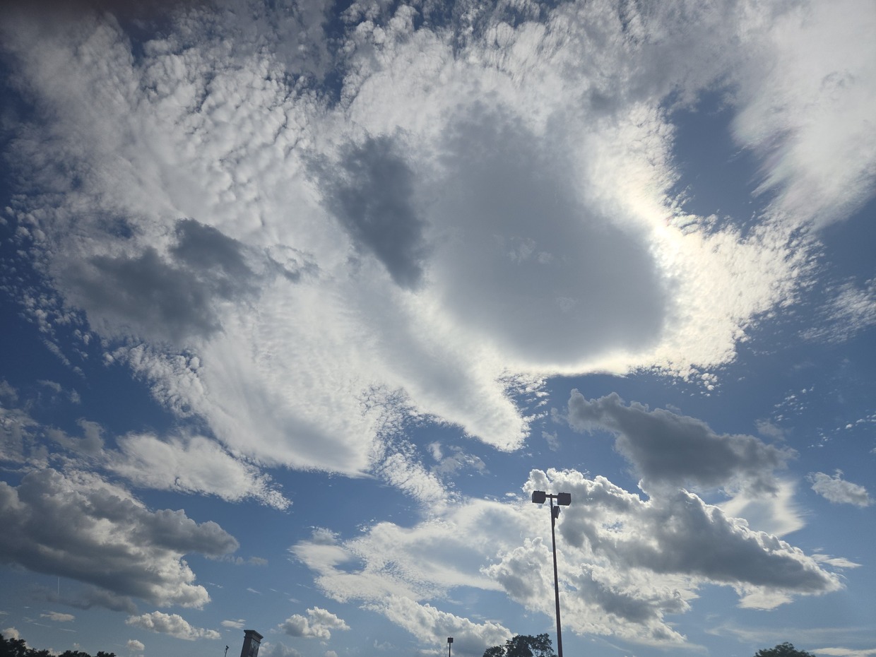
.thumb.gif.f92b16c631a1d15d405ed77b33f0710d.gif) Fun variety of clouds out there
Fun variety of clouds out there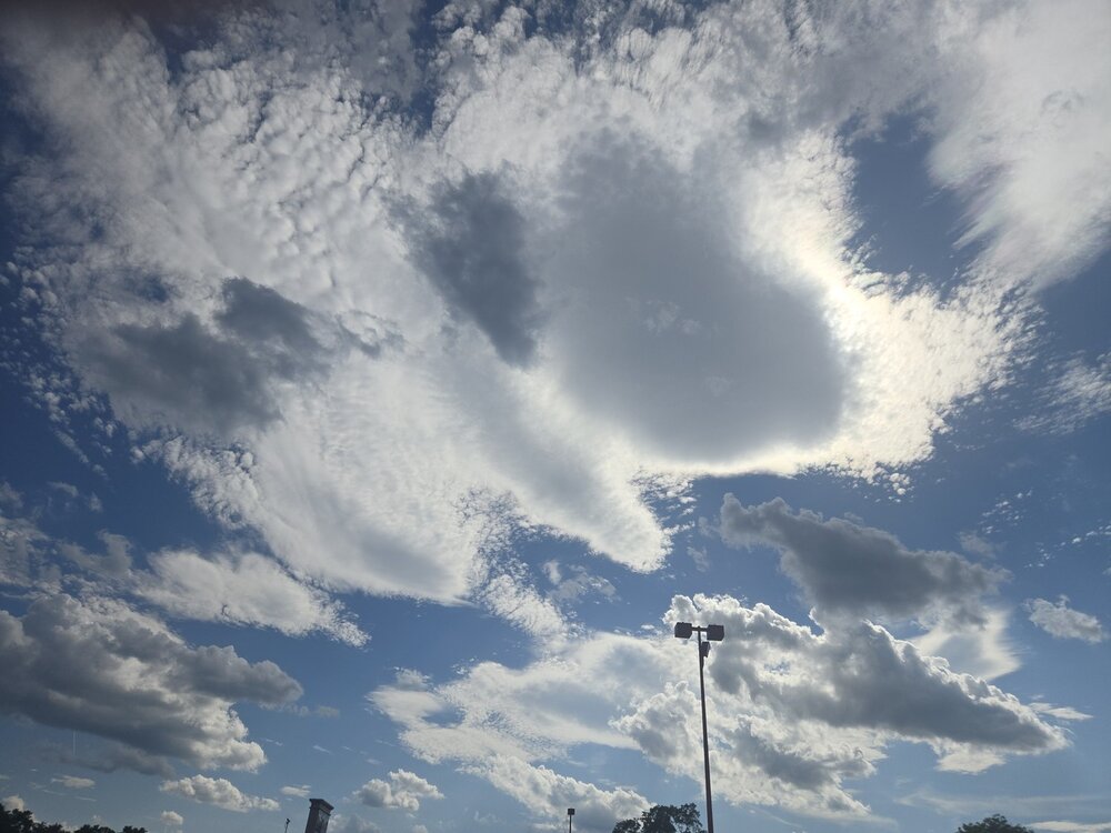
-
 Got back from Falmouth last night and I mowed well into the evening. Thinking I may not have to again for a few weeks.
 -
Keep saying we're going to look into a generac
-
Consistent moderate rain with rumbles of thunder at jones beach. Have to be near an inch here .
-
About 0.25” so far
-
 might have to make it a no-mow July
 -

2026-2027 Super El Nino
Maestrobjwa replied to Stormchaserchuck1's topic in Weather Forecasting and Discussion
Why do you say? I mean haven't all super ninos kinda been 50/50 boom or bust? As it happens...every other super has produced in the Mid-Atl and NE. 65-66 good, 72-73 bad, 82-83 good, 97-98 bad, 15-16 good (one hit wonder, but still) -
A sound I don't want to hear again for a while after a 66 hour stretch recently.
-
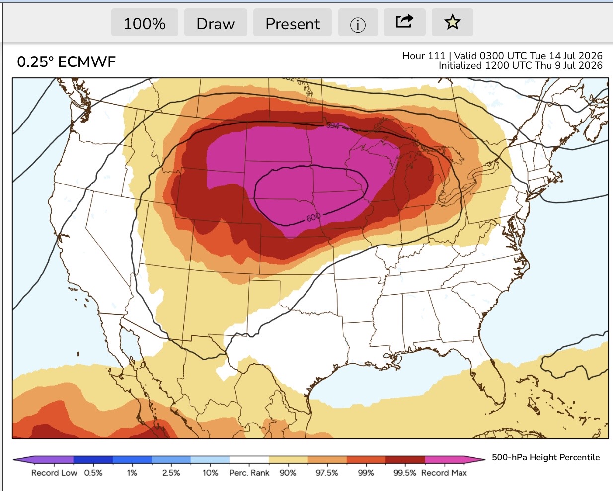
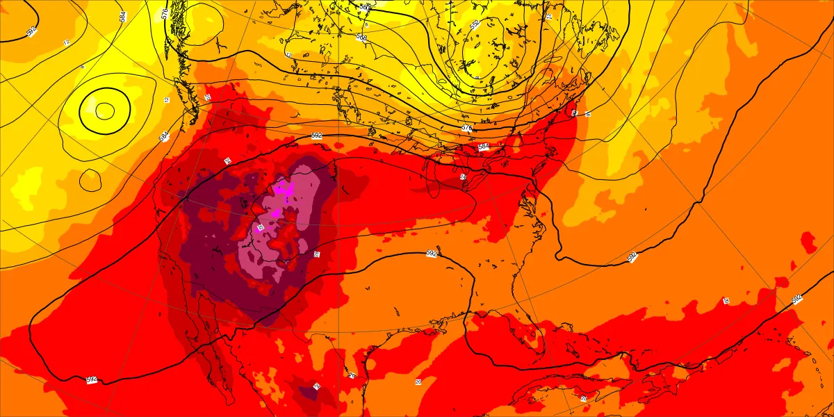
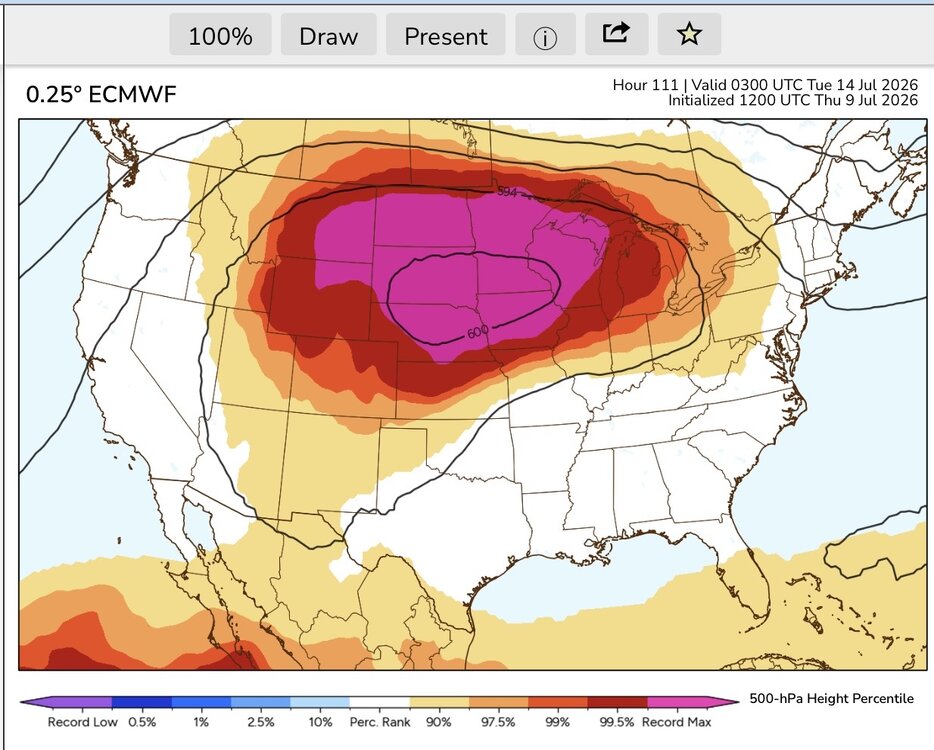
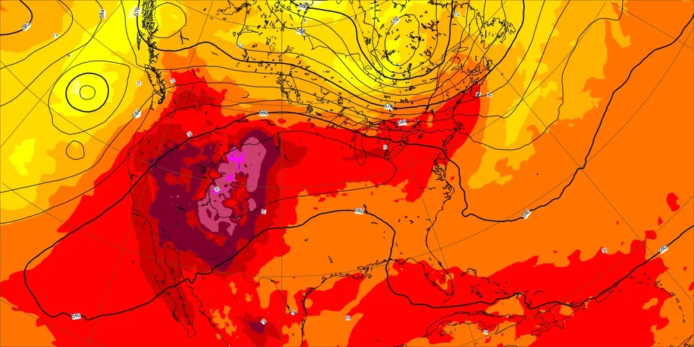
This will be a very rare pancake heat dome Notice how compressed the forecast record 600 dm heights for the MSP area will be. So the 850 mb plume will be fairly narrow. If it ejects perfectly coinciding with the daily highs next week around 4pm then my guess is the warm spots could reach 100° to 103°. If the warmest 850 mb temperatures occur at night then the daytime max could only be 96° to 100° for the warm spots. This is probably why each model is flipping from run to run since the timing of the peak 850 mb temperatures keeps changing. Fairly narrow 850 mb plume
-
No thunder yet, but at least it has started raining.
-
Thanks! Yeah we did a visit of Cape Henlopen State Park but want to explore it more. So defiantly on the list.
-
Getting a heck of a storm here. Torrential rain for more than 20 minutes so far and still going. Booming thunder and frequent wind gusts above 40 mph.
-
Generator just popped on.







.jpg.becbf7edbfad40ba2fbb4fef61c4040c.jpg)