All Activity
- Past hour
-
@Scraff Found this for tonight. Im out of town in Southern Monmouth County, NJ right on the beach. Fitting brew. Hope to get some snow on the sand.
-

December 2025 regional war/obs/disco thread
WinterWolf replied to Torch Tiger's topic in New England
Why do people think that other people want to see that, or care about that? So frieken stupid. That’s the bigger issue imo. He’s a weird dude. -
Even better when you can loop their old Christmas play lists: https://twcclassics.com/audio/playlists-christmas-2009.html
-
Yeah south of Harriman it’s pretty much bare ground
-

December 11th-14th Double Banger Clippers
cyclone77 replied to Jackstraw's topic in Lakes/Ohio Valley
Not a flake here yet. Looks like we may get about what we got with the last clipper, 0.2". -

12/14: Sunday funday? Will the south win again?
Weather Will replied to TSSN+'s topic in Mid Atlantic
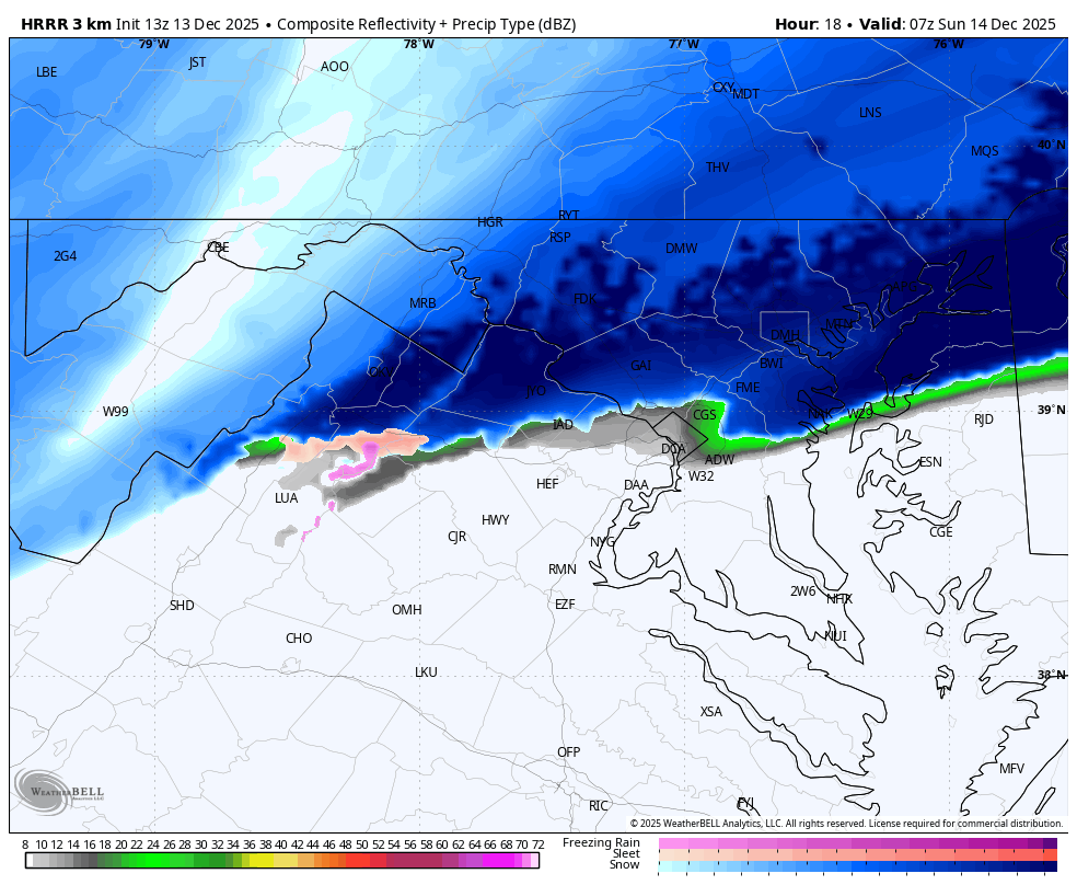
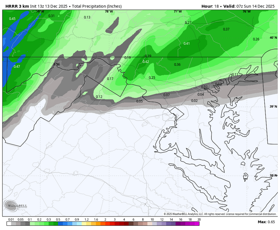
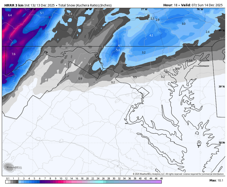
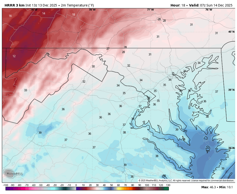
WB 13Z HRRR at HR 18.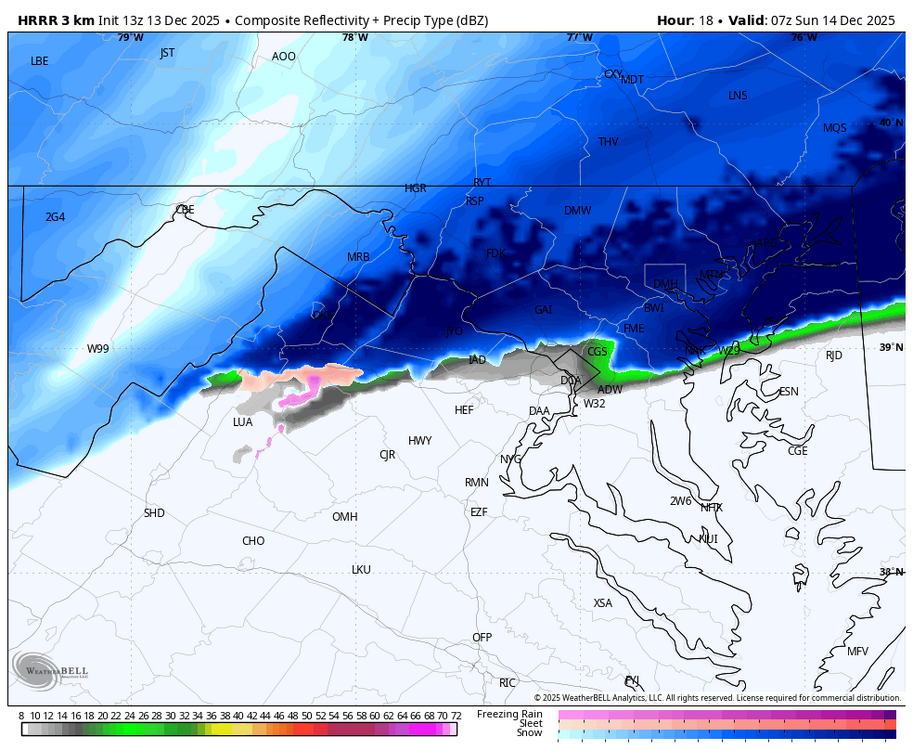
-
yes I have fond memories of the Trammel Starks music that TWC used to play a lot of, oh, 25-30 years ago?
-
Pulling me back in!
-

December 14th - Snow showers or Plowable snow?
CoastalWx replied to Sey-Mour Snow's topic in New England
So far the mesos like FV3 and Wrf NSSL came north from 00z…albeit some were paltry at 00z. -
Yep, we just got jawn’d…I mean HRRR’d and NAM’d. 31F/DP 24F
-
Real weenies know to play old TWC music from good winters of yore while watching models come in. It's the real magic.
-

Winter 2025-26 Medium/Long Range Discussion
CheeselandSkies replied to michsnowfreak's topic in Lakes/Ohio Valley
From wind chills in the -20s today and tomorrow to...that. The phrase "averages are merely a mean of extremes" comes to mind. Between the first and second halves, this month will likely show up as close to "normal" temperature-wise around these parts when all is said and done, but it will say absolutely nothing about the conditions actually experienced on any given day. -
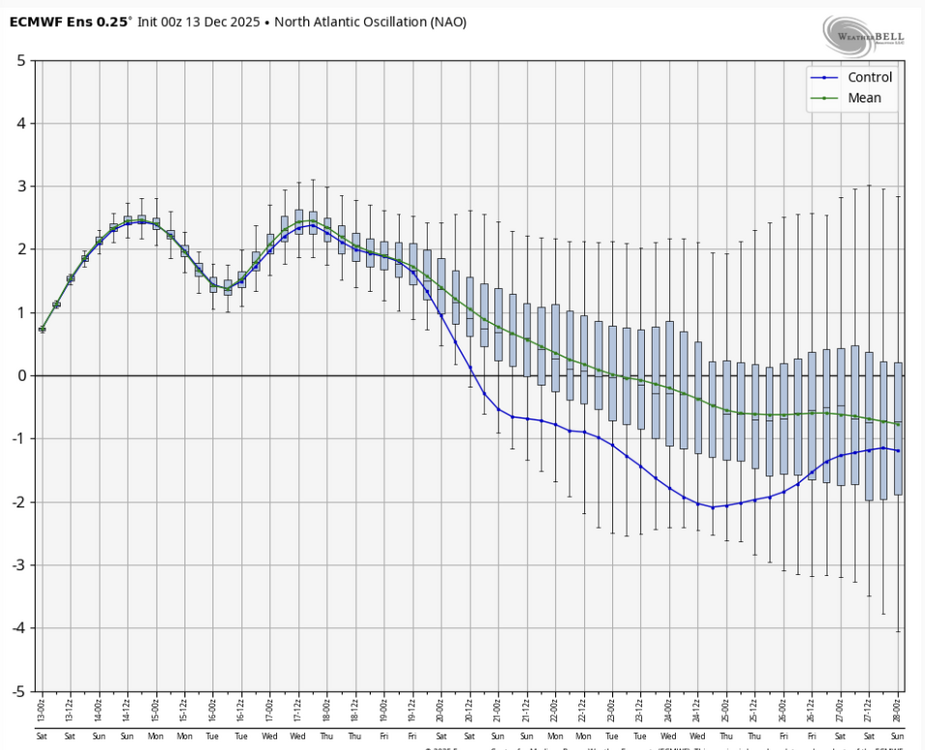
that configuration with low heights diving into the N ATL like that from SE Canada is pretty typical of retrograding -NAO events. would line up well with the lag from the SSW we had in late Nov @Stormchaserchuck1
-

12/14: Sunday funday? Will the south win again?
nw baltimore wx replied to TSSN+'s topic in Mid Atlantic
It ain’t over yet. Play it another 50 times. -

2025-2026 ENSO
brooklynwx99 replied to 40/70 Benchmark's topic in Weather Forecasting and Discussion
wouldn't be surprising in the slightest if this was partially due to the persistent SPV disruptions and SSW that we've seen over the last three weeks. ensembles are definitely picking up on a wavebreaking -NAO signal with some retrograding Scandi / N ATL high pressure -
I knew playing let it snow 50 times yesterday would do the trick.
-
I agree with you. They are messy and can give us hellacious ice storms, but they usually roll in good and juiced.
-

Minor snow event sunday 12/14 1-4 inches
Jersey_Snowhole replied to WeatherGeek2025's topic in New York City Metro
You going to quote the follow up to that when I said NYC is likely to get more -
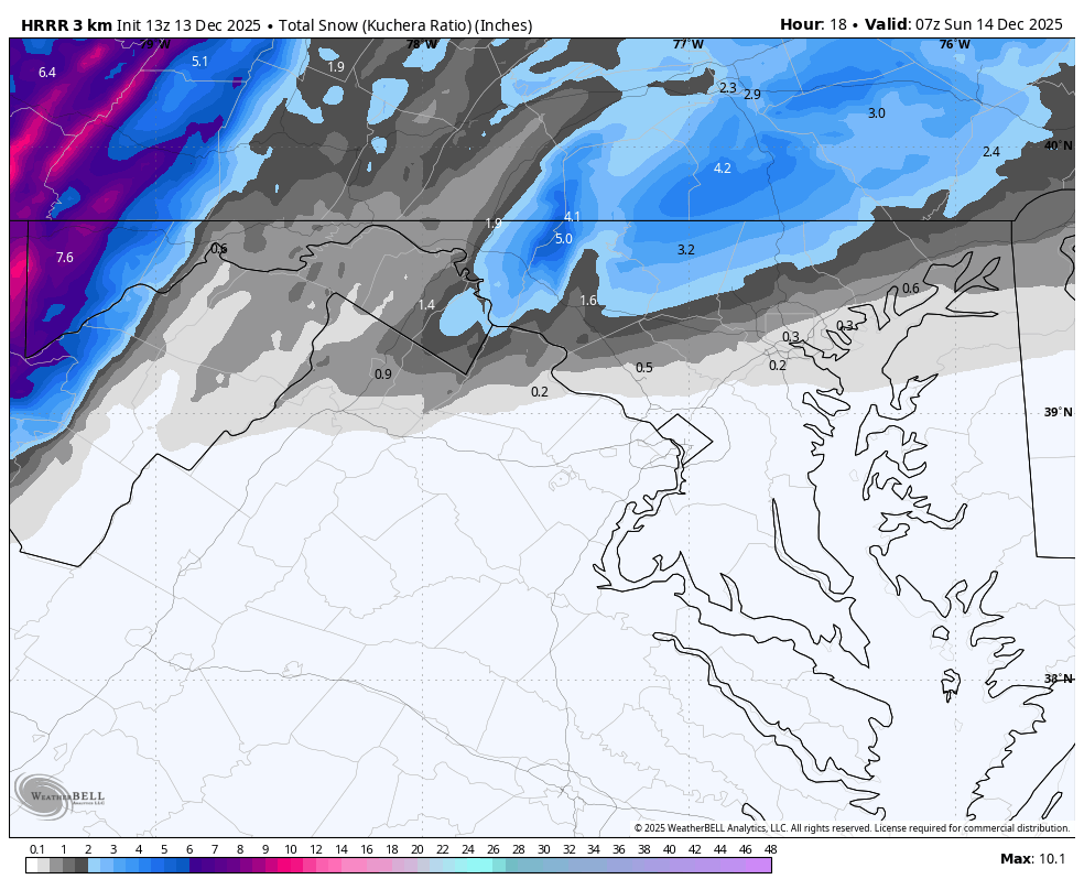
That 3.5" marker over central MoCo is just about on top of where I live (Gaithersburg, near Laytonsville), I'll take that.
-
Rob = The Snow Natzi bahaha
-

Central PA Winter 25/26 Discussion and Obs
canderson replied to MAG5035's topic in Upstate New York/Pennsylvania
Gonna be leaving Philly around 8 pm. We'lll se how that goes. -
Maybe the models are showing this due to a new -NAO signal for CAD events, but I'm not sure.
-
I think we are good for a minimum of 2.5” honestly. Even the warmer solutions at the start come in super heavy and drop 2”+ in 3 hours. Getting excited.
-
Watching for an expansion of wwa west to cover Loudoun and Frederick counties
-

December 14th - Snow showers or Plowable snow?
Damage In Tolland replied to Sey-Mour Snow's topic in New England
Should see advisories up to MA/CT border with afternoon package . Maybe even southern tiers of 4 MA counties