All Activity
- Past hour
-

E PA/NJ/DE Spring 2026 Obs/Discussion
RedSky replied to PhiEaglesfan712's topic in Philadelphia Region
It was a record late freeze in many areas -

E PA/NJ/DE Spring 2026 Obs/Discussion
Birds~69 replied to PhiEaglesfan712's topic in Philadelphia Region
Isn't this around normal (last freeze) around these parts? What makes this year especially bad? AI Overview The average last spring freeze (32°F) in Philadelphia usually occurs between late March and mid-April, with central city areas often seeing their last frost around April 4th–5th and suburban or outlying areas frequently experiencing frost as late as April 15th–20th. A safe, conservative date to avoid damage to sensitive plants is often considered mid-May. The Old Farmer’s Almanac +4 Average Last Frost Dates: Central Philadelphia/Franklin Institute: ~April 4-5 Suburban/Higher Elevation: ~April 15-20 Risk Period: A 30% chance of frost remains up until April 25 in some areas. -

Central PA Spring 2026 Discussion/Obs Thread
canderson replied to Voyager's topic in Upstate New York/Pennsylvania
Ugh. Last I heard was they were think a 30-40% crop reduction. Very sad. -

Spring 2026 Pattern Discussion Thread
Carvers Gap replied to Carvers Gap's topic in Tennessee Valley
It rained like crazy here overnight. Very thankful. I do think we are heading towards a pattern w/ more rain, and much cooler weather. I would not be shocked to see snow at higher elevations(above 5000') during early May if things work out correctly. AT hikers need to pay attention. Big weather changes under way as we speak. I am not saying the drought gets busted(those often take months to eradicate), but we should get some relief. -
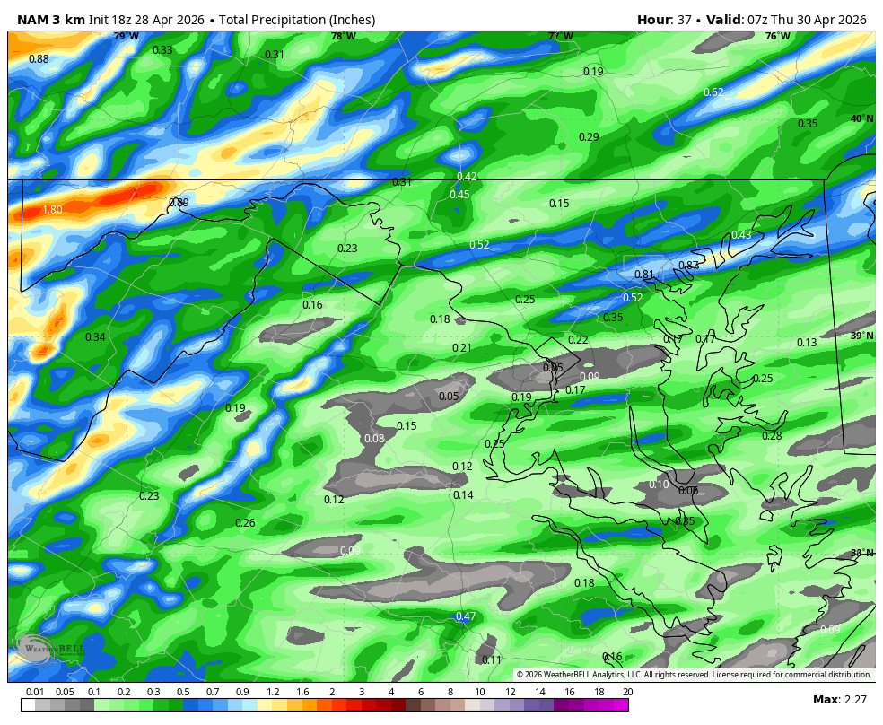
WB 18Z 3K NAM

-
Since you noted the errors first (a triple play), I'm responding your way. Average: 88.4" 2025-26: 86.8" Deficit: 1.6"
- Today
-
Brad P mentioned the possibility of very isolated strong/severe storms tomorrow. Obviously dont care for damage or anything, but im honestly craving a good evening thunderstorm.
-
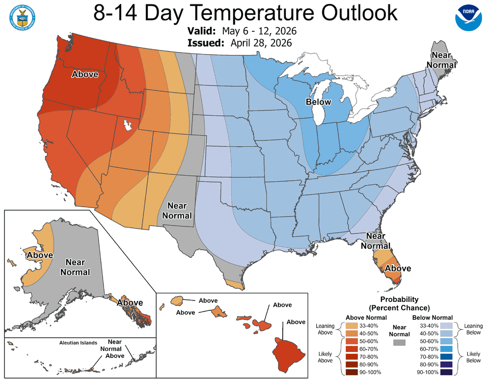
April is just about in the books, so we turn our attention to May flowers and the prospects of thunderstorms. CPC says cool and wet may be in order first.
-

Texas 2026 Discussion/Observations
Stx_Thunder replied to Stx_Thunder's topic in Central/Western States
Primary threat today around DFW still looks to be svr/large hail, once again. Significant Hail Index Parameter on special 19Z UA obs this afternoon is even higher than it was on Saturday evening's 0Z UA obs that was 3.4 At 4.0 this afternoon. Definitely high for that hail parameter, no doubt. I have not seen it go that high anywhere before in the state. As far as I can remember. -
Oak buds are starting to swell here. Things will probably slow down through the weekend. There's still a couple of freeze chances here Sun-Mon.
-
Take them apples-
-
Interesting. Now the Ravens have a third string QB. Why does he look like he is 35?
-

2026-2027 El Nino
snowman19 replied to Stormchaserchuck1's topic in Weather Forecasting and Discussion
-
Something like this?
-
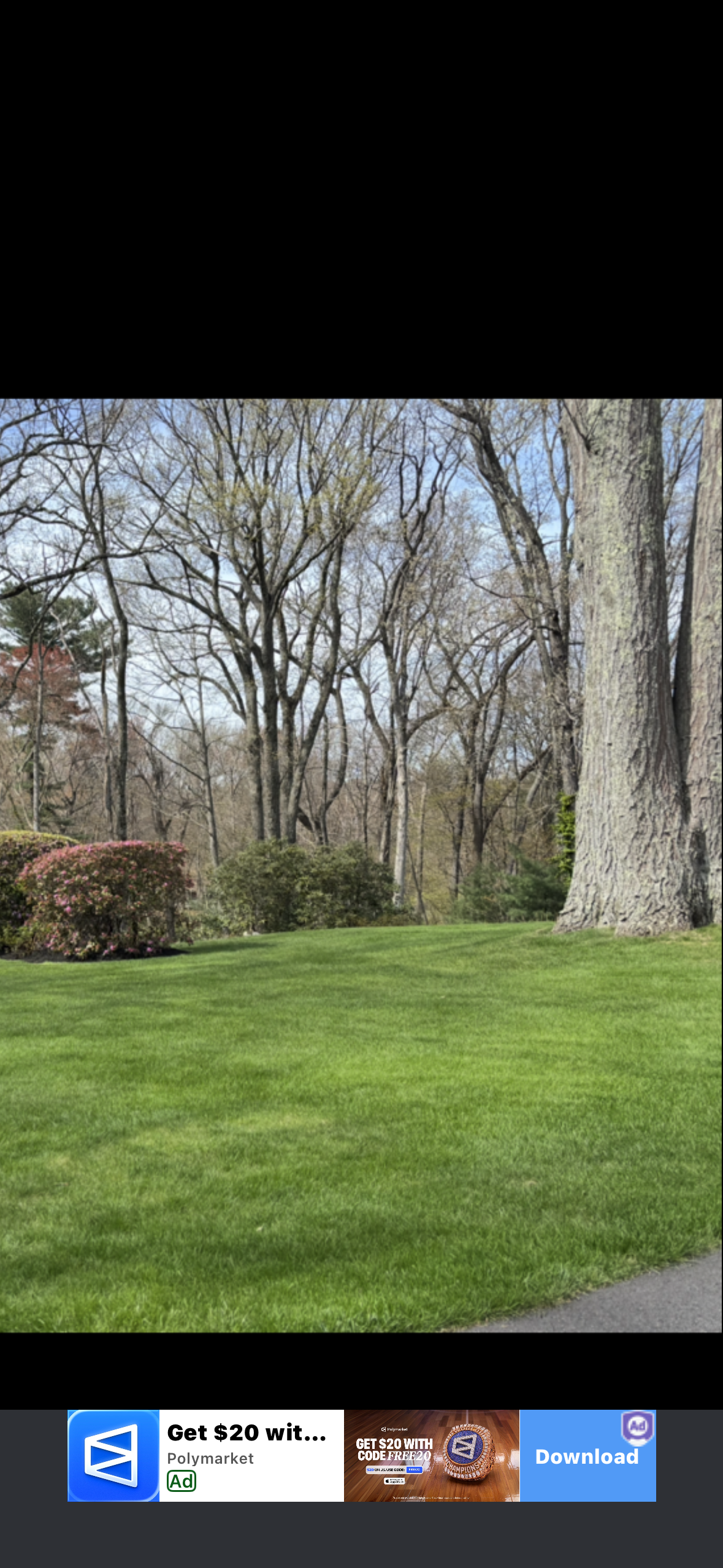
Yep, finished mowing around 2:30. The weeds look better now.
-
Big pun hit ya with the big bun

-

2026 Mid-Atlantic Severe Storm General Discussion
George BM replied to Kmlwx's topic in Mid Atlantic
No it wasn't. That tornado occurred on September 24, 2001. Coming to think about it... it sure was something that we got two different significant/violent tornadoes in the area a little over 7 months apart. -
Not a player just Punny ?
-
And for the record, I’m just being punny. Please don’t indict me.
-
He's on mobile. Strolling the beach hand in hand with the former FBI Director.
-
If you use his numbers… 86.6” is 1.8” below normal. Normal being 88.4”.
-
Mount Holly's graphic from this morning is still up, with a half to one inch for the entire forecast area. Their latest forecast for here is less than a tenth tomorrow, tenth to a quarter tomorrow night, less than a tenth Thursday. Another bust.
-
One thing seems certain- its not going to be hot anytime soon
-
86.47?
-