All Activity
- Past hour
-

E PA/NJ/DE Spring 2026 Obs/Discussion
Heisy replied to PhiEaglesfan712's topic in Philadelphia Region
Signal for a nice +PNA growing on euro guidance. It’s more muted on GFS/GEFS. Without blocking though wed need well timed waves. Shortwaves timed right after a cold front. Significant snow likely a long shot, but we’re going to get some decent cold shots if this is legit. -
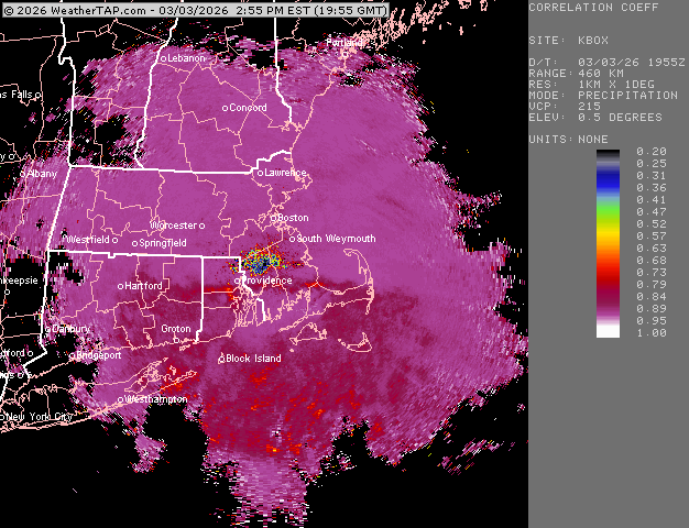
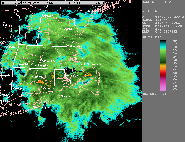
28/25, moderate snow huge flakes too bad we flip to sleet within the hour
-
1.0" so far in North Salem NH. 28F -SN with 19" OTG.
-
Moderate to heavy snow in methuen..
-
Just one more small 2-3" snow area wide should do it...
-

Winter 2025/26 Banter Thread
SchaumburgStormer replied to Chicago Storm's topic in Lakes/Ohio Valley
100%. Done with that single digit bullshit -
Down to 33° after reaching 37° -RA
-
HRRR way too cold. Sleet will be on my doorstep shortly.
-
The superintendents knew…smart decision to cancel here.
-
must be silver dollars falling near ORH.
-
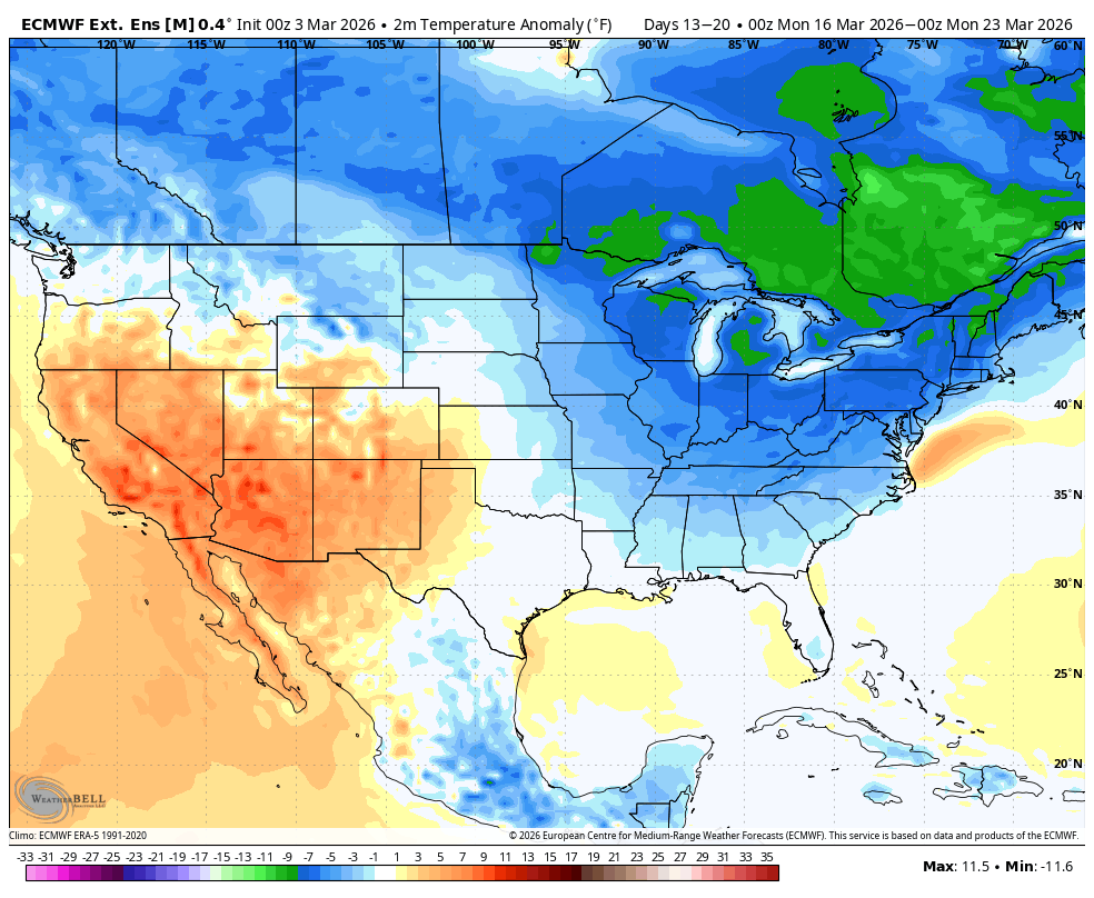
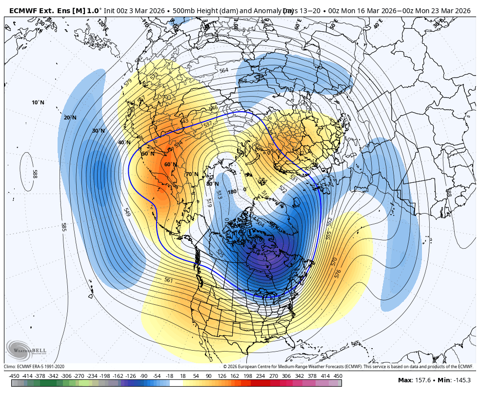
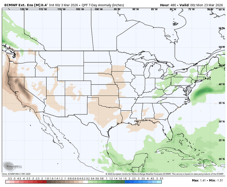
WB latest EURO weeklies. Looks like the 7 day period ending March 22nd will be our window of opportunity during March.


-
Good one, only thing is whoever made this image didn’t make the scales consistent with all the seasons
-
Poundtown
-
It won’t get to 80. Feel like it will be muted
-
I saw 5 pretty bad wrecks coming home from work just now, yikes.
-
34.7/34.4 Damp and Fog
-
2.25” Moderate to heavy rates. Roads are a mess here in the Gardner/Hubbardston area.
-
If its not snowing give me a day like today. 30s and raining.
-
around 1/2". ground/roads covered
-
Am taking care of my friend’s horses again this week. The mud is real. She lives up on Furnace Mountain and her main paddock is on a hill. Had to dig in all of my balance to not wipeout. Heading back soon for the night feed. Damp cold gray can go away.
-
SN+
-

Clipper Fires In Wednesday Feb 25 Disco/ Obs
The 4 Seasons replied to Damage In Tolland's topic in New England
still not great, but yeah better, most around there are 2+ -
I'm more bothered by backdoor action than late season polar vortex drops. Today is probably in top 5 miserable day of the winter. Looking forward to mist and 48 into May.
-
Yep. sleet moving steadily north. Hoipefully an inch.
-
Man, this is the type of stuff that would give us a quick 6” in 4 hours if we stayed all snow. Good ratios and growth right now with temps in upper 20s.