All Activity
- Past hour
-
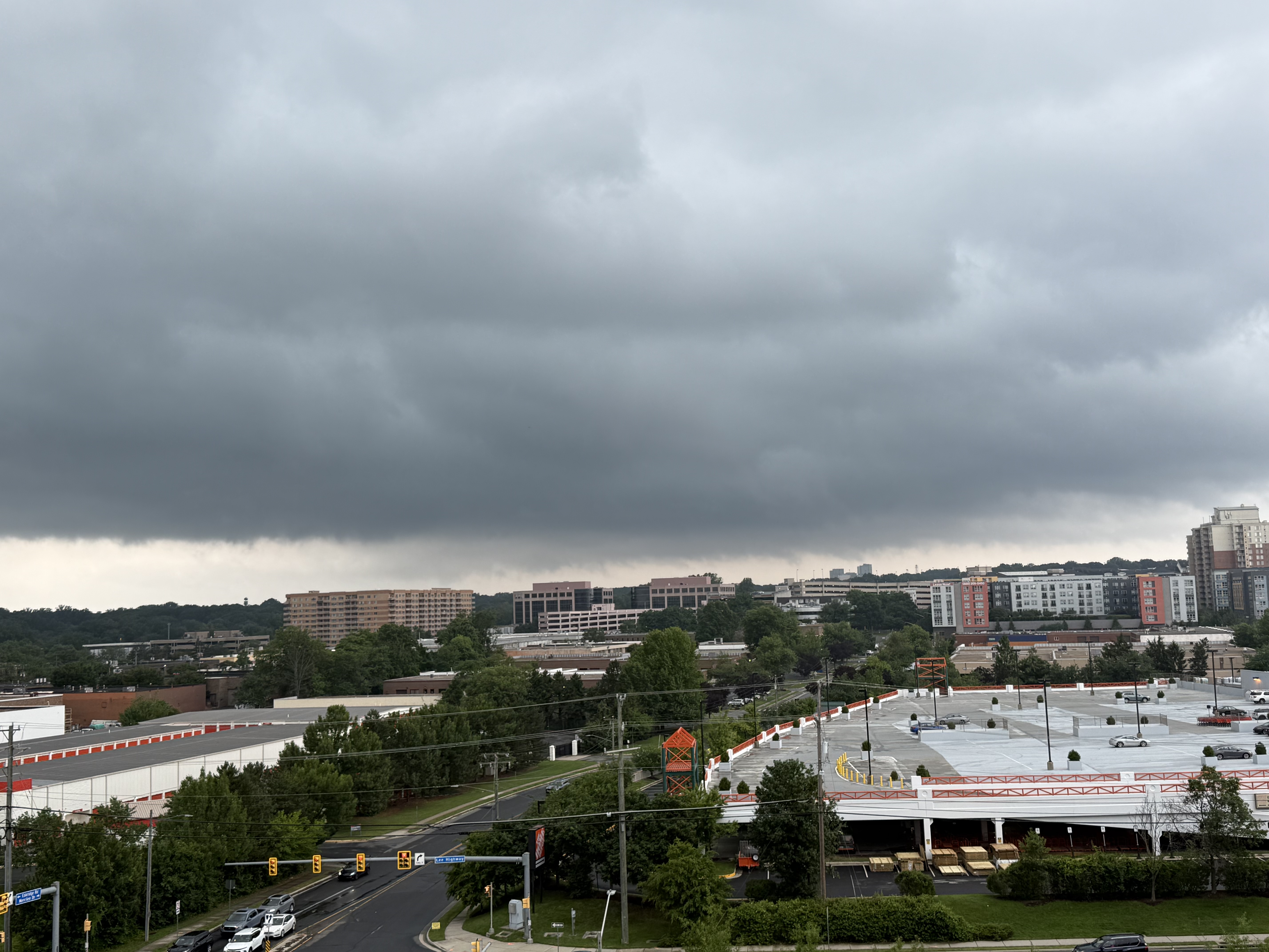
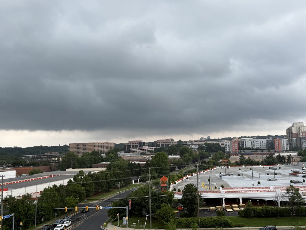
Was out running errands and thought that I’d see if that cell sliding by Tysons would deliver. Never tightened up. Pic from Mosaic overlooking the picturesque Merrifield Home Depot.
-
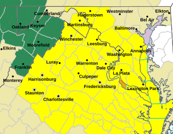
NWS Tornado watch until 10pm
-
Starting to get some sun here in the lowlands. It's definitely feeling warmer in the past 20 minutes. Hopefully there's a few wedges later.
-
TORNADO WATCH OUTLINE UPDATE FOR WT 392 NWS STORM PREDICTION CENTER NORMAN OK 225 PM EDT SUN JUN 8 2025 TORNADO WATCH 392 IS IN EFFECT UNTIL 1000 PM EDT FOR THE FOLLOWING LOCATIONS DCC001-090200- /O.NEW.KWNS.TO.A.0392.250608T1825Z-250609T0200Z/ DC . DISTRICT OF COLUMBIA COUNTIES INCLUDED ARE DISTRICT OF COLUMBIA $$ TORNADO WATCH OUTLINE UPDATE FOR WT 392 NWS STORM PREDICTION CENTER NORMAN OK 225 PM EDT SUN JUN 8 2025 TORNADO WATCH 392 IS IN EFFECT UNTIL 1000 PM EDT FOR THE FOLLOWING LOCATIONS MDC003-009-017-021-027-031-033-037-043-090200- /O.NEW.KWNS.TO.A.0392.250608T1825Z-250609T0200Z/ MD . MARYLAND COUNTIES INCLUDED ARE ANNE ARUNDEL CALVERT CHARLES FREDERICK HOWARD MONTGOMERY PRINCE GEORGES ST. MARYS WASHINGTON $$ TORNADO WATCH OUTLINE UPDATE FOR WT 392 NWS STORM PREDICTION CENTER NORMAN OK 225 PM EDT SUN JUN 8 2025 TORNADO WATCH 392 IS IN EFFECT UNTIL 1000 PM EDT FOR THE FOLLOWING LOCATIONS VAC003-013-015-029-033-036-041-043-047-049-057-059-061-065-069- 073-075-079-085-087-095-097-099-101-103-107-109-113-115-119-125- 127-133-137-139-145-153-157-159-165-171-177-179-187-193-199-510- 540-600-610-630-650-660-683-685-700-735-760-790-820-830-840- 090200- /O.NEW.KWNS.TO.A.0392.250608T1825Z-250609T0200Z/ VA . VIRGINIA COUNTIES INCLUDED ARE ALBEMARLE ARLINGTON AUGUSTA BUCKINGHAM CAROLINE CHARLES CITY CHESTERFIELD CLARKE CULPEPER CUMBERLAND ESSEX FAIRFAX FAUQUIER FLUVANNA FREDERICK GLOUCESTER GOOCHLAND GREENE HANOVER HENRICO JAMES CITY KING AND QUEEN KING GEORGE KING WILLIAM LANCASTER LOUDOUN LOUISA MADISON MATHEWS MIDDLESEX NELSON NEW KENT NORTHUMBERLAND ORANGE PAGE POWHATAN PRINCE WILLIAM RAPPAHANNOCK RICHMOND ROCKINGHAM SHENANDOAH SPOTSYLVANIA STAFFORD WARREN WESTMORELAND YORK VIRGINIA INDEPENDENT CITIES INCLUDED ARE ALEXANDRIA CHARLOTTESVILLE FAIRFAX FALLS CHURCH FREDERICKSBURG HAMPTON HARRISONBURG MANASSAS MANASSAS PARK NEWPORT NEWS POQUOSON RICHMOND STAUNTON WAYNESBORO WILLIAMSBURG WINCHESTER $$ TORNADO WATCH OUTLINE UPDATE FOR WT 392 NWS STORM PREDICTION CENTER NORMAN OK 225 PM EDT SUN JUN 8 2025 TORNADO WATCH 392 IS IN EFFECT UNTIL 1000 PM EDT FOR THE FOLLOWING LOCATIONS WVC003-037-090200- /O.NEW.KWNS.TO.A.0392.250608T1825Z-250609T0200Z/ WV . WEST VIRGINIA COUNTIES INCLUDED ARE BERKELEY JEFFERSON $$
-
Tornado watch up
-
Always La Plata
-
Was hoping the warm front would push a little further north, but seems like it's hit a wall. Not expecting much up here with the current temps and cloud cover except periods of showers.
-
90% plus cloud cover in the bronx.
-
Yeah that's cool visiting in winter like I said. Idk about doing the parks in July. That sounds rough...I haven't been to the parks since I was kid in the early 2000s. Nice, looking forward to more comfortable weather when I get home Tuesday.
-
Well so far the month of June has kept the trend going. Wet at times & no temps in the middle to high 90’s. The next 2 weeks look to be the same. Let’s hope this is the summer pattern for quite some time. The longer the heat dome is pushed back the shorter time we have to deal with it.
-
I can’t imagine living there and not being near the water. Strong hell no to interior Florida.
-

-
Interior FL is a hellhole. Gulf Coast Tampa-south is amazing. You need some air movement with the continuous 75-80+ dews and mins.
-
Special Marine Warning National Weather Service Baltimore MD/Washington DC 152 PM EDT Sun Jun 8 2025 The National Weather Service in Sterling Virginia has issued a * Special Marine Warning for... Tidal Potomac from Indian Head to Cobb Island MD... * Until 315 PM EDT. * At 152 PM EDT, a severe thunderstorm capable of producing waterspouts was located near Colonial Beach, moving northeast at 10 knots.
-
Chattanooga got it Saturday! Several thousand power outages were reported, something like 12K+ I estimate about 50 mph gusts at my location. Other parts of the city had instruments measure 60-70 mph. Saturday in Chattanooga and surrounding areas was a classic bow echo.
-
Clouds are coming for you guys
-
I haven't even turned the well on yet at my little farm spot. If it didn't rain this weekend I was going to turn it on. I had almost .40 yesterday and .03 today and it's raining as I type. I'm watching the radar to the SW. The lowlands might be in line for storms later.
- Today
-
Up to 0.8 in of rain from this morning and early afternoon just southeast of Gainesville. It has been very nice not having to water the plants much this year.
-
maybe I just enjoy it because I mostly stay in Orlando and visit parks. BTW today is perfect up here I wish this would last the rest of the Summer.. its so comfortable out
-
I'm in southeast St. Petersburg right on the bay. You have ass crack sweat just trying to walk at night. I've never longed for a desert climate (so long as it's not far south) as much as I have the last 10 days.
-
Yes, 100% visible. Especially as it moved off to my North East.
- 968 replies
-
- 4
-

-
- severe
- thunderstorms
- (and 2 more)
-

2025-2026 ENSO
TheClimateChanger replied to 40/70 Benchmark's topic in Weather Forecasting and Discussion
Not accurate. The high was 102F at the Weather Bureau office at the Battery on that date. The monthly mean was a comfortable 74.9F. The 106F was observed at the Park, which, as suggested, would have been secondary to the Weather Bureau office. -
Mesoscale Discussion 1197 NWS Storm Prediction Center Norman OK 1204 PM CDT Sun Jun 08 2025 Areas affected...portions of VA/MD Concerning...Severe potential...Watch possible Valid 081704Z - 081830Z Probability of Watch Issuance...60 percent SUMMARY...Isolated to widely scattered strong/severe storms are possible through the afternoon. Damaging gusts will be the main hazard but a tornado and sporadic hail also are possible. DISCUSSION...Isolated convection is develop early this afternoon in a weakly unstable airmass in the vicinity of an effective warm front draped across northern VA toward coastal MD. As additional heating occurs over the Blue Ridge, thunderstorm coverage should increase and storms will move across the Piedmont and Chesapeake Bay vicinity through the afternoon. Overall instability and midlevel lapse rates will remain modest. However, effective shear around 30-40 kt will support organized cells. Where steeper low-level lapse rates develop amid stronger heating, strong/severe gusts will be possible. Low-level shear will be somewhat enhanced along the warm front, as is evident in the LWX VWP, which shows a mildly enlarged and favorably curved low-level hodograph. Rotating storms interacting with the warm front could pose a risk for a brief tornado or two. The area is being evaluated for possible watch issuance. ..Leitman/Guyer.. 06/08/2025 ...Please see www.spc.noaa.gov for graphic product... ATTN...WFO...PHI...AKQ...LWX...RNK... LAT...LON 38987851 39297781 39267736 39157695 38847623 38407580 37587544 36967538 36607571 36577610 36557726 36777834 37207889 38027910 38577893 38987851 MOST PROBABLE PEAK TORNADO INTENSITY...85-115 MPH MOST PROBABLE PEAK WIND GUST...55-70 MPH MOST PROBABLE PEAK HAIL SIZE...1.00-1.75 IN
- 968 replies
-
- 1
-
-
- severe
- thunderstorms
- (and 2 more)
-
Was any rotation, or rising motion visible?
-
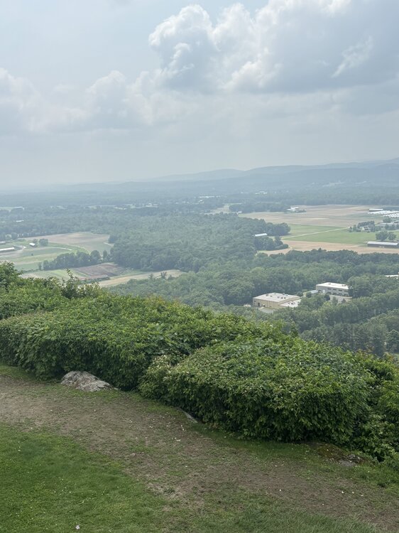
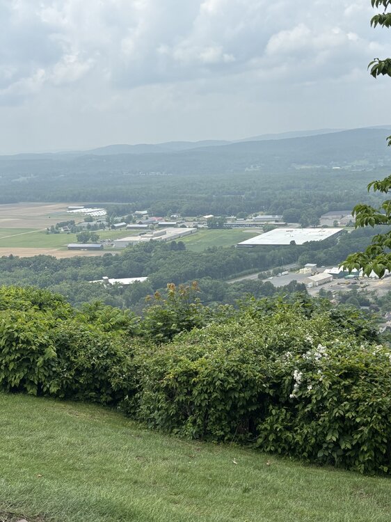
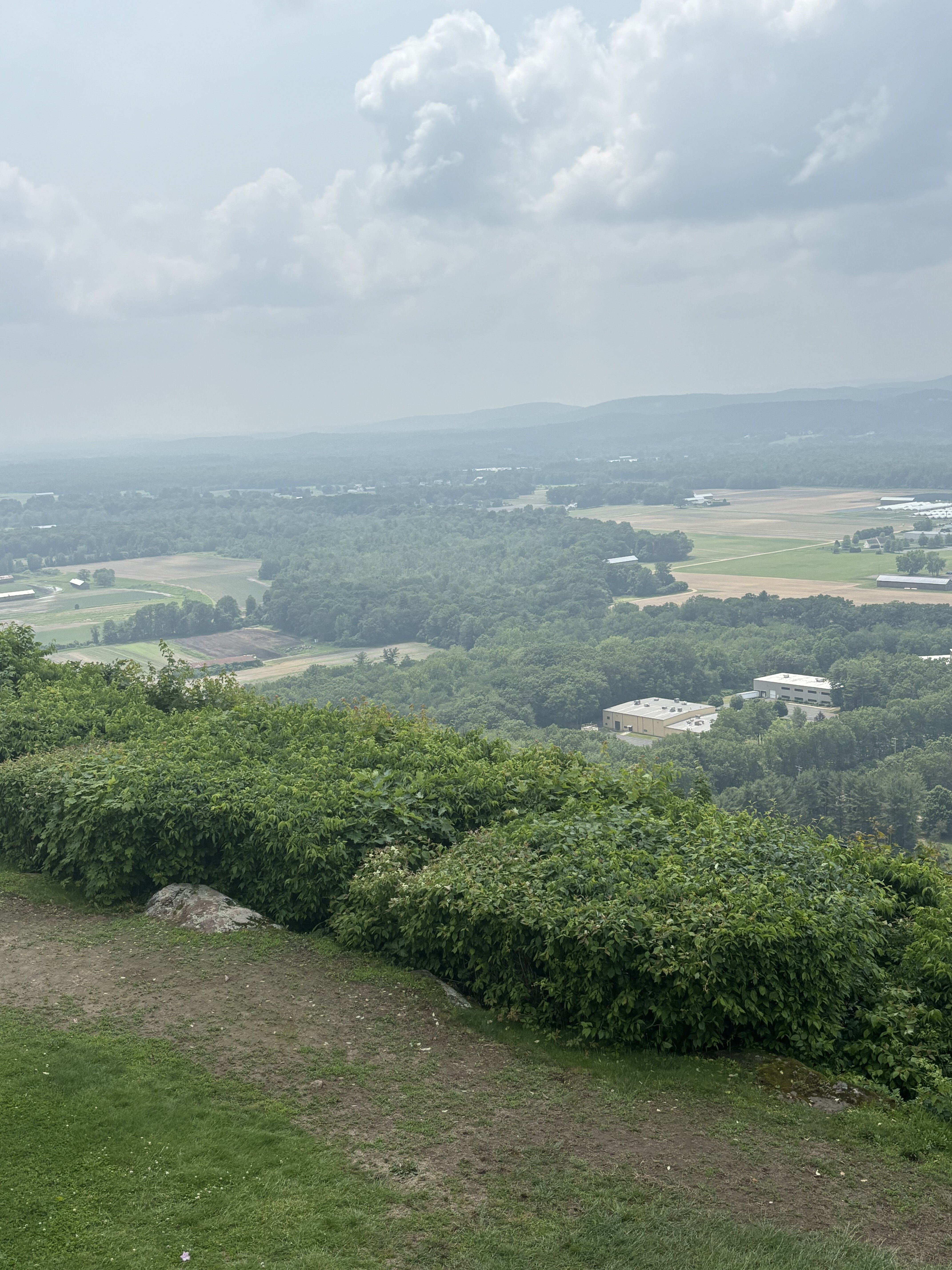
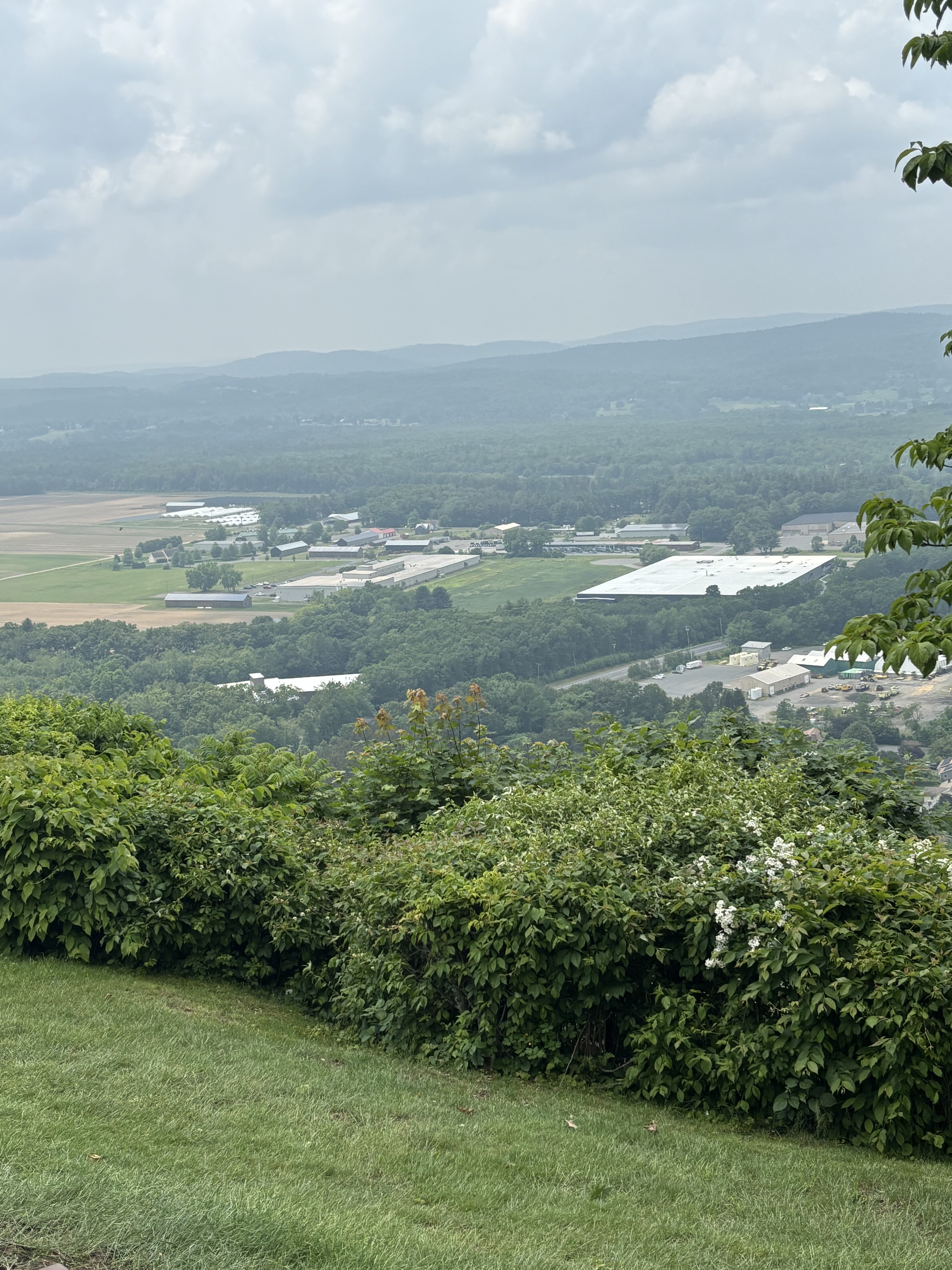
Smoky/hazy from Sugarloaf