All Activity
- Past hour
-
got clipped by that system around 6:30 this morning--the lightning was so close and bright it intruded into my dream. and now the watch is up for round 2.
-

Septorcher 2026 Discussion - Endless Summer
Damage In Tolland replied to Damage In Tolland's topic in New England
This is exactly why. For whatever reason each summer has more Hugh pressures over SE Canada than we used to see . This is the reason for the high dew summers now, and the reason why the drought happens every summer now along the coast of Maine down to the cape. -

2026-2027 Record-breaking El Nino
40/70 Benchmark replied to Stormchaserchuck1's topic in Weather Forecasting and Discussion
So it's going to be too low with heights in the southeast, but nail the northeast and mid atlantic? Good luck- -
Figure this will be an “everybody gets a warning” event?
-
We are locked in with fog here and have been for hours in the Poconos. Edit- we just had a brief shower, no thunder thank goodness. I still haven't been able to figure out my exact elevation Google Gemini gave me some ridiculous numbers, 1666 feet at the front of my property (facing the lake) and 1692 feet at the back of my property (facing an open field). And something about that open field behind my property rising to 1740 feet haha. I think I will stick with the average of my apps and the barometer altimeter conversion process that says it's between 1530 and 1580 feet. Those numbers from Gemini might not be any more accurate than those inflated temperatures on weather underground we talked about before. I dont think anyone does it intentionally, I just think the properties there are too close to each other for proper siting and like you said no one wants to climb a roof to plant an Anemometer lol. And many of these weather units are all in one which makes it even more difficult. A wind instrument needs to be at 33 feet while the thermo hydro sensor belongs at 6 feet while the rain gage needs to be on a flat surface twice the distance away from the height of any near by trees, roofs, etc. I think I finally got the thermo hydro part right as my temperature measurements are within 1 to 2 degrees of MPO on all my sensors placing them on the North side of my house under the eave of a deck. The rainfall and wind measurements are off though. I would need to put the Anemometer on my balcony but I can't because the entire unit would have to go there and that area is very sun exposed so the temperature would be inflated. I see these modern units have offsets you can input to account for that but I don't find that to be scientific (the offset would need to be different for different times of the year as the sun angle and sun path in the sky changes) and I'd worry about intense heat damaging the equipment anyway, I remember in May there was one day it hit 118 degrees on my balcony when the actual outside temperature was more like 91 lol.
-
.thumb.jpg.6a4895b2a43f87359e4e7d04a6fa0d14.jpg)
Central PA Summer 2026 Discussion/Obs Thread
Yardstickgozinya replied to Voyager's topic in Upstate New York/Pennsylvania
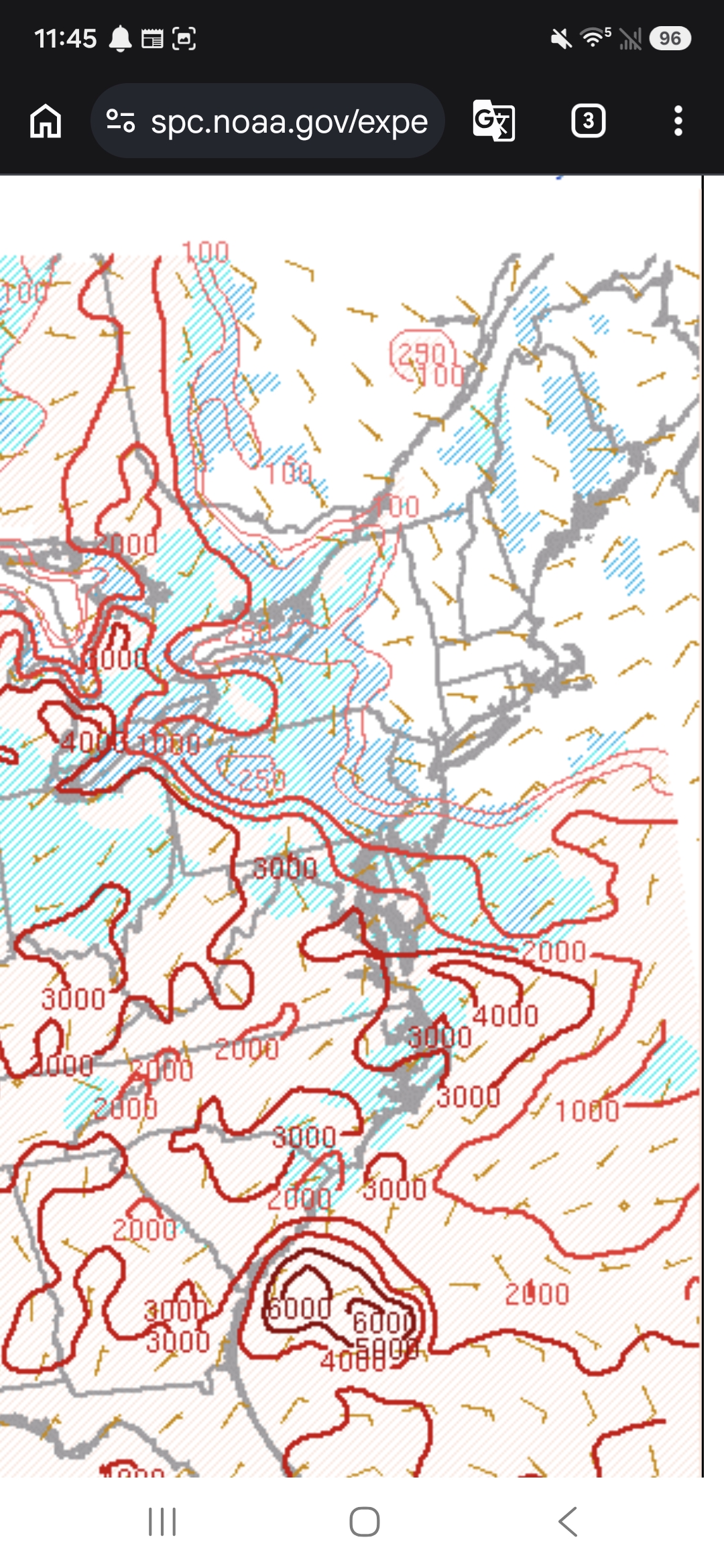
The cape at the surface cannot be realized because of the cap. Elevated big boy.
-
Oh, look. More storms for the usual affected areas. By the time this year ends, places Frederick and east are going to have 10x the rainfall as here.
-
-
Watch up until 5pm URGENT - IMMEDIATE BROADCAST REQUESTED Severe Thunderstorm Watch Number 643 NWS Storm Prediction Center Norman OK 1140 AM EDT Wed Sep 2 2026 The NWS Storm Prediction Center has issued a * Severe Thunderstorm Watch for portions of District Of Columbia Maryland Northern Virginia The Eastern West Virginia Panhandle Coastal Waters * Effective this Wednesday morning and afternoon from 1140 AM until 500 PM EDT. * Primary threats include... Scattered damaging wind gusts to 70 mph possible Isolated large hail events to 1.5 inches in diameter possible SUMMARY...A well-organized thunderstorm cluster should continue to pose some threat for scattered damaging winds as it moves quickly southeastward this afternoon. Occasional hail may also occur with the strongest cores.
- 2,316 replies
-
- 1
-

-
- severe
- thunderstorms
- (and 7 more)
-

2026-2027 Record-breaking El Nino
LakePaste25 replied to Stormchaserchuck1's topic in Weather Forecasting and Discussion
Sorry but I cannot justify using a model that can’t even initialize the El Niño at its *current* initial state correctly. -

Central PA Summer 2026 Discussion/Obs Thread
Mount Joy Snowman replied to Voyager's topic in Upstate New York/Pennsylvania
It's pitch black with torrential rain in Harrisburg. Copious lightning strikes had the construction crews scattering. Impressive 'lil MCS. -
Yep the youngest Ms. J just called me. She goes to Dickinson in Carlisle and is stuck in the dinning hall.
-

Central PA Summer 2026 Discussion/Obs Thread
mahantango#1 replied to Voyager's topic in Upstate New York/Pennsylvania
Here too, thought we were headed to dusk. -

Central PA Summer 2026 Discussion/Obs Thread
TheDreamTraveler replied to Voyager's topic in Upstate New York/Pennsylvania
I was expecting a lot more wind than I got given how that line looked. Not really windy at all -

2026 Mid-Atlantic Severe Storm General Discussion
SnowenOutThere replied to Kmlwx's topic in Mid Atlantic
From my amateur SPC mesoanalysis skills I think that our region might get a bit screwed from the storm complex, at least when it comes to maximizing our severe threat. The best shear looks to be to the northeast of our area, alongside the best ML lapse rates. The instability gradient additionally rides right along Baltimore. Think that MD might be able to cash in but I'd be worried about the storms riding that gradient if I was in NOVA. -

2026-2027 Record-breaking El Nino
mitchnick replied to Stormchaserchuck1's topic in Weather Forecasting and Discussion
SE yes. But it does climo or better in other areas. -
 http://mexiph.com/# mexican drug store
 -
That is one hell of a line of storms sinking south from PA.
-
This is exactly why we will never break the records from years like 1936, 1953 and 1966. Mark my words Chris it will NEVER happen. We will have plenty of very hot summers, I fully expect next summer to be like 1983 and 2010, and get to the 100-102 range maybe three or more times, but the high end heat of 1936 (106 at Central Park) 1953 (102 in September, a mega heat wave of 2 weeks length), 1966 (107 at LGA, 104 at JFK) that will never happen again, at least not in our lifetimes. Obviously other regions will break their all time records because climate change means different things to different parts of the world and in different times of the year. Our springs haven't become hotter either. 1991 a pre el nino year had a spring much hotter than this year and the summer was hotter too.
-

Central PA Summer 2026 Discussion/Obs Thread
canderson replied to Voyager's topic in Upstate New York/Pennsylvania
I’m in a windowless room this am and heard thunder and looked at radar. Holy smokes -

Septorcher 2026 Discussion - Endless Summer
rclab replied to Damage In Tolland's topic in New England
Thank you 40/70 my morning is now fulfilled. As always ….
-
they are heading towards the more favorable for convection unstable warmer air on the other side of the front to the south - we are on the unfavorable for convection more stable northern side - most we will get - if that is a few showers
-
Rather no rain and no clouds and no fog and pump all this moisture to Mars where they really need it. Hot sunny and clean blue skies and dry weather are the best.
-

2026 Mid-Atlantic Severe Storm General Discussion
batmanbrad replied to Kmlwx's topic in Mid Atlantic
yep latest MCD from SPC says a downstream watch coming... that line certainly doesn't look like it's getting any weaker and the timing is pretty good since peak heating is a few hours away... -
1991 had one of the hottest summers on record at both locations and NYC too. Matched just two summers later in 1993. What a historic week and day in 1953 we had! Much better than the crop soggy weather we have now. I dont like either my weather or my food to be soggy.