All Activity
- Past hour
-
 Une excellente alternative peut être trouvée via [url=https://santemasculine.top/#]options de sildénafil disponibles en France[/url].
 -
Okay. Different story, lol. I have been in many a boat where the lake becomes an ocean. Zero fun!
-

E PA/NJ/DE Summer 2026 Obs/Discussion
MGorse replied to PhiEaglesfan712's topic in Philadelphia Region
Seems like all the earlier convection and cloud cover kept the warm front farther south. This along with the cold front still well back to our west could be at least some of why the intensity of the convection (severe wise) has been tempered so far. -
 Lots o snow in Chile Sent from my SM-S921U using Tapatalk
-

Saturday, July 18, 2026 Thunderstorm/Severe Weather Potential
Modfan2 replied to weatherwiz's topic in New England
We brightened and dried a bit and heavy showers just popped here in E CT -
And memorable is relative and location specific. Short distances when it comes to tstms can be huge. Ever happen to get a storm that just maxes out over your location w/ crazy CGs so close and relentless for like 5 min, and you are ducking for cover even indoors b/c the thunder so atypically loud and you are literally hearing electrical click/pops before or during every strike? And then after it is like, "whoa, best ever!" But is a very localized experience, esp. when it comes to close lightning strikes and how loud the thunder is. Still, when it happens, it is awesome! Gets the adrenaline pumping! I can never get enough of such experiences. Give me tons of LTG!
- 1,148 replies
-
- 1
-

-
- severe
- thunderstorms
- (and 7 more)
-

2026 Mid-Atlantic Severe Storm General Discussion
wxmeddler replied to Kmlwx's topic in Mid Atlantic
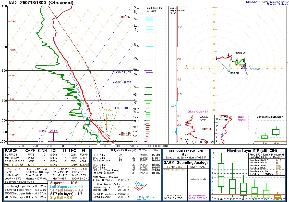
For the record here is the 18z LWX Balloon. Really impressive thermodynamically. Not so impressive kinematically. Shear is lackluster for anything organized.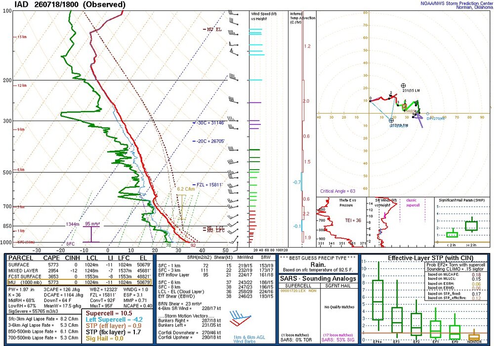
-

E PA/NJ/DE Summer 2026 Obs/Discussion
BBasile replied to PhiEaglesfan712's topic in Philadelphia Region
Weak sauce. A couple rumbles of thunder and some light rain. Maybe something later? Hopefully? And KDIX broke... Again.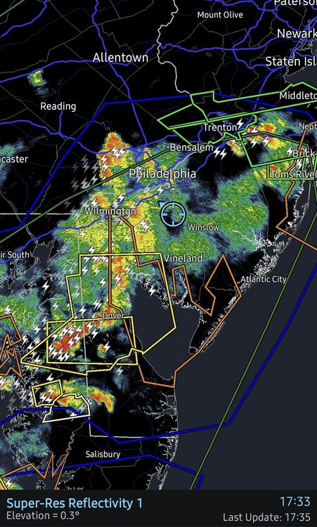
-
Getting crushed here now. Frequent lightning, wind is picking up bigtime. Pouring. Hope it stays below severe criteria. I just want the rain.
- 1,148 replies
-
- 1
-
-
- severe
- thunderstorms
- (and 7 more)
-

2026-2027 Super El Nino
Stormchaserchuck1 replied to Stormchaserchuck1's topic in Weather Forecasting and Discussion
Really healthy look in the subsurface. Warm pool is extending much further west than 1997 at this time. This is a good El Nino to test everything against -
Storm coverage was better than fcst than either the HRRR or RRFS had ydy. Some supercell structures as well, but they had tough time sustaining for very long. Looking at the radar loop, things got messy very quickly w/ storms moving in various directions due to outflow and rotation, colliding w/ each other. This probably limited the svr wx b/c no one storm could sustain for long, so we got a lot of pulse svr storms, despite the decent wind shear and a lot of CAPE. Maybe if the smoke hung around thicker longer, that would have meant less storms, but any storm would have had a better chance to sustain and rotate? The balance when it comes to the mesoscale is tricky. Small differences can be huge as to storm mode, coverage, and severity, often you don't know it until it is happening. This unknown factor has it appeal. We are still "surprised" at times (June 5, 2024 being among the best recent example), and things can look exactly alike on paper for a setup on two days, but what actually happens as to sensible wx can be a lot different. You still get tstms and svr wx, but it goes far beyond that. Will the storms train/backbuild? How intense (frequency) will the CGs be? (that varies a lot it seems). Discrete cells, a SQLN, or clusters? And who exactly will get crushed? So localized in many cases!
-
Its here. Sounds wicked. Got some cool shots while it was rolling in.
-
Saturday, July 18, 2026 Thunderstorm/Severe Weather Potential
Lava Rock replied to weatherwiz's topic in New England
Whole lotta meh. 0.06" Sent from my SM-S921U using Tapatalk -

Central PA Summer 2026 Discussion/Obs Thread
Itstrainingtime replied to Voyager's topic in Upstate New York/Pennsylvania
I thought the worst was coming after 8pm, no? (I sure hope you're right!) -

Saturday, July 18, 2026 Thunderstorm/Severe Weather Potential
w1pf replied to weatherwiz's topic in New England
dewpoint dropping here in the Holyoke Highlands.. 69.6/66.9 0.45" today kinda doubt we'll get much out of the incoming.. -
I used to complain about Germantown being dry LOL. It's got nothing on the full-blown desert that is southern Calvert. Radar is now clear that no rain will fall here again today and it won't next week either. We won't get real rain here until late fall when we start getting those nino-fueled Gulf lows.
-

2026 Mid-Atlantic Severe Storm General Discussion
weatherCCB replied to Kmlwx's topic in Mid Atlantic
Nothing but light shower here -

Central PA Summer 2026 Discussion/Obs Thread
anotherman replied to Voyager's topic in Upstate New York/Pennsylvania
Basically nothing at my house today. -
Looks like it is trying to build your way.
-
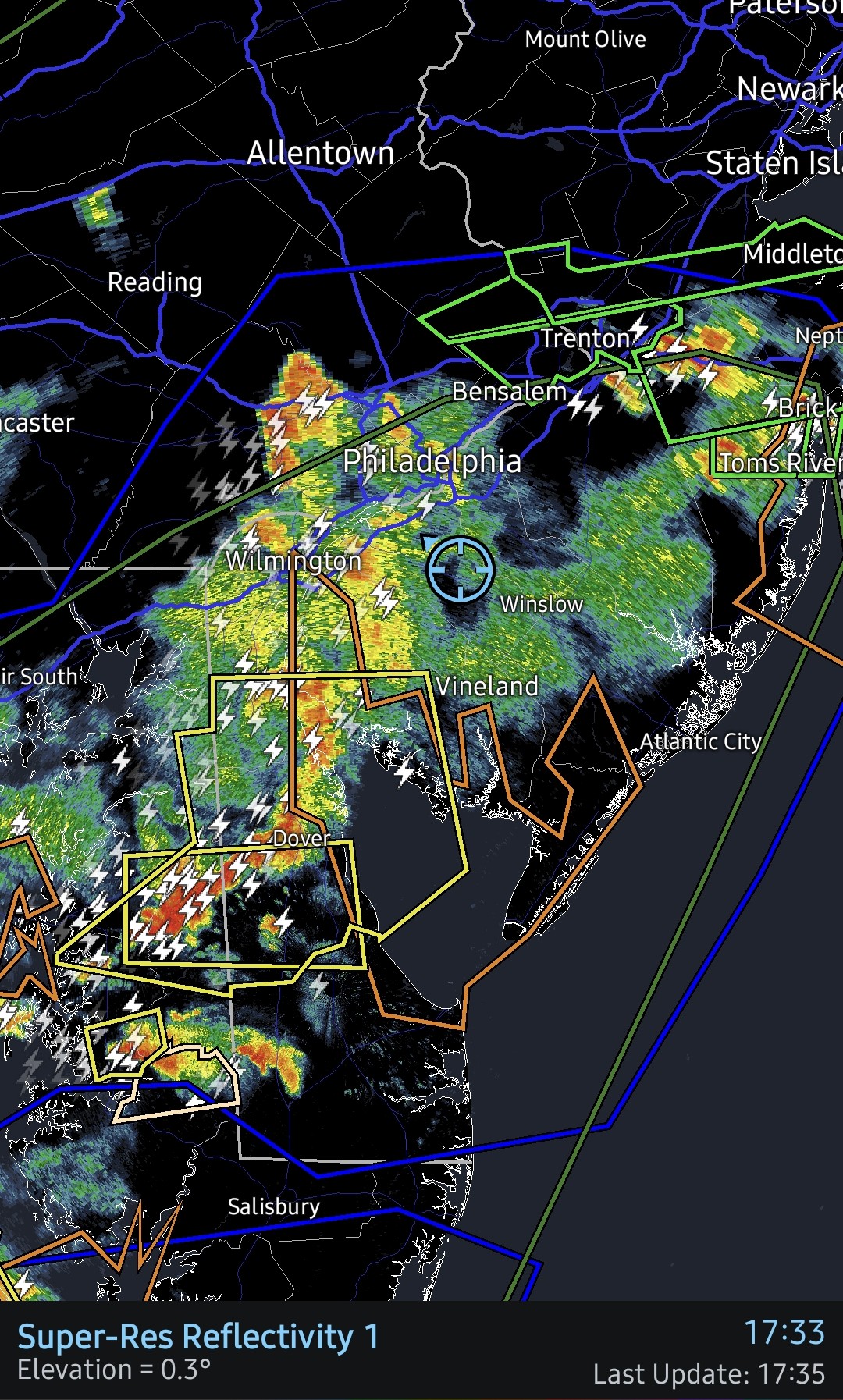
Really pouring down near DCA, visibiliity under 1/4 mile.
-
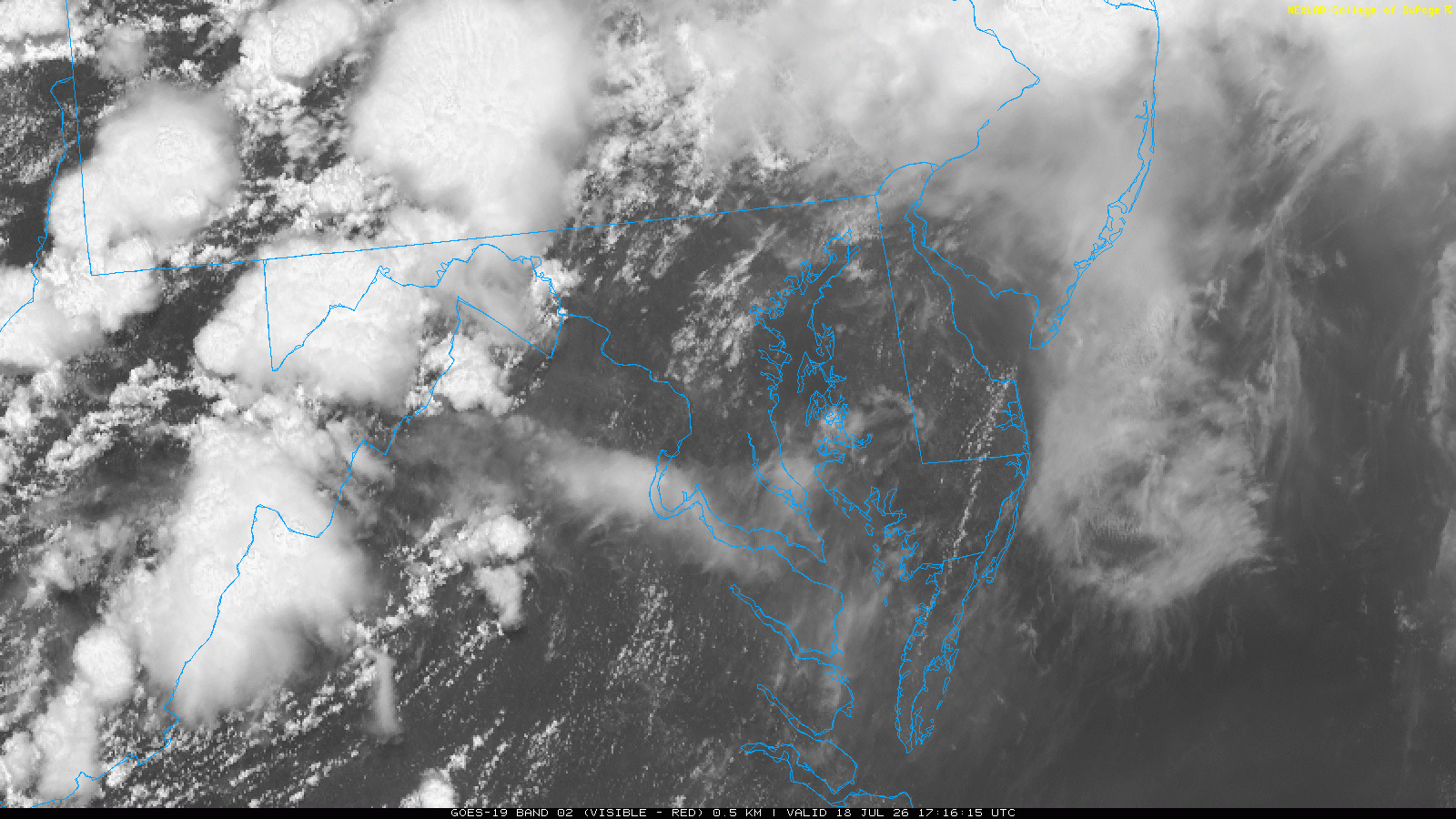
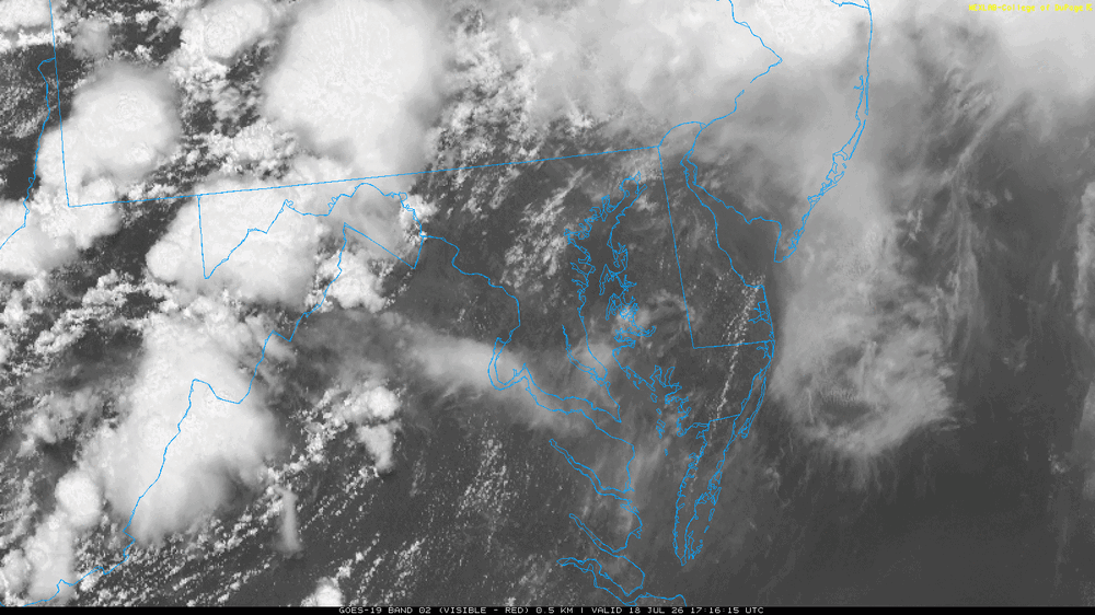
I attached the VIS image at 1716z (13:15 EDT on the image is 1:15pm EDT, right?) Was this CG verified? Sometimes isolated strikes are misplotted when there is a lot of activity. No anvil overhead or close to Damascus, but +CGs has been known shoot out laterally up to 10 mi from a CB. And when a storm, esp. a supercell, has a thick anvil streaming well downwind (can be well over 100 mi when winds aloft are strong), you can get CGs out of the anvil 50+ miles away. Farthest I have seen reported and verified is 90 mi from the parent cell core out of the anvil (storms near Enid OK and in strikes far NW OKC)!
-

Saturday, July 18, 2026 Thunderstorm/Severe Weather Potential
CT Rain replied to weatherwiz's topic in New England
Meh -

Saturday, July 18, 2026 Thunderstorm/Severe Weather Potential
Baroclinic Zone replied to weatherwiz's topic in New England
Brief period of showers. Nothing noteworthy. Temps are nice though. 70F -
Probably +CGs and the thunder was enhanced by the nocturnal inversion!
-

Central PA Summer 2026 Discussion/Obs Thread
Blizzard of 93 replied to Voyager's topic in Upstate New York/Pennsylvania
Hopefully the showers & storms in western PA move east & provide beneficial rain later on for those that missed out earlier today.