All Activity
- Past hour
-
NBM for Freezing Rain. They don't issue a sleet one that I know of.
-
Nope
-
No...lol
-

January 2026 regional war/obs/disco thread
SouthCoastMA replied to Baroclinic Zone's topic in New England
12z EPS showing some hangback moisture on Monday - i'm guessing a few members showing redevelopment or invt trough hanging back. -

January 25/26 Jimbo Back Surgery Storm
StantonParkHoya replied to Jimbo!'s topic in Southeastern States
The Euro showed 10 inches for Raleigh and the GFS had 17 inches, but the board morale is that of a soup-line snow-weenie. -
Definitely! Maybe I enjoy storm and then go to PR for a few less days.
-
Weeklies

-

Possible Record Breaking Cold + Snow 1/25 - 1/26
weatherpruf replied to TriPol's topic in New York City Metro
thankfully uncommon in this area....still remember 94. ouch. my butt still hurts....hint; don't walk out on the ice.... -

January 2026 regional war/obs/disco thread
CoastalWx replied to Baroclinic Zone's topic in New England
That was the event @ORH_wxman and I talk about where we had synoptic sleet with heavy OE snow at NZW. One of those Jan 94 events. -
18z NBM
-
Lemons into Lemonade!
-

January 25/26 Jimbo Back Surgery Storm
NorthHillsWx replied to Jimbo!'s topic in Southeastern States
We need to see some positive trends tonight for the sanity of this board but the fact remains- there will be winners and big time losers here. Losing here carries more repercussions than usual (extended outages, etc). -
I've been busy all day. Wonder if the whinging and meltdowns over op runs have been predominant from the usual. (my guess is yes) I just checked the 12z ensembles and they all look fine. All I need to see until HH. On we go.
-

January 25/26 Jimbo Back Surgery Storm
NYweatherguy replied to Jimbo!'s topic in Southeastern States
Wow, you have the sleet/snow line pretty far south. I am rooting for you to be right! -

Central PA Winter 25/26 Discussion and Obs
canderson replied to MAG5035's topic in Upstate New York/Pennsylvania
CTP being rightful caution in their afternoon update KEY MESSAGE 2: Medium-range guidance remains consistent in depicting a large-scale winter storm this weekend, tracking from the mid-South across the Mid-Atlantic states. The devil, however, will be in the details, with a tight northern edge snowfall gradient expected to be at play. Where exactly this gradient zone sets up is highly uncertain, with the potential for it lie somewhere across PA. In all probability, the highest winter storm impacts will be south of the Mason-Dixon line, but again with a tight snowfall gradient and the anticipation of heavy snowfall where jet dynamics are maximized, this situation bears watching. Please stay tuned for the latest forecast updates. -
-
I don't remember ever seeing a forecast like this from the GSP NWS. Thursday Night A 50 percent chance of rain. Mostly cloudy, with a low around 42. Light and variable wind. Friday A 50 percent chance of rain, mainly before 4pm. Cloudy, with a high near 51. Friday Night A chance of rain after 11pm, mixing with snow after 2am. Mostly cloudy, with a low around 28. Chance of precipitation is 50%. Saturday Snow before 2pm, then snow, freezing rain, and sleet. High near 32. Chance of precipitation is 90%. Saturday Night Snow, freezing rain, and sleet before 1am, then freezing rain and sleet. The sleet could be heavy at times. Low around 20. Chance of precipitation is 100%. Sunday Freezing rain likely before 9am, then snow and freezing rain likely. Mostly cloudy, with a high near 32. Chance of precipitation is 70%. Sunday Night A chance of snow and freezing rain. Mostly cloudy, with a low around 20. Chance of precipitation is 30%.
-

Central PA Winter 25/26 Discussion and Obs
Ruin replied to MAG5035's topic in Upstate New York/Pennsylvania
Hah go to jail for a wrong forecast -
Yet zwyts can post here to tell us he can’t post here? It was confusing. i too agree with the EPS trend gif being my favorite part of 12z, maybe minus the UK thrashing us all again
-

January 2026 regional war/obs/disco thread
vortex95 replied to Baroclinic Zone's topic in New England
-12 to -18 C. That sound right, Perhaps I was thinking the HGZ (hail growth layer) or the ideal charge layer for LTG for mixed phase! -

Pittsburgh/Western PA WINTER ‘25/‘26
colonel717 replied to Burghblizz's topic in Upstate New York/Pennsylvania
Would be nice to pull in 3 inches tomorrow as an appetizer.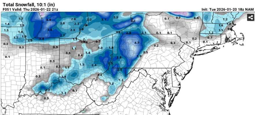
-
Other stuff keeping me in town Saturday. Maybe I enjoy the storm and then go.
-
Is there one of these for Middle yet?
-
Yay, meeting time at work. Will return for the GFS/ICON. Hopefully.
-
No mention of the Icon? I think we're The only ones that actually look at that model lol