All Activity
- Past hour
-

Central PA Winter 25/26 Discussion and Obs
pasnownut replied to MAG5035's topic in Upstate New York/Pennsylvania
I’d say we’ve got 1.25-1.5” addl on areas that I cleared when we switched to pingers. buddy outside of Etown said lingers still mixin in. He has 10” on deck. -

1/24-1/25 Major Winter Storm - S. IL, IN, and OH
NEILwxbo replied to A-L-E-K's topic in Lakes/Ohio Valley
The lake should do this more often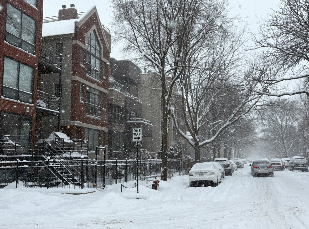
-
Southern Crippler - Get well soon Jimbo Storm Obs
NEGA_Dawg replied to BooneWX's topic in Southeastern States
Heavy sleet just started here and temp 25. -
You know things are way out of control when the NWS has to put this into their AFD (FFC) Source - National Weather Service Storm Threat Late Next Week? (Spoiler: Unlikely For Now) You may have heard about or seen posts on social media regarding a snow or winter weather threat in Georgia late next week or next weekend. Well, at this time, that threat appears to be quite low. The two primary ensemble models (ECMWF ENS and GEFS), which combine for over 70 members, are showing very strong agreement on the much cooler than normal airmass over the region. They`re also in pretty strong agreement on the region being in a dry and precipitation free airmass, with only a small sample (less than 10%) having some moisture moving through. So for now, we will continue to watch how things progress, but keep any winter weather out of the official forecast.
-
It's a bit misleading as the snow moved in early so the entire progression of the storm started earlier and any changeover should therefore be calculated accordingly. That's why it missed the totals the way it did, other models had the duration of snow (8-10 hours) depicted far better.
-
UKMET ensemble
.thumb.png.b38c3c9542d106e46eb867e9f676060a.png)
-
The only lows that matter are the one over West Virginia and the one off the coast of the Delmarva.
-
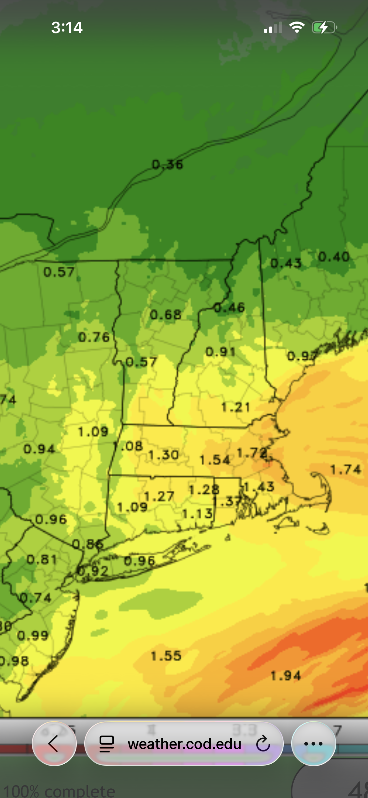
Ewr has .91 liquid so I'd imagine around 10" before the flip
-
The NBM is gospel, whatever you see that as, that's what theyll go then adjust up or down a bit from there. I knew when the NBM was throwing out big numbers they were going to go big there.
-

Southern Crippler - Get well soon Jimbo Storm Obs
SnowDawg replied to BooneWX's topic in Southeastern States
Really is, I've heard from folks in Jackson County area that it's been nothing but sleet the whole time for the most part. I've seen nothing but freezing rain since like 6 this morning. And even last night it was mixed with ZR. I had between a Qtr to half an inch already by like 9-10AM. -
 From 18z on
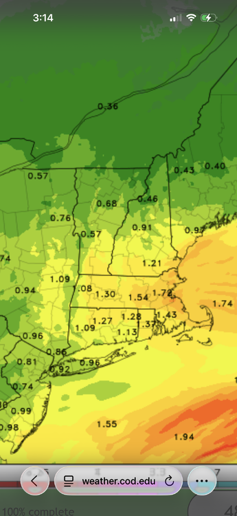
-
Used to hate that when I was a kid and we had on street parking. Digging out the car was an absolute pain in the arse.
-

Central PA Winter 25/26 Discussion and Obs
Jns2183 replied to MAG5035's topic in Upstate New York/Pennsylvania
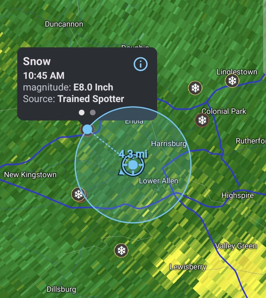
Camp hill. I got crushed this morning more than most. I had 8.5" by 11am and 10" by noon, the sleet hit for an hour but it mixed with snow enough I picked up another .5" by 1. That sleet line crashed and I was just north of it for an hour and it was heavy snow, with huge flakes that added 2" Sent from my SM-S731U using Tapatalk
-
GEFS
.thumb.png.04a244a87e7c803e029eb78a2802bf91.png)
-
Turning into mostly sleet under these heavier returns. Temp has risen a degree
-
CMC ensemble
.thumb.png.7b20fdceb46ea9cee28dfaf92dbdfb65.png)
-
Still at 13 degrees with heavy sleet in Harrisonburg. Nuts.
-
Roads are atrocious around Stafford/Fredericksburg. Some of the heaviest Sleet I’ve ever seen. I’d guess maybe 7.0” inches of Snow/Sleet but impossible to be accurate. Heavy Sleet and 17
-

Southern Crippler - Get well soon Jimbo Storm Obs
RockyKnob replied to BooneWX's topic in Southeastern States
The line appears to be moving much more slowly than modeled on the HRR. -
Blizzard like right now without the high winds, which I'm not a fan of anyway.
-
I’m well over a foot already. Probably going to finish close to 20”.
-

Richmond Metro/Hampton Roads Area Discussion
Conway7305 replied to RIC Airport's topic in Mid Atlantic
I swear, I think we’ve had at least about an inch or so of sleet -

Pittsburgh/Western PA WINTER ‘25/‘26
RitualOfTheTrout replied to Burghblizz's topic in Upstate New York/Pennsylvania
I don't think naming winter storms has caught on anywhere outside of the people who work at the weather channel. I don't think I've heard any other media outlets use that name. Sure regionally events gets names that catch on nationally ala snowmagedon. I tend to remember storms based on the year. -
 11in in Westport, still snowing HARD


.png.6af06d4f03de4fda6c748a3d07a27873.png)


.png.93e62692dd00a4a89d6ade40bd84ce08.png)


.png.86808aa19bd8a653c5b38d6d1f784e42.png)


