All Activity
- Past hour
-
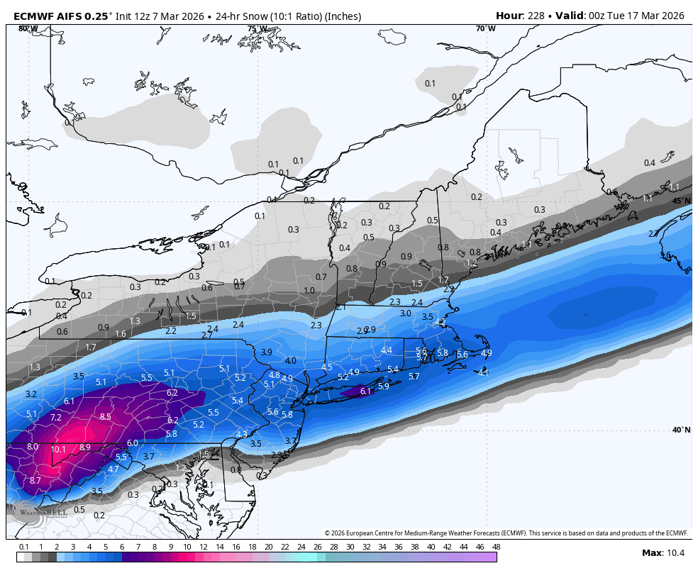
Those snow maps 10+ days out tho. Gotta be.
-
Sun is finally starting to think about breaking out in Haymarket for the first time in 6 days. Let’s go!!!
-
day one fail for warmth.. forecast was 48 only made it to 38 so far
-

Pittsburgh/Western PA WINTER ‘25/‘26
Ecanem replied to Burghblizz's topic in Upstate New York/Pennsylvania
I had a 78.1 temperature reading. -
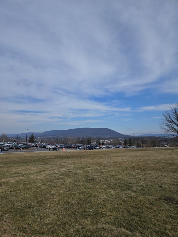
Found the nice weather in state college. TOR Watch one county ti the west.

-
My sump pump is running for the first time in over a year, so we are definitely melting pretty good here. Nice winter, but the older I get, the more I look forward to sun and warmth. I’m ready for some nice days. Still a lot of snow to melt here; but I’m guessing this week is going to put a serious dent in the pack here; maybe even eliminating most of it.
-
I'm kind of surprised they don't make/sell solar panels with some sort of heater/defrost system built in...
-
I actually agree. It’s underrated how miserable the last couple March/Aprils have been outside of a few days. Hopefully we can get a sustained stretch of nice weather before Mid May
-
Barring any cirrus contamination, Monday looks like overperformer to me. Models probably under mixing. AIFS popping mid-upper 60s across interior E MA.
-
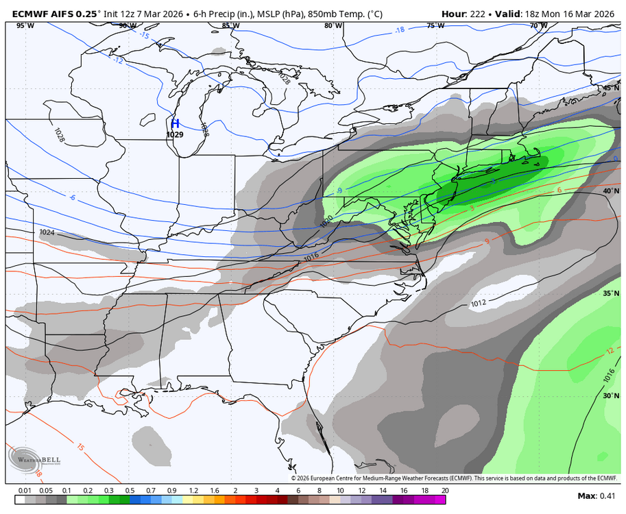
Euro op had interesting features too. Couple wintry threats. Still has the coastal potential.
-
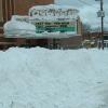
11.5" avg snow depth in full sun, 15.5" in the shade
-
48 and the sky is brightening just a bit now.
-
AI is getting better
-

Pittsburgh/Western PA WINTER ‘25/‘26
MikeB_01 replied to Burghblizz's topic in Upstate New York/Pennsylvania
Certainly doesn’t feel like March 7 outside. But I’ll take the late May preview. . -
Oh yeah. Loving this. It's wonderful. Absolutely.
-
Today's like day one of melt week, 2026 Yeah, we've put up a couple of 52ies recently, but those were dry DP, light wind, sparing the loss rates. Looking at 55 to 65 afternoons with more blow torch breezes ... even some over 40 DPs, lasting until that cold break toward a week from now. Actually looks like the 70 day may happen on Tuesday after all. I wouldn't be surprised if Wednesday morning on the way to work, people notice that field they pass everyday is no longer just planar white. I still have an issue with 70 over the fields but I've seen this in spring where cold drain out of the wooded areas is juxtaposing vividly against air that was not being protected. I agree with the sentiment that there's a window of interest in the 15-18th date range. It's not clear what that will mean.. .in fact, almost anything is possible from a Lakes cutter to a coastal, but there is a transient impressive +PNA bounce through that period.
-
I can top that example check out 1895-1896 monthlyseasonalsnowfall.pdf
-

Central PA Spring 2026 Discussion/Obs Thread
Blizzard of 93 replied to Voyager's topic in Upstate New York/Pennsylvania
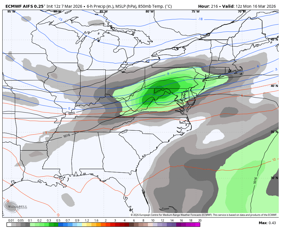
Timing would be decent with a good chunk of the precip coming overnight through the morning.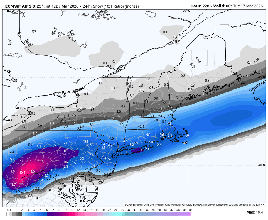

-
0.71” with the round Friday morning and 0.78” with the storms last night and this morning. Overall a good early spring soak
-
Central PA Spring 2026 Discussion/Obs Thread
Blizzard of 93 replied to Voyager's topic in Upstate New York/Pennsylvania
Yes, I would sign for the 12z AI. A nice & simple moderate wave with a good non complicated slug of precip this run.
-
March 2004, the season with two March storms, both in mid-March, after no snowstorms in February. Check the synoptics out.http://www.raymondcmartinjr.com/weather
-
"There's decades of data and evidence corroborating a warming climate in New England that impacts our winters vs. no there isn't".
-

Central PA Spring 2026 Discussion/Obs Thread
mitchnick replied to Voyager's topic in Upstate New York/Pennsylvania
Euro lost the threat, but it's AI cousin has it. -
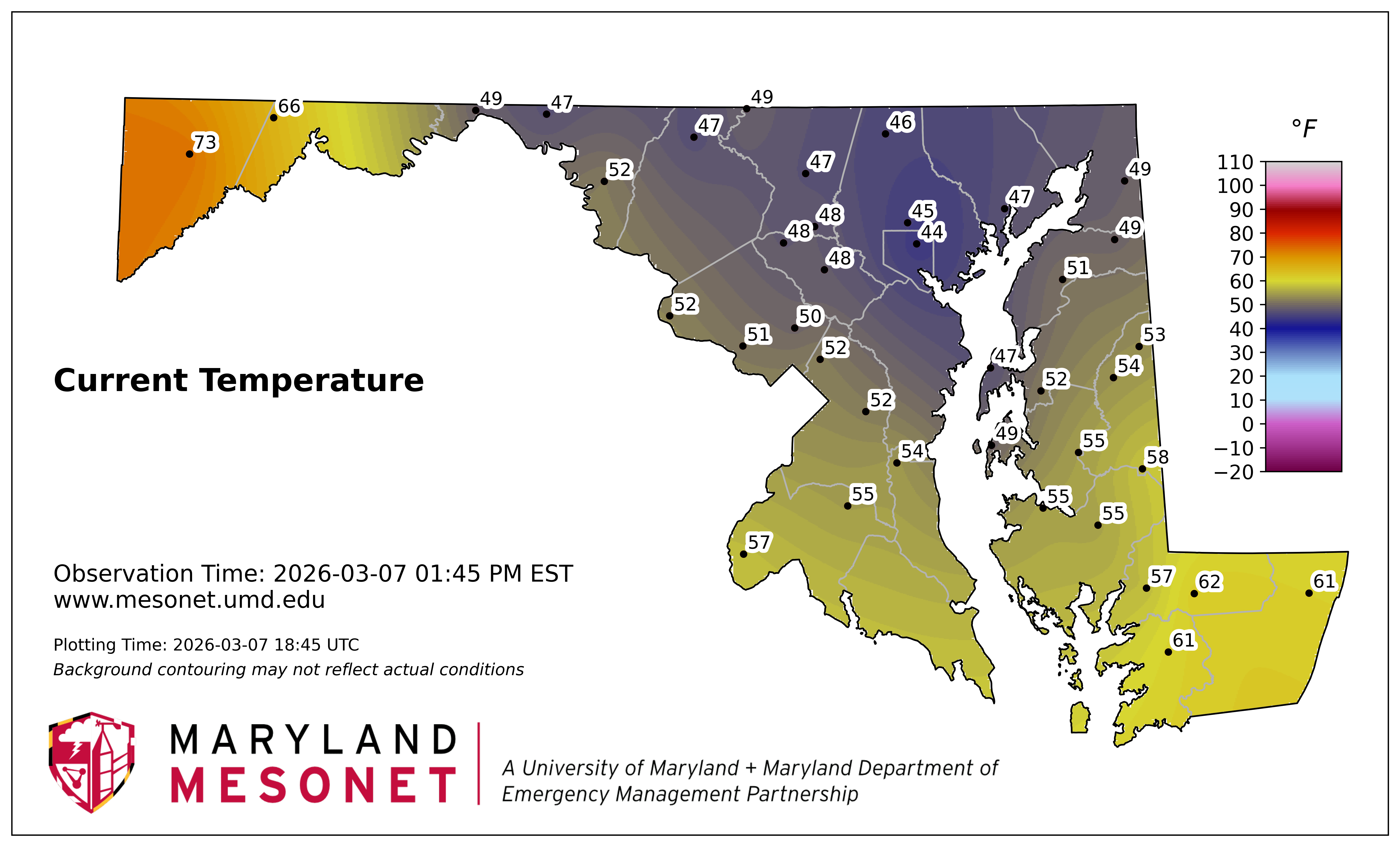
Fantastic. Outside of maybe a random pop-up thunderstorm, when are you ever going to see Baltimore City as the coldest spot in MD.

-
That run clocks me pretty good back here