All Activity
- Past hour
-
Peeking in on the MA forum it seems some are getting to sleet quicker than modeled?
-

“Cory’s in LA! Let’s MECS!” Jan. 24-26 Disco
CCHurricane replied to TheSnowman's topic in New England
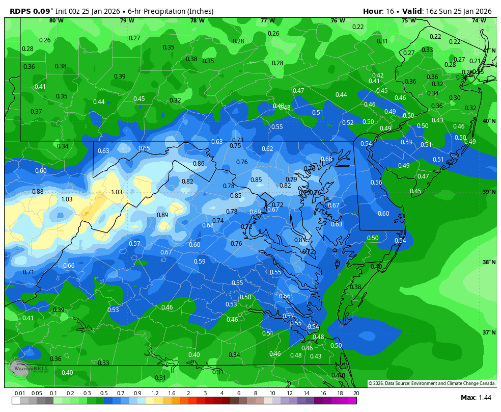
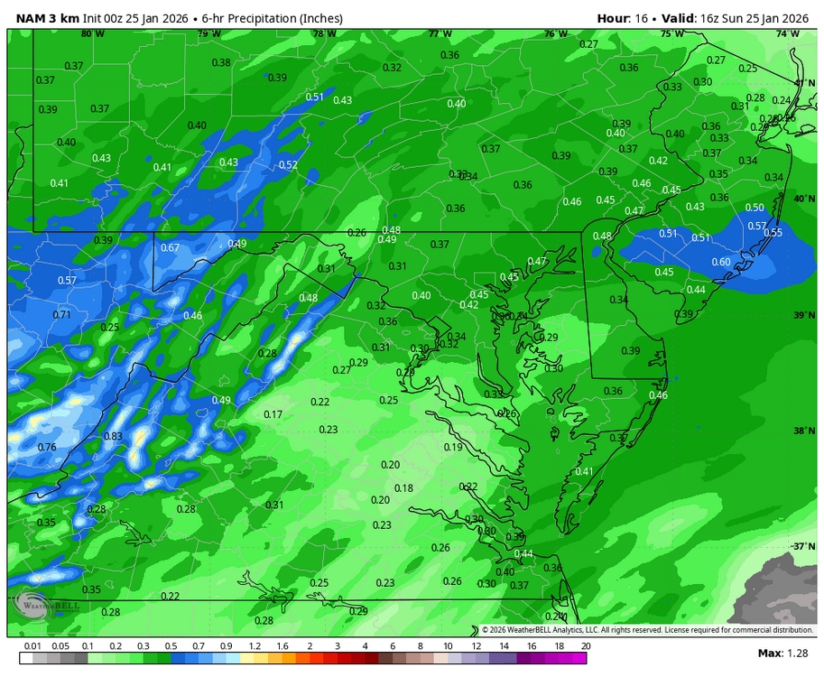
any idea what sort of ratio these images are using? doesn't look 10:1 based on amounts, kuchera or something different altogether? -
Lol he isn’t talking about dca
-
Yep, and radar returns look to be growing down toward Greenville - Spartanburg.
-
It’s just not that serious.
-

Pittsburgh/Western PA WINTER ‘25/‘26
blackngoldrules replied to Burghblizz's topic in Upstate New York/Pennsylvania
A few here seemed bothered by the virga, so figured I'd share a local met's explanation. I think he explained it pretty well. Lol -

-
Let’s Go Caaaaaps!! 3-2. Almost time for a stout.
-

Southern MD / Lower Eastern Shore weather discussion
SnowtoRain replied to PrinceFrederickWx's topic in Mid Atlantic
First pixie dust flakes in Easton, extremely light but basically no virga -

Southern Crippler - Get well soon Jimbo Storm Obs
NorthHillsWx replied to BooneWX's topic in Southeastern States
Worried for yall. This has transitioned from a midlands SC to SW VA ice storm -
see if we can hold it
-
Based off what I can tell, the transition line is from about Lewisburg, WV, east to Lynchburg, VA and then drops SE towards Emporia. This seems to line up fairly well with guidance so far.
-
14F / -9F ,Mostly Cloudy, light north winds
-
That map has me in the dark purple. Pretty close to my thinking of 6-10” imby.
-
The better argument is that the rgem/euro and other guidance that gives us 8-12” does so by sticking an incredibly intense band over us from 10-16z. It’s a lot easier for WAA to win in light to moderate precip than it will be to advance if there is a band of .1 qpf/hr+ stuff over the area. It’s all going to come down to that really imo. The NAM doesn’t have that. It shifts the heavy banding way up into central PA and the WAA routes us because there is no dynamic cooling to slow it down. Basically if this is what’s going on from 10-16z the snow will hold on longer north of about 66 and definitely north of a Winchester to Baltimore line this on the other hand, ain’t gonna get it done Everyone is focused on the temps on the NAM, the real issue is why is the NAM missing the heavy banding tomorrow morning that all other guidance has. That’s why the mid level warmth surges north from 10-15z there is nothing to slow it down on the NAM.

-

January 24-26: Miracle or Mirage OBS Thread!
nw baltimore wx replied to Jebman's topic in Mid Atlantic
Go Caps!!! -
-

“Cory’s in LA! Let’s MECS!” Jan. 24-26 Disco
40/70 Benchmark replied to TheSnowman's topic in New England
EURO -
January 24-26: Miracle or Mirage OBS Thread!
nw baltimore wx replied to Jebman's topic in Mid Atlantic
Please don’t direct any posts to me. Put me on ignore. The only reason I keep you off of ignore is because I find you an interesting study in cluelessness. -

January 24-26: Miracle or Mirage OBS Thread!
JenkinsJinkies replied to Jebman's topic in Mid Atlantic
I know it's going to snow, that was never in doubt. It's just that if the changeover happens sooner than expected then it'll be way less than most are forecasting. People keep putting words in my mouth and it's getting old. -
16 degrees with mixed sleet/ snow. Looks pretty heavy
-
“Cory’s in LA! Let’s MECS!” Jan. 24-26 Disco
40/70 Benchmark replied to TheSnowman's topic in New England
ICON -
Ok? It’s gonna snow. Then there will be sleet. And maybe some freezing rain. And we’ll all be alive. Though that is less than guaranteed when encountering ice these days.
-

January 24-26: Miracle or Mirage OBS Thread!
Snowciopathic Snow Bro replied to Jebman's topic in Mid Atlantic
Lemme know when your book is published. I'll buy the first copy! Kocin and Uccellini best be looking over their shoulders.